|
Fort Weaver Road
Route 76 or Fort Weaver Road is a major north–south highway on the island of Oahu which begins at Interstate H-1 (H-1) in Waipahu and ends in Ewa Beach. Route description Route 76 is the main thoroughfare from the Ewa Beach community to H-1. Along the route is an intersection with Farrington Highway Farrington Highway is a major highway through the western part of O‘ahu in the U.S. state of Hawaii. Starting from Kamehameha Highway north of Pearl Harbor, it heads west along the island's southwestern and western coast; another part of the h ..., Hawaii Medical Center West, West Loch Golf Course, Ewa Gentry, Laulani Park and Holomua Elementary School. History Fort Weaver Road is long and runs through Ewa Beach. Fort Weaver Road was completed in June 1982. Major intersections References External links Route Log on Hawaii Route 76 0076 Transportation in Honolulu County, Hawaii {{Hawaii-road-stub ... [...More Info...] [...Related Items...] OR: [Wikipedia] [Google] [Baidu] |
Ewa Beach, Hawaii
Ewa or EWA may refer to: Places ; Ethiopia * Ewa (woreda) ; Nauru * Ewa District, Nauru ; United States * Eastern Washington, the portion of the state of Washington east of the Cascade Range * ʻEwa Beach, Hawaii, a census-designated place * Ewa District, Hawaii, an ancient Hawaiian district of Oahu Other uses * Ewa (given name) * Eldercare Workforce Alliance * Ewa Air, a French airline in Mayotte * Ewa reactor, Poland's first research nuclear reactor * Marine Corps Air Station Ewa, a former air station in Hawaii * ''Ewa'', a sailing vessel later renamed ''Norda ''Norda'' is a wooden sailing vessel that was commissioned in 1928, originally used as a research vessel in Poland. It served as research vessel, fishing vessel and is now a yacht. History Research vessel The vessel was commissioned in 1928 by M ...'' See also * * {{Disambiguation, geo ... [...More Info...] [...Related Items...] OR: [Wikipedia] [Google] [Baidu] |
Waipahu
Waipahu () is a former sugarcane plantation town and now census-designated place (CDP) located in the Ewa District on the island of Oahu in the City & County of Honolulu, Hawaii, United States. As of the 2020 census, the CDP population was 43,485. The U.S. postal code for Waipahu is 96797. History Waipahu is the name of an artesian spring.Michael T. Yamamoto, Nina Yuriko (Ota) Sylva, Karen N. Yamamoto, ''Waipahu...Recollections from a Sugar Plantation Community in Hawaii'', 2005. Albuquerque: Innoventions In Hawaiian, Waipahu is derived from ''wai'', meaning water, and ''pahū'', meaning "burst or explode"; combined, ''Waipahu'' means "water forced up (as out of a spring)". The early Native Hawaiians took pleasure in the cool and clear water gushing from the ground and named this spring Waipahu. Before the Western civilization set foot in Hawaii, the Hawaiians considered Waipahu to be the capital of Oahu. Royalty in the Kingdom of Hawaii would often gather and enjoy the fresh w ... [...More Info...] [...Related Items...] OR: [Wikipedia] [Google] [Baidu] |
Honolulu County, Hawaii
Honolulu County (officially known as the City and County of Honolulu, formerly Oahu County) is a consolidated city–county in the U.S. state of Hawaii. The city–county includes both the city of Honolulu (the state's capital and largest city) and the rest of the island of Oʻahu, as well as several minor outlying islands, including all of the Northwestern Hawaiian Islands (islands beyond Niihau) except Midway Atoll. The consolidated city-county was established in the city charter adopted in 1907 and accepted by the Legislature of the Territory of Hawaii. As a municipal corporation and jurisdiction it manages aspects of government traditionally exercised by both municipalities and counties in the rest of the United States. As of the 2020 United States Census, the population was 1,016,508. Because of Hawaii's municipal structure, the United States Census Bureau divides Honolulu County into several census-designated places for statistical purposes. The mayor of Honolulu Co ... [...More Info...] [...Related Items...] OR: [Wikipedia] [Google] [Baidu] |
Oahu
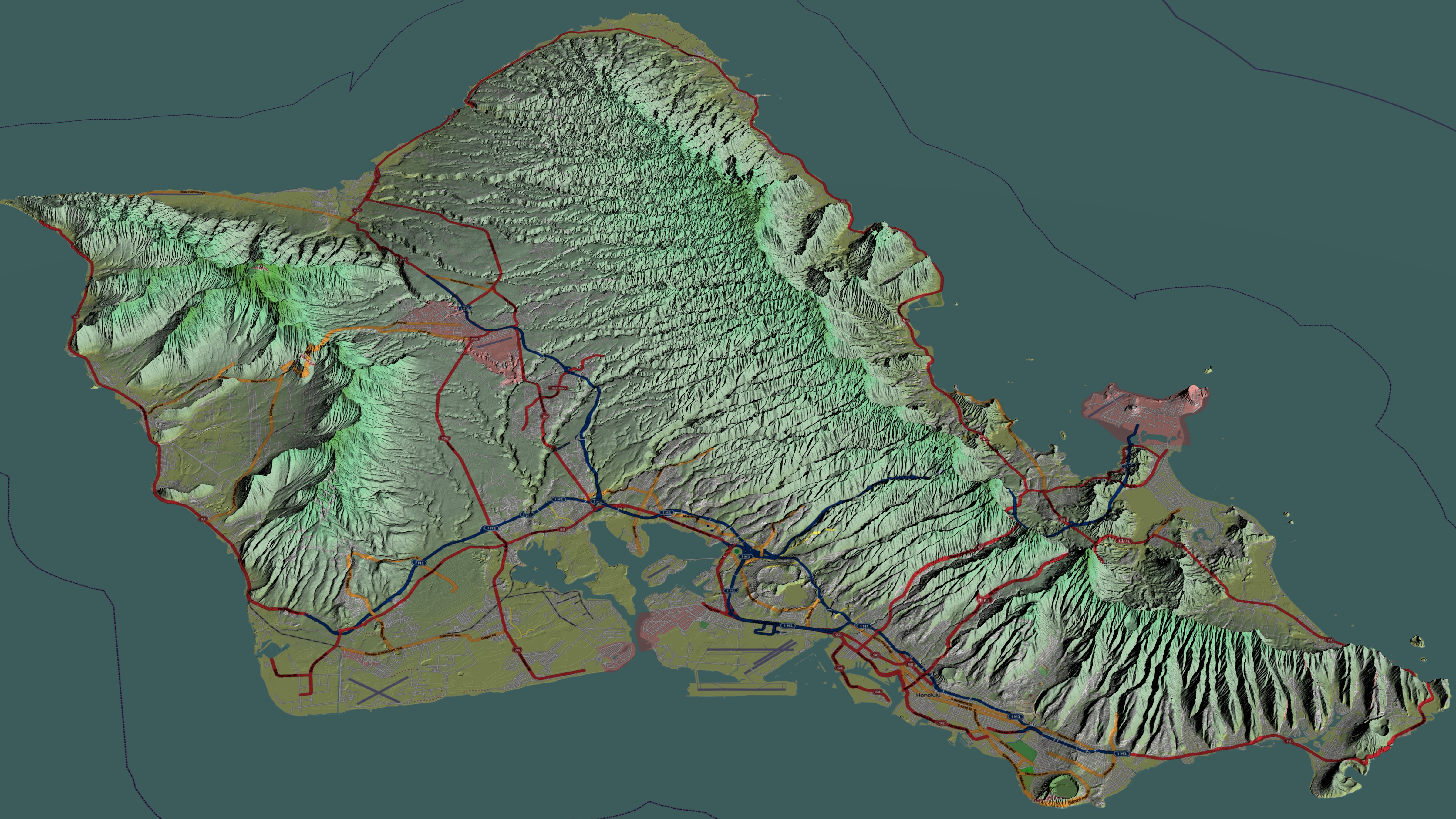
Oahu () (Hawaiian language, Hawaiian: ''Oʻahu'' ()), also known as "The Gathering place#Island of Oʻahu as The Gathering Place, Gathering Place", is the third-largest of the Hawaiian Islands. It is home to roughly one million people—over two-thirds of the population of the U.S. state of Hawaii. The island of O’ahu and the Northwestern Hawaiian Islands constitute the City and County of Honolulu, Hawaii, City and County of Honolulu. The state capital, Honolulu, is on Oʻahu's southeast coast. Oʻahu had a population of 1,016,508 according to the 2020 U.S. Census, up from 953,207 people in 2010 (approximately 70% of the total 1,455,271 population of the State of Hawaii, with approximately 81% of those living in or near the Honolulu urban area). Name The Island of O{{okinaahu in Hawaii is often nicknamed (or translated as) ''"The Gathering Place"''. It appears that O{{okinaahu grew into this nickname; it is currently the most populated Hawaiian islands, Hawaiian Island, how ... [...More Info...] [...Related Items...] OR: [Wikipedia] [Google] [Baidu] |
Interstate H-1
Interstate H-1 (abbreviated H-1) is the longest and busiest Interstate Highway in the US state of Hawaii. The highway is located on the island of O‘ahu. Despite the number, this is an east–west highway; the 'H'-series (for Hawaii) numbering reflects the order in which routes were funded and built. H-1 goes from Route 93 (Farrington Highway) in Kapolei to Route 72 (Kalanianaole Highway) in Kāhala. East of Middle Street in Honolulu (exit 19A), H-1 is also known as the ''Lunalilo Freeway'' and is sometimes signed as such at older signs in central Honolulu. West of Middle Street, H-1 is also known as the ''Queen Liliuokalani Freeway''; this name is shown on some roadmaps. It is both the southernmost and westernmost signed Interstate Highway located in the United States. Route description Interstate H-1 begins near the Campbell Industrial Park in the town of Kapolei, Hawaii. West of this point, Hawaii State Route 93 (Farrington Highway) continues toward Waianae. The freeway co ... [...More Info...] [...Related Items...] OR: [Wikipedia] [Google] [Baidu] |
ʻEwa Beach, Hawaii
Ewa Beach () or simply Ewa () is a census-designated place (CDP) located in Ewa District and the Honolulu County, Hawaii, City & County of Honolulu along the coast of Māmala Bay on the leeward side of Oahu, Oahu in Hawaii. As of the United States 2010 Census, 2010 Census, the CDP had a total population of 14,955. The U.S. postal code for Ewa Beach is 96706. History and etymology The word ''ewa'' means "stray" in Hawaiian. The name comes from the myth that the gods Kāne and Kanaloa threw a stone to determine the boundaries, but it was lost and later found at Pili o Kahe. Hawaiian settlement on the Ewa Plain dates back at least to the 12th Century C.E., at which time Kanaka maoli expanded the main channel of Puuloa (Pearl Harbor) before creating fishponds and terraced agricultural fields in the surrounding area. Scholars have recognized Ewa's ancient fishponds as exemplary evidence of Native Hawaiian ingenuity. Before Ewa Beach became a town it was first a huge plantation farm ... [...More Info...] [...Related Items...] OR: [Wikipedia] [Google] [Baidu] |
Ewa Beach
Ewa or EWA may refer to: Places ; Ethiopia * Ewa (woreda) ; Nauru * Ewa District, Nauru ; United States * Eastern Washington, the portion of the state of Washington east of the Cascade Range * ʻEwa Beach, Hawaii, a census-designated place * Ewa District, Hawaii, an ancient Hawaiian district of Oahu Other uses * Ewa (given name) * Eldercare Workforce Alliance * Ewa Air, a French airline in Mayotte * Ewa reactor, Poland's first research nuclear reactor * Marine Corps Air Station Ewa, a former air station in Hawaii * ''Ewa'', a sailing vessel later renamed ''Norda ''Norda'' is a wooden sailing vessel that was commissioned in 1928, originally used as a research vessel in Poland. It served as research vessel, fishing vessel and is now a yacht. History Research vessel The vessel was commissioned in 1928 by M ...'' See also * * {{Disambiguation, geo ... [...More Info...] [...Related Items...] OR: [Wikipedia] [Google] [Baidu] |
Farrington Highway
Farrington Highway is a major highway through the western part of O‘ahu in the U.S. state of Hawaii. Starting from Kamehameha Highway north of Pearl Harbor, it heads west along the island's southwestern and western coast; another part of the highway also serves the western part of the North Shore, ending in Waialua. With the exception of a gap around Kaena Point (which is a protected area and not accessible by car), the highway forms an almost continuous arc along the coast of the western half of the island of O‘ahu. The highway consists of the following sections, from north to south: * Hawaii Route 930, runs east to west along the North Shore, from Waialua to near Kaena Point. It is the major highway through this area. * A gap around Kaena Point. There is an unpaved path along the route of the old Farrington Highway. However, there is a gate blocking access to cars, and the path is washed out in several places. The highway does not currently run through the Point because ... [...More Info...] [...Related Items...] OR: [Wikipedia] [Google] [Baidu] |
Hawaii Medical Center West
Hawaii ( ; haw, Hawaii or ) is a state in the Western United States, located in the Pacific Ocean about from the U.S. mainland. It is the only U.S. state outside North America, the only state that is an archipelago, and the only state geographically located within the tropics. Hawaii comprises nearly the entire Hawaiian archipelago, 137 volcanic islands spanning that are physiographically and ethnologically part of the Polynesian subregion of Oceania. The state's ocean coastline is consequently the fourth-longest in the U.S., at about . The eight main islands, from northwest to southeast, are Niihau, Kauai, Oahu, Molokai, Lānai, Kahoolawe, Maui, and Hawaii—the last of these, after which the state is named, is often called the "Big Island" or "Hawaii Island" to avoid confusion with the state or archipelago. The uninhabited Northwestern Hawaiian Islands make up most of the Papahānaumokuākea Marine National Monument, the United States' largest protec ... [...More Info...] [...Related Items...] OR: [Wikipedia] [Google] [Baidu] |


