|
Folda, Trøndelag
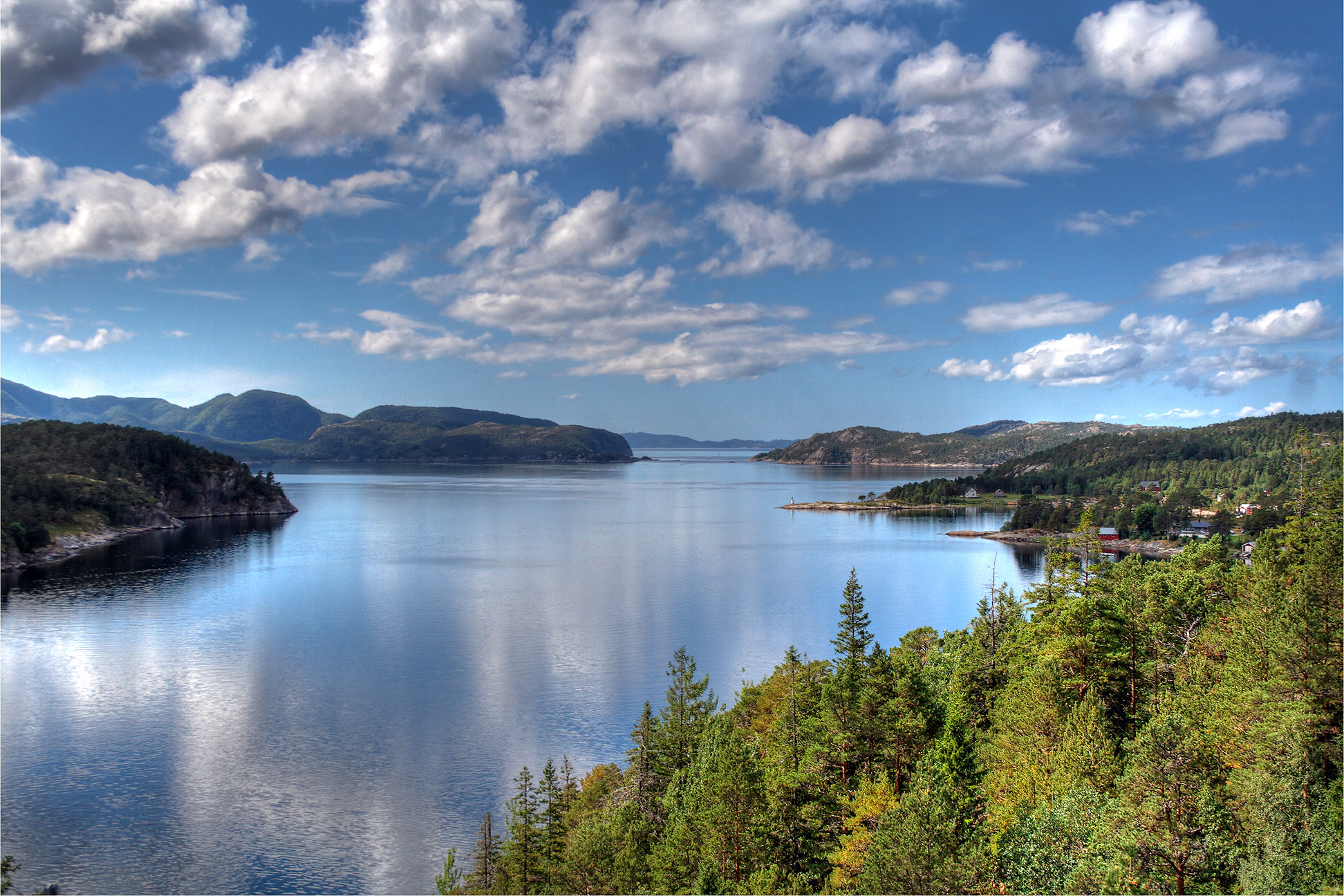
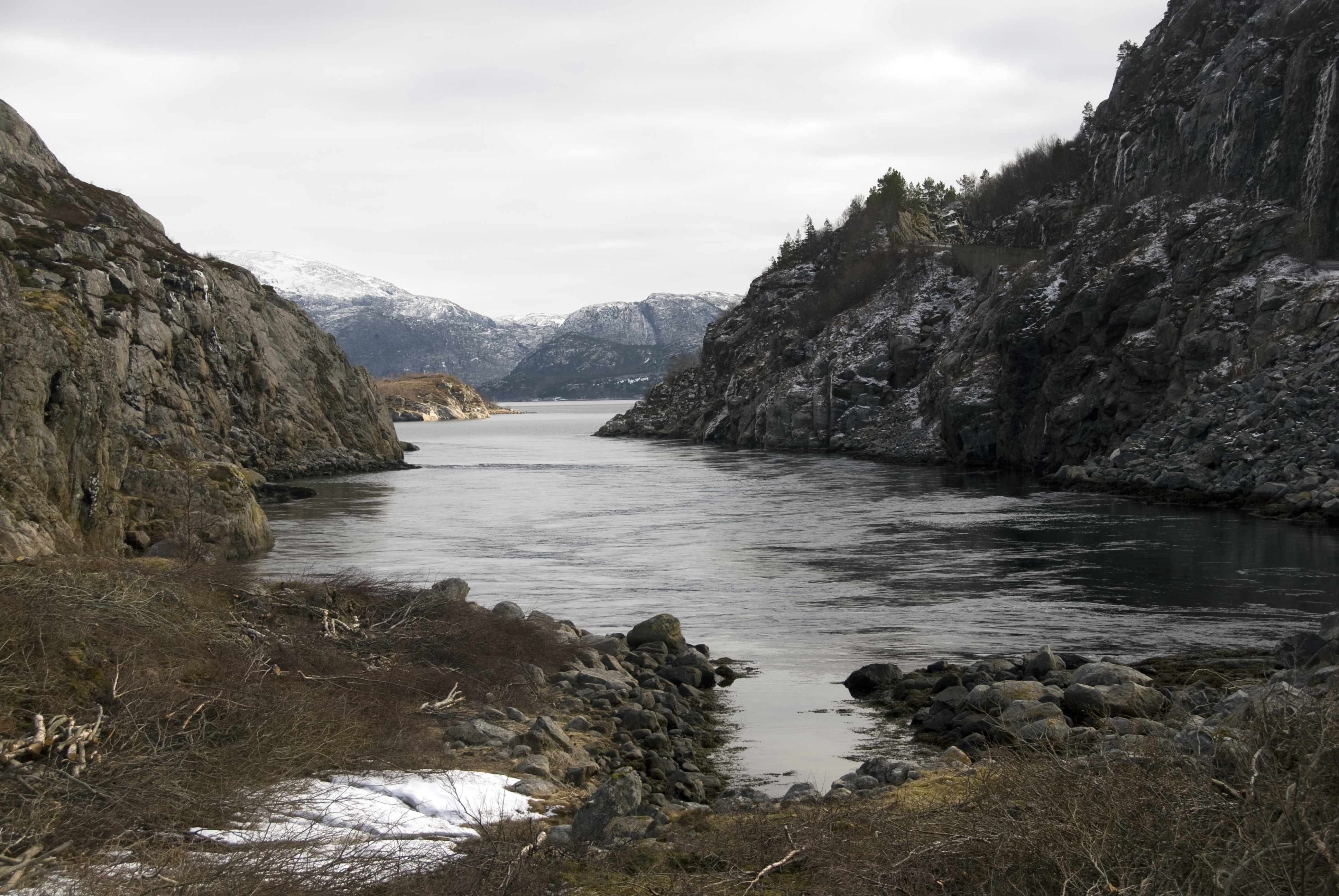
Folda or Folla is a firth and a fjord in Trøndelag county, Norway. It is located within the municipalities of Flatanger, Namsos, and Nærøysund. The large wide firth is about long which then narrows into a fjord which is about long. The narrower fjord part of Folda is often called the ''Foldfjorden'' or ''Innerfolda''. Most of the fjord is very narrow, some places with steep cliffs. It has the largest length to width factor among Norway's fjords. The fjord is crossed by the Norwegian County Road 17 road using the Folda Bridge at the village of Foldereid. Spruce forests cover most areas around the fjord. The outer-Folda area is notorious for its rough seas, and has been called an "ocean graveyard" ( no, havets kirkegård). See also * List of Norwegian fjords References Fjords of Trøndelag Flatanger Namsos Nærøysund {{Trøndelag-geo-stub ... [...More Info...] [...Related Items...] OR: [Wikipedia] [Google] [Baidu] |
Trøndelag
Trøndelag (; sma, Trööndelage) is a county in the central part of Norway. It was created in 1687, then named Trondhjem County ( no, Trondhjems Amt); in 1804 the county was split into Nord-Trøndelag and Sør-Trøndelag by the King of Denmark-Norway, and the counties were reunited in 2018 after a vote of the two counties in 2016. The largest city in Trøndelag is the city of Trondheim. The administrative centre is Steinkjer, while Trondheim functions as the office of the county mayor. Both cities serve the office of the county governor; however, Steinkjer houses the main functions. Trøndelag county and the neighbouring Møre og Romsdal county together form what is known as Central Norway. A person from Trøndelag is called a ''trønder''. The dialect spoken in the area, trøndersk, is characterized by dropping out most vowel endings; see apocope. Trøndelag is one of the most fertile regions of Norway, with large agricultural output. The majority of the production ends ... [...More Info...] [...Related Items...] OR: [Wikipedia] [Google] [Baidu] |
Norwegian County Road 17
County Road 17 ( no, Fylkesvei 17), also known as the Coastal Highway ( no, Kystriksveien), is a Norwegian highway that runs from the town of Bodø in Nordland county (in the north) to the town of Steinkjer in Trøndelag county (in the south). It is long and includes six ferry crossings. The road runs along the coast of Nordland and Trøndelag counties through 28 different municipalities. This road is a much more scenic, albeit longer and more time-consuming, route than the inland European Route E6 highway. Prior to 1 January 2010, this was National Road 17 ( no, Riksvei 17), but control and maintenance of the road was transferred to the counties from the national government on that date, so now it is a county road. Media gallery File:Saltstraumen quiet.JPG, Fv17 crosses Saltstraumen File:Helgelandsbrua1.jpg, The Helgeland Bridge north of Sandnessjøen File:Storvika-fra-skaret-2009-08-18.jpg, Storvik bay File:Sjona tunnel B.JPG, Sjona tunnel in Rana Rana may refer to: Astro ... [...More Info...] [...Related Items...] OR: [Wikipedia] [Google] [Baidu] |
List Of Norwegian Fjords ...
This list of Norwegian fjords shows many of the fjords in Norway. In total, there are about 1,190 fjords in Norway and the Svalbard islands. The sortable list includes the lengths and locations of those fjords. Fjords See also * List of glaciers in Norway * Geography of Norway {{Authority control Fjords Norway Fjords In physical geography, a fjord or fiord () is a long, narrow inlet with steep sides or cliffs, created by a glacier. Fjords exist on the coasts of Alaska, Antarctica, British Columbia, Chile, Denmark, Germany, Greenland, the Faroe Islands, Icela ... [...More Info...] [...Related Items...] OR: [Wikipedia] [Google] [Baidu] |
Kunnskapsforlaget
Kunnskapsforlaget () is a Norwegian publishing company based in Oslo. Kunnskapsforlaget was established in 1975, as a partnership between H. Aschehoug & Co. (W. Nygaard) and Gyldendal Norsk Forlag. The purpose was to co-operate on publishing encyclopaedias and dictionaries. The first volume of Store norske leksikon (SNL) was published in 1978. A total of four editions was published (the last one in 2004), before the online version was transferred to Institusjonen Fritt Ord og Sparebankstiftelsen DnB in 2011. Kunnskapsforlaget is the largest dictionary publisher in Norway. They publish both printed books, and digital dictionaries that are available through the online service Ordnett (launched in 2004). Their main languages are English and Norwegian, but they also have dictionaries in 21 other languages. In September 2018, Gyldendal Norsk Forlag became the single owner of the company. As of 2018, the publisher has eight full-time employees. The CEO is Thomas Nygaard Thomas m ... [...More Info...] [...Related Items...] OR: [Wikipedia] [Google] [Baidu] |
Store Norske Leksikon
The ''Great Norwegian Encyclopedia'' ( no, Store Norske Leksikon, abbreviated ''SNL''), is a Norwegian-language online encyclopedia. The online encyclopedia is among the most-read Norwegian published sites, with more than two million unique visitors per month. Paper editions 1978–2007 The ''SNL'' was created in 1978, when the two publishing houses Aschehoug and Gyldendal merged their encyclopedias and created the company Kunnskapsforlaget. Up until 1978 the two publishing houses of Aschehoug and Gyldendal, Norway's two largest, had published ' and ', respectively. The respective first editions were published in 1907–1913 (Aschehoug) and 1933–1934 (Gyldendal). The slump in sales for paper-based encyclopedias around the turn of the 21st century hit Kunnskapsforlaget hard, but a fourth edition of the paper encyclopedia was secured by a grant of ten million Norwegian kroner from the foundation Fritt Ord in 2003. The fourth edition consisted of 16 volumes, a t ... [...More Info...] [...Related Items...] OR: [Wikipedia] [Google] [Baidu] |
Spruce
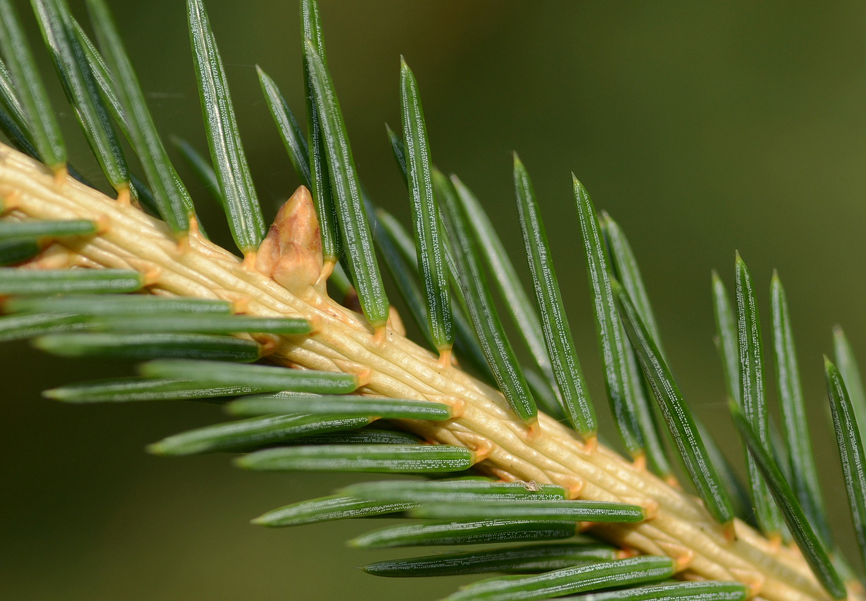
A spruce is a tree of the genus ''Picea'' (), a genus of about 35 species of coniferous evergreen trees in the family Pinaceae, found in the northern temperate and boreal (taiga) regions of the Earth. ''Picea'' is the sole genus in the subfamily Piceoideae. Spruces are large trees, from about 20 to 60 m (about 60–200 ft) tall when mature, and have whorled branches and conical form. They can be distinguished from other members of the pine family by their needles (leaves), which are four-sided and attached singly to small persistent peg-like structures (pulvini or sterigmata) on the branches, and by their cones (without any protruding bracts), which hang downwards after they are pollinated. The needles are shed when 4–10 years old, leaving the branches rough with the retained pegs. In other similar genera, the branches are fairly smooth. Spruce are used as food plants by the larvae of some Lepidoptera (moth and butterfly) species, such as the eastern spruce budwo ... [...More Info...] [...Related Items...] OR: [Wikipedia] [Google] [Baidu] |
Foldereid
Foldereid is a village in Nærøysund municipality in Trøndelag county, Norway. The village is located near the inner part of the Folda fjord, the ''Innerfolda'', just south of the border with Nordland county. The Norwegian County Road 770 and the Norwegian County Road 17 both run through the village and the Folda Bridge (over the Foldafjord) lies just east of the village. Foldereid Church is located in the village. The village was the administrative centre An administrative center is a seat of regional administration or local government, or a county town, or the place where the central administration of a commune is located. In countries with French as administrative language (such as Belgium, Lu ... of the old municipality of Foldereid that existed from 1886 until 1964. References External links *http://www.foldereid.no Villages in Trøndelag Nærøysund {{Trøndelag-geo-stub ... [...More Info...] [...Related Items...] OR: [Wikipedia] [Google] [Baidu] |
Folda Bridge
The Folda Bridge ( no, Follabrua) is a suspension bridge in Nærøysund municipality in Trøndelag county, Norway. The bridge crosses the Foldereidsundet strait which is part of the inner-Foldafjord. The bridge is long, the main span is , and the maximum clearance below the bridge . At the northern end of the bridge, the road enters a long tunnel through a mountain before entering the village of Foldereid Foldereid is a village in Nærøysund municipality in Trøndelag county, Norway. The village is located near the inner part of the Folda fjord, the ''Innerfolda'', just south of the border with Nordland county. The Norwegian County Road 770 and .... The bridge was completed in 1969. References External linksPicture of the Folda Bridge [...More Info...] [...Related Items...] OR: [Wikipedia] [Google] [Baidu] |
Nærøysund
Nærøysund is a municipality in Trøndelag county, Norway. It is located in the traditional district of Namdalen. The municipality was established on 1 January 2020 after the merger of the old municipalities of Vikna and Nærøy. The municipality is unique in that it has two equal administrative centre: Kolvereid and Rørvik. The other main population centres of Nærøysund include Abelvær, Foldereid, Gravvik, Ottersøy, Salsbruket, Steine, Torstad, Austafjord, Garstad, and Valøya. The municipality is the 70th largest by area out of the 356 municipalities in Norway. Nærøysund is the 114th most populous municipality in Norway with a population of 9,732. The municipality's population density is and its population has increased by 4.5% over the previous 10-year period. General information Municipal history The municipality was established on 1 January 2020 when the neighboring municipalities of Nærøy and Vikna were merged. The small Lund area of Nærøy was not part of ... [...More Info...] [...Related Items...] OR: [Wikipedia] [Google] [Baidu] |
Norway
Norway, officially the Kingdom of Norway, is a Nordic country in Northern Europe, the mainland territory of which comprises the western and northernmost portion of the Scandinavian Peninsula. The remote Arctic island of Jan Mayen and the archipelago of Svalbard also form part of Norway. Bouvet Island, located in the Subantarctic, is a dependency of Norway; it also lays claims to the Antarctic territories of Peter I Island and Queen Maud Land. The capital and largest city in Norway is Oslo. Norway has a total area of and had a population of 5,425,270 in January 2022. The country shares a long eastern border with Sweden at a length of . It is bordered by Finland and Russia to the northeast and the Skagerrak strait to the south, on the other side of which are Denmark and the United Kingdom. Norway has an extensive coastline, facing the North Atlantic Ocean and the Barents Sea. The maritime influence dominates Norway's climate, with mild lowland temperatures on the se ... [...More Info...] [...Related Items...] OR: [Wikipedia] [Google] [Baidu] |
Namsos
( sma, Nåavmesjenjaelmie) is a municipality in Trøndelag county, Norway. It is part of the Namdalen region. The administrative centre of the municipality is the town of Namsos. Some of the villages in the municipality include Bangsund, Klinga, Ramsvika, Skomsvoll, Spillum, Sævik, Dun, Salsnes, Nufsfjord, Lund, Namdalseid, Sjøåsen, Statland, Tøttdalen, and Sverkmoen. The municipality is the 30th largest by area out of the 356 municipalities in Norway. Namsos is the 80th most populous municipality in Norway with a population of 15,001. The municipality's population density is and its population has decreased by 2.1% over the previous 10-year period. General information Name The first part of the name comes from the local river Namsen. The last element is ''os'', which means the " mouth of a river". Coat of arms The coat of arms was granted to the town of Namsos on 5 May 1961. They were re-granted on 21 October 1966 when the town was merged into the municip ... [...More Info...] [...Related Items...] OR: [Wikipedia] [Google] [Baidu] |
Flatanger
Flatanger is a List of municipalities of Norway, municipality in Trøndelag Counties of Norway, county, Norway. It is part of the Namdalen Districts of Norway, region. The administrative centre of the municipality is the village of Lauvsnes. Other villages include Jøssund, Flatanger, Jøssund, Hasvåg, and Vik, Trøndelag, Vik. The municipality is the 217th largest by area out of the 356 municipalities in Norway. Flatanger is the 326th most populous municipality in Norway with a population of 1,101. The municipality's population density is and its population has decreased by 3.5% over the previous 10-year period. Flatanger is also known for having some of the most difficult sport climbing routes in the world. General information Flatanger was established as a municipality in the old Nord-Trøndelag county on 1 January 1871 when it was separated from the large municipality of Fosnes. Initially, Flatanger had 1,472 residents. It is one of the few municipalities in Norway whose ... [...More Info...] [...Related Items...] OR: [Wikipedia] [Google] [Baidu] |


