|
Five Mile Lane
The A4226 (better known as The Five Mile Lane) is a main road linking Bonvilston to Barry and Cardiff International Airport (CIA) in the Vale of Glamorgan, Wales. Road course First stage The A4226 begins at the junction with the A48 road (Sycamore Cross) just east of Bonvilston and south of Gwern-y-Steeple and Peterston-Super-Ely. It heads in a southerly direction past numerous farms and country lanes leading off to hamlets such as Llancadle, Moulton, Walterston and Dyffryn Gardens etc., past the Welsh Hawking Centre until the junction with Port Road (leading to the A4050 road at Colcot roundabout) at Weycock Cross in northwestern Barry. The Five Mile Lane This initial stage of the road is widely known locally as The Five Mile Lane, in fact it is nearer 4 miles today but historically the road extended along what is now Pontypridd Road in Barry to Romilly, roughly 5 miles in total. Second stage However, the A4226 route forks some 120 degrees at Weycock Cross to the right ... [...More Info...] [...Related Items...] OR: [Wikipedia] [Google] [Baidu] |
Bonvilston
Bonvilston ( cy, Tresimwn) is a village in the Vale of Glamorgan, Wales. The village is situated on the A48 about four miles east of Cowbridge and near the Welsh capital city of Cardiff. The population in 2011 was 392. History It is named after Simon de Bonville, a Norman nobleman; hence the name of the village, though different in English and Welsh, translates as "Simon's town" or "Bonville's town" and refers to the same person. Simon de Bonville lived here in the 12th century. In 1291, "Margam conveyed to Thomas le Spudur of Bonvilston an acre of arable land with a house and curtilage in the vill of 'Tudekistowe', which Thomas, son of Robert had previously leased from the abbey; in exchange, Thomas gave the abbey two acres of land in Bonvilston." The manor subsequently became increasingly under the power of Margam Abbey. In the 19th century, Richard Bassett, a prominent figure in Glamorgan resided at Bonvilston House and owned the manor. The 1811 ''A Topographical Dictio ... [...More Info...] [...Related Items...] OR: [Wikipedia] [Google] [Baidu] |
Dyffryn Gardens
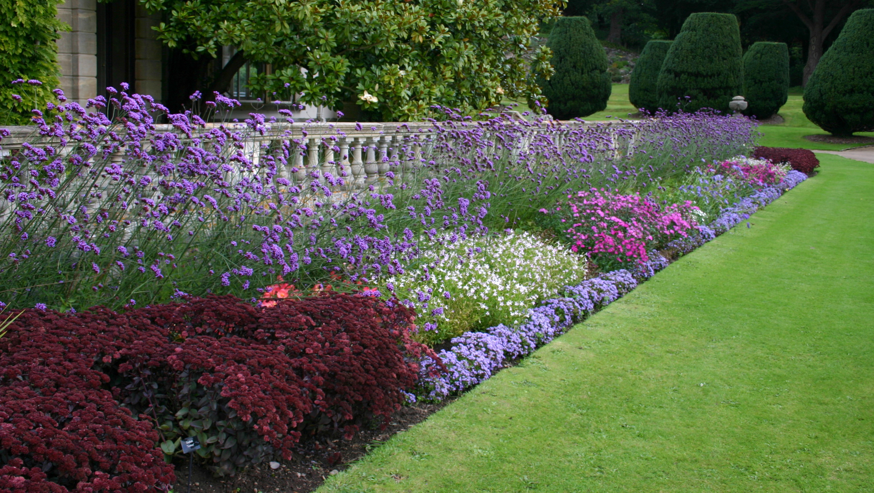
Dyffryn Gardens ( cy, Gerddi Dyffryn) is a collection of botanical gardens located near the villages of Dyffryn and St. Nicholas in the Vale of Glamorgan, Wales. The gardens were selected by the British Tourist Authority as one of the Top 100 gardens in the UK and are in the care of the National Trust. History of the Dyffryn Estate The Dyffryn Estate dates back to 640 A.D. when the Manor of Worlton (also known as Worleton), which included St Lythans and St Nicholas, was granted to Bishop Oudoceus of Llandaff. In the 16th century the Manor of Worlton was rented under copyhold by the Button family, who are believed to have first settled at the manor at Dog Hill in Dyffryn.Lloyd (1958), pg 60. The family's next residence, Columbar, was thought to be built on the location of Dyffryn Gardens. The Button family occupied the estate for a number of generations, producing Admiral Thomas Button who become a notable early explorer. The name of the Manor of Worlton was changed to the Manor ... [...More Info...] [...Related Items...] OR: [Wikipedia] [Google] [Baidu] |
Penmark
Penmark ( cy, Pen-marc) is a rural village south-west of Barry near Rhoose in the Vale of Glamorgan, in South Wales. The village is a parish and is a linear village. It has a parish church along the main road running through the village. Penmark is located near the international airport for Wales, Cardiff International Airport. Penmark Castle The village has the remains of a 13th-century castle A castle is a type of fortified structure built during the Middle Ages predominantly by the nobility or royalty and by military orders. Scholars debate the scope of the word ''castle'', but usually consider it to be the private fortified r .... Gallery File:Six Bells Pub, Penmark.jpg, Six Bells Pub File:Penmark Church 1.jpg, Penmark Church File:Penmark Church 2.jpg, Penmark Church See also * William Howells, the first Mormon missionary in France References External links www.penmark.org.uk : Penmark community website Villages in the Vale of Glamorgan Rhoose ... [...More Info...] [...Related Items...] OR: [Wikipedia] [Google] [Baidu] |
Bridgend
Bridgend (; cy, Pen-y-bont ar Ogwr or just , meaning "the end of the bridge on the Ogmore") is a town in Bridgend County Borough in Wales, west of Cardiff and east of Swansea. The town is named after the Old Bridge, Bridgend, medieval bridge over the River Ogmore. The River Ewenny also flows through the town. The population was 49,597 in 2021. Historic counties of Wales, Historically a part of Glamorgan, Bridgend has greatly expanded in size since the early 1980s – the United Kingdom Census 2001, 2001 census recorded a population of 39,429 for the town and the 2011 census reported that the Bridgend Local Authority had a population of 139,200 – up from 128,700 in 2001. This 8.2% increase was the largest increase in Wales except for Cardiff. The town is undergoing a redevelopment project, with the town centre mainly pedestrianised and ongoing works including Brackla Street Centre redevelopment to Bridgend Shopping Centre, Rhiw Car Park redevelopment, ongoing public realm im ... [...More Info...] [...Related Items...] OR: [Wikipedia] [Google] [Baidu] |
Llantwit Major
Llantwit Major ( cy, Llanilltud Fawr) is a town and community in Wales on the Bristol Channel coast. It is one of four towns in the Vale of Glamorgan, with the third largest population (13,366 in 2001) after Barry and Penarth, and ahead of Cowbridge. It is from Cowbridge, from Bridgend, from Barry, and from Cardiff. It had a population of 9,486 in 2011. ''Llanilltud Fawr'', named for the Llan of Saint Illtud, was home to the Monastery of Illtud and the college known as Bangor Illtyd. It became one of the most esteemed centres of Christian culture in the Celtic world. At its peak it had over 2000 students, including princes, eminent clergymen, and revered saints. The institutions were destroyed by the raiding Vikings in 987, but Norman rebuilt the monastery in 1111 and it continued to be a centre of learning until it was disbanded in 1539 during the Dissolution of the Monasteries. The 13th-century St Illtyd's Church, near the ancient monastery, is a Grade I listed building ... [...More Info...] [...Related Items...] OR: [Wikipedia] [Google] [Baidu] |
B4265 Road
The B4265 road (often known as the Barry-Llantwit road) is a main road in the Vale of Glamorgan, southeastern Wales, running in a northwesterly direction along near the coast. It links Cardiff Airport to Bridgend, lasting for 15.9 miles (25.6 km). The road begins at the roundabout near the airport and the village of Penmark at as a continuation of the A4226 road leading from Barry. Passing the junction turnoff to Gileston and St Athan, at Llantwit Major, the B4270 road branches off to the northwest to Llandow Industrial Estate. The road then moves progressively in northwesterly direction until St Brides Major, where the B4524 road to the south connects it to Southerndown and Ogmore-by-Sea. At St Brides Major, the road shifts to a northerly direction, where it passes Ewenny and Ogmore village leading to Bridgend, where it joins the A48 road The A48 is a trunk road in Great Britain running from the A40 at Highnam, west of Gloucester, England, to the A40 at Carmart ... [...More Info...] [...Related Items...] OR: [Wikipedia] [Google] [Baidu] |
Cwm Ciddi
Cwm may refer to: * Cwm (landform), a rounded, glaciated valley, also known as a corrie or cirque * Cwm (software), a general-purpose data processor for the semantic web * Cwm railway station, a station in Cwm, Blaenau Gwent, Wales, 1852–1963 * Cwm Rhondda, a famous Welsh hymn tune Places * Cwm, Blaenau Gwent, a community in Wales * Cwm, Llanrothal, a Jesuit gathering place in Herefordshire, England * Cwm, Denbighshire, a community in Wales * Cwm Cadnant, a community in Anglesey, north Wales * Cwm Gwaun, a community in northern Pembrokeshire, Wales * Cwm Penmachno, a community in Snowdonia, north Wales * Western Cwm, a geographical feature on Mount Everest Abbreviations * cwm (window manager) or Calm Window Manager, a stacking window manager for Unix systems * Canadian War Museum, Canada's national museum of military history * Cape Wine Master, a South African wine industry qualification * Christian Witness Ministries, a non-denominational church affiliation * Circus World M ... [...More Info...] [...Related Items...] OR: [Wikipedia] [Google] [Baidu] |
Romilly, Vale Of Glamorgan
Romilly is a western district of Barry in the Vale of Glamorgan, South Wales, United Kingdom. The area has an attractive public park which includes an extensive field and tennis court facilities. It is located around the corner from Cold Knap Cold Knap is a district of Barry in South Wales. Amenities Cold Knap is a coastal pebble beach (with some sand at low tide), approximately a mile west of the sandy beach at Barry Island, which attracts visitors during the summer months. It exte .... An educational centre was built on Romilly Road in 1957. References Neighbourhoods of Barry, Vale of Glamorgan {{ValeofGlamorgan-geo-stub ... [...More Info...] [...Related Items...] OR: [Wikipedia] [Google] [Baidu] |
Colcot
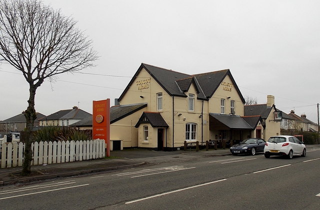
Colcot is a northern district of Barry, Vale of Glamorgan, in the Dyfan ward of South Wales. Dyfan ward is situated in the north west of Barry and its most northern edge is on the green belt of the town. Port Road West runs through the ward and is the main route to Cardiff and Cardiff International Airport in Rhoose. Dyfan benefits from a sports centre and Buttrills recreation field and The Barry Hospital can be found on Colcot Road. It also contains the Colcot Primary School, the Colcot Arms pub, the St David's Methodist Church, Coastlands Family Church, a fish and chip shop/Chinese takeaway, Barry Arts Centre and Merthyr Dyfan Cemetery. History Nearby Merthyr Dyfan contained land belonging to a sub manor of Cadoxton. It contained two carucates and 240 customary acres of arable land, and there was a court or grange belonging to it in Colcot. Historically the farms Colcot Fawr and Colcot Ganol were in the vicinity, and a Collcot Farm is also mentioned in 1784. Colcot Fawr, once b ... [...More Info...] [...Related Items...] OR: [Wikipedia] [Google] [Baidu] |
A4050 Road
The A4050 road connects Barry, Vale of Glamorgan with Culverhouse Cross on the outskirts of Cardiff, Wales. It is approximately long, and is the key link road between the M4 motorway and Cardiff International Airport. 2008 road improvements Wenvoe village lies along the road. In 2008 the Welsh Assembly allocated £576,000 to road resurfacing and improvement, which as of 2012 was still ongoing. One area given specific attention is the area around Pencoedtre between Waycock Cross and Barry as housing development and a new crematorium has been created in recent times. Culverhouse Cross At Culverhouse Cross, the A4050 connects to the A48 and the A4232. The A48 links with Cowbridge and to Cowbridge Road West which connects the western Cardiff district of Ely to Canton and the city centre. The A4232 links with the M4 at junction 33 and Cardiff Bay. History Original 1932 route In 1932, the A4050 was a short road along the Rhymney Valley, connecting Bargoed with the A4049 i ... [...More Info...] [...Related Items...] OR: [Wikipedia] [Google] [Baidu] |
Walterston
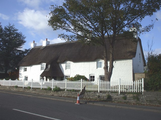
Walterston ( cy, Tre-walter) is a small farming hamlet just north of Barry in the Vale of Glamorgan in South Wales and west of Dyffryn. Walterston lies just to west of the Five Mile Lane leading down to Waycock Cross, Barry. The hamlet is very small and has just a few farms, all of which are twelfth to thirteenth century in origin. There are also several houses of which the two largest are the thatched 'Walterston Fach' and its neighbouring 'Trewalter Fawr'. The old monastic village of Llancarfan Llancarfan is a rural village and community in the Vale of Glamorgan, Wales. The village, located west of Barry and near Cowbridge, has a well-known parish church, the site of Saint Cadoc's 6th-century clas, famed for its learning. Cainnech of A ... lies a further two miles to the west. External linkswww.geograph.co.uk : photos of Walterston and surrounding area* Villages in the Vale of Glamorgan {{ValeofGlamorgan-geo-stub ... [...More Info...] [...Related Items...] OR: [Wikipedia] [Google] [Baidu] |
Cardiff International Airport
Cardiff Airport ( cy, Maes Awyr Caerdydd) is the only airport offering commercial passenger services in Wales. It has been under the ownership of the Welsh Government since March 2013, operating at an arm's length as a commercial business. Passenger numbers were 1.66 million in 2019 and were increasing year-on-year. Since 2020, like most other airports, Cardiff Airport has suffered a major downturn in passengers due to the Covid-19 pandemic. These however have failed to recover, and passenger numbers are now down to those experienced in the 1960s. Company In 2013, the Welsh Government purchased Cardiff International Airport Ltd (CIAL) from TBI Ltd as a going concern for £52million. The Welsh Government, on behalf of the Welsh Ministers, operates CIAL as an arms length public corporation, with distinct separation achieved through WGC Holdco Limited. WGC Holdco Limited was incorporated as a private company limited by shares on 21 March 2013. WGC Holdco Limited acquired CIAL ... [...More Info...] [...Related Items...] OR: [Wikipedia] [Google] [Baidu] |


