|
Firceall
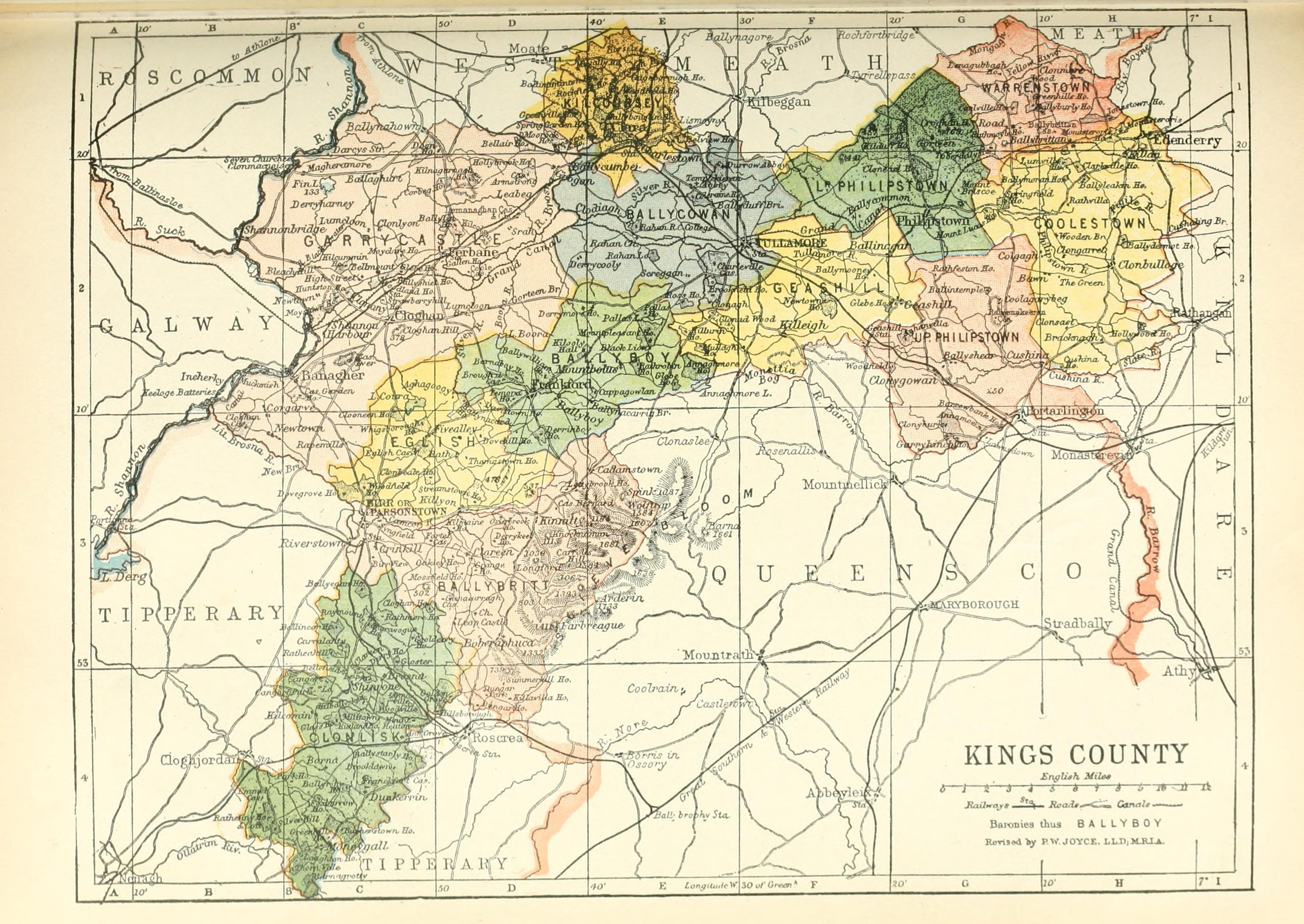
Firceall () was an ancient Gaelic Irish territory which formed the most south - westerly part of the ancient Kingdom of Meath. O'Molloy was chieftain of the territory. Firceall itself comprised the ancient baronies of Ballycowan, Ballyboy and Eglish, which are located in modern day mid County Offaly extending from Durrow north of Tullamore to Eglish on the edge of Birr in an area which is some 25 miles in length by 5 miles in width. The name Firceall comes from the Irish words ''Fir Ceala'' meaning ''Men of the Churches''. Details O'Molloy claimed descent from Niall of the Nine Hostages who ruled Tara from 380 - 405. Firceall formed land boundaries with a number of major ancient Irish Gaelic Kingdoms. A land boundary was formed with Éile (Ely) of the Kingdom of Munster just east of Birr. Near Tullamore another land boundary with Uí Failghe (anglicised as Offaly) of the Kingdom of Leinster was formed. Firceall also formed a land boundary with the territory of Delvi ... [...More Info...] [...Related Items...] OR: [Wikipedia] [Google] [Baidu] |
Tullamore
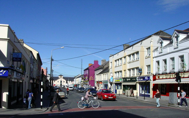
Tullamore (; ) is the county town of County Offaly in Ireland. It is on the Grand Canal, in the middle of the county, and is the fourth most populous town in the midlands region with 14,607 inhabitants at the 2016 census. The town retained Gold Medal status in the National Tidy Town Awards in 2015 and also played host to the World Sheep Dog Trials in 2005 which attracted international interest in the region. The Tullamore Show is held near the town every year. The town's most famous export is Tullamore Dew – an Irish whiskey distilled by Tullamore Distillery – that can be traced back to 1829. The original distillery was shut down in 1954, with the brand later being resurrected and produced at the Midleton Distillery, in Cork. However, the brand's new owners, William Grant & Sons, invested in a new distillery near Tullamore, bringing whiskey production back to the town in 2014. History In the Middle Ages, Tullamore was within the Gaelic territory of Firce ... [...More Info...] [...Related Items...] OR: [Wikipedia] [Google] [Baidu] |
Rath, County Offaly
Rath () is a hamlet in the south west area of County Offaly, Ireland., United States National Geospatial-Intelligence Agency The hamlet is located midway between the towns of Birr and Kilcormac on a northeast-southwest country road. It is located in the parish of Eglish and Drumcullen which is in the Roman Catholic Diocese of Meath. The hamlet has a number of local amenities for the local population including a church (dedicated to St. John the Baptist), a national school, a local community centre and a local shop. Drumcullen GAA is the local GAA club and is located about half a kilometre to the south of the hamlet. As the place-name suggests, Rath takes its name from the Irish word 'An Ráth' which means ringfort. Ringforts are circular fortified settlements with some dating as far back as the Iron Age (800 BCE–400 CE). There is no evidence of a ringfort at the present day hamlet, however there are remains of one at nearby Mullinafawnia, a few kilometres south west of t ... [...More Info...] [...Related Items...] OR: [Wikipedia] [Google] [Baidu] |
Eglish (barony)
Eglish (), also called Fercale (''Fir Ceall'') is a barony in County Offaly (formerly King's County), Republic of Ireland. Etymology The names Eglish (''An Eaglais'', "the church") and Fercale (''Fir Ceall'', "men of the churches") both refer to churches. Location Eglish is located in west County Offaly. It contains Lough Coura. History Eglish was territory of the Ó Maolmhuaidh (O'Molloy) of the Southern Uí Néill, prince of Firceall (Fir Cell, "men of the churches"). During its existence Firceall was the location of a number of ancient abbeys and castles. The church at Lynally (near Tullamore) formed the parish church until the foundation of parish churches at Rahan, Killoughey, Ballyboy Ballyboy or Ballaboy () is a village in County Offaly, Ireland. It is about two kilometres east of Kilcormac. Prior to the Plantations of Ireland, Ballyboy was ruled by O'Molloy in a territory known as Firceall which was allied to the Kingdom ..., Drumcullen and Eglish. A numbe ... [...More Info...] [...Related Items...] OR: [Wikipedia] [Google] [Baidu] |
County Offaly
County Offaly (; ga, Contae Uíbh Fhailí) is a county in Ireland. It is part of the Eastern and Midland Region and the province of Leinster. It is named after the ancient Kingdom of Uí Failghe. It was formerly known as King's County, in honour of Philip II of Spain. Offaly County Council is the local authority for the county. The county population was 82,668 at the 2022 census. Central Statistics Office figures Geography and political subdivisions Offaly is the 18th largest of Ireland's 32 counties by area and the 24th largest in terms of population. It is the fifth largest of Leinster's 12 counties by size and the 10th largest by population.Physical geography [...More Info...] [...Related Items...] OR: [Wikipedia] [Google] [Baidu] |
Ballyboy
Ballyboy or Ballaboy () is a village in County Offaly, Ireland. It is about two kilometres east of Kilcormac. Prior to the Plantations of Ireland, Ballyboy was ruled by O'Molloy in a territory known as Firceall which was allied to the Kingdom of Meath. When the Gaelic chieftains were removed from power following the English Plantations, Firceall was broken up with Ballyboy forming its own barony within the then newly formed King's County (now County Offaly). Although now a small village of several houses, a pub and a primary school, it was an important and thriving hub in the Middle Ages. During this era, the town had a hat and glove factory, and a mill which was used for making flour, grinding corn and cutting timber. The ruins of the mill are still standing today on the road from the village to Ballyoran. The mill, one of several in the area, was powered by water from the Silver River which is a tributary of the River Brosna. There is also a ring fort in the village env ... [...More Info...] [...Related Items...] OR: [Wikipedia] [Google] [Baidu] |
Kilcormac
Kilcormac () is a small town in County Offaly, Ireland, located on the N52 at its junction with the R437 regional road, between the towns of Tullamore and Birr. It is a small town of 935 people (as of the 2016 census), many of whom were previously employed by Bord na Móna to work the local peat bogs. The town is located near the Slieve Bloom Mountains. The Silver River flows through the town. The town was more commonly referred to as ''Frankford'' prior to Irish independence. History The name Kilcormac comes from the Irish Cill Chormaic meaning Cormac's Church. This name is based on the local patron saint; Cormac Ua Liatháin, a native of Cork, who paid a visit to St Colmcille at the famous monastery he had founded in Durrow in 553 A.D. Cormac was so inspired by the great saint that he joined Colmcille and spent many years at Durrow, eventually taking over as abbot after Colmcille had gone to Iona in Scotland. He eventually founded a church near the Silver River which ... [...More Info...] [...Related Items...] OR: [Wikipedia] [Google] [Baidu] |
Eglish
Eglish () is a small village in County Tyrone, Northern Ireland. It is about 6 km southwest of Dungannon, in the Mid Ulster District Council area. In the 2001 Census it had a population of 93. The village has grown in a dispersed form and has a mix of housing, industry and services. Sport Eglish St. Patrick's is the local Gaelic Athletic Association The Gaelic Athletic Association (GAA; ga, Cumann Lúthchleas Gael ; CLG) is an Irish international amateur sporting and cultural organisation, focused primarily on promoting indigenous Gaelic games and pastimes, which include the traditional ... club. Schools Roan St Patrick's is the local primary school. References Links Villages in County Tyrone {{Tyrone-geo-stub ... [...More Info...] [...Related Items...] OR: [Wikipedia] [Google] [Baidu] |
Killoughey
Killoughey, officially Killoughy and historically "Killaghy" or "Killahy" (), (see archival records) is a and south-west of in , . Before 1784 there were two ... [...More Info...] [...Related Items...] OR: [Wikipedia] [Google] [Baidu] |
Rahan, County Offaly
Rahan () is a parish and village in County Offaly, Ireland. It is associated with Mochuda (also known as St. Carthage). The village is located on the banks of the river Clodagh approximately 8 km from Tullamore. The parish of Rahan extends from The Island near Ballycumber in the north to Mucklagh in the south. History First monastery The first monastery in Rahan was created by Camelacus in the 5th century and later re-founded in the 6th century by St Carthage. The ancient monasteries and churches located here are known as the church of St Carthage or St Carthach, and the monastery of Mochuda.RAHAN MONASTIC SITE - A Conservation Plan (PDF) Saint |
Plantations Of Ireland
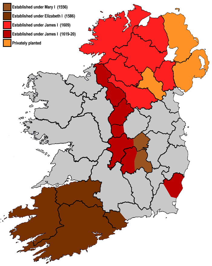
Plantations in 16th- and 17th-century Ireland involved the confiscation of Irish-owned land by the English Crown and the colonisation of this land with settlers from Great Britain. The Crown saw the plantations as a means of controlling, anglicising and 'civilising' Gaelic Ireland. The main plantations took place from the 1550s to the 1620s, the biggest of which was the plantation of Ulster. The plantations led to the founding of many towns, massive demographic, cultural and economic changes, changes in land ownership and the landscape, and also to centuries of ethnic and sectarian conflict. They took place before and during the earliest English colonisation of the Americas, and a group known as the West Country Men were involved in both Irish and American colonization. There had been small-scale immigration from Britain since the 12th century, after the Anglo-Norman invasion. By the 15th century, direct English control had shrunk to an area called the Pale. In the 1540 ... [...More Info...] [...Related Items...] OR: [Wikipedia] [Google] [Baidu] |


