|
Fencott
Fencott is a Hamlet (place), hamlet between the River Ray and Otmoor in the Civil parishes in England, civil parish of Fencott and Murcott, about south of Bicester in Oxfordshire, England. History In 1542 the Crown granted most of the land at Murcott to the Dean and Chapter of Westminster Abbey. They retained it until the end of the 19th century, when it passed to the Ecclesiastical Commissioners. There was also one Hide (unit), hide of land that belonged to Abingdon Abbey. In about 1180 the Abbot of Abingdon gave this holding in an exchange of land to one William Turpin. In 1230 Godstow Abbey bought the land from Osbert Turpin, but had to continue paying quit-rent to Abingdon Abbey. At the dissolution of the monasteries in the 1530s the land passed to the Crown, which disposed of it in 1553. Fencott used to have a public house, the Black Bull. It closed before 1939, but there is still a Black Bull Lane in the hamlet. References Sources and further reading * * Hamle ... [...More Info...] [...Related Items...] OR: [Wikipedia] [Google] [Baidu] |
Fencott And Murcott
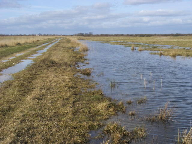
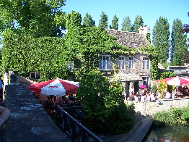
Fencott and Murcott is a Civil parishes in England, civil parish about south of Bicester in the Cherwell (district), Cherwell district of Oxfordshire, England. The parish is bounded on the north and west by the River Ray and has an area of just over being inclusive of roads and watercourses. It includes the villages of Fencott and Murcott, Oxfordshire, Murcott and had a population of about 285 residents in 2011. There are no shops or post offices but there is one public house, the Nut Tree Inn at Murcott. The M40 motorway passes through the northern part of the parish. The parish covers most of Otmoor, including the RSPB Otmoor, Otmoor RSPB nature reserve. References External links Fencott and Murcott page on the Alice's Meadow website Fencott & Murcott Parish Council page on Oxfordshire County Council website Fencott & Murcott page on the OWLS website provided by Oxfordshire County Council. This shows the different landscape types and Site of Special Scientific Interest ( ... [...More Info...] [...Related Items...] OR: [Wikipedia] [Google] [Baidu] |
Cherwell (district)
Cherwell ( ) is a local government district in northern Oxfordshire, England. The district takes its name from the River Cherwell, which drains south through the region to flow into the River Thames at Oxford. Towns in Cherwell include Banbury and Bicester. Kidlington is a contender for largest village in England. The district was formed on 1 April 1974, under the Local Government Act 1972, by a merger of the municipal borough of Banbury, Bicester urban district, Banbury Rural District and Ploughley Rural District. Geography The Northern half of the Cherwell district consists mainly of soft rolling hills going down towards the River Cherwell, but the southern half of the district around Bicester is much flatter. Much of the district is soft rolling hills with the northwest of the district lying at the northern extremity of the Cotswolds. Transport Much of the district is within easy reach of the M40, with junctions 9, 10 and 11 in the district. It also has good rail links w ... [...More Info...] [...Related Items...] OR: [Wikipedia] [Google] [Baidu] |
Otmoor
Otmoor or Ot Moor is an area of wetland and wet grassland in Oxfordshire, England, located halfway between Oxford and Bicester. It is about above sea level, and has an area of nearly . It is encircled by the "Seven Towns" of Otmoor: Beckley, Oxfordshire, Beckley, Noke, Oxfordshire, Noke, Oddington, Oxfordshire, Oddington, Charlton-on-Otmoor, Fencott, Murcott, Oxfordshire, Murcott and Horton-cum-Studley. Part of it is a nature reserve, RSPB Otmoor, which adjoins a Ministry of Defence firing range, which is part of a Site of Special Scientific Interest. History Bisected north–south by the Roman Road between Alchester Roman Town, Alchester and Dorchester-on-Thames, its name is derived from the Old English for "Otta's Fen". Enclosure Watered by the River Ray, it was until the early 19th century unenclosed marshland, and regularly flooded in winter. An Enclosure Act was passed in 1815, under which the area was extensively drained. This disadvantaged the local farmers and led to ci ... [...More Info...] [...Related Items...] OR: [Wikipedia] [Google] [Baidu] |
Victoria County History
The Victoria History of the Counties of England, commonly known as the Victoria County History or the VCH, is an English history project which began in 1899 with the aim of creating an encyclopaedic history of each of the historic counties of England, and was dedicated to Victoria of the United Kingdom, Queen Victoria. In 2012 the project was rededicated to Elizabeth II, Queen Elizabeth II in celebration of her Diamond Jubilee year. Since 1933 the project has been coordinated by the Institute of Historical Research in the University of London. History The history of the VCH falls into three main phases, defined by different funding regimes: an early phase, 1899–1914, when the project was conceived as a commercial enterprise, and progress was rapid; a second more desultory phase, 1914–1947, when relatively little progress was made; and the third phase beginning in 1947, when, under the auspices of the Institute of Historical Research, a high academic standard was set, and pr ... [...More Info...] [...Related Items...] OR: [Wikipedia] [Google] [Baidu] |
Oxfordshire Architectural And Historical Society
The Oxfordshire Architectural and Historical Society (OAHS) has existed in one form or another since at least 1839, although with its current name only since 1972. , , United Kingdom. Its annual publication, ''Oxoniensia'', has been produced since 1936. Overview The Society was founded in 1839 as the Society for Promoting the Study of Gothic Architecture. In 1848, it was renamed to become the Oxford Architectural Society and in 1860 it was re-founded as the Oxford Architectural and Historical Society. In 1972, the society was ...[...More Info...] [...Related Items...] OR: [Wikipedia] [Google] [Baidu] |
Oxoniensia
The Oxfordshire Architectural and Historical Society (OAHS) has existed in one form or another since at least 1839, although with its current name only since 1972. , , United Kingdom. Its annual publication, ''Oxoniensia'', has been produced since 1936. Overview The Society was founded in 1839 as the Society for Promoting the Study of Gothic Architecture. In 1848, it was renamed to become the Oxford Architectural Society and in 1860 it was re-founded as the Oxford Architectural and Historical Society. In 1972, the society was ...[...More Info...] [...Related Items...] OR: [Wikipedia] [Google] [Baidu] |
Public House
A pub (short for public house) is a kind of drinking establishment which is licensed to serve alcoholic drinks for consumption on the premises. The term ''public house'' first appeared in the United Kingdom in late 17th century, and was used to differentiate private houses from those which were, quite literally, open to the public as "alehouses", "taverns" and "inns". By Georgian times, the term had become common parlance, although taverns, as a distinct establishment, had largely ceased to exist by the beginning of the 19th century. Today, there is no strict definition, but CAMRA states a pub has four characteristics:GLA Economics, Closing time: London's public houses, 2017 # is open to the public without membership or residency # serves draught beer or cider without requiring food be consumed # has at least one indoor area not laid out for meals # allows drinks to be bought at a bar (i.e., not only table service) The history of pubs can be traced to Roman taverns in B ... [...More Info...] [...Related Items...] OR: [Wikipedia] [Google] [Baidu] |
Quit-rent
Quit rent, quit-rent, or quitrent is a tax or land tax imposed on occupants of freehold or leased land in lieu of services to a higher landowning authority, usually a government or its assigns. Under feudal law, the payment of quit rent (Latin ''Quietus Redditus'', pl. ''Redditus Quieti'') freed the tenant of a holding from the obligation to perform such other services as were obligatory under feudal tenure, or freed the occupier of the land from the burden of having others use their own distinct rights that affected the land (e.g. hunting rights which would have hindered farming). Thus it was a payment for distinct rights that were connected with the full enjoyment of the land but not parcelled up in the ownership of the land. Formally it was a sort of buy-back rather than a tax. A tax can be varied by the taxer; and if not paid there are penalties that can be varied by the taxer without formal limit. In contrast the only sanction for not paying a feudal quit rent was that the a ... [...More Info...] [...Related Items...] OR: [Wikipedia] [Google] [Baidu] |
Godstow Abbey
Godstow is about northwest of the centre of Oxford. It lies on the banks of the River Thames between the villages of Wolvercote to the east and Wytham to the west. The ruins of Godstow Abbey, also known as Godstow Nunnery, are here. A bridge spans the Thames and the Trout Inn is at the foot of the bridge across the river from the abbey ruins. There is also a weir and Godstow lock. History Godstow Abbey (see detailed history below) was built here, starting in 1133. It housed an order of Benedictine nuns. Rosamund Clifford, the mistress of King Henry II, retired here and died at 30 in about 1177. Her grave is somewhere in the grounds but now lost. The abbey was suppressed in 1539 under the Second Act of Dissolution. The abbey was then converted into Godstow House by George Owen. It was occupied by his family until 1645, when the building was badly damaged in the English Civil War. After this damage, the building fell into disrepair and was used by the locals as a source of ston ... [...More Info...] [...Related Items...] OR: [Wikipedia] [Google] [Baidu] |
Abingdon Abbey
Abingdon Abbey ( '' " St Mary's Abbey " '' ) was a Benedictine monastery located in the centre of Abingdon-on-Thames beside the River Thames. The abbey was founded c.675 AD in honour of The Virgin Mary. The Domesday Book of 1086 informs us that the abbey was a wealthy and powerful landowner : * There is nothing to see today of the abbey church. The existing buildings include : * Checker Hall ( Unicorn Theatre ). * The Checker. * The Long Gallery. * The Lower Hall. * Thames Street, the Mill and the Mill stream. Extant buildings There is nothing to see today of the abbey church. Apparent ruins in the Abbey Gardens are Trendell's Folly, built in the nineteenth century. Some of the stones may come from St Helen's Church. Associated monastic buildings do, however, survive, including the Abbey Exchequer, the timber-framed Long Gallery, the Abbey bakehouse, (all in the care of the Friends of Abingdon Civic Society) the Abbey gateway, St John's hospitium ( pilg ... [...More Info...] [...Related Items...] OR: [Wikipedia] [Google] [Baidu] |
Hide (unit)
The hide was an English unit of land measurement originally intended to represent the amount of land sufficient to support a household. It was traditionally taken to be , but was in fact a measure of value and tax assessment, including obligations for food-rent ('), maintenance and repair of bridges and fortifications, manpower for the army ('), and (eventually) the ' land tax. The hide's method of calculation is now obscure: different properties with the same hidage could vary greatly in extent even in the same county. Following the Norman Conquest of England, the hidage assessments were recorded in the Domesday Book of 1086, and there was a tendency for land producing £1 of income per year to be assessed at 1 hide. The Norman kings continued to use the unit for their tax assessments until the end of the 12th century. The hide was divided into 4 yardlands or virgates. It was hence nominally equivalent in area to a carucate, a unit used in the Danelaw. Original meaning The An ... [...More Info...] [...Related Items...] OR: [Wikipedia] [Google] [Baidu] |


