|
Extreme Points Of Indonesia
This is an article about the extreme points of Indonesia. In the context of its geography, the northern extreme is 6°4'30" North and southern is 11°0'27" South. The western extreme point is at 94°58'22" East and the furthest east is at 141°1'10" East. Each major island has its individual extreme points as well. Indonesia *Geographic center – Makassar Strait, near Balabalagan Islands *Northernmost point – Rondo Island, Sukakarya District, Sabang, Indonesia, Sabang City, Aceh *Southernmost point – Pamana Island, Southwest Rote District, Rote Ndao Regency, East Nusa Tenggara *Westernmost point – Benggala Island, Pulo Aceh District, |
Indonesia
Indonesia, officially the Republic of Indonesia, is a country in Southeast Asia and Oceania between the Indian and Pacific oceans. It consists of over 17,000 islands, including Sumatra, Java, Sulawesi, and parts of Borneo and New Guinea. Indonesia is the world's largest archipelagic state and the 14th-largest country by area, at . With over 275 million people, Indonesia is the world's fourth-most populous country and the most populous Muslim-majority country. Java, the world's most populous island, is home to more than half of the country's population. Indonesia is a presidential republic with an elected legislature. It has 38 provinces, of which nine have special status. The country's capital, Jakarta, is the world's second-most populous urban area. Indonesia shares land borders with Papua New Guinea, East Timor, and the eastern part of Malaysia, as well as maritime borders with Singapore, Vietnam, Thailand, the Philippines, Australia, Palau, and India ... [...More Info...] [...Related Items...] OR: [Wikipedia] [Google] [Baidu] |
Ie Meulee
Ie Meulee is a village (kelurahan) in Sukajaya sub-district, Sabang, Aceh, Indonesia Indonesia, officially the Republic of Indonesia, is a country in Southeast Asia and Oceania between the Indian and Pacific oceans. It consists of over 17,000 islands, including Sumatra, Java, Sulawesi, and parts of Borneo and New Guine .... Ie Meulee in Acehnese means 'Tapak Gajah' which comes from the discovery of an inscription with elephant treads in this village. This gampong is the northernmost settlement in the territory of Indonesia, with the population, most of whom work as fishermen. This village has several tourist attractions, namely Sumur Tiga Beach which has clear water. and Tapak Gajah Beach, which has historical heritage in the form of a Japanese fort. References {{reflist Populated places in Aceh ... [...More Info...] [...Related Items...] OR: [Wikipedia] [Google] [Baidu] |
Jambi
Jambi is a province of Indonesia. It is located on the east coast of central Sumatra and spans to the Barisan Mountains in the west. Its capital and largest city is Jambi. The province has a land area of 50,160.05 km2, and a sea area of 3,274.95 km2. It had a population of 3,092,265 according to the 2010 census and 3,548,228 according to the 2020 census.Badan Pusat Statistik, Jakarta, 2021. The official estimate as at mid 2021 was 3,585,119.Badan Pusat Statistik, Jakarta, 2022. History Jambi was the site of the Melayu kingdom that engaged in trade throughout the Strait of Malacca and beyond. It was recorded as having sent a mission to China in 644 CE. It seems to have been annexed by Srivijaya by 685 CE, but seemingly tried to declare its independence in the 9th century. Jambi succeeded Palembang, its southern economic and military rival, as the major player in trade in the Malacca straits. After the 1025 Chola raids in Southeast Asia, Jambi still sent missions to C ... [...More Info...] [...Related Items...] OR: [Wikipedia] [Google] [Baidu] |
West Sumatra
West Sumatra ( id, Sumatra Barat) is a Provinces of Indonesia, province of Indonesia. It is located on the west coast of the island of Sumatra and includes the Mentawai Islands off that coast. The province has an area of , with a population of 5,534,472 at the 2020 Indonesian census, 2020 census.Badan Pusat Statistik, Jakarta, 2021. The official estimate at mid 2021 was 5,580,232.Badan Pusat Statistik, Jakarta, 2022. West Sumatra borders the Indian Ocean to the west, as well as the provinces of North Sumatra to the north, Riau to the northeast, Jambi to the southeast, and Bengkulu to the south. The province is List of regencies and cities in West Sumatra, subdivided into twelve Regency (Indonesia), regencies and seven City status in Indonesia#Kota, cities. It has relatively more cities than other provinces outside of Java, although several of them are relatively low in population compared with cities elsewhere in Indonesia. ' is the province's capital city, capital and List of Indo ... [...More Info...] [...Related Items...] OR: [Wikipedia] [Google] [Baidu] |
Barisan Mountains
The Bukit Barisan or the Barisan Mountains are a mountain range on the western side of Sumatra, Indonesia, covering nearly 1,700 km (1,050 mi) from the north to the south of the island. The Bukit Barisan range consists primarily of volcanoes shrouded in dense jungle cover, including Sumatran tropical pine forests on the higher slopes. The highest peak of the range is Mount Kerinci at 3,800 metres (12,467 ft). The Bukit Barisan Selatan National Park is situated towards the southern end of the range Liwa, Indonesia. The name Bukit Barisan actually means "row of hills" or "hills that make a row" in Malay, for the range stretches end to end along the island of Sumatra. There are 35 active volcanoes in Bukit Barisan. The largest volcano is the supervolcano Toba within the 100 km (62 miles) × 30 km (19 miles) Lake Toba, which was created after a caldera collapse (est. in 74,000 Before Present). The eruption is estimated to have been at level eight ... [...More Info...] [...Related Items...] OR: [Wikipedia] [Google] [Baidu] |
Mount Kerinci
Mount Kerinci (also spelled Kerintji, among several other ways, and referred to as Gunung Kerinci, Gadang, Berapi Kurinci, Kerinchi, Korinci/Korintji, or Peak of Indrapura/Indrapoera) is an active stratovolcano and the highest mountain in Sumatra, Indonesia. At above sea level, it provides Sumatra with the fifth-highest maximum elevation of any island in the world. It is surrounded by the lush forest of Kerinci Seblat National Park, home to several endangered species including the Sumatran tiger. Geography At above sea level, Kerinci is the highest volcano in Indonesia, and the highest of any situated on an island that is a part of Asia. Kerinci is located in the border of the titular Kerinci Regency of Jambi province and South Solok Regency of West Sumatra province, in the west central part of the island near the west coast, and is about south of Padang. It is part of the Barisan Mountains, a chain of volcanoes that span from the extreme northwest of the island (in Aceh ... [...More Info...] [...Related Items...] OR: [Wikipedia] [Google] [Baidu] |
Central Papua
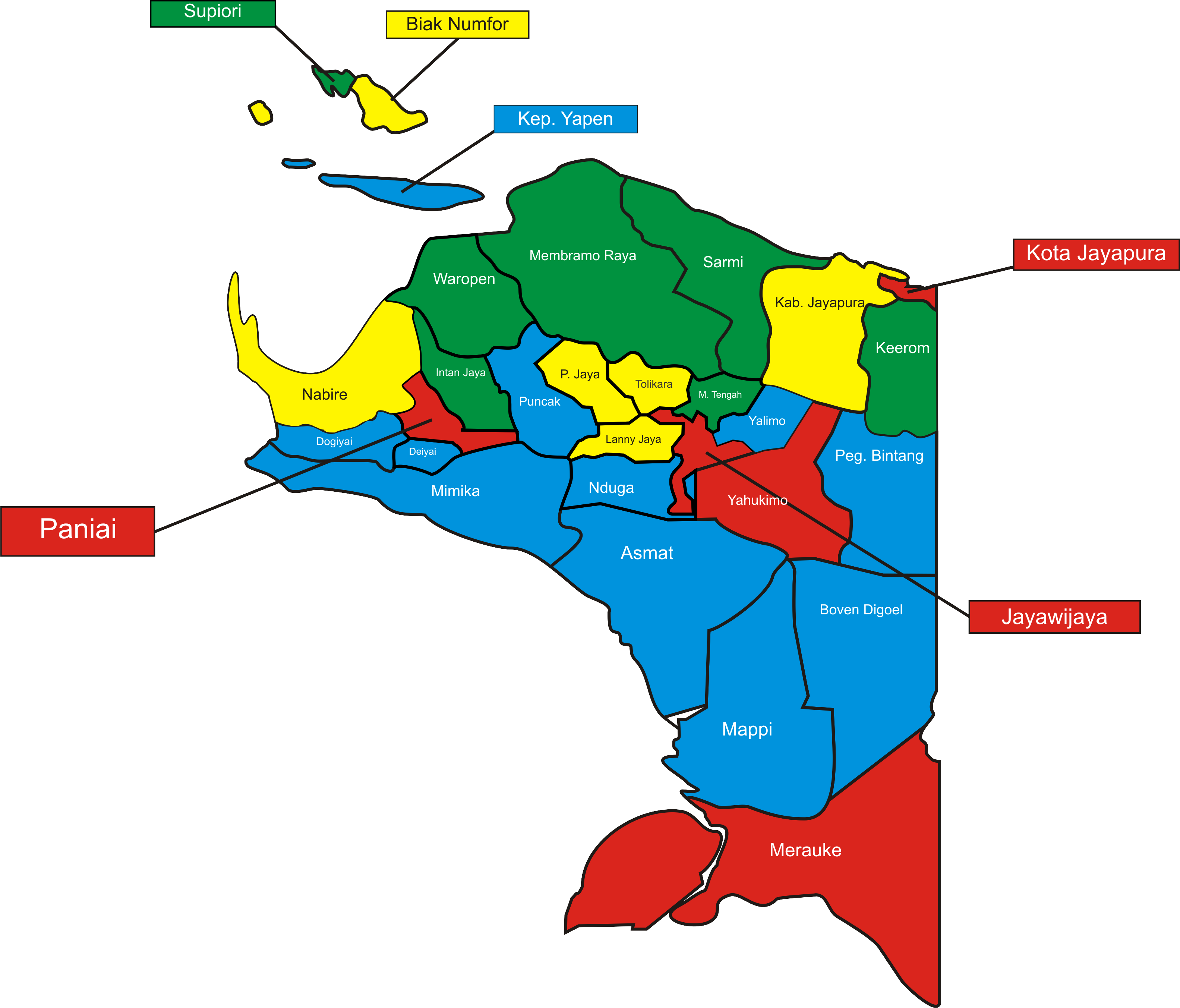
Central Papua, officially the Central Papua Province ( id, Provinsi Papua Tengah) is an Indonesian province located in the central region of Western New Guinea. It was formally established on 11 November 2022 from the former eight western regencies of the province of Papua. It covers an area of 66,130.49 km2 and had an estimated population of about 1,409,000 in mid 2021. It is bordered by the Indonesian provinces of West Papua to the west, the residual Papua to the north, and by Highland Papua and South Papua to the east. The designated administrative capital, Nabire, is the second largest town in Central Papua (after Timika), the economic centre of the province, and the seat of the Central Papua provincial government. The provincial border roughly follows the cultural region of Mee Pago and parts of Saireri. History After the approval of the bill for the creation of the province on 30 June 2022, controversy regarding the capital of the new province resulted in mass demonstra ... [...More Info...] [...Related Items...] OR: [Wikipedia] [Google] [Baidu] |
Mimika Regency
Mimika Regency is one of the regencies (''kabupaten'') in the Indonesian province of Central Papua. It covers an area of 21,693.51 km2, and had a population of 182,001 at the 2010 Census, but grew to 311,969 at the 2020 Census. The official estimate as at mid 2021 was 316,295. The administrative centre is the town of Timika, which lies within Mimika Baru District, which had 144,893 inhabitants in mid 2021. History On 8 October 1996, the Minister of Home Affairs in Jayapura designated Mimika as an Administrative District. After being formed into an Administrative Regency, the District area was determined to consist of: Mimika Timur (East Mimika) District, Mimika Barat (West Mimika) District, Agimuga District and the expansion area of Mimika Baru District which is domiciled in Timika. After approximately 4 (four) years of the implementation of the Administrative Regency administration, on 18 March 2000, the change of status from Administrative District to Definitive Regency was ... [...More Info...] [...Related Items...] OR: [Wikipedia] [Google] [Baidu] |
Sudirman Range
The Sudirman Range, also known as the Snow Mountains,"Sudirman Mountains (Snow Mountains)". Papua Insects Foundation. Accessed 5 August 2021/ref> Dugunduguoo, or Nassau Range is a mountain range in Central Papua province, Indonesia. It is named after the first armed forces commander-in-chief and Indonesian national hero Sudirman. It comprises a western portion of the Maoke Mountains. The highest peak in Oceania and Australasia, Puncak Jaya (4,884 m), is located here, as well as the large Grasberg copper and gold mine, operated by the Freeport company based out of the United States. Other peaks of the Sudirman Range are: * Sumantri (4,870 m) * Ngga Pulu (4,863 m) * Carstensz East (4,820 m or 4,808 m) See also * Lorentz National Park Lorentz National Park is a national park located in Central Papua, Indonesia, in the southwest of western New Guinea. With an area of 25,056 km2 (9,674 mi2), it is the largest national park in Southeast Asia. In 1999 Lorentz was declar ... [...More Info...] [...Related Items...] OR: [Wikipedia] [Google] [Baidu] |
Puncak Jaya
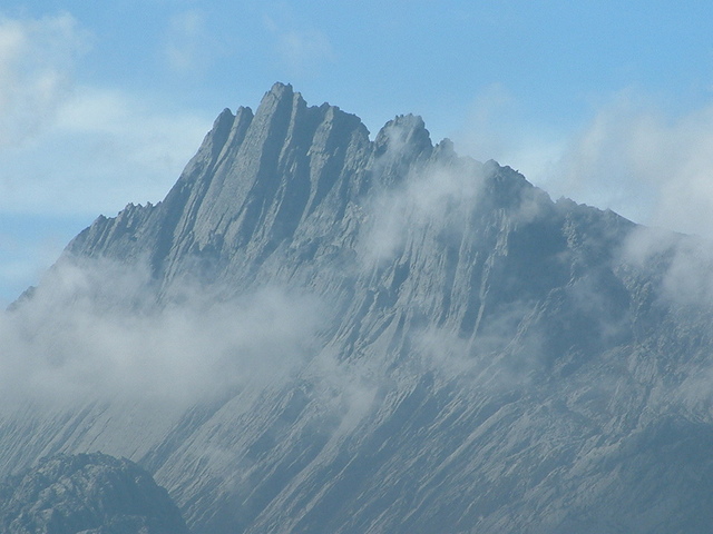
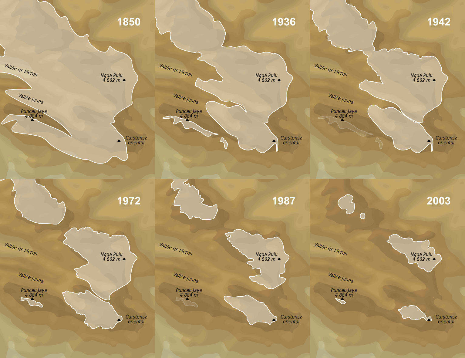
Puncak Jaya (; literally "Glorious Peak") or Carstensz Pyramid, Mount Jayawijaya or Mount Carstensz () on the island of New Guinea, with an elevation of , is the list of islands by highest point, highest mountain peak of an island on Earth. The mountain is located in the Sudirman Range of the highlands of Central Papua, Indonesia, in the southwest of Puncak Jaya Regency. The massive, open cut Grasberg mine, Grasberg gold and copper mine, the world's list of largest gold mines by production, fifth-largest gold mine, is west of Puncak Jaya. Other summits are ''Carstensz East, East Carstensz Peak'' (), ''Sumantri'' () and ''Ngga Pulu'' (). Other names include Nemangkawi in the Amung language, Amungkal language, Carstensz Toppen and Gunung Soekarno.Greater Atlas of the World, Mladinska knjiga, Ljubljana, Slovenia, 1986. It is also the highest point between the Himalayas and the Andes. Some sources claim Papua New Guinea's Mount Wilhelm, , as the highest mountain peak in Oceania, ... [...More Info...] [...Related Items...] OR: [Wikipedia] [Google] [Baidu] |
Philippine Sea
The Philippine Sea is a marginal sea of the Western Pacific Ocean east of the Philippine archipelago (hence the name), the largest in the world, occupying an estimated surface area of . The Philippine Sea Plate forms the floor of the sea. Its western border is the first island chain to the west, comprising the Ryukyu Islands in the northwest and Taiwan in the west. Its southwestern border comprises the Philippine islands of Luzon, Catanduanes, Samar, Leyte, and Mindanao. Its northern border comprises the Japanese islands of Honshu, Shikoku and Kyūshū. Its eastern border is the second island chain to the east, comprising the Bonin Islands and Iwo Jima in the northeast, the Mariana Islands (including Guam, Saipan, and Tinian) in the due east, and Halmahera, Palau, Yap and Ulithi (of the Caroline Islands) in the southeast. Its southern border is Indonesia's Morotai Island. The sea has a complex and diverse undersea relief. The floor is formed into a structural basin by a s ... [...More Info...] [...Related Items...] OR: [Wikipedia] [Google] [Baidu] |
Philippine Trench
The Philippine Trench (also Philippine Deep, Mindanao Trench, and Mindanao Deep) is a submarine trench to the east of the Philippines. The trench is located in the Philippine sea of the western North Pacific Ocean and continues NNW-SSE. It has a length of approximately and a width of about from the center of the Philippine island of Luzon trending southeast to the northern Maluku island of Halmahera in Indonesia. At its deepest point, the trench reaches 10,540 meters (34,580 ft or 5,760 fathoms). Immediately to the north of the Philippine Trench is the East Luzon Trench. They are separated, with their continuity interrupted and displaced, by Benham Plateau on the Philippine Sea Plate. Information The Philippine trench is hypothesized to be younger than 8–9 million years old. The central part of the Philippine fault formed during the Plio-Pleistocene times is considered to be an active depression of the Earth's crust. The trench formed from a coll ... [...More Info...] [...Related Items...] OR: [Wikipedia] [Google] [Baidu] |


