|
European Route E772
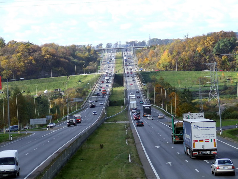
European route E772 is a class B road, part of the International E-road network in Bulgaria. It connects the two sections of the Hemus motorway (A2) constructed so far, and is part of one of the most important transport corridors in the country: from the capital Sofia in the west to Varna and the northern Bulgarian Black Sea Coast in the east. The road starts near Yablanitsa and ends near Shumen. It serves as a connection between the provincial capitals Shumen, Targovishte, Veliko Tarnovo and Lovech with Sofia and the port of Varna. It is a two-lane road (one lane in each direction). There are few three-lane parts for overtaking. The road surface is in a comparatively good condition since it is one of the main roads in northern Bulgaria and will remain so until the completion of the Hemus motorway. Route * ** E83 Jablanica ** E85 Veliko Tarnovo Veliko Tarnovo ( bg, Велико Търново, Veliko Tărnovo, ; "Great Tarnovo") is a town in north central Bulgaria a ... [...More Info...] [...Related Items...] OR: [Wikipedia] [Google] [Baidu] |
Yablanitsa
Yablanitsa ( bg, Ябланица; also ''Jablanica'', ''Iablanica'', ''Yablanica'', ''Jablanitsa'', ''Iablanitsa'', ''Jablanitza'', ''Yablanitza'', ''Iablanitza'', ) is a small town in the westernmost part of Lovech Province, central-north Bulgaria, located in the area of the Pre-Balkan, north of the Stara Planina mountain. It is the administrative centre of the homonymous Yablanitsa Municipality. The town is situated 70 kilometres from the capital Sofia, near the Hemus motorway linking Sofia and Varna. It was proclaimed a town in 1968. As of December 2011, Yablanitsa has a population of 2,854 inhabitants. The town is a noted confectionery production centre, particularly well known for the local halva and ''lokum'' (Turkish delight). Municipality Yablanitsa is the administrative center of Yablanitsa municipality (part of Lovech Province), which includes the following nine localities: Batultsi, Brestnitsa, Dabravata, Dobrevtsi, Golyama Brestnitsa, Malak Izvor, Oreshen ... [...More Info...] [...Related Items...] OR: [Wikipedia] [Google] [Baidu] |
Targovishte
Targovishte ( bg, Търговище, also transliterated ''Tǎrgovište'', , tr, Eski Cuma) is a city in Bulgaria, the administrative and economic capital of Targovishte Province. It is situated at the northern foot of the low mountain of Preslav on both banks of the Vrana River. The town is north-east of the capital Sofia and about west of the city of Varna and the Bulgarian Black Sea Coast. Targovishte is known as an old market settlement. Name The name comes from the Slavic root targ ("trade") + the Slavic placename suffix -ishte, "market town" (a calque of the Ottoman Turkish Eski Cuma, "old Friday", though the Turkish name may be derived from the earlier Bulgarian ''Sborishte'' "gathering place"). The name is etymologically and semantically the same as that of the city Târgoviște in Romania and Trgovište in Serbia. City Archaeological studies prove that in these places there were people in the Copper-Stone Age (Chalcolithic) – between the 5th and the 4th millenni ... [...More Info...] [...Related Items...] OR: [Wikipedia] [Google] [Baidu] |
Transport In Bulgaria
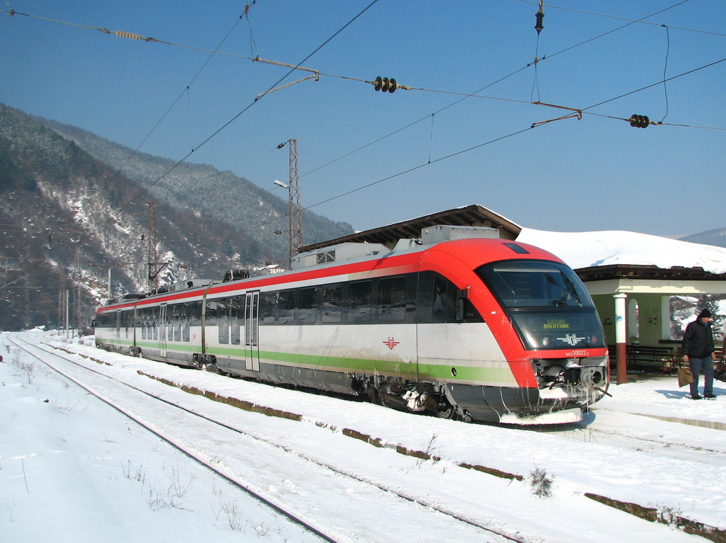
Transport in Bulgaria is dominated by road transport, despite nearly half of all paved roads belonging to the lowest category of roads. As of December 2015, the country had 829 kilometers of highways. Buses play a significant role in long-distance public transport, coaches are operated by private companies. Sofia has three major national bus terminals, the Central, the Western and the Southern Terminals. In the countryside share taxis are in operation between smaller settlements. Railway systems are mostly outdated, and the average speed is comparatively low; however, upgrading projects are underway. BDŽ is the national railway company, but private freight operators are also present. The Sofia Metro has three lines as of 2020. Air traffic has been growing since the 2000s, which was facilitated by the opening of a second terminal at Sofia Airport, as well as the implementation of new destinations and routes. The flag carrier is Bulgaria Air, but a number of private charter co ... [...More Info...] [...Related Items...] OR: [Wikipedia] [Google] [Baidu] |
E772
E77 may refer to: * King's Indian Defense, Encyclopaedia of Chess Openings code * European route E77, an international road * E 77 road (United Arab Emirates) * E77 balloon bomb, an American anti-crop biological munition * DRG Class E 77, a German locomotive class * San Manuel Airport San Manuel Airport , also known as San Manuel Ray Blair Airport, is a public-use airport located northwest of the central business district] of San Manuel, Arizona, San Manuel, a city in Pinal County, Arizona, United States. The airport is publ ... FAA code near San Manuel, Arizona, United States * Kyushu Chūō Expressway, route E77 in Japan {{Letter-NumberCombDisambig ... [...More Info...] [...Related Items...] OR: [Wikipedia] [Google] [Baidu] |
European Route E70
European route E70 is an A-Class West-East European route, extending from A Coruña in Spain in the west to the Georgian city of Poti in the east. Itinerary The E 70 routes through ten European countries, and includes one sea-crossing, from Varna in Bulgaria to Samsun in Turkey. *: A Coruña () - Baamonde *: Baamonde - Gijón - Torrelavega - Bilbao *: Bilbao () - Eibar () *: Eibar (Start of Concurrency with ) - Donostia/San Sebastián - Irún *: Hendaye - Bayonne (End of Concurrency with ) - Bordeaux *: Bordeaux () *: Bordeaux (End of Concurrency with ) *: Bordeaux () - Libourne *: Libourne - Brive-la-Gaillarde () *: Brive-la-Gaillarde () - Saint-Germain-les-Vergnes () *: Saint-Germain-les-Vergnes ( - Combronde () *: Combronde () - Clermont-Ferrand () *: Clermont-Ferrand () - Balbigny *: Balbigny - Saint-Étienne *: Saint-Étienne - Saint-Chamond *: Saint-Chamond - Givors () *: Givors () - Saint-Priest ( ) *: Lyon (Start of Concurrency with ) - Bourg ... [...More Info...] [...Related Items...] OR: [Wikipedia] [Google] [Baidu] |
European Route E85
European route E85 is part of the International E-road network, which is a series of main roads in Europe. The E 85 starts from Klaipėda (Lithuania) runs south through Belarus, Ukraine, Romania, Bulgaria to Greece, ending at Alexandroupoli. The E 85 is long. Route *: Klaipėda () - Kryžkalnis () - Kaunas ( ) - Vilnius ( ) *: Vilnius ( ) *: Vilnius () - Šalčininkai *: Beiniakoni - Lida - Slonim - Ivacevičy () *: Ivacevičy (Start of Concurrency with ) - Kobryn (End of Concurrency with ) *: Domanove - Kovel () - Dubno () - Ternopil () - Chernivtsi - Porubne *: Siret - Suceava () - Săbăoani () - Roman - Bacău () - Tișița () - Focșani - Buzău () - Urziceni (Start of concurrency with ) - București (End of concurrency with ) *: București (Start of concurrency with ) - Giurgiu *: Ruse (End of Concurrency with ) *: Ruse () - Byala () - Veliko Tarnovo () - Stara Zagora () - Dimitrovgrad () - Haskovo *: Haskovo - Harmanli - Novo Selo * ... [...More Info...] [...Related Items...] OR: [Wikipedia] [Google] [Baidu] |
European Route E83
European route E 83 is a road part of the International E-road network. It begins in Byala, Bulgaria and ends in Botevgrad, Bulgaria. The road follows: Byala - Pleven - Yablanitsa - Botevgrad Botevgrad ( bg, Ботевград ) is a town in western Bulgaria. It is located in Sofia Province and is close to Pravets. Botevgrad lies 47 km from Sofia. History and name The village was called Samundzhievo (Самунджиево) unti .... See also Roads in Bulgaria Highways in Bulgaria External links UN Economic Commission for Europe: Overall Map of E-road Network (2007) {{Europe-road-stub 83 E083 ... [...More Info...] [...Related Items...] OR: [Wikipedia] [Google] [Baidu] |
E-road BG which provides electric power to vehicles on it, through trolley wires or conductor rails embedded in its surface.
{{disambig ...
E road may refer to: * a road of the International E-road network in Europe * E roads in Cyprus are secondary roads * Malaysian Expressway System * E roads in Zimbabwe are expressways * Corridor E, a road from Morgantown, West Virginia, at Interstate 79 to Hancock, Maryland * an electric road An electric road, eroad, or electric road system (ERS) is a road which supplies electric power to vehicles travelling on it. Common implementations are overhead power lines above the road and ground-level power supply through conductive rails or ... [...More Info...] [...Related Items...] OR: [Wikipedia] [Google] [Baidu] |
Lovech
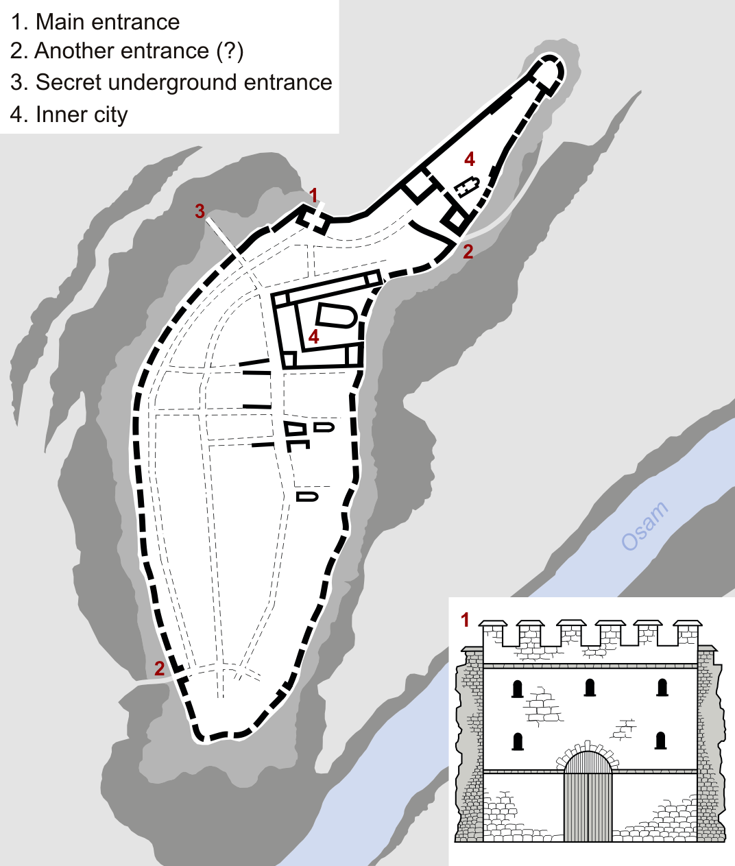
Lovech ( bg, Ловеч, Lovech, ) is a List of cities and towns in Bulgaria, city in north-central Bulgaria. It is the administrative centre of the Lovech Province and of the subordinate Lovech Municipality. The city is located about northeast from the capital city of Sofia. Near Lovech are the towns of Pleven, Troyan and Teteven. Name The name is possibly derived from the Slavic root ''lov'', "hunting" + the Slavic suffix ''-ech''. Geography Lovech is situated in the Balkan Mountains, Forebalkan area of northern Bulgaria, on both sides of the river Osam, and unifies both mountainous and plain relief. The eastern part of the town is surrounded by a 250 m high plateau, where the largest park in Lovech, ''Stratesh'', is located, and the southwestern part is surrounded by the hills ''Hisarya'' and ''Bash Bunar''. In the northwest the relief gradually changes to the plains of the neighbouring Pleven Province. The average altitude of Lovech is about 200 m above mean sea level. The ... [...More Info...] [...Related Items...] OR: [Wikipedia] [Google] [Baidu] |
Shumen
Shumen ( bg, Шумен, also romanized as ''Shoumen'' or ''Šumen'', ) is the tenth largest city in Bulgaria and the administrative and economic capital of Shumen Province. Etymology The city was first mentioned as ''Šimeonis'' in 1153 by the Arab traveler Idrisi. The name is probably from Bulgarian ''shuma'' '(deciduous forest).' Some believe Konstantin Jireček that it comes from the name of the Bulgarian emperor Simeon the Great. In the following periods, the city was mentioned with variants, such as ''Şumena'', ''Şumna'', ''Şumular'', ''Sumunum'', ''Şumnu'' and ''Şumen''. The eleventh edition of the Encyclopædia Britannica lists it as ''Shumla'', similar to the way it lists Pleven as Plevna. History Antiquity and the Middle Ages Earliest reports for Shumen fortress date back to the early Iron Age. From the 12th century BC is the first fort, surrounding accessible parts of the area. Archaeological surveys, conducted in 1957, 1961 to 1987, determined the chronol ... [...More Info...] [...Related Items...] OR: [Wikipedia] [Google] [Baidu] |
Veliko Tarnovo
Veliko Tarnovo ( bg, Велико Търново, Veliko Tărnovo, ; "Great Tarnovo") is a town in north central Bulgaria and the administrative centre of Veliko Tarnovo Province. Often referred as the "''City of the Tsars''", Veliko Tarnovo is located on the Yantra River and is famously known as the historical capital of the Second Bulgarian Empire, attracting many tourists with its unique architecture. The old part of the town is situated on three hills, Tsarevets, Trapezitsa, and Sveta Gora, rising amidst the meanders of the Yantra. On Tsarevets are the palaces of the Bulgarian emperors and the Patriarchate, the Patriarchal Cathedral, and also a number of administrative and residential edifices surrounded by thick walls. Trapezitsa is known for its many churches and as the former main residence of the nobility. During the Middle Ages, the town was among the main European centres of culture and gave its name to the architecture of the Tarnovo Artistic School, painting of ... [...More Info...] [...Related Items...] OR: [Wikipedia] [Google] [Baidu] |
Bulgarian Black Sea Coast
The Bulgarian Black Sea Coast (), also known as the Bulgarian Riviera, covers the entire eastern bound of Bulgaria stretching from the Romanian Black Sea resorts in the north to European Turkey in the south, along 378 km of coastline. White and golden sandy beaches occupy approximately 130 km of the 378 km long coast. The region is an important center of tourism during the summer season (May–October), drawing millions of foreign and local tourists alike and constituting one of the country's most popular tourist destinations. Prior to 1989 the Bulgarian Black Sea coast was internationally known as the ''Red Riviera''. Since the fall of the Iron Curtain, however, its nickname has been changed to the ''Bulgarian Riviera''. The Bulgarian Black Sea Coast has a humid subtropical climate (Köppen climate classification ''Cfa''), with considerable maritime and continental influences. The area's average air temperature in the summer is about 28 °C, with ... [...More Info...] [...Related Items...] OR: [Wikipedia] [Google] [Baidu] |


