|
European Route E22
European route E22 is one of the longest European routes. It has a length of about . Many of the E-roads have been extended into Asia since the year 2000; the E22 was extended on 24 June 2002. Route United Kingdom Port of Holyhead () *: Holyhead - **Ewloe Interchange () *: - Ellesmere Port **Dunkirk Roundabout () *: Ellesmere Port - Warrington **Lymm Interchange () *: Warrington(Concurrency with ) **Croft Interchange ()(Start of concurrency with ) *: Warrington - Manchester ** Eccles Interchange () *: Manchester Outer Ring Road **Simister Island () *: Manchester - Goole( /: Pontefract ) **Langham Interchange ()(End of concurrency with ) *: Goole - **North Ings Interchange () *: ''Whole length'' **Barnetby Top () *: - **Brocklesby Interchange () *: - Immingham (''Whole length'') Port of Immingham () Netherlands Amsterdam () **Knooppunt De Nieuwe Meer ()( //) *: Ring Amsterdam **Coenplein ()( /) *: Amsterdam - Zaandam **Knooppunt Zaandam () *: Zaandam - S ... [...More Info...] [...Related Items...] OR: [Wikipedia] [Google] [Baidu] |
Holyhead
Holyhead (,; cy, Caergybi , "Cybi's fort") is the largest town and a community in the county of Isle of Anglesey, Wales, with a population of 13,659 at the 2011 census. Holyhead is on Holy Island, bounded by the Irish Sea to the north, and is separated from Anglesey island by the narrow Cymyran Strait and was originally connected to Anglesey via the Four Mile Bridge. In the mid-19th century, Lord Stanley, a local philanthropist, funded the building of a larger causeway, known locally as "The Cobb", it now carries the A5 and the railway line. The A55 dual carriageway runs parallel to the Cobb on a modern causeway. The town houses the Port of Holyhead, a major Irish Sea port for connections towards Ireland. Etymology The town's English name, ''Holyhead'', has existed since the 14th century at least. As is the case with many coastal parts of Wales, the name in English is significantly different from its name in Welsh. It refers to the holiness of the locality and has taken ... [...More Info...] [...Related Items...] OR: [Wikipedia] [Google] [Baidu] |
Pontefract
Pontefract is a historic market town in the Metropolitan Borough of Wakefield in West Yorkshire, England, east of Wakefield and south of Castleford. Historically part of the West Riding of Yorkshire, it is one of the towns in the City of Wakefield District and had a population of 30,881 at the 2011 Census. Pontefract's motto is , Latin for "After the death of the father, support the son", a reference to the town's Royalist sympathies in the English Civil War. Etymology At the end of the 11th century, the modern township of Pontefract consisted of two distinct and separate localities known as Tanshelf and Kirkby.Eric Houlder, Ancient Roots North: When Pontefract Stood on the Great North Road, (Pontefract: Pontefract Groups Together, 2012) p.7. The 11th-century historian, Orderic Vitalis, recorded that, in 1069, William the Conqueror travelled across Yorkshire to put down an uprising which had sacked York, but that, upon his journey to the city, he discovered that the cro ... [...More Info...] [...Related Items...] OR: [Wikipedia] [Google] [Baidu] |
FFD200; Background:
FFD may refer to: Arts and entertainment * Fall for Dance Festival, in New York City * Fat Freddy's Drop, a New Zealand band Businesses * FF Developments, a British transmission engineering company * Final Frontier Design, an American spacesuit developer Government and politics * Forum for Democracy and Development, a Zambian political party * Fresno Fire Department, in California, United States * Finnish Agri-agency for Food and Forest Development Finland Places * Fairfield railway station, Melbourne, Australia * Freshford railway station, Somerset, England * RAF Fairford, a military airfield in England Science and technology * Finite factorization domain, a particular kind of atomic domain * Flame failure device * Flange focal distance * Focus film distance * Forward flank downdraft, or front flank downdraft * Free-form deformation * Front focal distance * First fit decreasing, an approximation algorithm for the bin packing problem The bin packing problem is an opt ... [...More Info...] [...Related Items...] OR: [Wikipedia] [Google] [Baidu] |
European Route
The international E-road network is a numbering system for roads in Europe developed by the United Nations Economic Commission for Europe, United Nations Economic Commission for Europe (UNECE). The network is numbered from E1 up and its roads cross national borders. It also reaches Central Asian countries like Kyrgyzstan, since they are members of the UNECE. Main international traffic arteries in Europe are defined by ECE/TRANS/SC.1/2016/3/Rev.1 which consider three types of roads: motorways, Limited-access road, limited access roads, and ordinary roads. In most countries, the roads carry the European route designation alongside national designations. Belgium, Norway and Sweden have roads which only have the European route designations (examples: European route E18, E18 and European route E6, E6). The United Kingdom, Iceland and Albania only use national road designations and do not show the European designations at all. Ukraine does not number its routes at all except in int ... [...More Info...] [...Related Items...] OR: [Wikipedia] [Google] [Baidu] |
Pustoshka, Pustoshkinsky District, Pskov Oblast
Pustoshka (russian: Пусто́шка) is a town and the administrative center of Pustoshkinsky District in Pskov Oblast, Russia, located on the Krupeya River, southeast of Pskov, the administrative center of the oblast. Population: History It was founded in 1901 due to the construction of a railway and was granted town status in 1925. At the time, it was the administrative center of Pustoshkinskaya Volost of Sebezhsky Uyezd in Pskov Governorate. On August 1, 1927, the uyezds and governorates were abolished and Pustoshkinsky District, with the administrative center in Pustoshka, was established as a part of Velikiye Luki Okrug of Leningrad Oblast.''Administrative-Territorial Structure of Pskov Oblast'', pp. 11–16 It included parts of former Nevelsky, Opochetsky, and Sebezhsky Uyezds. On June 3, 1929, Pustoshkinsky District was transferred to Western Oblast. On July 23, 1930, the okrugs were also abolished and the districts were directly subordinated t ... [...More Info...] [...Related Items...] OR: [Wikipedia] [Google] [Baidu] |
Salaspils
Salaspils (; german: Kircholm; sv, Kirkholm) is a town in Latvia, the administrative centre of Salaspils Municipality. The town is situated on the northern bank of the Daugava river, 18 kilometers to the south-east of the city of Riga. History Salaspils is one of the oldest settlements in Latvia. Archaeological excavations of 1964–1975 (during the construction of Riga HES) in ancient settlements, burial grounds and castle mounds give evidence of very dense population of the region. At this time, the remains of 11,000-year-old reindeer hunters were found (the oldest known human settlement in all of Latvia) and 3500-year-old remains of Baltic hunters, buried in hollowed-out oak-tree trunks, were found as well. There is evidence that both Livs and Balts built hill forts in the region. At the end of the 12th century, German merchants travelled up the Daugava, establishing missionaries among the Livonian settlements. One important centre of Daugava Livonians, the small island M ... [...More Info...] [...Related Items...] OR: [Wikipedia] [Google] [Baidu] |
Norrköping
Norrköping (; ) is a city in the province of Östergötland in eastern Sweden and the seat of Norrköping Municipality, Östergötland County, about 160 km southwest of the national capital Stockholm, 40 km east of county seat Linköping and 60 km west of the Södermanland capital of Nyköping. The city has a population of 95,618 inhabitants in 2016, out of a municipal total of 130,050,Folkmängd i Norrköpings kommun den 31 December 2010 making it Sweden's tenth largest city and eighth largest municipality. The city is situated by the mouth of the river , at |
Trelleborg
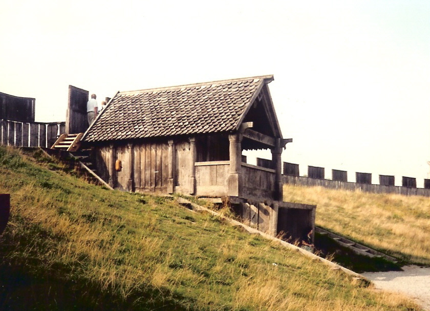
Trelleborg () is a town in Skåne County, Sweden, with 43,359 inhabitants as of December 31, 2015. It is the southernmost town in Sweden located some west from the southernmost point of Sweden and the Scandinavian peninsula. It is one of the most important ferry towns in Scandinavia as well as around the Baltic Sea, and the main town of the Söderslätt agricultural areas. Etymology The first written record of the name is from 1257, ''Threlæburgh''. The name is found in many places in Scandinavia. ''Borg'' means ''castle'' or ''stronghold'' and ''träl'' can mean thrall, but can also refer to the leaning poles on the outside of the medieval Viking stronghold. Remains of the original stronghold were excavated in 1988. The name may also have originated from the stronghold that still remains in the center of the city. Strongholds like that have been found at several places around Scandinavia, mostly in the south of Sweden and Denmark, and are all called trelleborgs. The name is l ... [...More Info...] [...Related Items...] OR: [Wikipedia] [Google] [Baidu] |
Sassnitz
Sassnitz (, before 1993 in german: Saßnitz) is a town on the Jasmund peninsula, Rügen Island, in the state of Mecklenburg-Vorpommern, Germany. The population as of 2012 was 9,498. Sassnitz is a well-known seaside resort and port town, and is a gateway to the nearby Jasmund National Park with its unique chalk cliffs. The decommissioned British submarine HMS ''Otus'' was purchased by a German entrepreneur and towed to Sassnitz to be a floating museum. The Sassnitz area is most popular for its famous chalk rocks (''Kreidefelsen''), which inspired artists like Caspar David Friedrich. Geography File:Sassnitz (2011-05-21).JPG, Sassnitz aerial view (2011), the famous chalk cliffs of the Jasmund National Park to the right. More aerial photos' File:Sassnitz Mukran (2011-05-21) 7.JPG, Sassnitz Mukran, the ferry port of Sassnitz File:Sassnitz Kreidefelsen 2011.jpg, Chalk rocks in the front, spa town of Sassnitz in the back File:Herthasee und Herthaburg auf Rügen.jpg, The small yet ... [...More Info...] [...Related Items...] OR: [Wikipedia] [Google] [Baidu] |
Grimmen
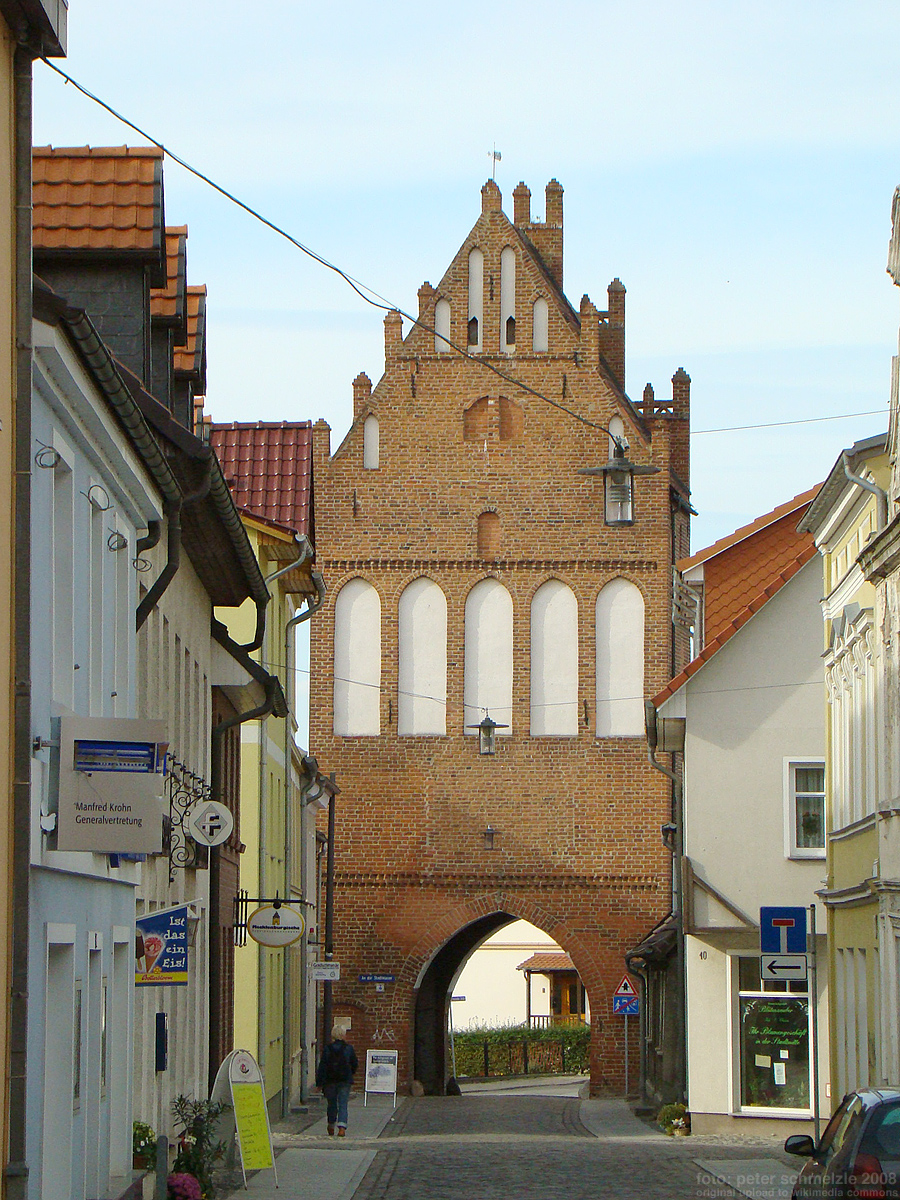
Grimmen (; csb, Grzëmié) is a town in Vorpommern-Rügen, a district in the Bundesland Mecklenburg-Vorpommern, Germany. Prior to 2011, when district reforms were made in Mecklenburg-Vorpommern, it was the capital of the now bygone Nordvorpommern district, which was abolished and merged to create the district of Vorpommern-Rügen. Geography Grimmen is located in southeastern Nordvorpommern on the banks of the river Trebel, about 30 km south of Stralsund and 30 km west of Greifswald. The town is connected to the Stralsund- Neustrelitz-Berlin railways, and to Autobahn A 20. Adjacent to the city limits are Amt Franzburg-Richtenberg in the West, Amt Miltzow in the North, and the Süderholz municipality in the Southeast. Villages within Grimmen's city limits In addition to the town of Grimmen, the following villages are also within Grimmen's city limits: * Appelshof * Gerlachsruh * Grellenberg * Groß Lehmhagen * Heidebrink * Hohenwarth * Hohenwieden * Jessin * K ... [...More Info...] [...Related Items...] OR: [Wikipedia] [Google] [Baidu] |
.jpg)


