|
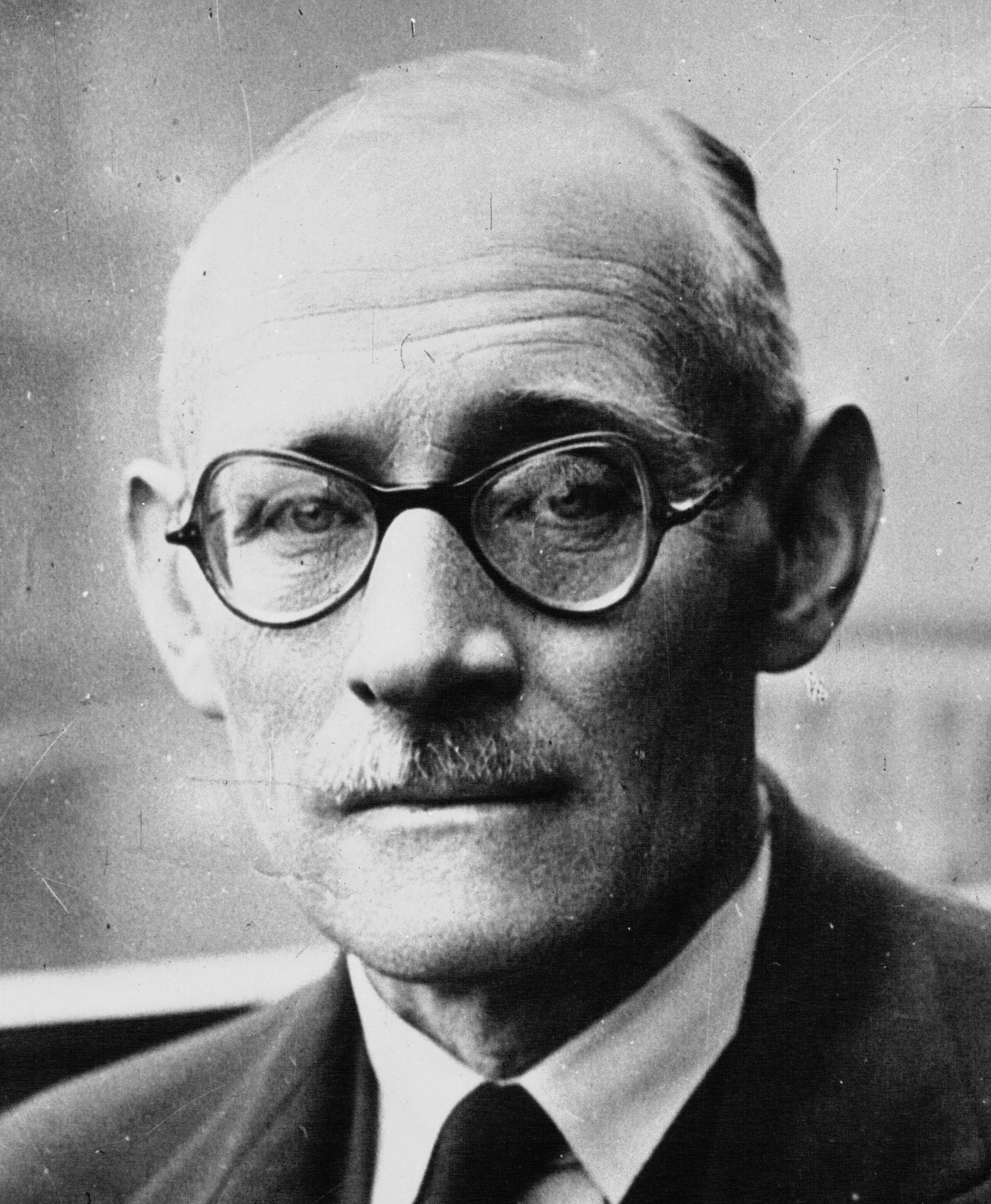
Eric Shipton
Eric Earle Shipton, CBE (1 August 1907 – 28 March 1977), was an English Himalayan mountaineer. Early years Shipton was born in Ceylon (now Sri Lanka) in 1907 where his father, a tea planter, died before he was three years old. When he was eight, his mother brought him to London for his education. When he failed the entrance exam to Harrow School, his mother sent him to Pyt House School in Wiltshire. His first encounter with mountains was at 15 when he visited the Pyrenees with his family. The next summer he spent travelling in Norway with a school friend and within a year he had begun climbing seriously. Africa and the Himalaya In 1928 he went to Kenya as a coffee grower and first climbed Nelion, a peak of Mount Kenya, in 1929. It was also in Kenya's community of Europeans where he met his future climbing partners Bill Tilman and Percy Wyn-Harris. Together with Wyn-Harris, he climbed the twin peaks of Mount Kenya. With Frank Smythe, Shipton was amongst the first climbers to st ... [...More Info...] [...Related Items...] OR: [Wikipedia] [Google] [Baidu] |
Order Of The British Empire
The Most Excellent Order of the British Empire is a British order of chivalry, rewarding contributions to the arts and sciences, work with charitable and welfare organisations, and public service outside the civil service. It was established on 4 June 1917 by King George V and comprises five classes across both civil and military divisions, the most senior two of which make the recipient either a knight if male or dame if female. There is also the related British Empire Medal, whose recipients are affiliated with, but not members of, the order. Recommendations for appointments to the Order of the British Empire were originally made on the nomination of the United Kingdom, the self-governing Dominions of the Empire (later Commonwealth) and the Viceroy of India. Nominations continue today from Commonwealth countries that participate in recommending British honours. Most Commonwealth countries ceased recommendations for appointments to the Order of the British Empire when they ... [...More Info...] [...Related Items...] OR: [Wikipedia] [Google] [Baidu] |
Hugh Ruttledge
Hugh Ruttledge (24 October 1884 – 7 November 1961) was an English civil servant and mountaineer who was the leader of two expeditions to Mount Everest in 1933 and 1936. Early life The son of Lt.-Colonel Edward Butler Ruttledge, of the Indian Medical Service, and of his wife Alice Dennison, Ruttledge was educated at schools in Dresden and Lausanne and then at Cheltenham College. In 1903 he matriculated as an exhibitioner at Pembroke College, Cambridge, and in 1906 he took a second-class Honours degree in the Classical Honours tripos.Audrey Salkeld, ''Ruttledge, Hugh (1884–1961), mountaineer'' in ''Oxford Dictionary of National Biography'', Oxford University Press, 2004, online aRuttledge, Hugh (1884–1961)(subscription required) accessed 1 March 2008 India and mountaineering Ruttledge passed the Indian Civil Service examination in 1908 and spent a year at the University of London studying Indian law, history and languages, before going out to India towards the end of 1909. ... [...More Info...] [...Related Items...] OR: [Wikipedia] [Google] [Baidu] |
Muztagh Ata
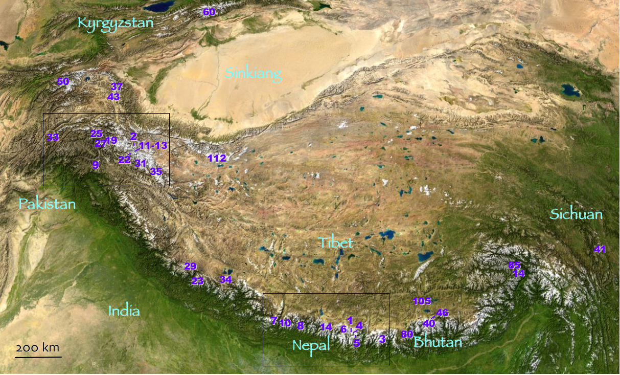
Muztagh Ata or Muztagata (, Музтағ Ата, literally "ice-mountain-father"; ; formerly known as Mount Tagharma or Taghalma and Wi-tagh) is the second highest (7546 metres) of the mountains which form the northern edge of the Tibetan Plateau in China (not the second highest of the mountains of the Tibetan Plateau). It is sometimes regarded as being part of the Kunlun Mountains, although physically it is more closely connected to the Pamirs. It is also one of the relatively easier 7,000 m peaks in the world to climb, due to its gentle western slope and the comparatively drier weather of Xinjiang, though a thorough acclimatization period and a very strong physical condition are crucial for success. Location Muztagh Ata lies just south of Kongur Tagh, the highest peak of this somewhat isolated range that is separated from the main chain of the Kunlun by the large Yarkand River valley, and thus generally included in the "Eastern Pamirs". Not far to the north and east of th ... [...More Info...] [...Related Items...] OR: [Wikipedia] [Google] [Baidu] |
Iran
Iran, officially the Islamic Republic of Iran, and also called Persia, is a country located in Western Asia. It is bordered by Iraq and Turkey to the west, by Azerbaijan and Armenia to the northwest, by the Caspian Sea and Turkmenistan to the north, by Afghanistan and Pakistan to the east, and by the Gulf of Oman and the Persian Gulf to the south. It covers an area of , making it the 17th-largest country. Iran has a population of 86 million, making it the 17th-most populous country in the world, and the second-largest in the Middle East. Its largest cities, in descending order, are the capital Tehran, Mashhad, Isfahan, Karaj, Shiraz, and Tabriz. The country is home to one of the world's oldest civilizations, beginning with the formation of the Elamite kingdoms in the fourth millennium BC. It was first unified by the Medes, an ancient Iranian people, in the seventh century BC, and reached its territorial height in the sixth century BC, when Cyrus the Great fo ... [...More Info...] [...Related Items...] OR: [Wikipedia] [Google] [Baidu] |
Kashgar
Kashgar ( ug, قەشقەر, Qeshqer) or Kashi ( zh, c=喀什) is an oasis city in the Tarim Basin region of Southern Xinjiang. It is one of the westernmost cities of China, near the border with Afghanistan, Kyrgyzstan, Tajikistan and Pakistan. With a population of over 500,000, Kashgar has served as a trading post and strategically important city on the Silk Road between China, the Middle East and Europe for over 2,000 years, making it one of the oldest continuously inhabited cities in the World. At the convergence point of widely varying cultures and empires, Kashgar has been under the rule of the Chinese, Turkic, Mongol and Tibetan empires. The city has also been the site of a number of battles between various groups of people on the steppes. Now administered as a county-level unit, Kashgar is the administrative center of Kashgar Prefecture, which has an area of and a population of approximately 4 million as of 2010. The city itself has a population of 506,640, and its ... [...More Info...] [...Related Items...] OR: [Wikipedia] [Google] [Baidu] |
Second World War
World War II or the Second World War, often abbreviated as WWII or WW2, was a world war that lasted from 1939 to 1945. It involved the vast majority of the world's countries—including all of the great powers—forming two opposing military alliances: the Allies and the Axis powers. World War II was a total war that directly involved more than 100 million personnel from more than 30 countries. The major participants in the war threw their entire economic, industrial, and scientific capabilities behind the war effort, blurring the distinction between civilian and military resources. Aircraft played a major role in the conflict, enabling the strategic bombing of population centres and deploying the only two nuclear weapons ever used in war. World War II was by far the deadliest conflict in human history; it resulted in 70 to 85 million fatalities, mostly among civilians. Tens of millions died due to genocides (including the Holocaust), starvation, ma ... [...More Info...] [...Related Items...] OR: [Wikipedia] [Google] [Baidu] |
Garhwal District
Garhwal District is a former district in Kumaon of British India of the United Provinces, and had an area of . It later became a part of the Indian state of Uttar Pradesh, today it is part of the Indian state Uttarakhand. History The first dynasty that ruled over Uttarakhand was Katyuri. It marked various milestones in the area of inscriptions and temples. After the downfall of Katyuris the whole of Garhwal region was broken up into more than sixty four principalities which were ruled by a chieftain. Originally Garhwal had 52 (fortresses). These were small and had their own chiefs who were responsible for the welfare of the fort. The Garhwal Kingdom was found by one of the chief named Ajay Pal, who reduced the petty forts and brought them under his own chieftainship. He and his ancestors ruled over Garhwal and Tehri till 1803. During their rule they encountered various attacks from "Mughals", "Sikhs", "Rohillas" and "Gorkhas". The Garhwalis started associating the term "Gorkhy ... [...More Info...] [...Related Items...] OR: [Wikipedia] [Google] [Baidu] |
Rishi Ganga
Rishiganga is a river in the Chamoli district, Uttarakhand, India. It springs from the Uttari Nanda Devi Glacier on the Nanda Devi mountain. It is also fed from the Dakshini Nanda Devi Glacier. Continuing through the Nanda Devi National Park, it flows into the Dhauliganga River near the village Rini. 2021 glacial outburst flood Starting approximately 10:45 a.m. IST on 7 February 2021, a flooding disaster occurred all along the river and its gorge following a landslide, avalanche or glacial lake outburst flood. Flash flood on February 7 in Chamoli district, Uttarakhand, claimed at least 72 lives with at least 200 missing. Now, Geological Survey of India (GSI) has submitted its report on causes of the disaster. Key findings: Flash flood was due to a large mass of snow, ice and rock avalanche along with a hanging mass of rock crashing into the Raunthi Garh valley floor. This impact pulverised the combination of rock, snow and ice causing a rapid flow downstream of R ... [...More Info...] [...Related Items...] OR: [Wikipedia] [Google] [Baidu] |
Nanda Devi
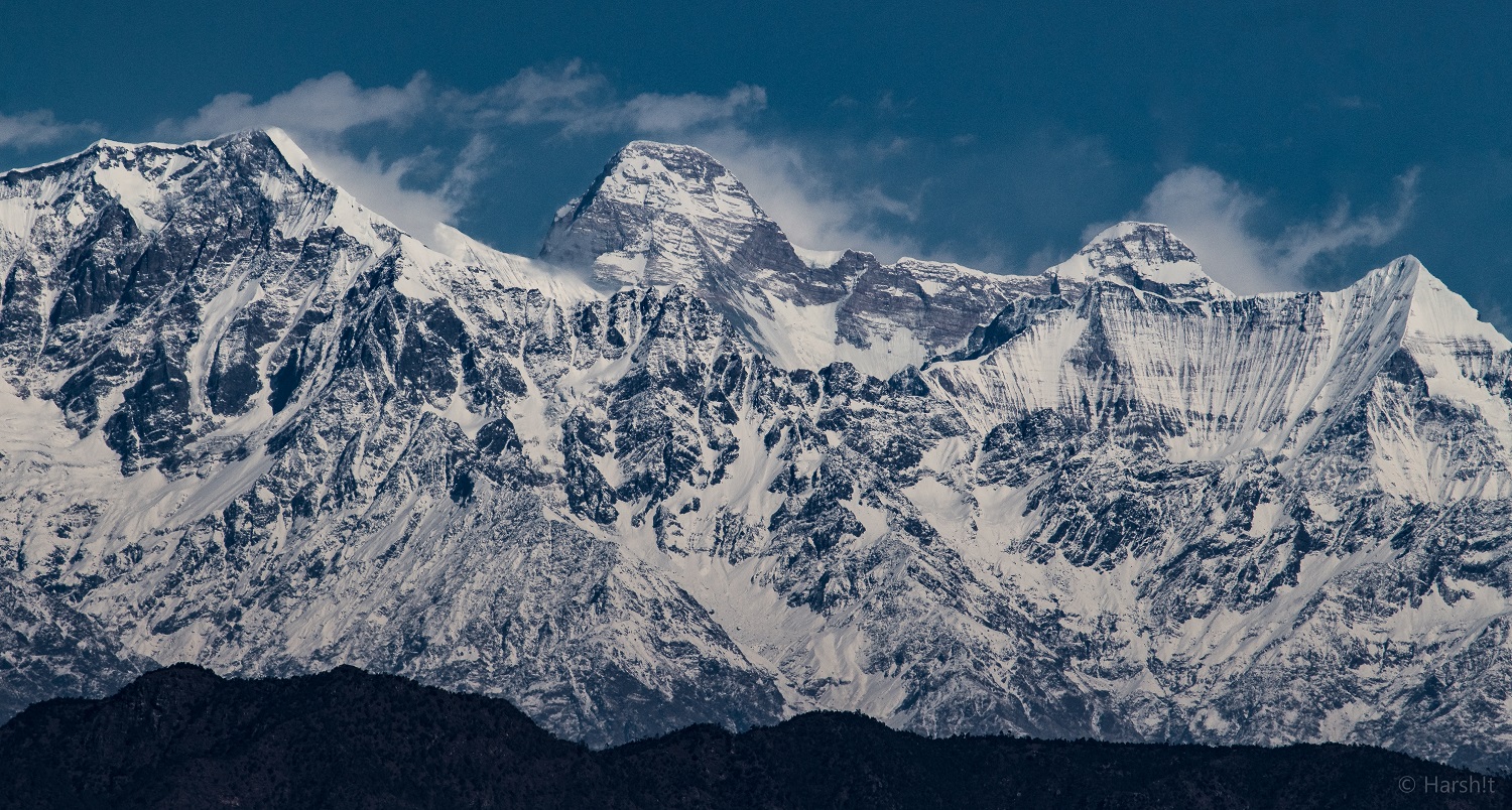
Nanda Devi is the second-highest mountain in India, after Kangchenjunga, and the highest located entirely within the country (Kangchenjunga is on the border of India and Nepal). It is the 23rd-highest peak in the world. Nanda Devi was considered the highest mountain in the world before computations in 1808 proved Dhaulagiri to be higher. It was also the highest mountain in India until 1975, when Sikkim, an independent kingdom until 1948 and a protectorate of India thereafter, became a part of the Republic of India. It is located in Chamoli Garhwal district of Uttarakhand, between the Rishiganga valley on the west and the Goriganga valley on the east. The peak, whose name means "Bliss-Giving Goddess", is regarded as the patron goddess of the Garhwal and Kumaon Himalayas. In acknowledgment of its religious significance and for the protection of its fragile ecosystem, the Government of India declared the peak as well as the circle of high mountains surrounding it—the Nanda ... [...More Info...] [...Related Items...] OR: [Wikipedia] [Google] [Baidu] |
Khumbu Glacier
The Khumbu Glacier ( ne, खुम्बु हिमनदी) is located in the Khumbu region of northeastern Nepal between Mount Everest and the Lhotse-Nuptse ridge. With elevations of at its terminus to at its source, it is the world's highest glacier. The Khumbu Glacier is followed for the final part of the trail to one of the Everest Base Camps. The start of the glacier is in the Western Cwm near Everest. The glacier has a large icefall, the Khumbu Icefall, at the west end of the lower Western Cwm. This icefall is the first major obstacle—and among the more dangerous—on the standard south col route to the Everest summit. It is also the largest glacier of Nepal. The end of Khumbu Glacier is located at . Overview Khumbu Glacier, Khumbu Icefall, Nepal, Asia.jpg, Khumbu Glacier and Khumbu Icefall Khumbu Glacier from Kala Patthar, Mountains of Nepal, Asia.jpg, Khumbu Glacier Khumbu glacier in relation to everest.jpg, Map See also * * List of glaciers * Retreat of gl ... [...More Info...] [...Related Items...] OR: [Wikipedia] [Google] [Baidu] |
1951 British Mount Everest Reconnaissance Expedition
The 1951 British Mount Everest reconnaissance expedition ran between 27 August 1951 and 21 November 1951 with Eric Shipton as leader. The expedition reconnoitred various possible routes for climbing Mount Everest from Nepal concluding that the one via the Khumbu Icefall, Western Cwm and South Col was the only feasible choice. This route was then used by the Swiss in their two expeditions in 1952 followed by the successful ascent by the British in 1953. Background After World War II, with Tibet closing its borders and Nepal becoming considerably more open, the reconnaissance of Mount Everest from Nepal had become possible for the first time. In 1950 a highly informal trek involving Charlie Houston and Bill Tilman reached what was to become Everest Base Camp on the Khumbu Glacier. Although their report about whether the summit could be reached from there was not very encouraging, they thought an attempt might nonetheless be viable. Topographical knowledge in 1951 By 1951 t ... [...More Info...] [...Related Items...] OR: [Wikipedia] [Google] [Baidu] |
Tenzing Norgay
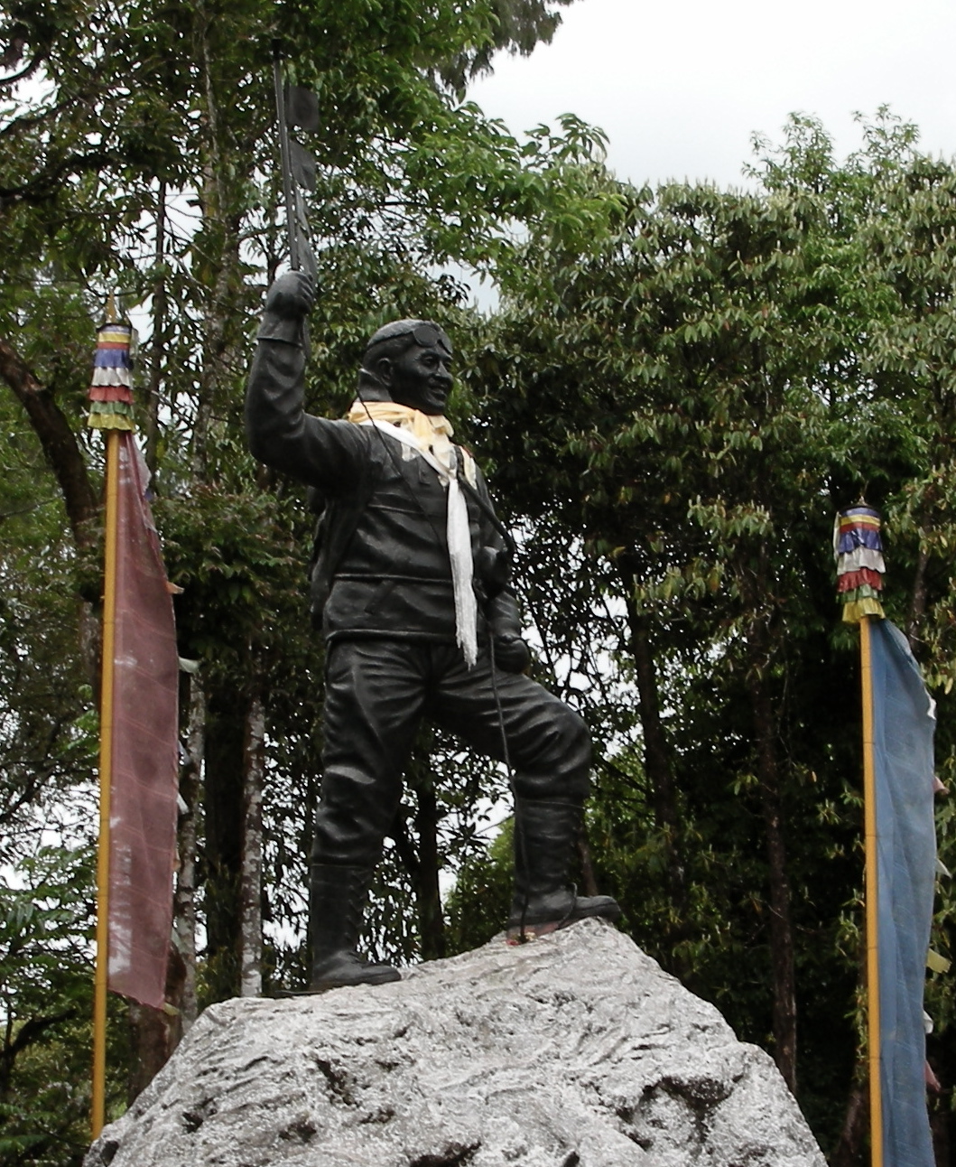
Tenzing Norgay (; ''tendzin norgyé''; perhaps 29 May 1914 – 9 May 1986), born Namgyal Wangdi, and also referred to as Sherpa Tenzing, was a Nepali-Indian Sherpa mountaineer. He was one of the first two people known to reach the summit of Mount Everest, which he accomplished with Edmund Hillary on 29 May 1953. ''Time'' named Norgay one of the 100 most influential people of the 20th century. Early life There are conflicting accounts of Tenzing's early life. In his autobiography, he wrote that he was a Sherpa born and raised in Tengboche, Khumbu, in northeastern Nepal.Tenzing & Ullman In a 1985 interview with All India Radio, he said his parents came from Tibet, but that he was born in Nepal. According to many later accounts, including a book co-written by his son Jamling Tenzin Norgay, he was born in Tibet, at Tse Chu in the Kama Valley, and grew up in Thame. He spent his early childhood in Kharta, near the north of the country. Norgay went to Nepal as a child to ... [...More Info...] [...Related Items...] OR: [Wikipedia] [Google] [Baidu] |


_of_Kashgar%2C_73_CE.jpg)


