|
Eravikulam National Park
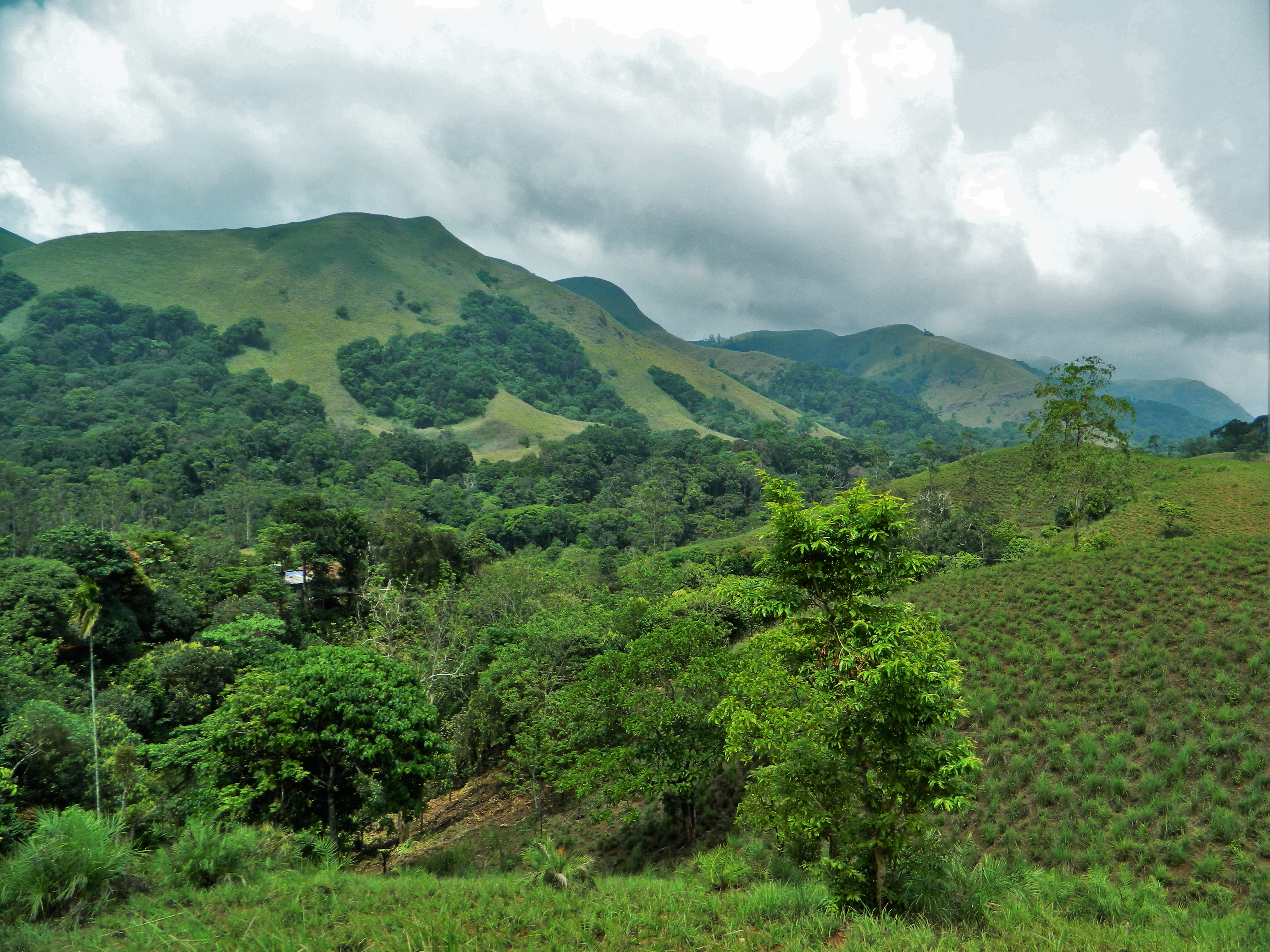
Eravikulam National Park is a 97 km2 national park located along the Western Ghats in the Idukki and Ernakulam districts of Kerala in India. Situated between 10º05'N and 10º20' north, and 77º0' and 77º10' east, (Semap) it is the first national park in Kerala. Eravikulam National Park is administered by the Kerala Department of Forests and Wildlife, Munnar Wildlife Division, which also runs the nearby Mathikettan Shola National Park, Anamudi Shola National Park, Pambadum Shola National Park, Chinnar Wildlife Sanctuary and the Kurinjimala Sanctuary. Geography The main body of the park consists of a high rolling hill plateau with a base elevation of about 2,000 m. The terrain consists of high altitude grasslands interspersed with sholas. Anamudi, 2,695 meters, the highest peak in South India is inside this park. Many perennial streams criss-cross the park. They merge to form tributaries of the Periyar river in the west and of the Cauvery River in the east. The Nati ... [...More Info...] [...Related Items...] OR: [Wikipedia] [Google] [Baidu] |
Strobilanthes Kunthiana
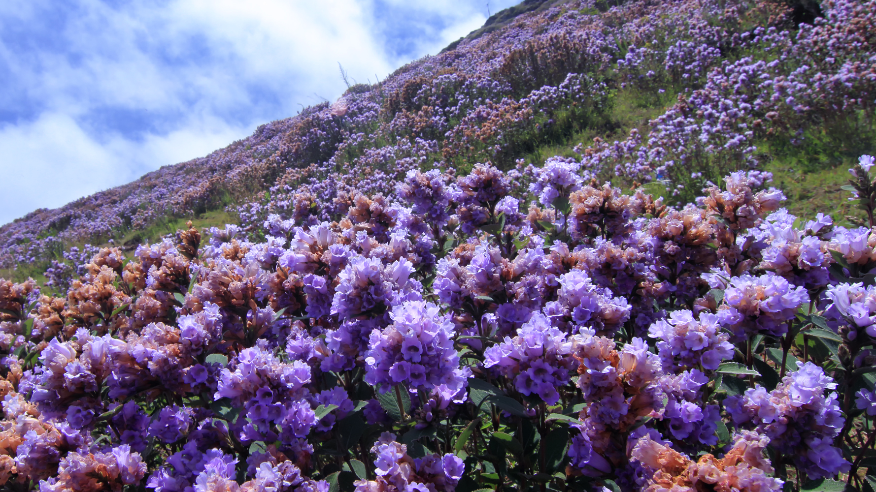
''Strobilanthes kunthiana'', known as Kurinji or Neelakurinji in Malayalam and Tamil and Gurige in Kannada is a shrub that is found in the shola forests of the Western Ghats in Kerala, Karnataka and Tamil Nadu. The purplish blue flower blossoms only once in 12 years, and gave the Nilgiri Mountains range its name, from the Tamil language ''Kurinji'' (flower). a small shrub, blooms once in twelve years, covering the hillsides with bluish flowers, giving the Nilgiris its name.''Strobilanthes kunthiana'' is the most rigorously demonstrated, with documented bloomings in 1838, 1850, 1862, 1874, 1886, 1898, 1910, 1922, 1934, 1946, 1958, 1970, 1982, 1994, 2006 and 2018, these have no match to Solar cycles. The Paliyan tribal people living in Tamil Nadu used it as a reference to calculate their age. This plant flowers during September–October. Description Kurinji grows at an altitude of 1300 to 2400 metres. The plant is usually 30 to 60 cm high. They can, however, grow well beyon ... [...More Info...] [...Related Items...] OR: [Wikipedia] [Google] [Baidu] |
Kurinjimala Sanctuary
Kurinjimala Sanctuary protects the approximately 32 hectare core habitat of the endangered Neelakurinji plant in the Kottakamboor and Vattavada villages in Devikulam Taluk, in the Idukki district of Kerala, a state in southern India. History According to some historians, the earliest known inhabitants of southern India were hunter-gatherers who inhabited Kurinjimala. The sanctuary was declared by the Kerala Forest Minister Benoy Viswam at the Neelakurinji Fest at Munnar on 7 October 2006. During the 2006 bloom, massive flowering of Neelakurinji attracted nearly ten lakh (1,000,000) people to Munnar and other places. The Government notification said that the sanctuary would ensure the long-term protection of the unique biodiversity of the area, especially ''Strobilanthes kunthiana'' and its habitat. Private land holdings having legal titles are excluded from the sanctuary area. Wildlife The sanctuary is home to threatened species of elephant, gaur, nilgiri tahr and deer. T ... [...More Info...] [...Related Items...] OR: [Wikipedia] [Google] [Baidu] |
Ungulates
Ungulates ( ) are members of the diverse clade Ungulata which primarily consists of large mammals with hooves. These include odd-toed ungulates such as horses, rhinoceroses, and tapirs; and even-toed ungulates such as cattle, pigs, giraffes, camels, sheep, deer, and hippopotamuses. Cetaceans such as whales, dolphins, and porpoises are also classified as even-toed ungulates, although they do not have hooves. Most terrestrial ungulates use the hoofed tips of their toes to support their body weight while standing or moving. The term means, roughly, "being hoofed" or "hoofed animal". As a descriptive term, "ungulate" normally excludes cetaceans as they do not possess most of the typical morphological characteristics of other ungulates, but recent discoveries indicate that they were also descended from early artiodactyls. Ungulates are typically herbivorous and many employ specialized gut bacteria to allow them to digest cellulose. Some modern species, such as pigs, are omnivorous, ... [...More Info...] [...Related Items...] OR: [Wikipedia] [Google] [Baidu] |
Nilgiri Tahr
The Nilgiri tahr (''Nilgiritragus hylocrius'') is an ungulate that is endemic to the Nilgiri Hills and the southern portion of the Western and Eastern Ghats in the states of Tamil Nadu and Kerala in southern India. It is the state animal of Tamil Nadu.Prater, S. H. 1948, 1971. ''The book of Indian Animals'', Bombay Natural History Society and Oxford University Press, India. 324 pages. . Despite its local name, it is more closely related to the sheep of the genus ''Ovis'' than the ibex and wild goats of the genus ''Capra''. It is the only species in the genus ''Nilgiritragus''. Etymology In Tamil, the Nilgiri tahr is called வரையாடு (''varaiaadu''). The word ''varaiaadu'' is derived from the Tamil words ''wurrai'' meaning "precipice" and ''aadu'' meaning "goat". The word in ancient Tamil was வருடை (''varudai''). In Malayalam, the word is വരയാട് (''varyaadu''). The Nilgiri tahr was described as ''Capra warryato'' by Gray. The genus name ''Ni ... [...More Info...] [...Related Items...] OR: [Wikipedia] [Google] [Baidu] |
Mammals
Mammals () are a group of vertebrate animals constituting the class Mammalia (), characterized by the presence of mammary glands which in females produce milk for feeding (nursing) their young, a neocortex (a region of the brain), fur or hair, and three middle ear bones. These characteristics distinguish them from reptiles (including birds) from which they diverged in the Carboniferous, over 300 million years ago. Around 6,400 extant species of mammals have been described divided into 29 orders. The largest orders, in terms of number of species, are the rodents, bats, and Eulipotyphla (hedgehogs, moles, shrews, and others). The next three are the Primates (including humans, apes, monkeys, and others), the Artiodactyla ( cetaceans and even-toed ungulates), and the Carnivora (cats, dogs, seals, and others). In terms of cladistics, which reflects evolutionary history, mammals are the only living members of the Synapsida (synapsids); this clade, together with Saur ... [...More Info...] [...Related Items...] OR: [Wikipedia] [Google] [Baidu] |
Nilgiri Tahr (Nilgiritragus Hylocrius) Female Head
The Nilgiri tahr (''Nilgiritragus hylocrius'') is an ungulate that is endemic to the Nilgiri Hills and the southern portion of the Western and Eastern Ghats in the states of Tamil Nadu and Kerala in southern India. It is the only species in the genus ''Nilgiritragus'' and is closely related to the sheep of the genus ''Ovis''. It is the state animal of Tamil Nadu. Etymology In Tamil, the Nilgiri tahr is called வரையாடு (''varaiaadu''). The word ''varaiaadu'' is derived from the Tamil words ''wurrai'' meaning "precipice" and ''aadu'' meaning "goat". The word in ancient Tamil was வருடை (''varudai''). In Malayalam, the word is വരയാട് (''varyaadu''). The Nilgiri tahr was described as ''Capra warryato'' by Gray. The genus name ''Nilgiritragus'' is derived from the Tamil word ''Neelagiri'' meaning "blue hills" and the Greek word '' trágos'' meaning "goat". Taxonomy Results of a phylogenetic analysis showed that the Nilgiri tahr forms a sister gro ... [...More Info...] [...Related Items...] OR: [Wikipedia] [Google] [Baidu] |
Lakkom Water Falls
Lakkom Water Falls, also known as Lakkam Waterfalls, is a tourist attraction located near Marayoor in the Idukki district of Kerala. These falls are part of the Eravikulam stream, which is a part of Eravikulam National Park and is one of the major tributaries of the Pambar River. Reaching there Situated at about 25 km from Munnar, Lakkom Waterfalls is on the way to Udumalaipettai from Munnar. One can either catch a bus to Udumalaipettai or hire a local taxi A taxi, also known as a taxicab or simply a cab, is a type of vehicle for hire with a driver, used by a single passenger or small group of passengers, often for a non-shared ride. A taxicab conveys passengers between locations of their choic ... from Munnar to reach here. It is on State Highway 17. Other details Visiting time at Lakkom Waterfalls is from 8:00 am to 5:00 pm and visitors have to pay an entrance fees of . There are no separate fees for DSLR cameras. There is also a guided trekking programme av ... [...More Info...] [...Related Items...] OR: [Wikipedia] [Google] [Baidu] |
Idamalayar
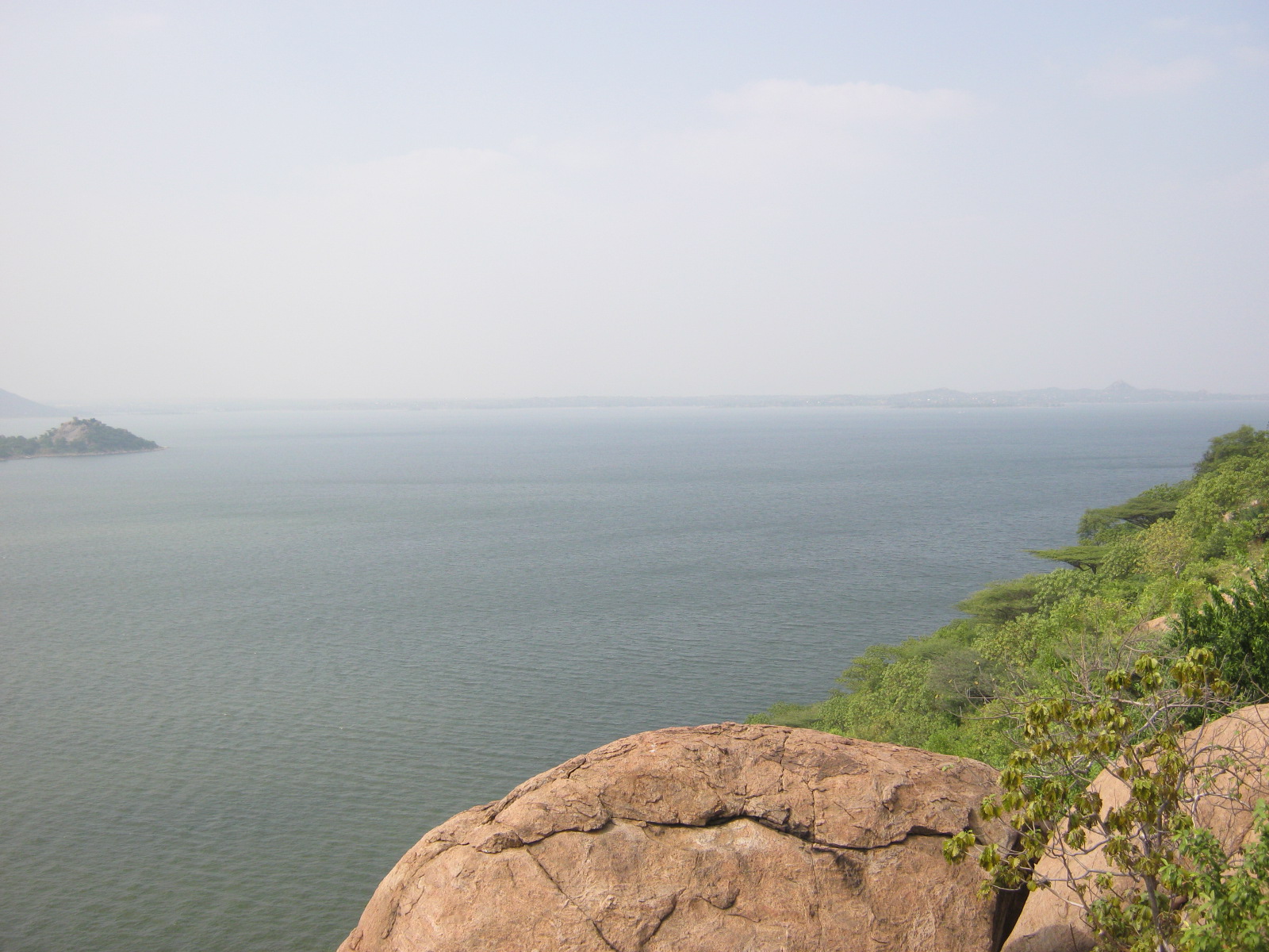
Edamalayar or Idamalayar is one of the major tributaries of the Periyar (river), Periyar river, the longest river in Kerala state south India. Idamalayar Dam is situated in this river. It originates in the Anamalais of Kerala's Ernakulam district, and flows into Tamil Nadu. It re-enters Kerala near Malakkappara, and flows into the Idamalayar Dam. It joins the Periyar (river), Periyar near Kuttampuzha. See also * Periyar River - Main river Other major tributaries of Periyar river *Muthirapuzha River *Mullayar *Cheruthoni *Perinjankutti Rivers of Ernakulam district Periyar (river) {{India-river-stub ... [...More Info...] [...Related Items...] OR: [Wikipedia] [Google] [Baidu] |
Cauvery River
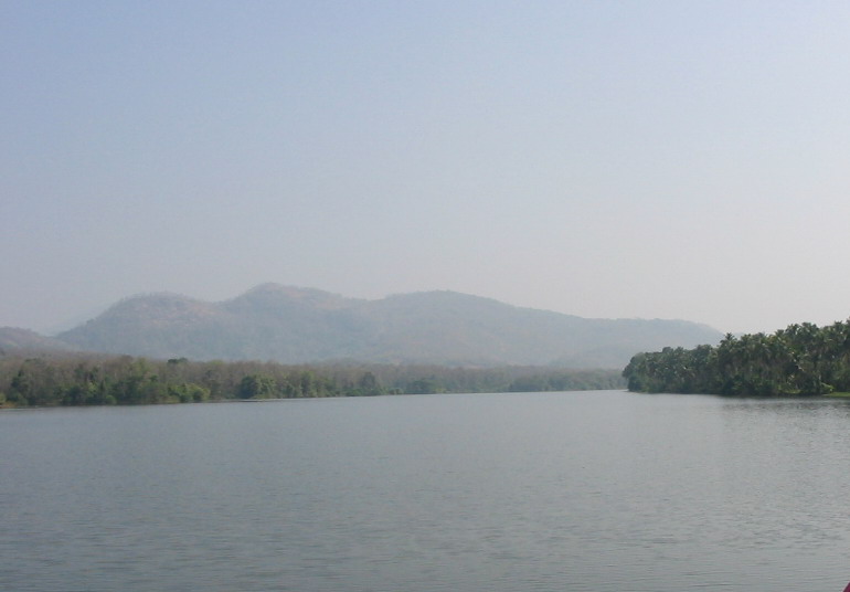
The Kaveri (also known as Cauvery, the anglicized name) is one of the major Indian rivers flowing through the states of Karnataka and Tamil Nadu. The Kaveri river rises at Talakaveri in the Brahmagiri range in the Western Ghats, Kodagu district of the state of Karnataka, at an elevation of 1,341 m above mean sea level and flows for about 800 km before its outfall into the Bay of Bengal. It reaches the sea in Poompuhar in Mayiladuthurai district. It is the third largest river after Godavari and Krishna in southern India, and the largest in the State of Tamil Nadu, which, on its course, bisects the state into north and south. In ancient Tamil literature, the river was also called Ponni (the golden maid, in reference to the fine silt it deposits). The Kaveri is a sacred river to the people of South India and is worshipped as the Goddess Kaveriamma (Mother Cauvery). It is considered to be among the seven holy rivers of India. It is extensively used for agriculture in bot ... [...More Info...] [...Related Items...] OR: [Wikipedia] [Google] [Baidu] |
Periyar River
Periyar, , (meaning: ''big river'') is the longest river and the river with the largest discharge potential in the Indian state of Kerala. It is one of the few perennial rivers in the region and provides drinking water for several major towns. The Periyar is of utmost significance to the economy of Kerala. It generates a significant proportion of Kerala's electrical power via the Idukki Dam and flows along a region of industrial and commercial activity. The river also provides water for irrigation and domestic use throughout its course besides supporting a rich fishery. Due to these reasons, the river has been named the "Lifeline of Kerala". Kochi city, in the vicinity of the river mouth draws its water supply from Aluva, an upstream site sufficiently free of seawater intrusion. Twenty five percent of Kerala's industries are along the banks of river Periyar. These are mostly crowded within a stretch of in the Eloor-Edayar region (Udhyogamandal), about north of Kochi harbor. ... [...More Info...] [...Related Items...] OR: [Wikipedia] [Google] [Baidu] |
Anamudi
Anamudi is a mountain located in Ernakulam district and Idukki district of the Indian state of Kerala. It is the highest peak in the Western Ghats and in South India, at an elevation of and a topographic prominence of . The name Anamudi literally translates to "elephant's head" a reference to the resemblance of the mountain to an elephant's head. Anamudi is the highest mountain in peninsular India as well as the largest mountain in Kerala. Meanwhile, the highest independent mountain (free-standing mountain) in Kerala is the Cheriyam mountain in Malappuram district. Cheriyam mountain is located at an elevation of 613 m (2,011 ft) above sea level. The first recorded ascent of Anamudi was by General Douglas Hamilton of the Madras Army on 4 May 1862, but it is likely that there had been earlier ascents by local people. Anamudi peak is one of only three ultra prominent peaks in South India. It is also the peak with the greatest topographic isolation within India. It is ... [...More Info...] [...Related Items...] OR: [Wikipedia] [Google] [Baidu] |
Shola
Sholas are the local name for patches of stunted tropical montane forest found in valleys amid rolling grassland in the higher montane regions of South India, largely in Kerala, Karnataka and Tamilnadu. These patches of shola forest are found mainly in the valleys and are usually separated from one another by undulating montane grassland. The shola and grassland together form the shola-grassland complex or mosaic. Not all such high-elevation grasslands have sholas in their valleys, especially if they are isolated from other such meadows, such as the meadows found in the Idamalayar Reserve Forest in Ernakulam district of Kerala. The word 'Shola' is probably derived from the Tamil language word cõlai (சோலை) meaning grove. The shola-forest and grassland complex has been described as a climatic climax vegetation with forest regeneration and expansion restricted by climatic conditions such as frost or soil characteristics while others have suggested that it may have anthr ... [...More Info...] [...Related Items...] OR: [Wikipedia] [Google] [Baidu] |
_female_head.jpg)


