|
Elslack
Elslack is a village and civil parish in the Craven district of North Yorkshire, England, close to the border with Lancashire and 4 miles west of Skipton. Thornton in Craven is nearby. The Tempest Arms is a large pub in the village, sited by the A56, which is popular with locals from the surrounding area. Elslack Moor, above the village, is crossed by the Pennine Way, though this does not visit the village itself. History A Roman fort lies at about north-west of Elslack. The fort may have been named Olenacum, or Ριγοδουνον, according to the analysis of Ptolemy's coordinates by Kleineberg et al. It guarded a Roman road linking two other forts: Bremetennacum at Ribchester and another at Ilkley. This road has been traced by archaeologists running north-east up Ribblesdale about east of Clitheroe. Then at it turns eastwards passing Barnoldswick, Elslack and Skipton. Elslack is mentioned in the 1086 ''Domesday Book'' as ''Eleslac''. Elslack had its own railway stat ... [...More Info...] [...Related Items...] OR: [Wikipedia] [Google] [Baidu] |
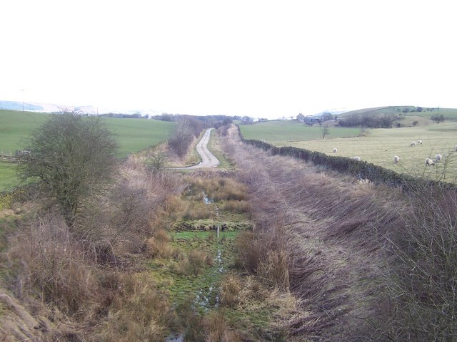
Elslack Railway Station
Elslack railway station once served the small village of Elslack in North Yorkshire, England. The station was built by the Leeds and Bradford Extension Railway The Leeds and Bradford Extension Railway was an early British railway company in the West Riding of Yorkshire. It built a line from near Bradford through and to . The Skipton–Colne Line closed in 1970, but the remainder of the line is ... in 1848. It merged in to the Midland Railway in 1851 though some services were operated by the Lancashire and Yorkshire Railway. The station was closed in 1952. References Disused railway stations in North Yorkshire Former Midland Railway stations Railway stations in Great Britain opened in 1848 Railway stations in Great Britain closed in 1952 {{Yorkshire-Humber-railstation-stub ... [...More Info...] [...Related Items...] OR: [Wikipedia] [Google] [Baidu] |
Craven District
Craven is a local government district of North Yorkshire, England centred on the market town of Skipton. In 1974, Craven District was formed as the merger of Skipton urban district, Settle Rural District and most of Skipton Rural District, all in the West Riding of Yorkshire. The population of the Local Authority area at the 2011 Census was 55,409. It comprises the upper reaches of Airedale, Wharfedale, Ribblesdale, and includes most of the Aire Gap and Craven Basin. The name Craven is much older than the modern district, and encompassed a larger area. This history is also reflected in the way the term is still commonly used, for example by the Church of England. History ''Craven'' has been the name of this district throughout recorded history. Note: Select the Thorton in Craven entry. Its extent in the 11th century can be deduced from The Domesday Book but its boundaries now differ according to whether considering administration, taxation or religion. Toponymy The deri ... [...More Info...] [...Related Items...] OR: [Wikipedia] [Google] [Baidu] |
Ilkley Roman Fort
Ilkley Roman Fort is a Roman fort on the south bank of the River Wharfe, at the centre of the modern town of Ilkley, a Victorian spa town in West Yorkshire, England. Identification The traditional view is that ''Olicana'' is the fort at Ilkley, but the identification is not settled.ILKLEY - ''The Romans in West Yorkshire'' - West Yorkshire Archaeology Advisory Service mentions ''Olikana'' in his '''' (c. 150), although Rivet and Smith give ''Olenacum'' as the proper form of the name, rejecting Ptolemy's ''Olikana'' as corrupt. The 1086 |
Lancashire
Lancashire ( , ; abbreviated Lancs) is the name of a historic county, ceremonial county, and non-metropolitan county in North West England. The boundaries of these three areas differ significantly. The non-metropolitan county of Lancashire was created by the Local Government Act 1972. It is administered by Lancashire County Council, based in Preston, and twelve district councils. Although Lancaster is still considered the county town, Preston is the administrative centre of the non-metropolitan county. The ceremonial county has the same boundaries except that it also includes Blackpool and Blackburn with Darwen, which are unitary authorities. The historic county of Lancashire is larger and includes the cities of Manchester and Liverpool as well as the Furness and Cartmel peninsulas, but excludes Bowland area of the West Riding of Yorkshire transferred to the non-metropolitan county in 1974 History Before the county During Roman times the area was part of the Bri ... [...More Info...] [...Related Items...] OR: [Wikipedia] [Google] [Baidu] |
Thornton In Craven
Thornton-in-Craven is a village and civil parish in the Craven district of North Yorkshire, England. It is approx from the border with Lancashire and north of Earby. Barnoldswick is nearby. The Pennine Way passes through the village, as does the A56 road. The village has a church, a primary school and a retirement home, but no shops or pub. Near the medieval church to the west of the village is a holy well, dating from Saxon times and now covered by an octagonal structure erected in 1764 by the rector. Thornton-in-Craven railway station was closed when passenger trains over the Skipton to Colne route were withdrawn in 1970. SELRAP are actively pursuing a re-opening of the line which was given a boost in February 2018, when the transport minister, Chris Grayling Christopher Stephen Grayling (born 1 April 1962) is a British Conservative Party (UK), Conservative Party politician and author who served as Secretary of State for Transport from 2016 to 2019. He has served ... [...More Info...] [...Related Items...] OR: [Wikipedia] [Google] [Baidu] |
The Good Pub Guide
''The Good Pub Guide'' is a long-running Restaurant rating, critical publication which lists and rates public houses (pubs) in the United Kingdom.The Good Pub Guide 2009 launch press release Published by Random House's Ebury Publishing subsidiary since 1982, it is released annually in book form and, since 2009, online. By 2009, the book form guide contained over 5,000 of pubs based upon food, drink, and atmosphere. There were 1,140 fully inspected main entries and 1,931 entries recommended by readers which had yet to be inspected. In addition, the website contained a list of 55,000 pubs. New Media Age [...More Info...] [...Related Items...] OR: [Wikipedia] [Google] [Baidu] |
Domesday Book
Domesday Book () – the Middle English spelling of "Doomsday Book" – is a manuscript record of the "Great Survey" of much of England and parts of Wales completed in 1086 by order of King William I, known as William the Conqueror. The manuscript was originally known by the Latin name ''Liber de Wintonia'', meaning "Book of Winchester", where it was originally kept in the royal treasury. The '' Anglo-Saxon Chronicle'' states that in 1085 the king sent his agents to survey every shire in England, to list his holdings and dues owed to him. Written in Medieval Latin, it was highly abbreviated and included some vernacular native terms without Latin equivalents. The survey's main purpose was to record the annual value of every piece of landed property to its lord, and the resources in land, manpower, and livestock from which the value derived. The name "Domesday Book" came into use in the 12th century. Richard FitzNeal wrote in the ''Dialogus de Scaccario'' ( 1179) that the book ... [...More Info...] [...Related Items...] OR: [Wikipedia] [Google] [Baidu] |
Barnoldswick
Barnoldswick (pronounced ) is a market town and civil parish in the Borough of Pendle, Lancashire, England. It is within the boundaries of the historic West Riding of Yorkshire, Barnoldswick and the surrounding areas of West Craven have been administered since 1974 as part of Lancashire. This was when West Riding County Council and Barnoldswick Urban District Council were abolished and the town was transferred to the Borough of Pendle. It lies near the Yorkshire Dales National Park and the Forest of Bowland Area of Outstanding Natural Beauty. Stock Beck, a tributary of the River Ribble, runs through the town, which has a population of 10,752. On the lower slopes of Weets Hill in the Pennines, astride the natural watershed between the Ribble and Aire valleys, Barnoldswick is the highest town on the Leeds and Liverpool Canal, lying on the summit level of the canal between Barrowford Locks to the south west and Greenberfield Locks just north east of the town, from Leeds, Manch ... [...More Info...] [...Related Items...] OR: [Wikipedia] [Google] [Baidu] |
Clitheroe
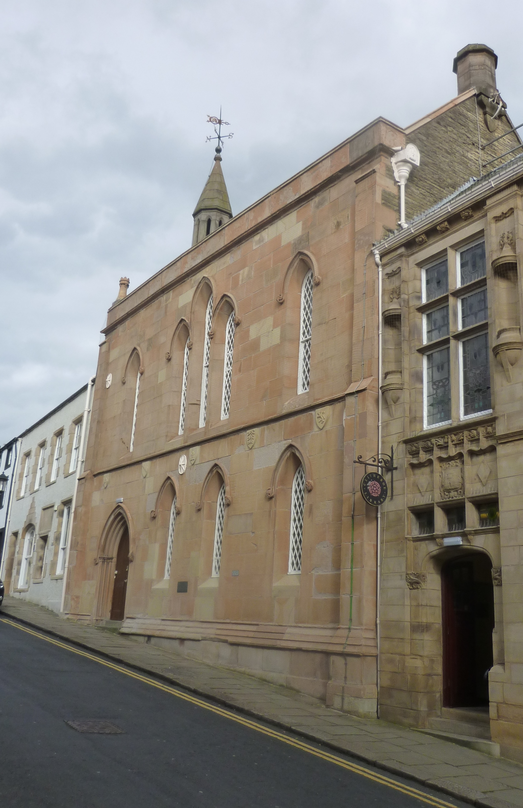
Clitheroe () is a town and civil parish in the Borough of Ribble Valley, Lancashire, England; it is located north-west of Manchester. It is near the Forest of Bowland and is often used as a base for tourists visiting the area. In 2018, the Clitheroe built-up area had an estimated population of 16,279. The town's most notable building is Clitheroe Castle, which is said to be one of the smallest Norman keeps in Great Britain. Several manufacturing companies have sites here, including Dugdale Nutrition, Hanson Cement, Johnson Matthey and Tarmac. History The name ''Clitheroe'' is thought to come from the Anglo-Saxon for "Rocky Hill", and was also spelled ''Clyderhow'' and ''Cletherwoode'', amongst others. The town was the administrative centre for the lands of the Honour of Clitheroe. The Battle of Clitheroe was fought in 1138 during the Anarchy. These lands were held by Roger de Poitou, who passed them to the De Lacy family, from whom they passed by marriage in 1310 or 1311 to ... [...More Info...] [...Related Items...] OR: [Wikipedia] [Google] [Baidu] |
Ribblesdale
Ribblesdale is one of the Yorkshire Dales in England. It is the dale or upper valley of the River Ribble in North Yorkshire. Towns and villages in Ribblesdale (downstream, from north to south) include Selside, Horton-in-Ribblesdale, Stainforth, Langcliffe, Giggleswick, Settle, Long Preston and Hellifield. Below Hellifield (sometimes below Settle) the valley of the river is generally known as the Ribble Valley. Above Settle the dale is within the Yorkshire Dales National Park. It is a popular tourist area, particularly for walking. The Yorkshire Three Peaks rise to the east and west of the dale. The Ribble Way runs the length of the dale. At the head of the dale is the Ribblehead Viaduct, crossed by the Settle to Carlisle railway which runs through the dale. Quarrying has been an important industry within the dale, and three quarries are still being worked; Arcow and Dry Rigg quarries produce gritstone (greywacke), and Horton Quarry produces limestone. The dale was h ... [...More Info...] [...Related Items...] OR: [Wikipedia] [Google] [Baidu] |
Bremetennacum
Bremetennacum, or Bremetennacum Veteranorum, was a Roman fort on the site of the present day village of Ribchester in Lancashire, England (). (Misspellings in ancient geographical texts include ''Bremetonnacum'', ''Bremetenracum'' or ''Bresnetenacum''.) The site is a Scheduled Monument. The site guarded a crossing-point of the River Ribble. The first known Roman activity was the building of a timber fort, believed to have been constructed during the campaigns of Petillius Cerialis around AD 72/3. This was replaced by a stone fort in the 2nd century. For most of its existence the fort was garrisoned by Sarmatian auxiliaries, first stationed in Britain by Marcus Aurelius in 175. Prior to that it is suggested that the fort was garrisoned by the ''Ala II Asturum'' from Spain, but there is some uncertainty about this. Pottery evidence indicates that the fort was occupied for most of the 4th century until the end of the Roman period. History The first fort was built in timber in A ... [...More Info...] [...Related Items...] OR: [Wikipedia] [Google] [Baidu] |


