|
Elham Valley
The Elham Valley is a chalk valley carved by the River Nailbourne situated in the North Downs in East Kent. The valley is named after the settlement of Elham. Other settlements in the valley include Etchinghill, Lyminge, Barham, Kingston, Bishopsbourne and Bridge. Located in the upper slopes of the valley are a number of examples of unimproved chalk downland such as Baldock Downs and Park Gate Down. At Bishopsbourne and North Lyminge there are examples of traditional sheep-grazed pasture and water meadow. Elham Valley Way The Elham Valley Way, a recreational walking route passes through the valley. The route starts at Hythe and finishes at Canterbury Cathedral. It utilises much of the erstwhile route of the Elham Valley Railway, constructed in the 19th century and connecting Folkestone and Canterbury Canterbury (, ) is a cathedral city and UNESCO World Heritage Site, situated in the heart of the City of Canterbury local government district of Kent, England. It lie ... [...More Info...] [...Related Items...] OR: [Wikipedia] [Google] [Baidu] |
Elham Valley Railway
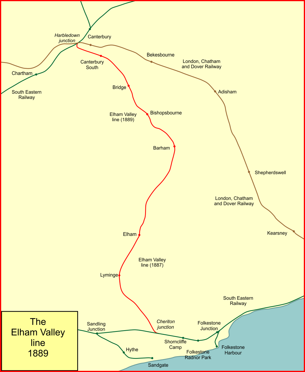
The Elham Valley Railway was a line connecting Folkestone and Canterbury in Kent, England. It opened between 1887 and 1889 and closed in 1947. The line was originally proposed by the independent Elham Valley Light Railway Company in the mid-19th century. After the project was cancelled owing to financial difficulties, it was revived by the South Eastern Railway who were competing with the rival London, Chatham and Dover Railway for railway traffic. The scheme was complicated by the imposing geography of the Elham Valley and the construction of two significant tunnels. The southern section from Cheriton to Barham opened in 1887, with the northern section to Canterbury opening two years later. The Elham Valley Railway was never commercially successful as it passed through predominantly rural areas. During World War II it was appropriated by the War Department who used it for defence, including a large rail-mounted gun stationed on the line. After the conflict, the line passed ... [...More Info...] [...Related Items...] OR: [Wikipedia] [Google] [Baidu] |
Elham Valley 2
Elham or Ilham may refer to: * Elham (given name), list of people with the name * Elham (surname), list of people with the surname * Elham, Kent * Elham railway station * Elham Deanery * Elham Valley Railway * Elham Valley The Elham Valley is a chalk valley carved by the River Nailbourne situated in the North Downs in East Kent. The valley is named after the settlement of Elham. Other settlements in the valley include Etchinghill, Lyminge, Barham, Kingston, Bish ... See also * Ilham & Wahi, a form of revelation in Islam {{disambig, geo, surname ... [...More Info...] [...Related Items...] OR: [Wikipedia] [Google] [Baidu] |
Bridge, Kent
Bridge is a village and civil parish near Canterbury in Kent, South East England. Bridge village is in the Nailbourne valley in a rural setting on the old Roman road, Watling Street, formerly the main road between London and Dover. The village itself is centred 2.5 miles south-east of the city of Canterbury. History It is likely that the parish took its name from "Bregge", a bridge which crossed the river Nailbourne, a tributary of the Stour. The parish church is dedicated to Saint Peter. Geography The village is surrounded by a buffer zone, and is almost entirely residential and agricultural. Its layout is a cross between a linear settlement A linear settlement is a (normally small to medium-sized) settlement or group of buildings that is formed in a long line. Many of these settlements are formed along a transport route, such as a road, river, or canal. Others form due to physical re ... and a clustered settlement. Amenities Bourne Park is a Queen Anne mansion with la ... [...More Info...] [...Related Items...] OR: [Wikipedia] [Google] [Baidu] |
Channel Tunnel
The Channel Tunnel (french: Tunnel sous la Manche), also known as the Chunnel, is a railway tunnel that connects Folkestone (Kent, England, UK) with Coquelles ( Hauts-de-France, France) beneath the English Channel at the Strait of Dover. It is the only fixed link between the island of Great Britain and the European mainland. At its lowest point, it is deep below the sea bed and below sea level. At , it has the longest underwater section of any tunnel in the world, and is the third longest railway tunnel in the world. The speed limit for trains through the tunnel is . The tunnel is owned and operated by the company Getlink, formerly "Groupe Eurotunnel". The tunnel carries high-speed Eurostar passenger trains, the Eurotunnel Shuttle for road vehicles and international freight trains. It connects end-to-end with the high-speed railway lines of the LGV Nord in France and High Speed 1 in England. In 2017, through rail services carried 10.3 million passengers and 1.22 milli ... [...More Info...] [...Related Items...] OR: [Wikipedia] [Google] [Baidu] |
Canterbury
Canterbury (, ) is a City status in the United Kingdom, cathedral city and UNESCO World Heritage Site, situated in the heart of the City of Canterbury local government district of Kent, England. It lies on the River Stour, Kent, River Stour. The Archbishop of Canterbury is the primate (bishop), primate of the Church of England and the worldwide Anglican Communion owing to the importance of Augustine of Canterbury, St Augustine, who served as the apostle to the Anglo-Saxon paganism, pagan Kingdom of Kent around the turn of the 7th century. The city's Canterbury Cathedral, cathedral became a major focus of Christian pilgrimage, pilgrimage following the 1170 Martyr of the Faith, martyrdom of Thomas Becket, although it had already been a well-trodden pilgrim destination since the murder of Ælfheah of Canterbury, St Alphege by the men of cnut, King Canute in 1012. A journey of pilgrims to Becket's shrine served as the narrative frame, frame for Geoffrey Chaucer's 14th-century Wes ... [...More Info...] [...Related Items...] OR: [Wikipedia] [Google] [Baidu] |
Folkestone
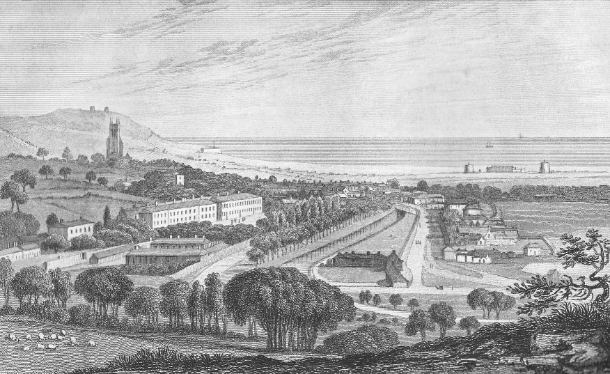
Folkestone ( ) is a port town on the English Channel, in Kent, south-east England. The town lies on the southern edge of the North Downs at a valley between two cliffs. It was an important harbour and shipping port for most of the 19th and 20th centuries. There has been a settlement in this location since the Mesolithic era. A nunnery was founded by Eanswith, granddaughter of Æthelberht of Kent in the 7th century, who is still commemorated as part of the town's culture. During the 13th century it subsequently developed into a seaport and the harbour developed during the early 19th century to provide defence against a French invasion. Folkestone expanded further west after the arrival of the railway in 1843 as an elegant coastal resort, thanks to the investment of the Earl of Radnor under the urban plan of Decimus Burton. In its heyday - during the Edwardian era - Folkestone was considered the most fashionable resort of the time, visited by royalties - amongst them Queen Victo ... [...More Info...] [...Related Items...] OR: [Wikipedia] [Google] [Baidu] |
Canterbury Cathedral
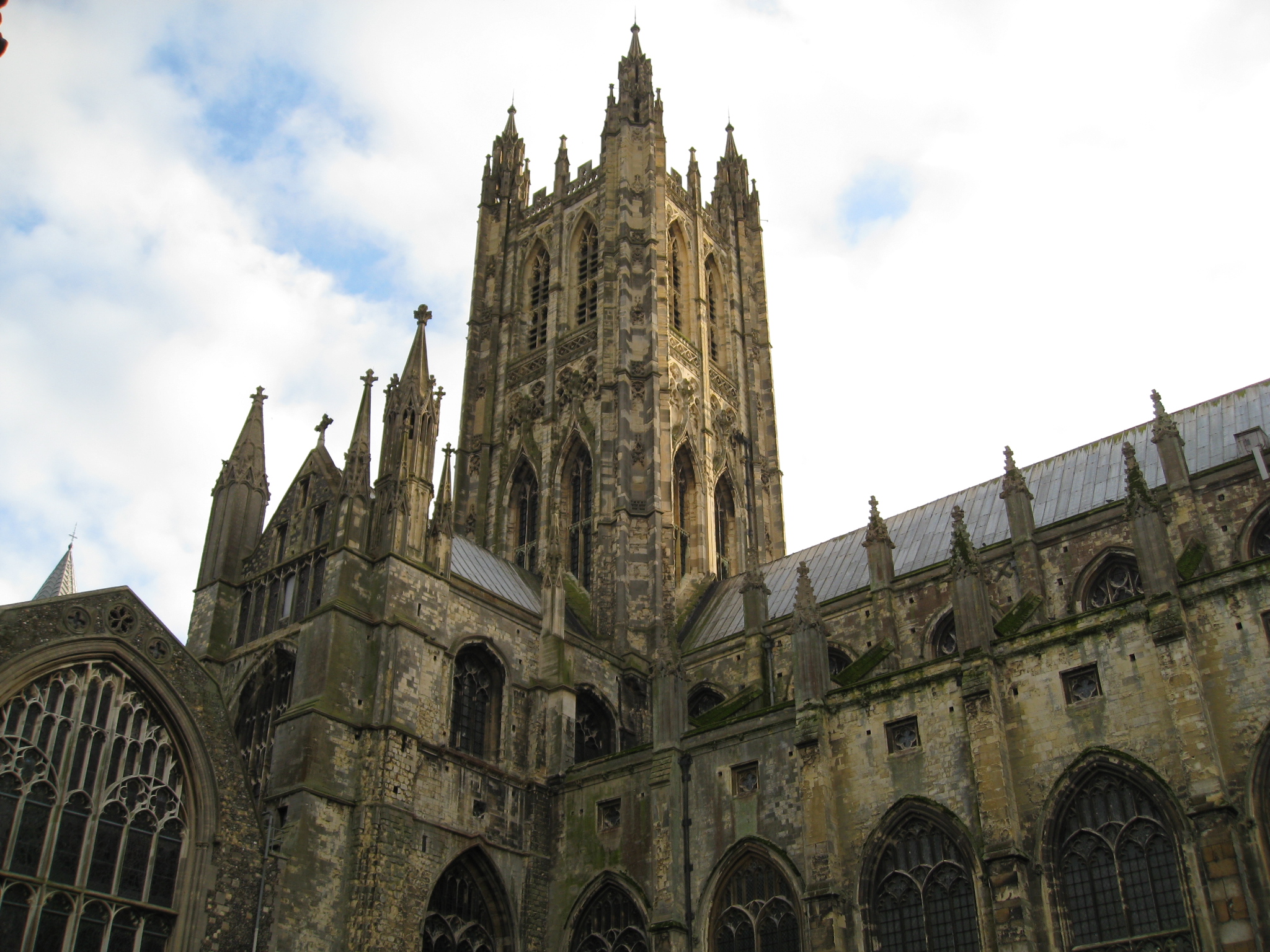
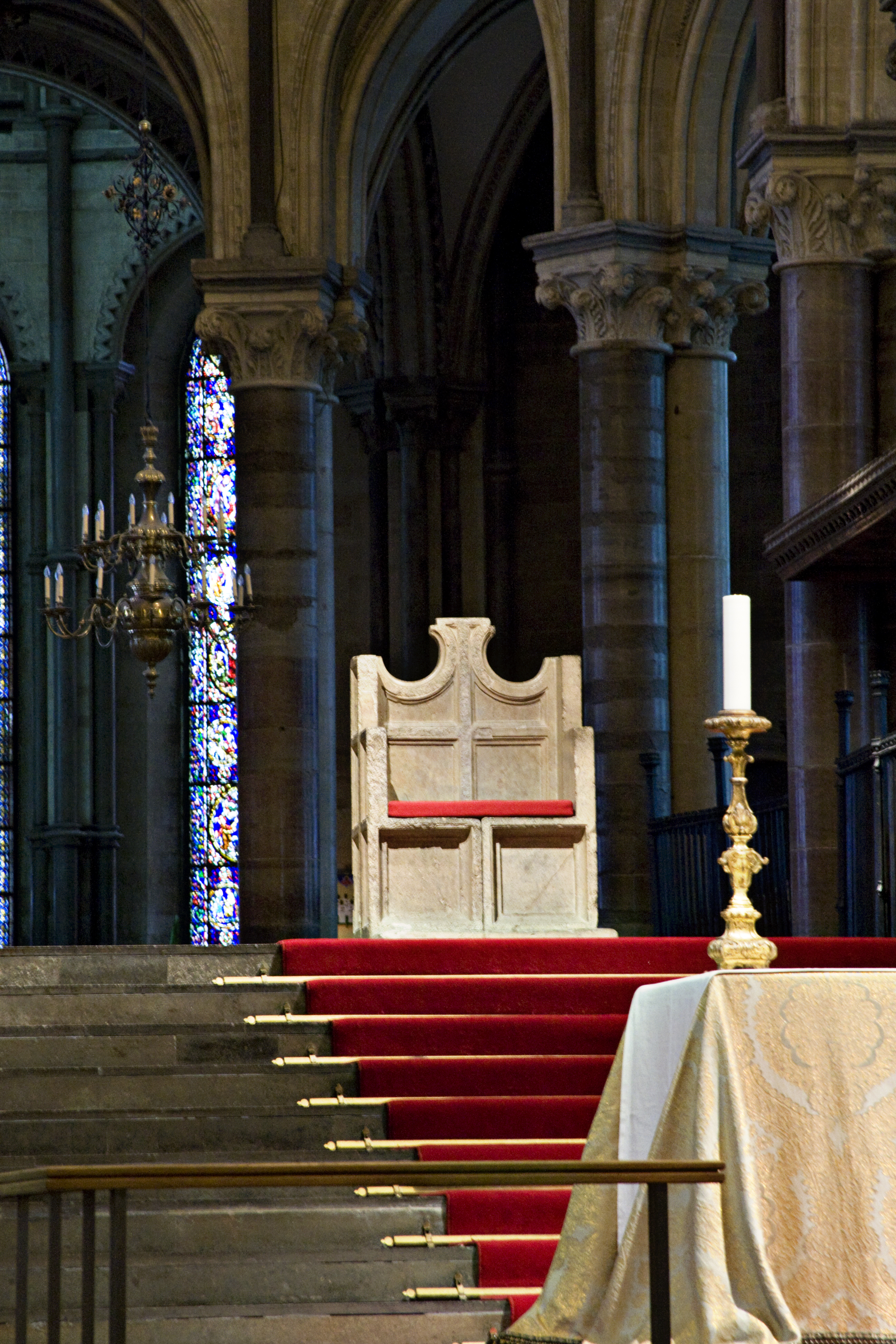
Canterbury Cathedral in Canterbury, Kent, is one of the oldest and most famous Christian structures in England. It forms part of a World Heritage Site. It is the cathedral of the Archbishop of Canterbury, currently Justin Welby, leader of the Church of England and symbolic leader of the worldwide Anglican Communion. Its formal title is the Cathedral and Metropolitical Church of Christ at Canterbury. Founded in 597, the cathedral was completely rebuilt between 1070 and 1077. The east end was greatly enlarged at the beginning of the 12th century and largely rebuilt in the Gothic style following a fire in 1174, with significant eastward extensions to accommodate the flow of pilgrims visiting the shrine of Thomas Becket, the archbishop who was murdered in the cathedral in 1170. The Norman nave and transepts survived until the late 14th century when they were demolished to make way for the present structures. Before the English Reformation the cathedral was part of a Benedictine ... [...More Info...] [...Related Items...] OR: [Wikipedia] [Google] [Baidu] |
Hythe, Kent
Hythe () is a coastal market town on the edge of Romney Marsh, in the district of Folkestone and Hythe on the south coast of Kent. The word ''Hythe'' or ''Hithe'' is an Old English word meaning haven or landing place. History The town has mediaeval and Georgian buildings, as well as a Saxon/Norman church on the hill and a Victorian seafront promenade. Hythe was once defended by two castles, Saltwood and Lympne. Hythe Town Hall, a neoclassical style building, was completed in 1794. Hythe's market once took place in Market Square (now Red Lion Square) close to where there is now a farmers' market every second and fourth Saturday of the month. Hythe has gardening, horse riding, bowling, tennis, cricket, football, squash and sailing clubs. Lord Deedes was once patron of Hythe Civic Society. As an important Cinque Port Hythe once possessed a bustling harbour which, over the course of 300 years, has now disappeared due to silting. Hythe was the central Cinque Port, sitting bet ... [...More Info...] [...Related Items...] OR: [Wikipedia] [Google] [Baidu] |
Park Gate Down
Park Gate Down or Parkgate Down is a biological Site of Special Scientific Interest south-east of Stelling Minnis in Kent. It is also a Special Area of Conservation and is managed by the Kent Wildlife Trust, Topography Park Gate Down is located at (Ordnance Survey reference ) and covers seven hectares on the eastern slopes of a dry valley on the dip slope of the North Downs. The reserve is predominantly chalk grassland although the eastern fringes consist of a mixture of woodland and scrub which is partially situated on a layer of clay with flints that caps the chalk. In the south eastern corner of the reserve is a disused chalk pit and the western and northern area of the reserve borders on Elham Park Wood. To the south of the reserve is an area of land managed under the Countryside Stewardship Scheme which is being reverted from arable land to chalk downland. Ecology Flora The dominant chalk grassland community at Park Gate Down is CG4 ''Brachypodium pinnatum''. However, f ... [...More Info...] [...Related Items...] OR: [Wikipedia] [Google] [Baidu] |
Chalk Downland
Downland, chalkland, chalk downs or just downs are areas of open chalk hills, such as the North Downs. This term is used to describe the characteristic landscape in southern England where chalk is exposed at the surface. The name "downs" is derived from the Old English word dun, meaning "hill". Distribution The largest area of downland in southern England is formed by Salisbury Plain, mainly in Wiltshire. To the southwest, downlands continue via Cranborne Chase into Dorset as the Dorset Downs and southwards through Hampshire as the Hampshire Downs onto the Isle of Wight. To the northeast, downlands continue along the Berkshire Downs and Chiltern Hills through parts of Berkshire, Oxfordshire, Buckinghamshire, Hertfordshire, Bedfordshire and into Cambridgeshire. To the east downlands are found north of the Weald in Surrey, Kent and part of Greater London, forming the North Downs. To the southeast the downlands continue into West Sussex and East Sussex as the South Downs. Similar cha ... [...More Info...] [...Related Items...] OR: [Wikipedia] [Google] [Baidu] |
Bishopsbourne
Bishopsbourne is a mostly rural and wooded village and civil parish in Kent, England. It has two short developed sections of streets at the foot of the Nailbourne valley south-east of Canterbury and centred from Dover. The settlement of Pett Bottom is included in the civil parish. Geography Bishopsbourne is located within the Kent Downs Area of Outstanding Natural Beauty. High-up Goresley Wood occupies about half of the parish, which rises gradually in the south-west. A Roman Britain collective burial mound (tumulus) is at a point in the north-centre of this forested area. Amenities A pub trades in Bishopsbourne, ''The Mermaid Inn'', which was built in 1861 and previously called the ''Lion's Head''. Its church, St Mary's, is one of the Church of England, and contains notable 14th-century wall paintings. It is listed in the highest grading of the national system at Grade I. The Tadpole Tearoom, located on Frog Lane, opened in a converted farmyard in 2017 and serves hot ... [...More Info...] [...Related Items...] OR: [Wikipedia] [Google] [Baidu] |
Valley
A valley is an elongated low area often running between Hill, hills or Mountain, mountains, which will typically contain a river or stream running from one end to the other. Most valleys are formed by erosion of the land surface by rivers or streams over a very long period. Some valleys are formed through erosion by glacier, glacial ice. These glaciers may remain present in valleys in high mountains or polar areas. At lower latitudes and altitudes, these glaciation, glacially formed valleys may have been created or enlarged during ice ages but now are ice-free and occupied by streams or rivers. In desert areas, valleys may be entirely dry or carry a watercourse only rarely. In karst, areas of limestone bedrock, dry valleys may also result from drainage now taking place cave, underground rather than at the surface. Rift valleys arise principally from tectonics, earth movements, rather than erosion. Many different types of valleys are described by geographers, using terms th ... [...More Info...] [...Related Items...] OR: [Wikipedia] [Google] [Baidu] |


