|
Eilean Chathastail
Eilean Chathastail ( Eng: ''Castle Island'') is one of the Small Isles in the Inner Hebrides of Scotland. Geography EiggLandsat.jpg, Satellite view of Eigg (Landsat image viewed using NASA World Wind software). Eilean Chathastail is the island in the bottom right of the picture Eigg_1892_map.jpg, Map of Eigg 1892, with Eilean Chathastail to its Southeast Eilean Chathastail protects the only harbour on Eigg at Galmisdale. It is roughly in length and lies only off the south-east coast of the island of Eigg. Eigg lighthouse was built on the island in 1906 by brothers David A. and Charles Alexander Stevenson. History In July 1884 the geologist and writer Hugh Miller arrived at the Eilean Chathastail anchorage on board the yacht ''Betsey''. He had just begun his journey at Tobermory and he produced a diary of his travels in the Hebrides for the newspaper ''Witness'', of which he was the editor. His contributions were later collated and published as ''The Cruise of the Betsey'' i ... [...More Info...] [...Related Items...] OR: [Wikipedia] [Google] [Baidu] |
Small Isles
The Small Isles ('' gd, Na h-Eileanan Tarsainn'') are a small archipelago of islands in the Inner Hebrides, off the west coast of Scotland. They lie south of Skye and north of Mull and Ardnamurchan – the most westerly point of mainland Scotland. The islands form part of the Lochaber area of the Highland council area. Until 1891, Canna, Rùm and Muck were historically part of the shire of Argyll; Eigg was historically part of Inverness-shire. All of the Small Isles were in Inverness-shire between 1891 and 1975, and remain part of the registration county of Inverness for land registration and statistical purposes. A single community council covers the islands. Name "Small Isles" is the name of the coterminous civil parish and former Church of Scotland parish,Haswell-Smith, Hamish (2004). The Scottish Islands. Edinburgh: Canongate. . p. 134 originally created in 1726 from part of Sleat parish, the balance of which lies on the much larger island of Skye. The original n ... [...More Info...] [...Related Items...] OR: [Wikipedia] [Google] [Baidu] |
David Alan Stevenson
David Alan Stevenson (21 July 1854 in Edinburgh – 11 April 1938) was a lighthouse engineer who built 26 lighthouses in and around Scotland. Life He was born on 21 July 1854 the son of David Stevenson and his wife, Elizabeth Mackay. His early years were spent at their home at 8 Forth Street in the eastern section of the New Town in Edinburgh. The family later moved to 45 Melville Street. He was part of the famous Stevenson family of lighthouse engineers, including brother Charles Stevenson, uncle Thomas Stevenson, and grandfather Robert Stevenson. His cousin was the author Robert Louis Stevenson. Stevenson was educated at Edinburgh Academy (1865–70) and then studied Engineering at the University of Edinburgh, graduating BSc in 1875. In 1884 he was elected a Fellow of the Royal Society of Edinburgh. His proposers were William Swan, Peter Guthrie Tait, Robert MacKay Smith and George Chrystal.). Stevenson died at his home, "Troqueer", in the Kingsknowe area of Edi ... [...More Info...] [...Related Items...] OR: [Wikipedia] [Google] [Baidu] |
List Of Islands Of Scotland
This is a list of islands of Scotland, the mainland of which is part of the island of Great Britain. Also included are various other related tables and lists. The definition of an offshore island used in this list is "land that is surrounded by seawater on a daily basis, but not necessarily at all stages of the tide, excluding human devices such as bridges and causeways". Scotland has over 790 offshore islands, most of which are to be found in four main groups: Shetland, Orkney, and the Hebrides, sub-divided into the Inner Hebrides and Outer Hebrides. There are also clusters of islands in the Firth of Clyde, Firth of Forth, and Solway Firth, and numerous small islands within the many bodies of fresh water in Scotland including Loch Lomond and Loch Maree. The largest island is Lewis and Harris which extends to 2,179 square kilometres, and there are a further 200 islands which are greater than 40 hectares in area. Of the remainder, several such as Staffa and the Flannan Isles ... [...More Info...] [...Related Items...] OR: [Wikipedia] [Google] [Baidu] |
Hebrides
The Hebrides (; gd, Innse Gall, ; non, Suðreyjar, "southern isles") are an archipelago off the west coast of the Scottish mainland. The islands fall into two main groups, based on their proximity to the mainland: the Inner and Outer Hebrides. These islands have a long history of occupation (dating back to the Mesolithic period), and the culture of the inhabitants has been successively influenced by the cultures of Celtic-speaking, Norse-speaking, and English-speaking peoples. This diversity is reflected in the various names given to the islands, which are derived from the different languages that have been spoken there at various points in their history. The Hebrides are where much of Scottish Gaelic literature and Gaelic music has historically originated. Today, the economy of the islands is dependent on crofting, fishing, tourism, the oil industry, and renewable energy. The Hebrides have less biodiversity than mainland Scotland, but a significant number of seals an ... [...More Info...] [...Related Items...] OR: [Wikipedia] [Google] [Baidu] |
Tobermory, Mull
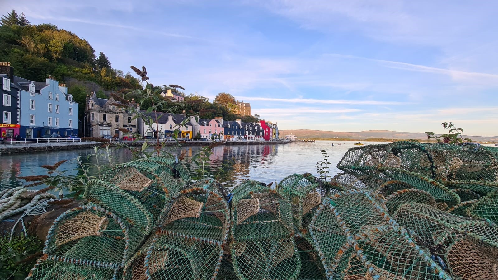
Tobermory (; gd, Tobar Mhoire) is the capital of, and until 1973 the only burgh on, the Isle of Mull in the Scottish Inner Hebrides. It is located on the east coast of Mishnish, the most northerly part of the island, near the northern entrance of the Sound of Mull. The village was founded as a fishing port in 1788; its layout was based on the designs of Dumfriesshire engineer Thomas Telford. It has a current population of about 1,000. Etymology The name ''Tobermory'' is derived from the Gaelic ', meaning "Mary's well". The name refers to a well located nearby which was dedicated in ancient times to the Virgin Mary. Prehistory and archaeology Archaeological Excavations have taken place at Baliscate just outside of the town. The site was first noted by Hylda Marsh and Beverley Langhorn as part of the Scotland's Rural Past. In 2009, it was partially excavated Time Team and a further longer excavation took place in 2012 as part of a community archaeology project through the Mul ... [...More Info...] [...Related Items...] OR: [Wikipedia] [Google] [Baidu] |
Hugh Miller
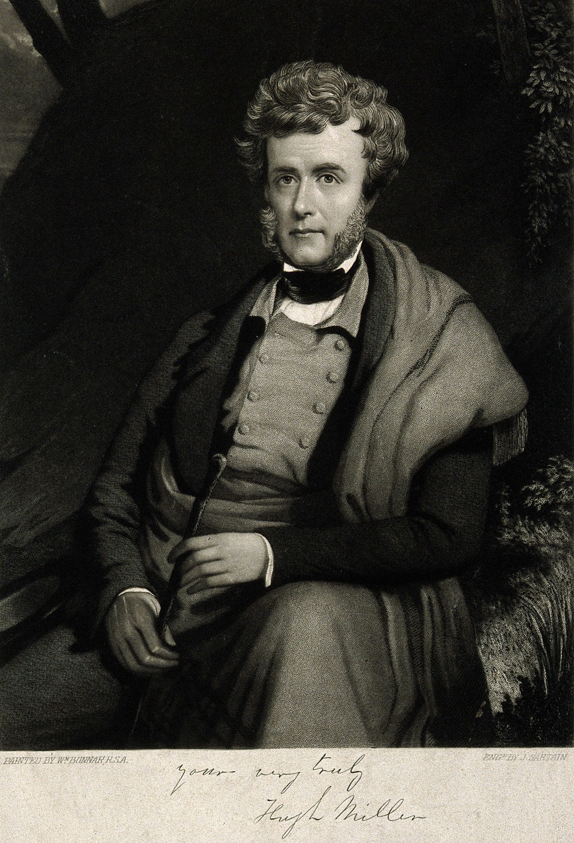
Hugh Miller (10 October 1802 – 23/24 December 1856) was a self-taught Scottish geologist and writer, folklorist and an evangelical Christian. Life and work Miller was born in Cromarty, the first of three children of Harriet Wright (''bap''. 1780, ''d''. 1863) and Hugh Miller (''bap''. 1754, ''d''. 1807), a shipmaster in the coasting trade. Both parents were from trading and artisan families in Cromarty. His father died in a shipwreck in 1807, and he was brought up by his mother and uncles. He was educated in a parish school where he reportedly showed a love of reading. It was at this school that Miller was involved in an altercation with a classmate in which he stabbed his peer's thigh. Miller was subsequently expelled from the school following an unrelated incident. At 17 he was apprenticed to a stonemason, and his work in quarries, together with walks along the local shoreline, led him to the study of geology. In 1829 he published a volume of poems, and soon afterwards ... [...More Info...] [...Related Items...] OR: [Wikipedia] [Google] [Baidu] |
Charles Alexander Stevenson
Charles Alexander Stevenson MICE MIEE FRSE (23 December 1855, – 9 May 1950) was a Scottish lighthouse engineer who built twenty-three lighthouses in and around Scotland. Life He was born at 8 Forth Street in the east part of Edinburgh's New Town The family moved to 20 Royal Terrace on Calton Hill shortly after his birth. Born into the famous Stevenson family of lighthouse engineers, son of David Stevenson and his wife Elizabeth Mackay, brother of David Alan Stevenson, and nephew of Thomas Stevenson, he was educated at Edinburgh Academy 1866 to 1872 then studied mathematics and engineering at the University of Edinburgh where he graduated BSc. He joined the family business of lighthouse design in 1875 remaining unpaid as a family member until 1887 when his uncle, Thomas Stevenson died, after which he became a partner. Between 1887 and 1937 he built 23 lighthouses with his brother, David, and is noted for his experiments with optics. He also improved foghorns and created ... [...More Info...] [...Related Items...] OR: [Wikipedia] [Google] [Baidu] |
Galmisdale
Galmisdale is the main port of the island of Eigg, one of the Small Isles of the Inner Hebrides. It is in the Scottish council area of Highland Highlands or uplands are areas of high elevation such as a mountainous region, elevated mountainous plateau or high hills. Generally speaking, upland (or uplands) refers to ranges of hills, typically from up to while highland (or highlands) is .... References {{Commons category Populated places in Lochaber Villages in the Inner Hebrides Eigg ... [...More Info...] [...Related Items...] OR: [Wikipedia] [Google] [Baidu] |
Highland (council Area)
Highland ( gd, A' Ghàidhealtachd, ; sco, Hieland) is a council area in the Scottish Highlands and is the largest local government area in the United Kingdom. It was the 7th most populous council area in Scotland at the 2011 census. It shares borders with the council areas of Aberdeenshire, Argyll and Bute, Moray and Perth and Kinross. Their councils, and those of Angus and Stirling, also have areas of the Scottish Highlands within their administrative boundaries. The Highland area covers most of the mainland and inner-Hebridean parts of the historic counties of Inverness-shire and Ross and Cromarty, all of Caithness, Nairnshire and Sutherland and small parts of Argyll and Moray. Despite its name, the area does not cover the entire Scottish Highlands. Name Unlike the other council areas of Scotland, the name ''Highland'' is often not used as a proper noun. The council's website only sometimes refers to the area as being ''Highland'', and other times as being ''the Hig ... [...More Info...] [...Related Items...] OR: [Wikipedia] [Google] [Baidu] |
NASA World Wind
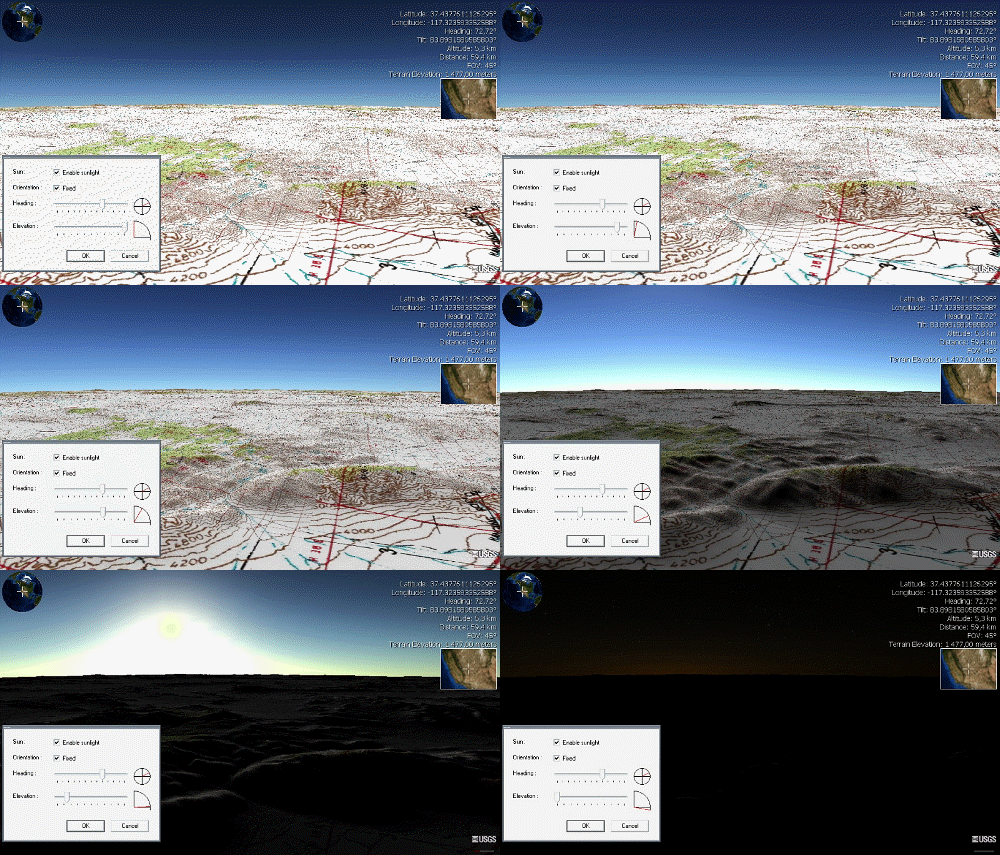
NASA WorldWind is an open-source (released under the NOSA license and the Apache 2.0 license) virtual globe. According to the website (https://worldwind.arc.nasa.gov/), "WorldWind is an open source virtual globe API. WorldWind allows developers to quickly and easily create interactive visualizations of 3D globe, map and geographical information. Organizations around the world use WorldWind to monitor weather patterns, visualize cities and terrain, track vehicle movement, analyze geospatial data and educate humanity about the Earth." It was first developed by NASA in 2003 for use on personal computers and then further developed in concert with the open source community since 2004. As of 2017, a web-based version of WorldWind is available online. An Android version is also available. The original version relied on .NET Framework, which ran only on Microsoft Windows. The more recent Java version, WorldWind Java, is cross platform, a software development kit (SDK) aime ... [...More Info...] [...Related Items...] OR: [Wikipedia] [Google] [Baidu] |
Landsat
The Landsat program is the longest-running enterprise for acquisition of satellite imagery of Earth. It is a joint NASA / USGS program. On 23 July 1972, the Earth Resources Technology Satellite was launched. This was eventually renamed to Landsat 1 in 1975. The most recent, Landsat 9, was launched on 27 September 2021. The instruments on the Landsat satellites have acquired millions of images. The images, archived in the United States and at Landsat receiving stations around the world, are a unique resource for global change research and applications in agriculture, cartography, geology, forestry, regional planning, surveillance and education, and can be viewed through the U.S. Geological Survey (USGS) "EarthExplorer" website. Landsat 7 data has eight spectral bands with spatial resolutions ranging from ; the temporal resolution is 16 days. Landsat images are usually divided into scenes for easy downloading. Each Landsat scene is about 115 miles long and 115 miles wide (or ... [...More Info...] [...Related Items...] OR: [Wikipedia] [Google] [Baidu] |


