|
Effects Of Hurricane Ivan In The Lesser Antilles And South America
In September 2004, Hurricane Ivan caused significant effects in the Lesser Antilles and South America, including 44 deaths and over $1 billion in damage (2004 USD), primarily in Grenada where it was considered the worst hurricane in nearly 50 years. Hurricane Ivan developed from a tropical wave on September 2 and rapidly intensified to become a major hurricane, passing through the southern Lesser Antilles on September 7 with winds of . At the time, its typical storm force winds extended outward up to with hurricane-force winds outward to , and the northern portion of the eye (cyclone), eye passed over Grenada. In the region, the worst damage occurred on Grenada, where the damage total of $1.1 billion (2004 USD, ($ USD)) represented 200% of its Gross Domestic Product, GDP. The hurricane damaged more than 14,000 homes and destroyed 30% of the houses, leaving about 18,000 people homeless. A total of 39 people were killed by the hurr ... [...More Info...] [...Related Items...] OR: [Wikipedia] [Google] [Baidu] |
Windward Islands
french: Îles du Vent , image_name = , image_caption = ''Political'' Windward Islands. Clockwise: Dominica, Martinique, Saint Lucia, Saint Vincent and the Grenadines, and Grenada. , image_alt = , locator_map = , location = Caribbean SeaNorth Atlantic Ocean , coordinates = , area_km2 = 3232.5 , total_islands = 90+ , major_islands = CarriacouDominicaGrenadaMartiniquePetite MartiniqueSaint Lucia Saint Vincent , highest_mount = Morne Diablotins, Dominica , elevation_m = 1,447 , country = Dominica , country_largest_city = Roseau , country1 = Grenada , country1_largest_city = St. George's , country2 = Martinique , country2_largest_city = Fort-de-France , country3 = Saint Lucia , country3_largest_city = Castries , country4 = Saint Vincent and the Grenadines , country4_largest_city = Kingstown , density_km2 = 227 , population = 854,000 , ethnic_groups = The Windward Islands are the southern, generally larger islands of the Lesser Antilles. Part of the West Indies, they lie south ... [...More Info...] [...Related Items...] OR: [Wikipedia] [Google] [Baidu] |
Guajira Peninsula
The Guajira Peninsula ( es, Península de La Guajira, links=no, also spelled ''Goajira'', mainly in colonial period texts, guc, Hikükariby) is a peninsula in northern Colombia and northwestern Venezuela in the Caribbean. It is the northernmost peninsula in South America and has an area of extending from the Manaure Bay (Colombia) to the Calabozo Ensenada in the Gulf of Venezuela (Venezuela), and from the Caribbean to the Serranía del Perijá mountains range. It was the subject of a historic dispute between Venezuela and Colombia in 1891, and on arbitration was awarded to the latter and joined to its Magdalena Department. Nowadays, most of the territory is part of Colombia, making it part of La Guajira Department. The remaining strip is part of the Venezuelan Zulia State. The northernmost part of the peninsula is called Punta Gallinas (12° 28´ N) and is also considered the northernmost part of mainland South America. [...More Info...] [...Related Items...] OR: [Wikipedia] [Google] [Baidu] |
Vargas, Venezuela
) , anthem = '' Carmañola Americana'' , image_map = Vargas in Venezuela.svg , map_alt = , map_caption = Location within Venezuela , pushpin_map = , pushpin_map_alt = , pushpin_mapsize = , pushpin_map_caption = , coordinates = , coordinates_footnotes = , subdivision_type = Country , subdivision_name = Venezuela , subdivision_type1 = , subdivision_name1 = , subdivision_type2 = , subdivision_name2 = , established_title = Created , established_date = 1998 , founder = , named_for = , seat_type = Capital , seat = La Guaira , government_footnotes = , government_type = , leader_party = , governing_body= Legislative Council , leader_title = Governor , leader_name = José Manuel Suárez (2021–) , ... [...More Info...] [...Related Items...] OR: [Wikipedia] [Google] [Baidu] |
Storm Surge
A storm surge, storm flood, tidal surge, or storm tide is a coastal flood or tsunami-like phenomenon of rising water commonly associated with low-pressure weather systems, such as cyclones. It is measured as the rise in water level above the normal tidal level, and does not include waves. The main meteorological factor contributing to a storm surge is high-speed wind pushing water towards the coast over a long fetch. Other factors affecting storm surge severity include the shallowness and orientation of the water body in the storm path, the timing of tides, and the atmospheric pressure drop due to the storm. There is a suggestion that climate change may be increasing the hazard of storm surges. Some theorize that as extreme weather becomes more intense and sea level rises due to climate change, storm surge is expected to cause more risk to coastal populations. Communities and governments can adapt by building hard infrastructure, like surge barriers, soft infrastructure, ... [...More Info...] [...Related Items...] OR: [Wikipedia] [Google] [Baidu] |
Atlantic LNG
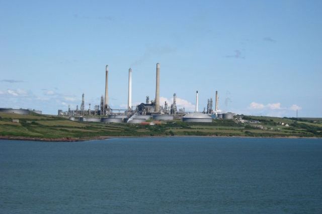
The Atlantic LNG Company of Trinidad and Tobago is a liquefied natural gas (LNG) producing company operating a liquefied natural gas plant in Point Fortin, Trinidad and Tobago. Atlantic LNG operates four liquefaction units (trains). Train 4, with a 5.2 million tonnes per year production capacity, is among the world's largest LNG trains in operation. History The Atlantic LNG project was started by Cabot LNG (now Suez) in 1992. In 1993, Cabot LNG, National Gas Company of Trinidad and Tobago, Amoco and British Gas plc signed the Memorandum of Understanding, and launched a feasibility study of the project. The Atlantic LNG company was formed in July 1995. Construction of the first train started in 1996, and the train was officially opened on 13 March 1999. The first cargo was loaded in April 1999. Train 2 started up on 12 August 2002, Train 3 on 28 April 2003, and Train 4 in December 2005. A feasibility study for the fifth train—Train X—was scheduled to be concluded by December ... [...More Info...] [...Related Items...] OR: [Wikipedia] [Google] [Baidu] |
Trinidad And Tobago
Trinidad and Tobago (, ), officially the Republic of Trinidad and Tobago, is the southernmost island country in the Caribbean. Consisting of the main islands Trinidad and Tobago, and numerous much smaller islands, it is situated south of Grenada and off the coast of northeastern Venezuela. It shares maritime boundaries with Barbados to the northeast, Grenada to the northwest and Venezuela to the south and west. Trinidad and Tobago is generally considered to be part of the West Indies. The island country's capital is Port of Spain, while its largest and most populous city is San Fernando. The island of Trinidad was inhabited for centuries by Indigenous peoples before becoming a colony in the Spanish Empire, following the arrival of Christopher Columbus, in 1498. Spanish governor José María Chacón surrendered the island to a British fleet under the command of Sir Ralph Abercromby in 1797. Trinidad and Tobago were ceded to Britain in 1802 under the Treaty of Amiens as se ... [...More Info...] [...Related Items...] OR: [Wikipedia] [Google] [Baidu] |
Aruba
Aruba ( , , ), officially the Country of Aruba ( nl, Land Aruba; pap, Pais Aruba) is a constituent country of the Kingdom of the Netherlands physically located in the mid-south of the Caribbean Sea, about north of the Venezuela peninsula of Paraguaná and northwest of Curaçao. It measures long from its northwestern to its southeastern end and across at its widest point. Together with Bonaire and Curaçao, Aruba forms a group referred to as the ABC islands. Collectively, these and the other three Dutch substantial islands in the Caribbean are often called the Dutch Caribbean, of which Aruba has about one-third of the population. In 1986, it became a constituent country within the Kingdom of the Netherlands, and acquired the formal name the Country of Aruba. Aruba is one of the four countries that form the Kingdom of the Netherlands, along with the Netherlands, Curaçao, and Sint Maarten; the citizens of these countries are all Dutch nationals. Aruba has no administrat ... [...More Info...] [...Related Items...] OR: [Wikipedia] [Google] [Baidu] |
Valero Energy Corporation
Valero Energy Corporation is a Fortune 500 international manufacturer and marketer of transportation fuels, other petrochemical products, and power. It is headquartered in San Antonio, Texas, United States. Throughout the United States and Canada, the company owns and operates 15 refineries, and one in Wales, with a combined throughput capacity of approximately per day, 11 ethanol plants with a combined production capacity of per year, and a 50-megawatt wind farm. Before the 2013 spinoff of CST Brands, Valero was one of the United States' largest retail operators with approximately 6,800 retail and branded wholesale outlets in the United States, Canada, United Kingdom, and the Caribbean under the Valero, Diamond Shamrock, Shamrock, Beacon, and Texaco brands. History Valero was created on January 1, 1980, as the successor of Coastal States Gas Corporation's Subsidiary, LoVaca Gathering Company. Valero took over the natural gas operations of the LoVaca Gathering Company, late ... [...More Info...] [...Related Items...] OR: [Wikipedia] [Google] [Baidu] |
Curaçao
Curaçao ( ; ; pap, Kòrsou, ), officially the Country of Curaçao ( nl, Land Curaçao; pap, Pais Kòrsou), is a Lesser Antilles island country in the southern Caribbean Sea and the Dutch Caribbean region, about north of the Venezuela coast. It is a constituent country of the Kingdom of the Netherlands. Together with Aruba and Bonaire, it forms the ABC islands. Collectively, Curaçao, Aruba, and other Dutch islands in the Caribbean are often called the Dutch Caribbean. Curaçao was formerly part of the Curaçao and Dependencies colony from 1815 to 1954 and later the Netherlands Antilles from 1954 to 2010, as Island Territory of Curaçao ( nl, Eilandgebied Curaçao, links=no, pap, Teritorio Insular di Kòrsou, links=no), and is now formally called the Country of Curaçao. It includes the main island of Curaçao and the much smaller, uninhabited island of Klein Curaçao ("Little Curaçao"). Curaçao has a population of 158,665 (January 2019 est.), with an area of ; its ... [...More Info...] [...Related Items...] OR: [Wikipedia] [Google] [Baidu] |
Simón Bolívar International Airport (Venezuela)
Maiquetía "Simón Bolívar" International Airport (, es, link=no, Aeropuerto Internacional de Maiquetía "Simón Bolívar") is an international airport located in Maiquetía, Vargas, Venezuela, about west of downtown Caracas, the capital of the country. Simply called by the local population, it is the main international air passenger gateway to Venezuela. It handles flights to destinations in the Americas, Europe and the Middle East. History The airport opened in 1945 as the . The site had been recommended as an appropriate location for an airport by Charles Lindbergh on behalf of Pan Am. The USA subsidised the construction of the airport as part of the Airport Development Program. Luis Malaussena was the architect who designed the original passenger terminal. It was regularly visited by the Anglo-French supersonic airliner Concorde until the 1980s. Commencing in the late 1970s, Air France operated weekly Concorde service between Caracas and Paris via a stop at Santa Ma ... [...More Info...] [...Related Items...] OR: [Wikipedia] [Google] [Baidu] |
Isla Margarita
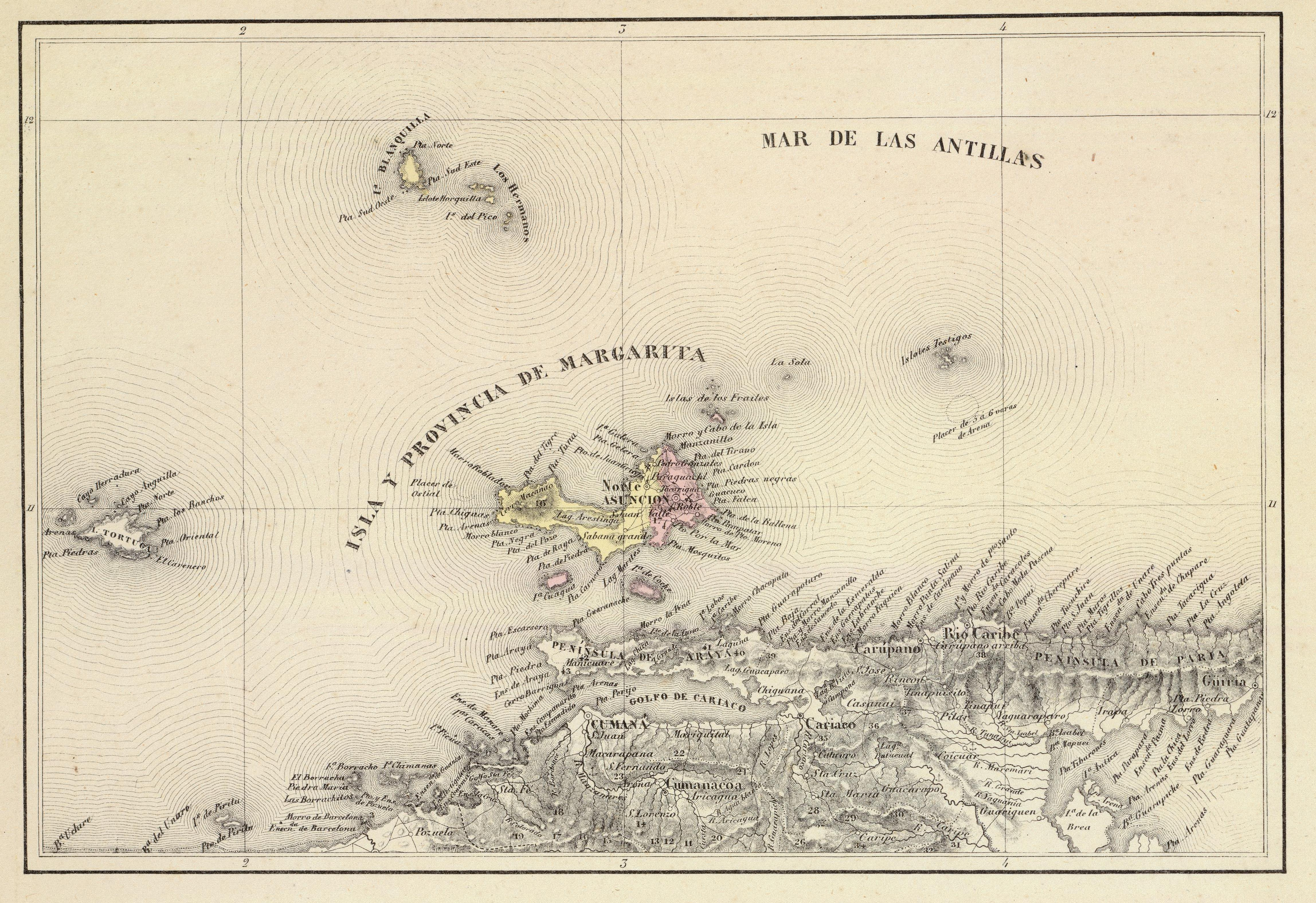
Margarita Island (, ) is the largest island in the Venezuelan state of Nueva Esparta, situated off the northeastern coast of the country, in the Caribbean Sea. The capital city of Nueva Esparta, La Asunción, is located on the island. History Age of Exploration Christopher Columbus was the first European to arrive on Margarita Island in 1498. The local natives were the Guaiqueries people. The coast of the island was abundant in pearls, which represented almost a third of all New World tribute to the Spanish Crown. Margarita Island was fortified against the increasing threat of pirate attacks, and some fortifications remain today. It was the center of Spanish colonial Margarita Province, established in 1525. In 1561, the island was seized by Lope de Aguirre, a notoriously violent and rebellious conquistador. Around 1675, the island was captured again, this time by Red Legs Greaves, a pirate known for his humanity and morality. He captured a fleet of Spanish ships off por ... [...More Info...] [...Related Items...] OR: [Wikipedia] [Google] [Baidu] |

_2014-09-21_(3).jpg)


