|
Earl's Sluice
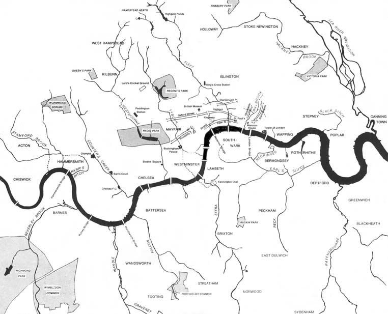
Earl's Sluice is an underground river in south-east London, England. Its source is Ruskin Park on Denmark Hill. In South Bermondsey it is joined by the River Peck before emptying into the Thames at Deptford Wharf. Earl's Creek marks the boundary between St Mary's parish, Rotherhithe and St Paul's parish, Deptford and their successors the London Borough of Southwark and the London Borough of Lewisham. It also marks the boundary between the historic counties of Kent and Surrey. The river is named after the Earl of Gloucester in the time of Henry I. See also * Subterranean rivers of London * Thames Tideway Scheme The Thames Tideway Tunnel is a combined sewer under construction running mostly under the tidal section (estuary) of the River Thames across Inner London to capture, store and convey almost all the raw sewage and rainwater that currently over ... References Further reading * London's Lost Rivers' by Paul Talling External links on Diamond Geezer blo ... [...More Info...] [...Related Items...] OR: [Wikipedia] [Google] [Baidu] |
Subterranean Rivers Of London
The subterranean or underground rivers of London are or were the direct or indirect tributaries of the upper estuary of the Thames (the Tideway), that were built over during the growth of the metropolis of London. They now flow through culverts, with some of them now integral parts of London's sewerage system and diverted accordingly. Subterranean rivers in London North of the River Thames * Black Ditch * Hackney Brook * The River Moselle (all three subtributaries via the Lea) * Muswell Stream''London's Lost Rivers'' (2011) Paul Talling, Random House, pp148-150 (sub-sub-tributary via |
Deptford Wharf
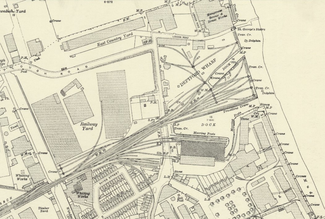
Deptford Wharf in London, UK is situated on the Thames Path southeast of South Dock Marina, across the culverted mouth of the Earl's Sluice and north of Aragon Tower. In the late 18th and early 19th century this area was used for shipbuilding with several building slips. With the coming of the railway in 1848 Deptford wharf and docks were used to import coal and for other goods. The housing here, completed in 1992, is on the site of former railway sidings and riverside wharves.Plaque at entrance to Tariff Crescent Dock and shipyard The dock built was by John Winter in 1704 and belonged to the Evelyn family. Described in 1726 as having a great depth of water, and as being the best private dock upon the river.In the 1726 grant from Sir Frederic Evelyn to Sir John Evelyn.A topographical dictionary of England [...More Info...] [...Related Items...] OR: [Wikipedia] [Google] [Baidu] |
Rotherhithe
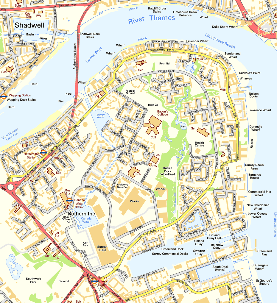
Rotherhithe () is a district of south-east London, England, and part of the London Borough of Southwark. It is on a peninsula on the south bank of the Thames, facing Wapping, Shadwell and Limehouse on the north bank, as well as the Isle of Dogs to the east of the Thames and is a part of the London Docklands, Docklands area. It borders Bermondsey to the west and Deptford to the south east. Rotherhithe has a long history as a port, with Elizabethan era, Elizabethan shipyards and working docks until the 1970s. In the 1980s, the area along the river was redeveloped as housing through a mix of warehouse conversions and new-build developments. Following the arrival of the Jubilee line in 1999 (giving quick connections to the West End of London, West End and to Canary Wharf) and the London Overground in 2010 (providing a quick route to the City of London), the rest of Rotherhithe is now a gentrification, gentrifying residential and commuter area, with urban regeneration progressing arou ... [...More Info...] [...Related Items...] OR: [Wikipedia] [Google] [Baidu] |
Thames Tideway Scheme
The Thames Tideway Tunnel is a combined sewer under construction running mostly under the tidal section (estuary) of the River Thames across Inner London to capture, store and convey almost all the raw sewage and rainwater that currently overflows into the estuary. These events occur when rainfall volumes exceed the capacity of Bazalgette's and other engineers' London sewerage system. The tunnelling phase of the project was completed in April 2022. Bazalgette Tunnel Limited (BTL) is the licensed infrastructure provider for its finance, building, maintenance and operation. It has as investors: Allianz, Amber Infrastructure, Dalmore Capital and DIF. Since the licence award, it also trades as Tideway. On 3 November 2015, the award was made by Ofwat, ensuring the start of the project. Started in 2016, the construction aimed to be completed by 2024. The COVID-19 pandemic has delayed this to early 2025. Once constructed, the main tunnel will have an internal diameter of and w ... [...More Info...] [...Related Items...] OR: [Wikipedia] [Google] [Baidu] |
Earl Pumping Station - Geograph
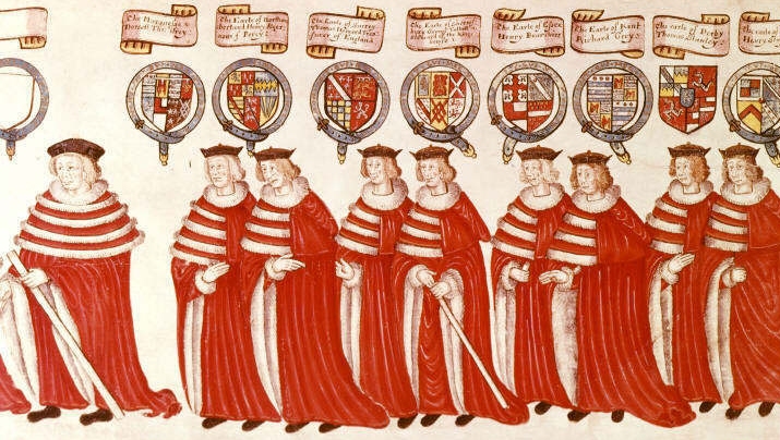
Earl () is a rank of the nobility in the United Kingdom. The title originates in the Old English word ''eorl'', meaning "a man of noble birth or rank". The word is cognate with the Scandinavian form ''jarl'', and meant "chieftain", particularly a chieftain set to rule a territory in a king's stead. After the Norman Conquest, it became the equivalent of the continental count (in England in the earlier period, it was more akin to a duke; in Scotland, it assimilated the concept of mormaer). Alternative names for the rank equivalent to "earl" or "count" in the nobility structure are used in other countries, such as the ''hakushaku'' (伯爵) of the post-restoration Japanese Imperial era. In modern Britain, an earl is a member of the peerage, ranking below a marquess and above a viscount. A feminine form of ''earl'' never developed; instead, ''countess'' is used. Etymology The term ''earl'' has been compared to the name of the Heruli, and to runic ''erilaz''. Proto-Norse ''eri ... [...More Info...] [...Related Items...] OR: [Wikipedia] [Google] [Baidu] |
Henry I Of England
Henry I (c. 1068 – 1 December 1135), also known as Henry Beauclerc, was King of England from 1100 to his death in 1135. He was the fourth son of William the Conqueror and was educated in Latin and the liberal arts. On William's death in 1087, Henry's elder brothers Robert Curthose and William Rufus inherited Normandy and England, respectively, but Henry was left landless. He purchased the County of Cotentin in western Normandy from Robert, but his brothers deposed him in 1091. He gradually rebuilt his power base in the Cotentin and allied himself with William Rufus against Robert. Present at the place where his brother William died in a hunting accident in 1100, Henry seized the English throne, promising at his coronation to correct many of William's less popular policies. He married Matilda of Scotland and they had two surviving children, Empress Matilda and William Adelin; he also had many illegitimate children by his many mistresses. Robert, who invaded from Normandy ... [...More Info...] [...Related Items...] OR: [Wikipedia] [Google] [Baidu] |
Robert, 1st Earl Of Gloucester
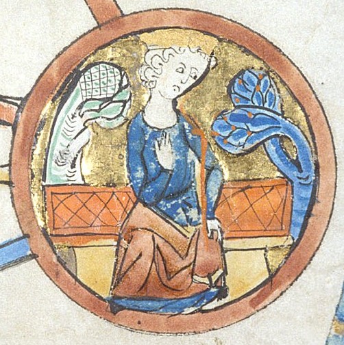
Robert FitzRoy, 1st Earl of Gloucester (c. 1090 – 31 October 1147 David Crouch, 'Robert, first earl of Gloucester (b. c. 1090, d. 1147)’, Oxford Dictionary of National Biography, Oxford University Press, 2004; online edn, May 200Retrieved 1 Oct 2010/ref>) (''alias'' Robert Rufus, Robert de Caen ( Latinised to Robertus de Cadomo), Robert Consul) was an illegitimate son of King Henry I of England. He was the half-brother of the Empress Matilda, and her chief military supporter during the civil war known as The Anarchy, in which she vied with Stephen of Blois for the throne of England. Early life Robert was probably the eldest of Henry's many illegitimate children. He was born before his father's accession to the English throne, either during the reign of his grandfather William the Conqueror or his uncle William Rufus. He is sometimes and erroneously designated as a son of Nest, daughter of Rhys ap Tewdwr, last king of Deheubarth, although his mother has been identified a ... [...More Info...] [...Related Items...] OR: [Wikipedia] [Google] [Baidu] |
Surrey
Surrey () is a ceremonial and non-metropolitan county in South East England, bordering Greater London to the south west. Surrey has a large rural area, and several significant urban areas which form part of the Greater London Built-up Area. With a population of approximately 1.2 million people, Surrey is the 12th-most populous county in England. The most populated town in Surrey is Woking, followed by Guildford. The county is divided into eleven districts with borough status. Between 1893 and 2020, Surrey County Council was headquartered at County Hall, Kingston-upon-Thames (now part of Greater London) but is now based at Woodhatch Place, Reigate. In the 20th century several alterations were made to Surrey's borders, with territory ceded to Greater London upon its creation and some gained from the abolition of Middlesex. Surrey is bordered by Greater London to the north east, Kent to the east, Berkshire to the north west, West Sussex to the south, East Sussex to ... [...More Info...] [...Related Items...] OR: [Wikipedia] [Google] [Baidu] |
Kent
Kent is a county in South East England and one of the home counties. It borders Greater London to the north-west, Surrey to the west and East Sussex to the south-west, and Essex to the north across the estuary of the River Thames; it faces the French department of Pas-de-Calais across the Strait of Dover. The county town is Maidstone. It is the fifth most populous county in England, the most populous non-Metropolitan county and the most populous of the home counties. Kent was one of the first British territories to be settled by Germanic tribes, most notably the Jutes, following the withdrawal of the Romans. Canterbury Cathedral in Kent, the oldest cathedral in England, has been the seat of the Archbishops of Canterbury since the conversion of England to Christianity that began in the 6th century with Saint Augustine. Rochester Cathedral in Medway is England's second-oldest cathedral. Located between London and the Strait of Dover, which separates England from mainla ... [...More Info...] [...Related Items...] OR: [Wikipedia] [Google] [Baidu] |
London Borough Of Lewisham
Lewisham () is a London borough in south-east London; it forms part of Inner London. The principal settlement of the borough is Lewisham. The local authority is Lewisham London Borough Council, based in Catford. The Prime Meridian passes through Lewisham. Blackheath, Goldsmiths, University of London and Millwall F.C. are located within the borough. History The borough was formed in 1965, by the London Government Act 1963, as an amalgamation of the former area of the Metropolitan Borough of Lewisham and the Metropolitan Borough of Deptford, which had been created in 1900 as divisions of the County of London. Minor boundary changes have occurred since its creation. The most significant amendments were made in 1996, when the former area of the Royal Docks in Deptford was transferred from the London Borough of Greenwich. The metropolitan borough of Lewisham corresponded to the ancient parishes of Lee and Lewisham and the borough of Deptford corresponded to the parish of Deptford ... [...More Info...] [...Related Items...] OR: [Wikipedia] [Google] [Baidu] |
London Borough Of Southwark
The London Borough of Southwark ( ) in South London forms part of Inner London and is connected by bridges across the River Thames to the City of London and London Borough of Tower Hamlets. It was created in 1965 when three smaller council areas amalgamated under the London Government Act 1963. All districts of the area are within the London postal district. It is governed by Southwark London Borough Council. The part of the South Bank within the borough is home to London Bridge terminus station and the attractions of The Shard, Tate Modern, Shakespeare's Globe and Borough Market that are the largest of the venues in Southwark to draw domestic and international tourism. Dulwich is home to the Dulwich Picture Gallery and the Imperial War Museum is in Elephant and Castle. History Southwark is the oldest part of south London. An urban area to the south of the bridge was first developed in the Roman period, but subsequently abandoned. The name Southwark dates from the establishm ... [...More Info...] [...Related Items...] OR: [Wikipedia] [Google] [Baidu] |
Thames
The River Thames ( ), known alternatively in parts as the River Isis, is a river that flows through southern England including London. At , it is the longest river entirely in England and the second-longest in the United Kingdom, after the River Severn. The river rises at Thames Head in Gloucestershire, and flows into the North Sea near Tilbury, Essex and Gravesend, Kent, via the Thames Estuary. From the west it flows through Oxford (where it is sometimes called the Isis), Reading, Henley-on-Thames and Windsor. The Thames also drains the whole of Greater London. In August 2022, the source of the river moved five miles to beyond Somerford Keynes due to the heatwave in July 2022. The lower reaches of the river are called the Tideway, derived from its long tidal reach up to Teddington Lock. Its tidal section includes most of its London stretch and has a rise and fall of . From Oxford to the Estuary the Thames drops by 55 metres. Running through some of the drier parts of mai ... [...More Info...] [...Related Items...] OR: [Wikipedia] [Google] [Baidu] |

