|
Extreme Points Of Croatia
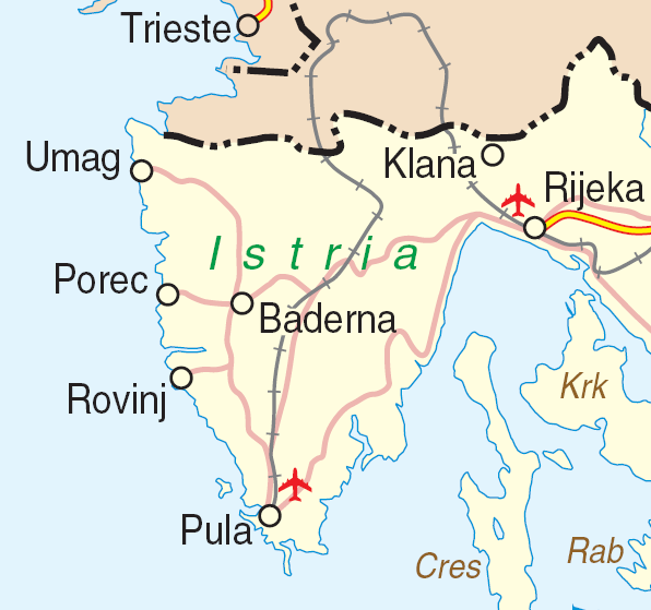
The geographical extreme points of Croatia are * Northernmost point: ** Sveti Martin na Muri (administratively in the Međimurje County) - Statistical Yearbook of the Republic of Croatia 2015, p. 46 * Southernmost point: ** Islet Galijula in Palagruža archipelago of the Adriatic Sea (administratively belongs to the city of Komiža on the Isle of Vis, Split-Dalmatia County) - ** On the mainland: Vitaljina, Cape Oštra () on the Prevlaka peninsula (administratively in the municipality of Cavtat, Dubrovnik-Neretva County) - * Easternmost point: ** Ilok (administratively part of the Vukovar-Syrmia County) - * Westernmost point: ** Bašanija, Cape Lako () (administratively part of the city of Umag, Istria County) - Altitude * Highest point : Dinara, Statistical Yearbook of the Republic of Croatia 2015, p. 48 * Lowest point : Adriatic Sea, 0 m See also * Geography of Croatia References Sources * {{Extreme points of Europe Geography of Croatia Croatia , image_flag ... [...More Info...] [...Related Items...] OR: [Wikipedia] [Google] [Baidu] |
Croatia
, image_flag = Flag of Croatia.svg , image_coat = Coat of arms of Croatia.svg , anthem = "Lijepa naša domovino"("Our Beautiful Homeland") , image_map = , map_caption = , capital = Zagreb , coordinates = , largest_city = capital , official_languages = Croatian , languages_type = Writing system , languages = Latin , ethnic_groups = , ethnic_groups_year = 2021 , religion = , religion_year = 2021 , demonym = , government_type = Unitary parliamentary republic , leader_title1 = President , leader_name1 = Zoran Milanović , leader_title2 = Prime Minister , leader_name2 = Andrej Plenković , leader_title3 = Speaker of Parliament , leader_name3 = Gordan Jandroković , legislature = Sabor , sovereignty_type ... [...More Info...] [...Related Items...] OR: [Wikipedia] [Google] [Baidu] |
Cavtat
Cavtat (, it, Ragusa Vecchia, lit=Old Ragusa) is a village in the Dubrovnik-Neretva County of Croatia. It is on the Adriatic Sea coast south of Dubrovnik and is the centre of the Konavle municipality. History Antiquity The original city was founded by the Greeks in the 6th century BC under the name of Epidaurus (or Epidauros, el, Ἐπίδαυρος). The surrounding area was inhabited by the Illyrians, who called the city Zaptal. The town changed its name to Epidaurum when it came under Roman rule in 228 BC. Justinian I the Emperor of the Byzantine Empire sent his fleet to Cavtat during the Gothic War (535–554) and occupied the town. The city was sacked and destroyed by the Avars and Slavs in the 7th century. Refugees from Epidaurum fled to the nearby island, Laus (Ragusa) which over time evolved into the city of Dubrovnik. Middle Ages The town was re-established in the Middle Ages ( it, Ragusa Vecchia). After a short while it came under the control of its powerful ne ... [...More Info...] [...Related Items...] OR: [Wikipedia] [Google] [Baidu] |
Geography Of Croatia
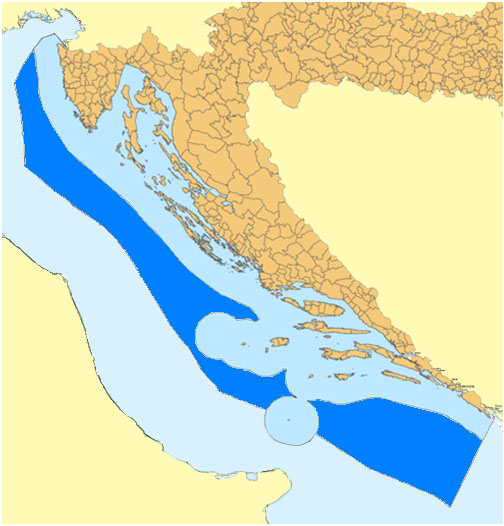
The geography of Croatia is defined by its location—it is described as a part of Central Europe and Southeast Europe, a part of the Balkans and Southern Europe. Croatia's territory covers , making it the 127th largest country in the world. Bordered by Bosnia and Herzegovina and Serbia in the east, Slovenia in the west, Hungary in the north and Montenegro and the Adriatic Sea in the south, it lies mostly between latitudes 42° and 47° N and longitudes 13° and 20° E. Croatia's territorial waters encompass in a wide zone, and its internal waters located within the baseline cover an additional . The Pannonian Basin and the Dinaric Alps, along with the Adriatic Basin, represent major geomorphological parts of Croatia. Lowlands make up the bulk of Croatia, with elevations of less than above sea level recorded in 53.42% of the country. Most of the lowlands are found in the northern regions, especially in Slavonia, itself a part of the Pannonian Basin plain. The plains are ... [...More Info...] [...Related Items...] OR: [Wikipedia] [Google] [Baidu] |
Dinara
Dinara is a long mountain range in the Dinaric Alps, located on the border of Bosnia and Herzegovina and Croatia. It has four major mountains or peaks, from north-west to south-east: * Ilica or Ujilica (1654 m) * Sinjal or Dinara (1831 m), eponym to the range, highest mountain in Croatia * Troglav (1913 m), highest peak in the range * Kamešnica, with peak Konj (1855 m) Note the dual use of the name ''Dinara'', which is also the origin of the name for the whole Dinaric Alps.''Statistical Yearbook of the Republic of Croatia 2015'', p. 48 The range is composed of limestone and dolomite. Etymology The origin of the name is uncertain. It may deliver from a forgotten Illyrian tribe name, or it is named after a settlement in or near the region. Dinara Mountain Sinjal, often marked as ''Dinara'' on maps, is the highest mountain in Croatia and has an impressive south-western cliff, several hundred meters high, that is prominently visible from the Dalmatian plain below. It has ... [...More Info...] [...Related Items...] OR: [Wikipedia] [Google] [Baidu] |
Istria County
Istria County (; hr, Istarska županija; it, Regione istriana, "Istrian Region") is the westernmost county of Croatia which includes the biggest part of the Istrian peninsula ( out of , or 89%). Administrative centers in the county are Pazin, Pula and Poreč. Istria County is the most prominent Italian-speaking part of Croatia. History The caves near Pula (in latinium ''Pietas Julia''), ''Lim fjord'', ''Šandalja'', and ''Roumald's cave'', house Stone Age archaeological remains. Less ancient Stone Age sites, from the period between 6000 and 2000 BC can also be found in the area. More than 400 locations are classified as Bronze Age (1800–1000 BC) items. Numerous findings including weapons, tools, and jewelry) which are from the earlier iron era around the beginning of common era. The Istrian peninsula was known to Romans as the ''terra magica''. Its name is derived from the Histri, an Illyrian tribe who as accounted by the geographer Strabo lived in the region. Roma ... [...More Info...] [...Related Items...] OR: [Wikipedia] [Google] [Baidu] |
Umag
Umag (; it, Umago) is a coastal town in Istria, Croatia. Geography It is the westernmost town of Croatia, and it includes Bašanija, the westernmost point of Croatia. Population Umag has a population of 7,281, with a total municipal population of 13,467 (2011 census). Like many other towns in Istria, Umag has a multi-ethnic population. Croats, because of the exodus of many Italians after the Second World War, are nowadays an absolute majority with 59.6%; Italians 18.3%, Serbs 3.8%, Slovenes 2.2%, Bosniaks 1.7%, Albanians 1.3% and those regionally declared (as Istrians) make up the final 1.57%. However, according to the 1921 census, 100% of the population spoke Italian. Settlements The list of settlements in the Municipality of Umag. * Babići / Babici * Bašanija / Bassania *Crveni Vrh / Monterosso * Čepljani / Ceppiani * Đuba / Giubba * Finida / Finida *Juricani / Giurizzani * Katoro / Cattoro *Kmeti / Metti *Križine / Cresine *Lovrečica / San Lorenzo *Materada / Matt ... [...More Info...] [...Related Items...] OR: [Wikipedia] [Google] [Baidu] |
Bašanija
Bašanija ( it, Bassania) is a naselje (settlement) in the municipality of Umag, Istria County, Croatia , image_flag = Flag of Croatia.svg , image_coat = Coat of arms of Croatia.svg , anthem = "Lijepa naša domovino"("Our Beautiful Homeland") , image_map = , map_caption = , capit .... According to the 2011 census, it had 256 inhabitants. It is the westernmost point of Croatia. References Populated places in Istria County {{Istria-geo-stub ... [...More Info...] [...Related Items...] OR: [Wikipedia] [Google] [Baidu] |
West
West or Occident is one of the four cardinal directions or points of the compass. It is the opposite direction from east and is the direction in which the Sunset, Sun sets on the Earth. Etymology The word "west" is a Germanic languages, Germanic word passed into some Romance languages (''ouest'' in French, ''oest'' in Catalan, ''ovest'' in Italian, ''oeste'' in Spanish and Portuguese). As in other languages, the word formation stems from the fact that west is the direction of the setting sun in the evening: 'west' derives from the Indo-European root ''*wes'' reduced from ''*wes-pero'' 'evening, night', cognate with Ancient Greek ἕσπερος Hesperus, hesperos 'evening; evening star; western' and Latin vesper 'evening; west'. Examples of the same formation in other languages include Latin Occident, occidens 'west' from occidō 'to go down, to set' and Hebrew מַעֲרָב maarav 'west' from עֶרֶב erev 'evening'. Navigation To go west using a compass for navigation (in ... [...More Info...] [...Related Items...] OR: [Wikipedia] [Google] [Baidu] |
Vukovar-Syrmia County
Vukovar-Srijem County ( hr, Vukovarsko-srijemska županija), Vukovar-Sirmium County or Vukovar-Syrmia County, named after the eponymous town of Vukovar and the region of Syrmia, is the easternmost Croatian county. It includes the eastern parts of the region of Slavonia and the western parts of the region of Syrmia, as well as the lower Sava river basin, Posavina and Danube river basin Podunavlje. Due to the overlapping definitions of geographic regions, division on Slavonia and Syrmia approximately divides the county vertically into north-west and south-east half, while division on Posavina and Podunavlje divides it horizontally on north-east and south-west half. The county's seat is in Vukovar, a town on the Danube river while its biggest town and economic and transportation center is in Vinkovci, town with 33,328 inhabitants. Vinkovci served as an temporary ''de facto'' seat of the county during the Croatian War of Independence with some institutions still remaining in the town ... [...More Info...] [...Related Items...] OR: [Wikipedia] [Google] [Baidu] |
Ilok
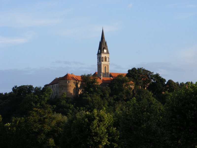
Ilok () is the easternmost town in Croatia forming a geographic salient surrounded by Vojvodina. Located in the Syrmia region, it lies on a hill overlooking the Danube river, which forms the border with the Bačka region of Serbia. The population of the settlement of Ilok is 5,072, while the total town population is 3,407 (census 2021). The town is home to a Franciscan monastery and Ilok Castle, which is a popular day trip for domestic tourists. Name In Croatian, the town is known as ''Ilok'', in German as ''Illok'', in Hungarian as ''Újlak'', in Serbian Cyrillic as Илок and in Turkish as ''Uyluk''. In Hungarian language "Újlak" means "new dwelling or lodge". History The area of present-day Ilok was populated since the neolithic and Bronze Ages. One Scordisci archaeological site dating back to late La Tène culture was excavated in the 1970s and 1980s as a part of rescue excavations in eastern Croatia. The Romans settled there in the 1st or 2nd century and built Cuc ... [...More Info...] [...Related Items...] OR: [Wikipedia] [Google] [Baidu] |
East
East or Orient is one of the four cardinal directions or points of the compass. It is the opposite direction from west and is the direction from which the Sun rises on the Earth. Etymology As in other languages, the word is formed from the fact that east is the direction where the Sun rises: ''east'' comes from Middle English ''est'', from Old English ''ēast'', which itself comes from the Proto-Germanic *''aus-to-'' or *''austra-'' "east, toward the sunrise", from Proto-Indo-European *aus- "to shine," or "dawn", cognate with Old High German ''*ōstar'' "to the east", Latin ''aurora'' 'dawn', and Greek ''ēōs'' 'dawn, east'. Examples of the same formation in other languages include Latin oriens 'east, sunrise' from orior 'to rise, to originate', Greek ανατολή anatolé 'east' from ἀνατέλλω 'to rise' and Hebrew מִזְרָח mizraḥ 'east' from זָרַח zaraḥ 'to rise, to shine'. ''Ēostre'', a Germanic goddess of dawn, might have been a personification ... [...More Info...] [...Related Items...] OR: [Wikipedia] [Google] [Baidu] |
Dubrovnik-Neretva County
The Dubrovnik-Neretva County (; hr, Dubrovačko-neretvanska županija, ) is the southernmost county of Croatia, located in south Dalmatia. The county seat is Dubrovnik and other large towns are Korčula, Metković, Opuzen and Ploče. The Municipality of Neum, which belongs to neighbouring Bosnia and Herzegovina, divides the county in two parts which are connected only by the Pelješac Bridge. The southern part of the county consists of Dubrovnik and the surrounding area, including the Pelješac peninsula, and the islands of Korčula, Lastovo, Mljet, Šipan, Lopud and Koločep. The northern part of the county includes the Neretva Delta, the Baćina lakes north of Ploče, and a swath of hinterland near the southernmost slopes of Biokovo and around the hill of Rujnica. The northern part of the Mljet island is a national park. The Lastovo archipelago is a designated nature park. The southernmost tip of the county is the Prevlaka peninsula at the border with Montenegro. It is the onl ... [...More Info...] [...Related Items...] OR: [Wikipedia] [Google] [Baidu] |


