|
Exeter City Council
Exeter City Council is the council and local government of the city of Exeter, Devon. History Proposed unitary authority status The government proposed that the city should become an independent unitary authority within Devon, much like neighbouring Plymouth and Torbay. The statutory orders to set up the unitary authority were passed in Parliament and a new unitary city council was due to start in Exeter on 1 April 2011. However, following the 2010 general election the new government announced in May 2010 that the reorganisation would be blocked. Boundaries The Local Government Boundary Commission for England published its final recommendations in September 2015 for changes to the wards in Exeter. The aim was to reduce the city's high levels in electoral inequality. The number of wards was reduced to 13; each electing three councillors for a total of 39. Following parliamentary approval, it came into effect at the 2016 election. Wards and councillors The wards of the city ... [...More Info...] [...Related Items...] OR: [Wikipedia] [Google] [Baidu] |
List Of Mayors Of Exeter
This is a chronological list of the Mayors and Lord Mayors of the city of Exeter, England. The role of Mayor was granted the dignity and style of Lord Mayor by letters patent dated 1 May 2002 as the result of a competition to celebrate the Golden Jubilee of Elizabeth II. Mayors of Exeter *c.1207: William Durling – first known Mayor *1218, 1231, 1239: Walter Gervase. *1385-6, 1397–8, 1407–8, 1411–12: Adam Scut *July 1414 to October 1415: John Lake *1414–15, 1419–20, 1422–3, 1426–7: Thomas Eston *1413–14, 1415–16: Peter Sturt *1425-6: Robert Vessy *1423–24, 1428–30, 1444–5, 1446–8: John Shillingford *1436-7, 1442–3, 1448–9: John Cutler alias Carwithan *1491: Stephen Ridgeway *1502: John Calwoodleigh of Calwoodleigh Vivian, Lt.Col. J.L., (Ed.) The Visitations of the County of Devon: Comprising the Heralds' Visitations of 1531, 1564 & 1620, Exeter, 1895, p.132 *1502–03: John Noseworthy *1506-7, 1513–14: Richard Hewet *1508: John Calwo ... [...More Info...] [...Related Items...] OR: [Wikipedia] [Google] [Baidu] |
Local Government Boundary Commission For England
The Local Government Boundary Commission for England (LGBCE) is a parliamentary body established by statute to conduct boundary, electoral and structural reviews of local government areas in England. The LGBCE is independent of government and political parties, and is directly accountable to the Speaker's Committee of the House of Commons. History and establishment The Local Democracy, Economic Development and Construction Act 2009, which received royal assent on 12 November 2009, provided for the establishment of the Local Government Boundary Commission for England (LGBCE), and for the transfer to it of all the boundary-related functions of the Boundary Committee for England of the Electoral Commission. The transfer took place in April 2010. Responsibilities and objectives The Local Government Boundary Commission for England is responsible for three types of review: electoral reviews; administrative boundary reviews; and structural reviews. Electoral reviews An electoral re ... [...More Info...] [...Related Items...] OR: [Wikipedia] [Google] [Baidu] |
Topsham, Devon
Topsham (, also ) is a town in Devon, England, located on the east side of the River Exe, immediately north of its confluence with the River Clyst and the former's estuary, between Exeter and Exmouth. Topsham is a historic port and was designated a town by a 1300 royal charter granted by Edward I; it was formally amalgamated into the City of Exeter in 1966. The town is served by Topsham railway station, about midway on the branch line from Exeter Central to Exmouth, now called the Avocet Line; 2011 saw the 150th anniversary of the railway coming to Topsham. The electoral ward of Topsham had a population recorded at 5,519 in the 2011 census, though this ward extends further northwest and includes the east half of Countess Wear as well as the new suburb of Newcourt. History The native Celtic settlement of Topsham became the port of the Roman city of Isca Dumnoniorum (Exeter) in the first century AD, and continued to serve it until the Roman occupation of southern Britain cea ... [...More Info...] [...Related Items...] OR: [Wikipedia] [Google] [Baidu] |
St Thomas, Exeter
St Thomas (St Thomas the Apostle's) is an area of Exeter and formerly a civil parish and registration district in Devon, England, on the western side of the River Exe, connected to Exeter by Exe Bridge. It has a number of pubs, places of worship, several schools and a large shopping precinct. The population, according to the 2001 census, is 6,246, increasing to 6,455 at the 2011 Census. St Thomas ward is currently politically represented by County and City Councillor, Rob Hannaford and City Councillor Adrian Fullam. It originally consisted of two detached parts, the main part of which was the former village of Cowick, to the west of the River Exe. The urban area built up here but was not originally part of Exeter. The other part, about a mile to the west of the main body of the parish, contained the hamlet of Oldridge and was transferred to the parish of Whitestone in 1884. St Thomas the Apostle became an urban district in 1894 with the passing of the Local Governmen ... [...More Info...] [...Related Items...] OR: [Wikipedia] [Google] [Baidu] |
Pinhoe
Pinhoe is a former village, manor and ecclesiastical parish, now a suburb on the north eastern outskirts of the City of Exeter in the English county of Devon. The 2001 census recorded a population of 6,108 people resident within Pinhoe Ward, one of 18 wards comprising the City of Exeter. The population increased to 6,454 at the 2011 Census. History Historically Pinhoe formed part of Wonford Hundred. It falls within Aylesbeare Deanery for ecclesiastical purposes. A parish history file is held in Pinhoe Library. Pinhoe is mentioned as 'Pinnoch' in the Great Domesday Book compiled in 1086. There have been several significant archaeological finds in the village over the past 100 years. These have included Roman coins and what is known as 'the Pinhoe hoard' of Bronze Age metalwork found in 1999. In 1001, the Danes, having landed at Exmouth, marched to Exeter, which they besieged, but unable to take the settlement, they laid waste the surrounding country. At Pinhoe, they were co ... [...More Info...] [...Related Items...] OR: [Wikipedia] [Google] [Baidu] |
Pennsylvania, Exeter
Pennsylvania is a suburb situated on the high ground to the north of the city of Exeter in the county of Devon, England. It lies between the ancient deer park of Duryard and Stoke Hill. It was named after the US state by Joseph Sparkes, a Quaker banker who built the first terrace, Pennsylvania Park, in about 1821. Its southern slopes, nearest to the city, include many spacious late Victorian and Edwardian houses, while on the steep higher hills, heading north out of Exeter, the housing is mainly 1920s–1970s, with a few newer estates on the city's extremities. Its proximity within walking distance of Exeter University has made it popular with academics and students. J. K. Rowling Joanne Rowling ( "rolling"; born 31 July 1965), also known by her pen name J. K. Rowling, is a British author and Philanthropy, philanthropist. She wrote ''Harry Potter'', a seven-volume children's fantasy series published from 1997 to ... was a resident of Pennsylvania while a student ... [...More Info...] [...Related Items...] OR: [Wikipedia] [Google] [Baidu] |
Newtown, Exeter
Newtown is an area of Exeter between St Sidwells and Heavitree and has been an area for the poor since Anglo-Saxons, Saxon times. A workhouse was built in 1671 on a site currently used as a car park, but Newtown remained largely rural up until the 19th century. Around 1700 a new workhouse was built on what is now the site of Heavitree Hospital. Brick and tile making were carried on in Exeter by the Ancient Rome, Romans from clay workings within the city wall. By the 16th century, the rich red clay of Newtown was exploited for brick making, the main brickworks being sited in the location of what is currently the dry ski-slope and golf driving range. Due to the Cholera epidemics of the 1830s the open sewer that ran along the bottom of the hill was covered over, to create Clifton Road. In the mid-19th century four streets of small terraced houses were built to house manual workers, labourers and their families. In the 1880s St Matthews Church was built. In May 1942 Exeter was ... [...More Info...] [...Related Items...] OR: [Wikipedia] [Google] [Baidu] |
Whipton Barton
Whipton Barton was an estate farm to the East of Exeter. The ' Barton' suffix is the traditional Devon wording for the manor house, and indicates a demesne in the feudal system. Whilst the house and farm no longer exist, they have given their name to an area of Exeter. History Estate farm Whipton Barton was for hundreds of years, a tenant farm of the Poltimore Estate, seat of the Bampfylde family, with the Rewe (spelt Rew in some reports) family being tenants for over 300 years. In 1850, the Whipton Barton farm was the location for the Royal Show of the Royal Agricultural Society of England, where it was described as having "a deep, red loamy surface soil, with gravelly base". In 1859, land from Whipton Barton was set aside for the building of a chapel of rest to serve the local area. During the coming of age ceremony in 1880 for his son, the then Lord Poltimore talked of the generations of the Rewe family who had been tenants of Whipton Barton, and expressed his wish that ... [...More Info...] [...Related Items...] OR: [Wikipedia] [Google] [Baidu] |
Heavitree
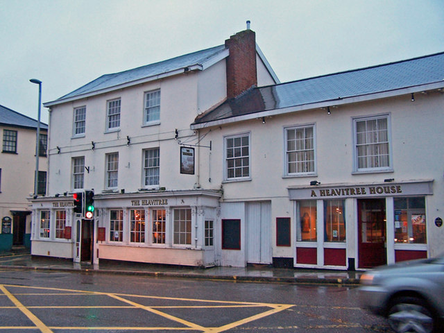
Heavitree is a historic village and parish situated formerly outside the walls of the City of Exeter in Devon, England, and is today an eastern district of that city. It was formerly the first significant village outside the city on the road to London. It was the birthplace of Thomas Bodley, and Richard Hooker, and from the 16th century to 1818 was a site for executions within what is now the car park of the St Luke's Campus of the University of Exeter. History The name appears in Domesday Book as ''Hevetrowa'' or ''Hevetrove'', and in a document of c.1130 as ''Hefatriwe''. Its derivation is uncertain, but because of the known execution site at Livery Dole, it is thought most likely to derive from ''heafod–treow'' (old English for "head tree"), which refers to a tree on which the heads of criminals were placed, though an alternative explanation put forward by W. G. Hoskins is that it was a meeting place for the hundred court. The last executions for witchcraft in England to ... [...More Info...] [...Related Items...] OR: [Wikipedia] [Google] [Baidu] |
Exwick
Exwick is an historic parish and manor in Devon, England, which today is a north-western suburb of the City of Exeter. Its name is derived from the River Exe, which forms its eastern boundary. It is also an Ecclesiastical parish and an electoral ward. Mentioned in the Domesday Book, it was the site of farms, orchards and mills. Exwick meaning farm by the river Exe. Being on the edge of the Exe floodplain, mill industries were important in Exwick. A leat from the Exe was dug before the Doomsday book was compiled. Other industries formerly in the area include clothmaking, aeroparts and baking. Manufacture of wooden flooring continues to this day. There were a number of large houses in the area including Cleve House which became a Guide Dogs for the Blind training centre in the 1950s. Later it became private houses and the site of a new primary school. The Mallet family bought Exwick Mill. Another important family with an Exwick Connection were the Gibbs. Andrew Gibbs from C ... [...More Info...] [...Related Items...] OR: [Wikipedia] [Google] [Baidu] |
Duryard
Duryard is an ancient area of Exeter in Devon, England. Duryard was once the hunting land of the Anglo-Saxon kings. The name comes from the Anglo-Saxon ''dear'' (deer) and ''geard'' (fold). Today, much of the area is occupied by the University of Exeter The University of Exeter is a public university , public research university in Exeter, Devon, England, United Kingdom. Its predecessor institutions, St Luke's College, Exeter School of Science, Exeter School of Art, and the Camborne School of Min ..., which has a halls of residence named Duryard. In popular culture This article was the topic of conversation in the third episode of series one of the web series "Two Of These People Are Lying" hosted by The Technical Difficulties. References Areas of Exeter {{Devon-geo-stub ... [...More Info...] [...Related Items...] OR: [Wikipedia] [Google] [Baidu] |
Marsh Barton
Marsh Barton is the largest trading estate in Exeter, covering over . It supports over 500 diverse businesses including one of Europe's largest motoring centres, showrooms, city plumbing, Exeter College's automotive site, builders merchants, and tool and plant hire. It is also home to the head office of the Apple Premium Reseller, Stormfront Retail Ltd. A new railway station to serve Marsh Barton is currently under construction. History Marsh Barton was a medieval village south of Exeter and north of Alphington. At the turn of the 20th century the main part of Marsh Barton was the former Marsh Barton Priory, also known as St Marys Priory (home to Augustinian Canons Regular Canons regular are priests who live in community under a rule ( and canon in greek) and are generally organised into religious orders, differing from both secular canons and other forms of religious life, such as clerics regular, designated by ...). On the west and east was the Exeter railway and ... [...More Info...] [...Related Items...] OR: [Wikipedia] [Google] [Baidu] |


