|
Exclusive Economic Zone Of Spain
Spain's exclusive economic zone (EEZ) (Spanish: ''Zona económica exclusiva de España'') is the 30th largest in the world with . It is mostly in the Atlantic Ocean and the Mediterranean Sea. This is approximately double the entire Spanish land area. Together the land and sea surface would account for approximately 0.3% of the world's land surface. Geography The Spanish EEZ is divided into three compact regions: the Cantabrian and Atlantic regions (Área Atlántica), the Mediterranean together with the Gulf of Cádiz region (Área mediterránea junto) and the dependent area of the Canary Islands (Áreas de las Canarias). It is located in the Mediterranean Sea (Balearic Sea, Alboran Sea) and the Atlantic Ocean (Bay of Biscay). The most notable areas are the Canary Islands, the Balearic Islands and the north western area in the Bay of Biscay. Disputes Active Algeria Algeria on 17 April 2018 establishes an exclusive economic zone (EEZ) off its coasts by Presidential Decree No. 18 ... [...More Info...] [...Related Items...] OR: [Wikipedia] [Google] [Baidu] |
Peace Of Utrecht
The Peace of Utrecht was a series of peace treaties signed by the belligerents in the War of the Spanish Succession, in the Dutch city of Utrecht between April 1713 and February 1715. The war involved three contenders for the vacant throne of Spain, and involved much of Europe for over a decade. The main action saw France as the defender of Spain against a multinational coalition. The war was very expensive and bloody and finally stalemated. Essentially, the treaties allowed Philip V (grandson of King Louis XIV of France) to keep the Spanish throne in return for permanently renouncing his claim to the French throne, along with other necessary guarantees that would ensure that France and Spain should not merge, thus preserving the balance of power in Europe. The treaties between several European states, including Spain, Great Britain, France, Portugal, Savoy and the Dutch Republic, helped end the war. The treaties were concluded between the representatives of Louis XIV of Fra ... [...More Info...] [...Related Items...] OR: [Wikipedia] [Google] [Baidu] |
Borders Of Spain
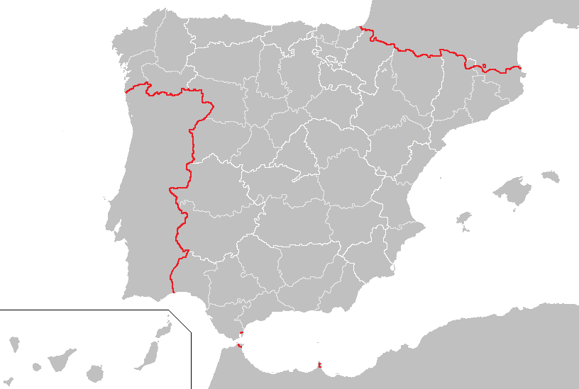
Spain has of borders, with 5 countries. Borders Spain–Portugal border The Spain-Portugal border, commonly known as ''La Raya'', is 1,292 kilometers long. It extends through the provinces of Province of Pontevedra, Pontevedra, Province of Ourense, Ourense, Province of Zamora, Zamora, Province of Salamanca, Salamanca, Province of Cáceres, Cáceres, Province of Badajoz, Badajoz and Province of Huelva, Huelva in Spain, and the districts of Viana do Castelo District, Viana do Castelo, Braga District, Braga, Vila Real District, Vila Real, Bragança District, Bragança, Guarda District, Guarda, Castelo Branco District, Castelo Branco, Portalegre District, Portalegre, Évora District, Évora, Beja District, Beja, Faro District, Faro in Portugal. The border starts in the mouth of Minho (river), Minho River, and ends in the mouth of Guadiana River. Spain-France border The Spain-France border is 656.3 km long. It is divided in two parts, since it is interrupted by Andor ... [...More Info...] [...Related Items...] OR: [Wikipedia] [Google] [Baidu] |
Exclusive Economic Zone Of Portugal
Portugal has the 5th largest exclusive economic zone (EEZ) within Europe, 3rd largest of the EU and the 20th largest EEZ in the world, at 1,727,408 km2.Seaaroundus.org Portugal's exclusive economic zone * 327,667 km2 * Islands 446,108 km2 * Islands 953,633 km2 * Total: 1,727,408 km2 Portugal submitted a claim to extend its |
Exclusive Economic Zone Of France
France has, due to its Overseas department and region, Overseas departments and regions that are scattered in all the Ocean, oceans of Earth, the largest exclusive economic zone of the world. The total EEZ of France is . It covers approximately 8% of the surface of all the EEZs of the world, while the France, French Republic is only 0.45% of the world's land surface. Geography Monaco's waters are enclaves in the French EEZ.European French EEZ website miscellanees01.files.wordpress.com The situation is more unclear for the Channel Islands. Some maps show the EEZ being enclaved by the French EEZ, while others show the Guernsey EEZ extending to the border with the UK EEZ. Outside of mainland France and overseas departments or communities (Guadeloupe, French Guiana, Guyane ... [...More Info...] [...Related Items...] OR: [Wikipedia] [Google] [Baidu] |
Geography Of Spain
Spain is a country located in southwestern Europe occupying most (about 82 percent) of the Iberian Peninsula. It also includes a small exclave inside France called Llívia, as well as the Balearic Islands in the Mediterranean, the Canary Islands in the Atlantic Ocean off northwest Africa, and five plazas de soberanía, places of sovereignty (''plazas de soberanía'') on and off the coast of North Africa: Ceuta, Melilla, Islas Chafarinas, Peñón de Alhucemas, and Peñón de Vélez de la Gomera. The Spanish mainland is bordered to the south and east almost entirely by the Mediterranean Sea (except for the small British territory of Gibraltar); to the north by France, Andorra, and the Bay of Biscay; and to the west by the Atlantic Ocean and Portugal. With a land area of in the Iberian peninsula, Spain is the largest country in Southern Europe, the second largest country in Western Europe (behind France), and the fourth largest country in the European continent (behind Russia ... [...More Info...] [...Related Items...] OR: [Wikipedia] [Google] [Baidu] |
Status Of Gibraltar
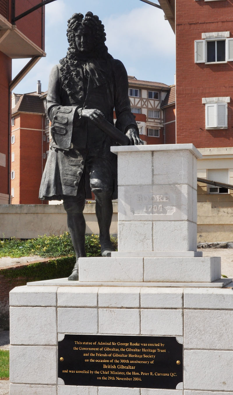
Gibraltar, a British Overseas Territory, located at the southern tip of the Iberian Peninsula, is the subject of a territorial claim by Spain. It was captured in 1704 during the War of the Spanish Succession (1701–1714). The Spanish Crown formally ceded the territory in perpetuity to the British Crown in 1713, under Article X of the Treaty of Utrecht. Spain later attempted to recapture the territory during the thirteenth siege (1727) and the Great Siege (1779–1783). British sovereignty over Gibraltar was confirmed in later treaties signed in Seville (1729) and the Treaty of Paris (1783). Reclamation of the territory became government policy under the regime of the dictator Francisco Franco and has remained in place under successive governments following the Spanish transition to democracy. The Gibraltarians themselves reject any such claim and no political party or pressure group in Gibraltar supports union with Spain. In a referendum in 2002 the people of Gibraltar ... [...More Info...] [...Related Items...] OR: [Wikipedia] [Google] [Baidu] |
Territorial Waters
The term territorial waters is sometimes used informally to refer to any area of water over which a sovereign state has jurisdiction, including internal waters, the territorial sea, the contiguous zone, the exclusive economic zone, and potentially the extended continental shelf. In a narrower sense, the term is used as a synonym for the territorial sea. Baseline Normally, the baseline from which the territorial sea is measured is the low-water line along the coast as marked on large-scale charts officially recognized by the coastal state. This is either the low-water mark closest to the shore, or alternatively it may be an unlimited distance from permanently exposed land, provided that some portion of elevations exposed at low tide but covered at high tide (like mud flats) is within of permanently exposed land. Straight baselines can alternatively be defined connecting fringing islands along a coast, across the mouths of rivers, or with certain restrictions across the mou ... [...More Info...] [...Related Items...] OR: [Wikipedia] [Google] [Baidu] |
Gibraltar
) , anthem = " God Save the King" , song = " Gibraltar Anthem" , image_map = Gibraltar location in Europe.svg , map_alt = Location of Gibraltar in Europe , map_caption = United Kingdom shown in pale green , mapsize = , image_map2 = Gibraltar map-en-edit2.svg , map_alt2 = Map of Gibraltar , map_caption2 = Map of Gibraltar , mapsize2 = , subdivision_type = Sovereign state , subdivision_name = , established_title = British capture , established_date = 4 August 1704 , established_title2 = , established_date2 = 11 April 1713 , established_title3 = National Day , established_date3 = 10 September 1967 , established_title4 = Accession to EEC , established_date4 = 1 January 1973 , established_title5 = Withdrawal from the EU , established_date5 = 31 January 2020 , official_languages = English , languages_type = Spoken languages , languages = , capital = Westside, Gibraltar (de facto) , coordinates = , largest_settlement_type = largest district , l ... [...More Info...] [...Related Items...] OR: [Wikipedia] [Google] [Baidu] |
Port Of Gibraltar
The Port of Gibraltar, also known as Gibraltar Harbour, is a seaport in the British Overseas Territory of Gibraltar. It was a strategically important location during the Napoleonic Wars and after 1869 served as a supply point for ships travelling to British Raj, India through the Suez Canal. The harbour of Gibraltar was transformed in the nineteenth century as part of the British Government's policy of enabling the Royal Navy to defeat its next two largest rival navies combined. Both Gibraltar and Malta were to be made torpedo proof, and as a result the North Mole, Gibraltar Harbour, North and South Mole, Gibraltar Harbour, South Mole were extended and the Detached Mole, Gibraltar Harbour, Detached Mole was constructed. Three large dry docks were constructed and plans were available by 1894. Over 2,000 men were required and had to be billeted in old ships which had not been required since convict labour was abandoned. The demand for stone and sand necessitated building the Admiralt ... [...More Info...] [...Related Items...] OR: [Wikipedia] [Google] [Baidu] |


