|
Eureka Valley, San Francisco
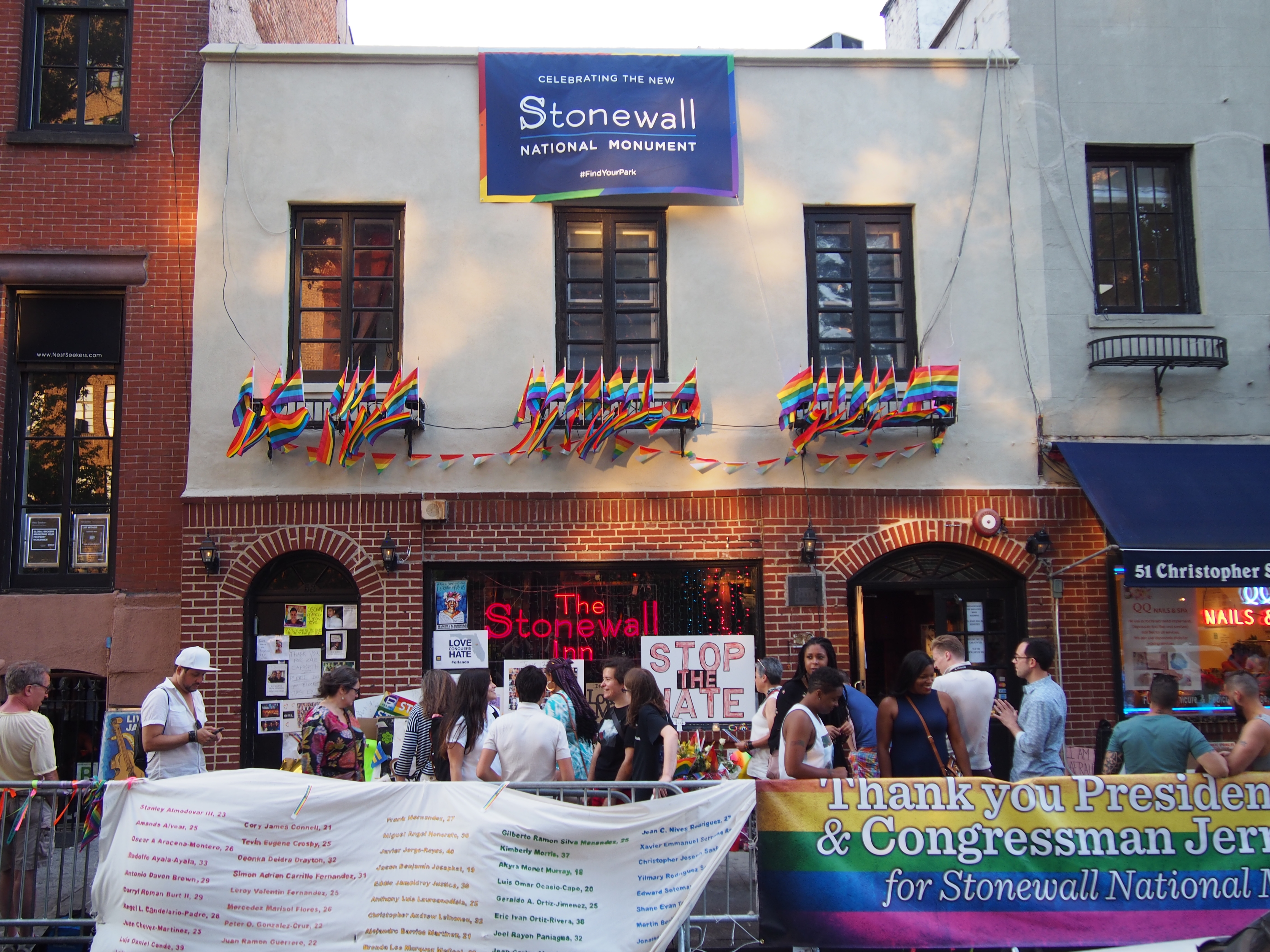
Eureka Valley is a neighborhood in San Francisco, primarily a quiet residential neighborhood but boasting one of the most visited sub-neighborhoods in the city, The Castro. The neighborhood is popular with families and the LGBT community. The rainbow flag, signifying LGBT pride, can be seen displayed throughout the area. It was initially a working-class Irish neighborhood until a combination of factory jobs loss and the migration of gays into The Castro radically changed the neighborhood in the 1960s. In 1977, this district elected the first openly gay politician—Harvey Milk—to public office (San Francisco Board of Supervisors). Geography The only official definition of neighborhoods in San Francisco is by the city's Planning Department, which defines, a larger "Castro/Upper Market" neighborhood. The definition of Eureka Valley by the Castro/Eureka Valley Neighbors Association as well as a 2007 Planning Department study is: * Sanchez Street on the east * 22nd Street on th ... [...More Info...] [...Related Items...] OR: [Wikipedia] [Google] [Baidu] |
Neighborhoods In San Francisco
San Francisco, in the US state of California, has both major, well-known neighborhoods and districts as well as smaller, specific subsections and developments. While there is considerable fluidity among the sources, one guidebook identifies five major districts, corresponding to the four quadrants plus a south central district. These five broad districts, counterclockwise are: Central/downtown, Richmond, Sunset, Upper Market and beyond (south central) and Bernal Heights/Bayview and beyond (southeast). Within each of these five districts are located major neighborhoods, and again there is considerable fluidity seen in the sources. The San Francisco Planning Department officially identifies 36 neighborhoods. Within these 36 official neighborhoods are a large number of minor districts, some of which are historical, and some of which are overlapping. Some of San Francisco's neighborhoods are also officially designated as " cultural districts." Alamo Square Alamo Square is a subset o ... [...More Info...] [...Related Items...] OR: [Wikipedia] [Google] [Baidu] |
José De Jesús Noé
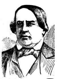
José de Jesús Noé (1805 – 17 March 1862) was a Californio politician, soldier, and ranchero, who served as the 7th and 12th Alcalde of San Francisco. He is the last Hispanic Californian (Californio) to serve as Mayor of San Francisco. Life In 1845, Noé was granted the land known as Rancho San Miguel, which covered the neighborhoods now known as Noe Valley, Eureka Valley, Fairmont Heights, Glen Park and Sunnyside. Following U.S. military occupation of Yerba Buena in the Mexican–American War, Noé became alcalde again in 1846, becoming the last man born in Mexico to serve in that office (the office of alcalde was abolished with adoption of the California Constitution in 1849). Noé was appointed alcalde by U.S. Navy Commodore Robert F. Stockton, under his authority as military governor of the occupied territory. Also appointed alcalde, and serving concurrently with Noé, was Navy Lt. Washington Allon Bartlett. As a military officer, Bartlett was a direct representative ... [...More Info...] [...Related Items...] OR: [Wikipedia] [Google] [Baidu] |
Gay Village
A gay village is a geographical area with generally recognized boundaries that is inhabited or frequented by many lesbian, gay, bisexuality, bisexual, transgender, and queer (LGBT) people. Gay villages often contain a number of gay-oriented establishments, such as gay bars and pubs, gay nightclub, nightclubs, Gay bathhouse, bathhouses, restaurants, boutiques, and bookstores. Among the most famous gay villages are New York City's Greenwich Village, Hell's Kitchen, Manhattan, Hell's Kitchen, and Chelsea, Manhattan, Chelsea neighborhoods in Manhattan; Fire Island and The Hamptons on Long Island; Asbury Park, New Jersey, Asbury Park, Lambertville, New Jersey, Lambertville, and Maplewood, New Jersey, Maplewood in New Jersey; Boston's South End, Boston, South End, Jamaica Plain, Boston, Jamaica Plain, and Provincetown, Massachusetts; Philadelphia's Gayborhood, Philadelphia, Pennsylvania, Gayborhood; Washington D.C.'s Dupont Circle; Midtown Atlanta; Chicago's Boystown, Chicago, ... [...More Info...] [...Related Items...] OR: [Wikipedia] [Google] [Baidu] |
Daly City, California
Daly City () is the second most populous city in San Mateo County, California, United States, with population of 104,901 according to the 2020 census. Located in the San Francisco Bay Area, and immediately south of San Francisco (sharing its northern border with almost all of San Francisco's southern border), it is named for businessman and landowner John Donald Daly. History Archaeological evidence suggests the San Francisco Bay Area has been inhabited as early as 2700 BC. People of the Ohlone language group probably occupied Northern California from at least the year A.D. 500. Though their territory had been claimed by Spain since the early 16th century, they would have relatively little contact with Europeans until 1769, when, as part of an effort to colonize Alta California, an exploration party led by Don Gaspar de Portolá learned of the existence of San Francisco Bay. Seven years later, in 1776, an expedition led by Juan Bautista de Anza selected the site for ... [...More Info...] [...Related Items...] OR: [Wikipedia] [Google] [Baidu] |
San Francisco Public Library
The San Francisco Public Library is the public library system of the city and county of San Francisco. The Main Library is located at Civic Center, at 100 Larkin Street. The library system has won several awards, such as '' Library Journal'''s Library of the Year award in 2018. The library is well-funded due to the city's dedicated Library Preservation Fund that was established by a 1994 ballot measure, which was subsequently renewed until 2022 by a ballot measure in 2007. History In August 1877 a residents' meeting was called by state senator George H. Rogers and Andrew Smith Hallidie who advocated the creation of a free public library for San Francisco. A board of trustees for the Library was created in 1878 through the Free Library Act, signed by Governor of California William Irwin on March 18, which also created a property tax to fund the Library project. The San Francisco Public Library (then known as the San Francisco Free Library) opened on June 7, 1879 at Pacific Hal ... [...More Info...] [...Related Items...] OR: [Wikipedia] [Google] [Baidu] |
J Church
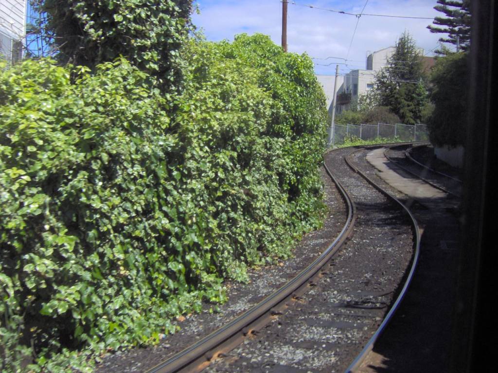
The J Church is a hybrid light rail/streetcar line of the Muni Metro system in San Francisco, California. The line runs between Embarcadero station and Balboa Park station through Noe Valley. Opened on August 11, 1917, it is the oldest and has the lowest ridership of all of the Muni Metro lines. Route description The inbound terminal is at Embarcadero station. The line runs west through the Market Street subway to a portal on Duboce Avenue, before turning onto Church Street. The line continues south on Church Street to 18th Street. Between 18th and 20th Street, the line cuts through Dolores Park in a private right-of-way featuring a 9% grade, the steepest section of the Muni Metro system. After crossing 20th Street, it cuts across the blocks east of Church, around a steep hill and returns to Church Street at 22nd Street in Noe Valley. The J then follows Church to 30th Street, then to San Jose Avenue and Geneva. Between Randall and Cotter Streets, there is a right-of-way in ... [...More Info...] [...Related Items...] OR: [Wikipedia] [Google] [Baidu] |
Muni Metro
Muni Metro is a light rail system serving San Francisco, California, United States. Operated by the San Francisco Municipal Railway (Muni), a part of the San Francisco Municipal Transportation Agency (SFMTA), Muni Metro served an average of 157,700 passengers per weekday in the fourth quarter of 2019, making it the second-busiest light rail system in the United States. Six services – J Church, K Ingleside, L Taraval, M Ocean View, N Judah, and T Third Street run on separate surface alignments and merge into a single downtown tunnel. The supplementary S Shuttle service operates within the tunnel. Muni Metro operates a fleet of 151 Breda high-floor light rail vehicles (LRVs), which are currently being replaced by a fleet of 249 Siemens S200 LRVs. The system has 113 stations, of which 59 (52%) are accessible. Muni Metro is one of the surviving first-generation streetcar systems in North America. The San Francisco Municipal Railway was created in 1909 and opened its fir ... [...More Info...] [...Related Items...] OR: [Wikipedia] [Google] [Baidu] |
Twin Peaks Tunnel
The Twin Peaks Tunnel is a light rail/streetcar tunnel in San Francisco, California. The tunnel runs under Twin Peaks and is used by the K Ingleside/T Third Street, M Ocean View and S Shuttle lines of the Muni Metro system. The eastern entrance to the tunnel is located at the west end of the Market Street subway near the intersection of Market and Castro streets in the Castro neighborhood, and the western entrance is located at West Portal Avenue and Ulloa Street in the West Portal neighborhood, named for the tunnel. There are three stations along the tunnel, West Portal at the western entrance, Forest Hill near the middle, and the now disused Eureka Valley near the eastern end. History Plans for a tunnel extending from Market Street under Twin Peaks were first presented at the Merchants' Association banquet in May 1909; A. W. Scott Jr. spoke on the need for the tunnel to open up the western part of San Francisco to development, as "40,000 San Franciscans lived across t ... [...More Info...] [...Related Items...] OR: [Wikipedia] [Google] [Baidu] |
1906 San Francisco Earthquake
At 05:12 Pacific Standard Time on Wednesday, April 18, 1906, the coast of Northern California was struck by a major earthquake with an estimated moment magnitude of 7.9 and a maximum Mercalli intensity of XI (''Extreme''). High-intensity shaking was felt from Eureka on the North Coast to the Salinas Valley, an agricultural region to the south of the San Francisco Bay Area. Devastating fires soon broke out in San Francisco and lasted for several days. More than 3,000 people died, and over 80% of the city was destroyed. The events are remembered as one of the worst and deadliest earthquakes in the history of the United States. The death toll remains the greatest loss of life from a natural disaster in California's history and high on the lists of American disasters. Tectonic setting The San Andreas Fault is a continental transform fault that forms part of the tectonic boundary between the Pacific Plate and the North American Plate. The strike-slip fault is character ... [...More Info...] [...Related Items...] OR: [Wikipedia] [Google] [Baidu] |
Market Street Railway (1893–1944)
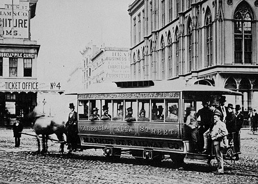
The Market Street Railway Company was a commercial streetcar and bus operator in San Francisco. The company was named after the famous Market Street of that city, which formed the core of its transportation network. Over the years, the company was also known as the Market Street Railroad Company, the Market Street Cable Railway Company and the United Railroads of San Francisco. Once the largest transit operator in the city, the company folded in 1944 and its assets and services were acquired by the city-owned San Francisco Municipal Railway. Many of the former routes continue to exist into the 2020s, but served by buses. The company should not be mistaken for the current Market Street Railway, which is named after its predecessor but is actually a legally unconnected non-profit support group for San Francisco's heritage streetcar lines. History Horse and steam The franchise for what would become the Market Street Railway was granted in 1857 to Thomas Hayes. The line was th ... [...More Info...] [...Related Items...] OR: [Wikipedia] [Google] [Baidu] |
Mission Dolores
Dolores, Spanish for "pain; grief", most commonly refers to: * Our Lady of Sorrows or La Virgen María de los Dolores * Dolores (given name) Dolores may also refer to: Film * ''Dolores'' (2017 film), an American documentary by Peter Bratt * ''Dolores'' (2018 film), an Argentine film Literature * " Dolores (Notre-Dame des Sept Douleurs)", a poem by A. C. Swinburne * ''Dolores'' (Susann novel), a 1976 novel by Jacqueline Susann * ''Dolores'', a 1911 novel by Ivy Compton-Burnett Music * Dolores Recordings, a record label * ''Dolores'' (album), an album by Bohren & der Club of Gore * "Dolores" (song), a 1940 song written by Frank Loesser and Louis Alter and popularized by Bing Crosby * "Dolores", a song by the Mavericks from '' Trampoline'' * ''Dolorès'', a waltz written by Émile Waldteufel Places * 1277 Dolores, an asteroid Argentina * Dolores, Buenos Aires Belize * Dolores, Belize, a village in Toledo District *Rancho Dolores, a village in Belize District Colombia * Do ... [...More Info...] [...Related Items...] OR: [Wikipedia] [Google] [Baidu] |
Noe Valley, San Francisco
Noe Valley ( ; originally spelt Noé) is a neighborhood in the central part of San Francisco, California. It is named for Don José de Jesús Noé, noted 19th-century Californio statesman and ranchero, who owned much of the area and served as mayor. Location Roughly speaking, Noe Valley is bounded by 21st Street to the north, 30th Street to the south, San Jose Ave and Guerrero Street to the east, and Grand View Avenue and Diamond Heights Blvd to the west. The Castro ( Eureka Valley) is north of Noe Valley; the Mission District is east. History The neighborhood is named after José de Jesús Noé, the last Mexican ''alcalde'' (mayor) of Yerba Buena (present day San Francisco), who owned what is now Noe Valley as part of his ''Rancho San Miguel''. Noé sold the land, later to be known as Noe Valley, to John Meirs Horner, a Mormon immigrant, in 1854. At this time the land was called Horner's Addition. The original Noé adobe house was located in the vicinity of the present da ... [...More Info...] [...Related Items...] OR: [Wikipedia] [Google] [Baidu] |


