|
Euproops
''Euproops'' is an extinct genus of xiphosuran, related to the modern horseshoe crab. It lived during the Carboniferous Period. The ''Treatise on Invertebrate Paleontology'' describes ''Euproopidae'' as "small forms with wedge-shaped cardiac lobe bordered by distinct axial furrows, abdominal shield with annulated axis bearing a high boss on last segment." The same source describes ''Euproops'' as follows. "Prosoma with flat genal spines and carinate opthamalic spines; cardiopthamalic region with or without intercardiopthamalic area; abdomen with raised pleural ridges that cross flattened rim and are prolonged as marginal spines; annulated axis with knob on 1st and 3rd segments and elevated boss or short spine on hindmost segment; telson long." Unusually, ''Euproops'' may have been semiaquatic, due to being found in terrestrial substrates more often than aquatic ones, as well as the genal and ophthalmic spines of ''E. danae'' closely resembling lycopod twigs, alongside ''E. rotund ... [...More Info...] [...Related Items...] OR: [Wikipedia] [Google] [Baidu] |
Xiphosura
Xiphosura (; , in reference to its sword-like telson) is an order of arthropods related to arachnids. They are more commonly known as horseshoe crabs (a name applied more specifically to the only extant family, Horseshoe crab, Limulidae). They first appeared in the Hirnantian (Late Ordovician). Currently, there are only four living species. Xiphosura contains one suborder, Xiphosurida, and several stem-genera. The group has hardly changed in appearance in hundreds of millions of years; the modern horseshoe crabs look almost identical to prehistoric genera and are considered to be living fossils. The most notable difference between ancient and modern forms is that the abdominal segments in present species are fused into a single unit in adults. Xiphosura were historically placed in the class Merostomata, although this term was intended to encompass also the Eurypterida, eurypterids, whence it denoted what is now thought to be an unnatural (paraphyletic) group (although this is a gr ... [...More Info...] [...Related Items...] OR: [Wikipedia] [Google] [Baidu] |
Beeman Formation
The Beeman Formation is a geologic formation in the Sacramento Mountains of New Mexico. It preserves fossils dating back to the Kasimovian Age of the Pennsylvanian Period. Description The Beeman Formation consists of cyclic shale and argillaceous limestone with some conglomerate. The thickness is . The formation overlies the Gobbler Formation and is overlain by the Holder Formation. The formation is interpreted as cyclic deposition on a continental shelf following rejuvenation of the Pedernal uplift of the Ancestral Rocky Mountains. Fossils The unit contains middle to upper Missourian (Kasimovian) fusulinids and conodonts, including several species of the fusulinid '' Triticites'' and the conodont '' Idiognathodus symmetricus'', related species, and species of ''Streptognathodus''. These species indicate that the Beeman Formation is entirely Kasimovian in age. The formation has a diverse coprofauna. The formation has also produced a lacustrine fauna from one of its shell ... [...More Info...] [...Related Items...] OR: [Wikipedia] [Google] [Baidu] |
Mazon Creek Fossil Beds
The Mazon Creek fossil beds are a conservation ' found near Morris, in Grundy County, Illinois. The fossils are preserved in ironstone concretions, formed approximately in the mid- Pennsylvanian epoch of the Carboniferous period. These concretions frequently preserve both hard and soft tissues of animal and plant materials, as well as many soft-bodied organisms that do not normally fossilize. The quality, quantity and diversity of fossils in the area, known since the mid-nineteenth century, make the Mazon Creek ' important to paleontologists attempting to reconstruct the paleoecology of the sites. The locality was declared a National Historic Landmark in 1997.. Geology The Mazon Creek fossils are found in the Upper Carboniferous Francis Creek Shale. The type locality is the Mazon River (or Mazon Creek), a tributary of the Illinois River near Morris, Grundy County, Illinois. The 25 to 30 meters of shale were formed approximately , during the Pennsylvanian period. T ... [...More Info...] [...Related Items...] OR: [Wikipedia] [Google] [Baidu] |
Pennant Measures
The Pennant Measures is the traditional name for a sequence of sedimentary rocks of the South Wales Coalfield. They were also referred to as the Upper Coal Measures and assigned to the Westphalian 'C' and Westphalian 'D' stages of the Carboniferous Period. The Pennant Measures were divided into the Lower Pennant Measures and the Upper Pennant Measures, differing from the underlying Middle and Lower Coal Measures in being principally of sandstone units – known collectively as the Pennant Sandstone – with mudstone being the subsidiary rock type. Numerous coal seams occur within the Pennant Measures though they are less common than in the underlying Coal Measures.British Geological Survey 1:50,000 map sheet 231 'Merthyr Tydfil' & accompanying memoir. However recent reclassification of the sequence has resulted in the definition by the British Geological Survey of the Pennant Sandstone Formation as a sub-unit of the newly established Warwickshire Group. The formation is recognis ... [...More Info...] [...Related Items...] OR: [Wikipedia] [Google] [Baidu] |
Westhoughton
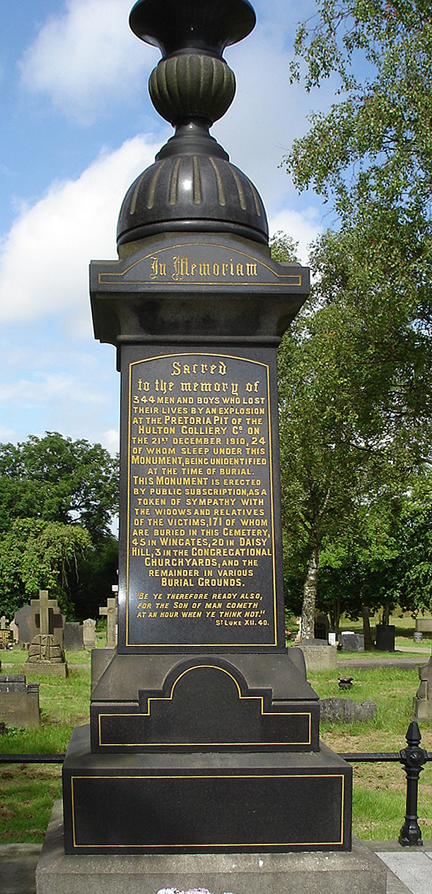
Westhoughton ( ) is a List of towns in England, town and civil parish in the Metropolitan Borough of Bolton, Greater Manchester, England, southwest of Bolton, east of Wigan and northwest of Manchester.AA Route Planner . URL accessed 29 May 2007. Within the boundaries of the Historic counties of England, historic county of Lancashire, Westhoughton was once a centre for coal mining, Spinning (textiles), cotton-spinning and Textile manufacture during the Industrial Revolution, textile manufacture. It had a population of 24,974 at the 2011 Census. Westhoughton incorporates several former villages and hamlets which have their own distinctive character, sports traditions and amenities, including Wingates, White Horse, Over Hulton, Four Gates, Chequerbent, Hunger Hill, Snydale, ... [...More Info...] [...Related Items...] OR: [Wikipedia] [Google] [Baidu] |
Upper Silesian Coal Basin
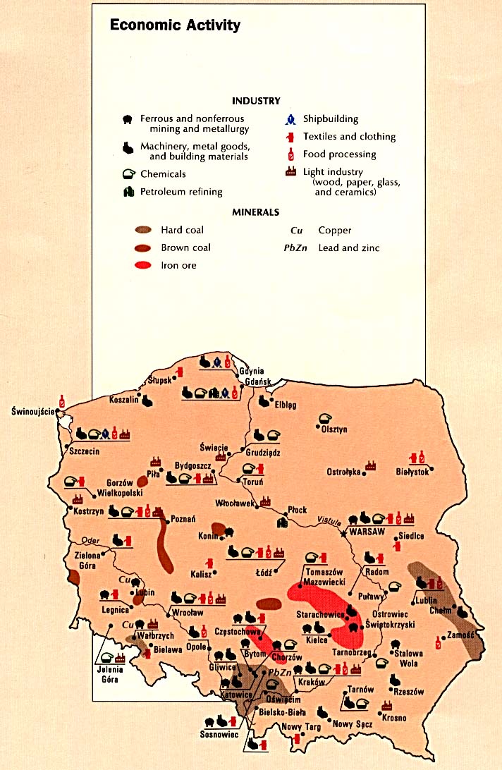
The Upper Silesian Coal Basin (''USCB''; , ) is a coal basin in Silesia, in Poland and the Czech Republic."''Górnośląskie Zagłębie Węglowe''" - PWN Encyclopedia The Basin also contains a number of other minable resources, such as methane, cadmium, lead, silver and zinc. Coal depth is approximately 1,000 meters, and contains about 70 billion tons, with good extraction potential. Industrial areas within the Upper Silesian Coal Basin include the following: * Upper Silesian Industrial Region () * [...More Info...] [...Related Items...] OR: [Wikipedia] [Google] [Baidu] |
Sosnowiec
Sosnowiec is an industrial city county in the Dąbrowa Basin of southern Poland, in the Silesian Voivodeship, which is also part of the Metropolis GZM municipal association.—— Located in the eastern part of the Upper Silesian Industrial Region, Sosnowiec is one of the cities of the Katowice urban area, which is a conurbation with a total population of 2.7 million people; as well as the greater Katowice-Ostrava metropolitan area populated by about 5.3 million people. The population of the city is 189,178 as of December 2022. Geography It is believed that the name Sosnowiec originates from the Polish word '' sosna'', referring to the pine forests growing in the area prior to 1830. The village was originally known as ''Sosnowice''. Other variations of the name include ''Sosnowietz, Sosnowitz, Sosnovitz'' (Yiddish), ''Sosnovyts, Sosnowyts, Sosnovytz, Sosnowytz,'' and ''Sosnovetz''. There are five other smaller settlements in Poland also called Sosnowiec, located in the Kielce ... [...More Info...] [...Related Items...] OR: [Wikipedia] [Google] [Baidu] |
Westphalian (stage)
The Westphalian is a regional stage or age in the regional stratigraphy of northwest Europe, with an age between roughly 315 and 307 Ma (million years ago). It is a subdivision of the Carboniferous System or Period and the regional Silesian Series. The Westphalian is named for the region of Westphalia ( German: ''Westfalen'') in western Germany where strata of this age occur. The Coal Measures of England and Wales are also largely of Westphalian age, though they also extend into the succeeding Stephanian. The Westphalian is preceded by the Namurian Stage/Age (which corresponds to the Millstone Grit Series of Great Britain) and succeeded by the Stephanian Stage/Age (which corresponds to the uppermost part of the Coal Measures of Great Britain). In the official geologic time scale of the International Commission on Stratigraphy (ICS), the Westphalian is placed within the Pennsylvanian Subsystem/Subperiod (323-299 Ma) of the Carboniferous System/Period. As a regionally defi ... [...More Info...] [...Related Items...] OR: [Wikipedia] [Google] [Baidu] |
Allegheny Formation
The Allegheny Group, often termed the Allegheny Formation, is a Pennsylvanian-age geological unit in the Appalachian Plateau. It is a major coal-bearing unit in the eastern United States, extending through western and central Pennsylvania, western Maryland and West Virginia, and southeastern Ohio. Fossils of fishes such as ''Bandringa'' are known from the Kittaning Formation,R. Zangerl. (1969). ''Bandringa rayi'': A New Ctenacanthoid Shark form the Pennsylvanian Essex Fauna of Illinois. ''Fieldiana Geology'' 12:157-169 which is part of the Allegheny Group. Stratigraphy In Pennsylvania, the Allegheny Group includes rocks from the base of the Brooksville Coal to the top of the Upper Freeport Coal, and was defined to include all economically significant coals in the upper Pennsylvanian sequence. The unit consists of cyclothemic sequences of coal, shale, limestone, sandstone, and clay. It contains six major coal zones, which, in stratigraphic order, are: * Upper Freeport Coal * Low ... [...More Info...] [...Related Items...] OR: [Wikipedia] [Google] [Baidu] |
Joseph Prestwich
Sir Joseph Prestwich (12 March 1812 – 23 June 1896) was a British geologist and businessman, known as an expert on the Tertiary Period and for having confirmed the findings of Boucher de Perthes of ancient flint tools in the Somme valley gravel beds. Biography Born in Clapham, Prestwich was educated in Paris and Reading before entering University College, London where he studied chemistry and natural philosophy. Whilst a student he founded the short-lived Zetetical Society. In 1830, he began working for the family wine business. This job required him to travel throughout the United Kingdom and also abroad to France and Belgium, and during the course of these travels he made many geological observations. He became a Fellow of Geological Society in 1833 and published his first paper there two years later. His 1836 memoir on the ''Geology of Coalbrookdale'', based upon observations made during 1831 and 1832, established his reputation as a geologist. From 1846, his attent ... [...More Info...] [...Related Items...] OR: [Wikipedia] [Google] [Baidu] |
Glamorgan
Glamorgan (), or sometimes Glamorganshire ( or ), was Historic counties of Wales, one of the thirteen counties of Wales that existed from 1536 until their abolishment in 1974. It is located in the South Wales, south of Wales. Originally an early medieval petty kingdom of varying boundaries known in Welsh as Kingdom of Morgannwg, Morgannwg (or Glywysing), which was then invaded and taken over by the Anglo-Normans, Normans as the Lordship of Glamorgan. The area that became known as Glamorgan was both a rural, pastoral area, and a conflict point between the Normans, Norman lords and the Welsh princes. It was defined by a large concentration of castles. After falling under English rule in the 16th century, Glamorgan became a more stable county, and exploited its natural resources to become an important part of the Industrial Revolution. Glamorgan was the most populous and industrialised county in Wales, and was once called the "crucible of the Industrial Revolution", as it contain ... [...More Info...] [...Related Items...] OR: [Wikipedia] [Google] [Baidu] |


