|
Etalin
Etalin is a village and the headquarters of an eponymous circle (subdistrict) in the Dibang Valley district in the Indian state of Arunachal Pradesh.District Census Handbook – Dibang Valley, Part B Census of India, 2011. It is a rest stop used by those taking the route to Anini or Malinye. Etalin is approximately 52 km from Anini and approximately 42 km from Malinye. The nearest hospital is the |
Emra River
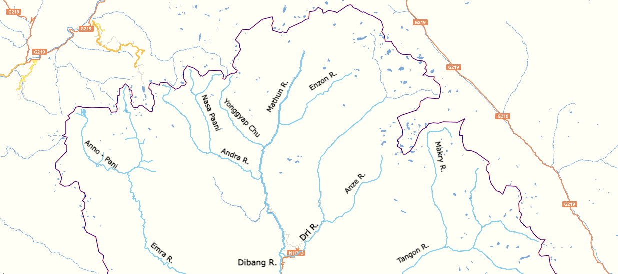
Emra River is a right-bank tributary of the Dibang River which eventually flows into the Brahmaputra River. The entire valley of the river is contained in the Etalin Circle of the Dibang Valley district.District Census Handbook – Dibang Valley, Part B Census of India, 2011. The river originates near the India-China in Arunachal Pradesh at an elevation of about 4000 m.R. S. Envirolink Technologies (July 2016) [...More Info...] [...Related Items...] OR: [Wikipedia] [Google] [Baidu] |
Anini
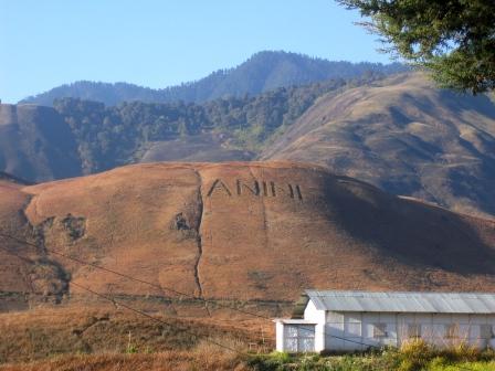
Anini is the headquarters of the Dibang Valley district in the state of Arunachal Pradesh in Northeast India. Anini was also the district headquarters of the undivided Dibang Valley district. Most of this location's population consists of the Idu Mishmi tribal people. Due to its remote location, Anini remains a small and underdeveloped town. However, it still has basic road and air links to the rest of India. The town is fully dependent on the nearest major settlement, Roing, which is in the Lower Dibang Valley District, for most commercial needs. The Anini sub-division consists of six administrative circles— Anini, Mipi, Dambeun, Etalin, Anelih, and Arzoo. Etymology While there is no definite answer, Anini's name may have come from Inini or Innini. Historical maps of Arunachal Pradesh from times before the Lower Dibang Valley district were carved out of the Dibang Valley District in 2001. Before Roing was established, these maps indicate the capital of the Dibang Valley Di ... [...More Info...] [...Related Items...] OR: [Wikipedia] [Google] [Baidu] |
Anini General Hospital
Anini is the headquarters of the Dibang Valley district in the state of Arunachal Pradesh in Northeast India. Anini was also the district headquarters of the undivided Dibang Valley district. Most of this location's population consists of the Idu Mishmi tribal people. Due to its remote location, Anini remains a small and underdeveloped town. However, it still has basic road and air links to the rest of India. The town is fully dependent on the nearest major settlement, Roing, which is in the Lower Dibang Valley District, for most commercial needs. The Anini sub-division consists of six administrative circles— Anini, Mipi, Dambeun, Etalin, Anelih, and Arzoo. Etymology While there is no definite answer, Anini's name may have come from Inini or Innini. Historical maps of Arunachal Pradesh from times before the Lower Dibang Valley district were carved out of the Dibang Valley District in 2001. Before Roing was established, these maps indicate the capital of the Dibang Valley Di ... [...More Info...] [...Related Items...] OR: [Wikipedia] [Google] [Baidu] |
India
India, officially the Republic of India (Hindi: ), is a country in South Asia. It is the seventh-largest country by area, the second-most populous country, and the most populous democracy in the world. Bounded by the Indian Ocean on the south, the Arabian Sea on the southwest, and the Bay of Bengal on the southeast, it shares land borders with Pakistan to the west; China, Nepal, and Bhutan to the north; and Bangladesh and Myanmar to the east. In the Indian Ocean, India is in the vicinity of Sri Lanka and the Maldives; its Andaman and Nicobar Islands share a maritime border with Thailand, Myanmar, and Indonesia. Modern humans arrived on the Indian subcontinent from Africa no later than 55,000 years ago., "Y-Chromosome and Mt-DNA data support the colonization of South Asia by modern humans originating in Africa. ... Coalescence dates for most non-European populations average to between 73–55 ka.", "Modern human beings—''Homo sapiens''—originated in Africa. Then, int ... [...More Info...] [...Related Items...] OR: [Wikipedia] [Google] [Baidu] |
Arunachal Pradesh
Arunachal Pradesh (, ) is a state in Northeastern India. It was formed from the erstwhile North-East Frontier Agency (NEFA) region, and became a state on 20 February 1987. It borders the states of Assam and Nagaland to the south. It shares international borders with Bhutan in the west, Myanmar in the east, and a disputed border with China in the north at the McMahon Line. Itanagar is the state capital of Arunachal Pradesh. Arunachal Pradesh is the largest of the Seven Sister States of Northeast India by area. Arunachal Pradesh shares a 1,129 km border with China's Tibet Autonomous Region. As of the 2011 Census of India, Arunachal Pradesh has a population of 1,382,611 and an area of . It is an ethnically diverse state, with predominantly Monpa people in the west, Tani people in the centre, Mishmi and Tai people in the east, and Naga people in the southeast of the state. About 26 major tribes and 100 sub-tribes live in the state. The main tribes of the state are Adi, Nyshi ... [...More Info...] [...Related Items...] OR: [Wikipedia] [Google] [Baidu] |
Dibang Valley District
Dibang Valley (Pron:/dɪˈbæŋ/) is a district of Arunachal Pradesh named after the Dibang River or the Talon as the Mishmis call it. It is the least populated district in India and has an area of . History In June 1980, Dibang Valley district was created out of part of Lohit district. On 16 December 2001, Dibang Valley district was bifurcated into Dibang Valley district and Lower Dibang Valley district. Geography The Dibang River originates in the mountains of Arunachal Pradesh and flows through the length of the valley which is named after it. The Dibang has multiple tributaries and only once it debouches into the plains is it called by its name. Some of the major rivers of Dibang Valley District are: Ahui, Emra, Mathun, Dri, Tangon, Ithun, and Ange. The capital of this district, Anini, is the northernmost district capital in Northeast India. This district contains the northernmost point of Northeast India. Transport The proposed Mago-Thingbu to Vijaynagar Arunachal P ... [...More Info...] [...Related Items...] OR: [Wikipedia] [Google] [Baidu] |
Indian Standard Time
Indian Standard Time (IST), sometimes also called India Standard Time, is the time zone observed throughout India, with a time offset of UTC+05:30. India does not observe daylight saving time or other seasonal adjustments. In military and aviation time, IST is designated E* ("Echo-Star"). It is indicated as Asia/Kolkata in the IANA time zone database. History After Independence in 1947, the Union government established IST as the official time for the whole country, although Kolkata and Mumbai retained their own local time (known as Calcutta Time and Bombay Time) until 1948 and 1955, respectively. The Central observatory was moved from Chennai to a location at Shankargarh Fort in Allahabad district, so that it would be as close to UTC+05:30 as possible. Daylight Saving Time (DST) was used briefly during the China–India War of 1962 and the Indo-Pakistani Wars of 1965 and 1971. Calculation Indian Standard Time is calculated from the clock tower in Mirzapur nearly exa ... [...More Info...] [...Related Items...] OR: [Wikipedia] [Google] [Baidu] |
Dibang Valley District
Dibang Valley (Pron:/dɪˈbæŋ/) is a district of Arunachal Pradesh named after the Dibang River or the Talon as the Mishmis call it. It is the least populated district in India and has an area of . History In June 1980, Dibang Valley district was created out of part of Lohit district. On 16 December 2001, Dibang Valley district was bifurcated into Dibang Valley district and Lower Dibang Valley district. Geography The Dibang River originates in the mountains of Arunachal Pradesh and flows through the length of the valley which is named after it. The Dibang has multiple tributaries and only once it debouches into the plains is it called by its name. Some of the major rivers of Dibang Valley District are: Ahui, Emra, Mathun, Dri, Tangon, Ithun, and Ange. The capital of this district, Anini, is the northernmost district capital in Northeast India. This district contains the northernmost point of Northeast India. Transport The proposed Mago-Thingbu to Vijaynagar Arunachal P ... [...More Info...] [...Related Items...] OR: [Wikipedia] [Google] [Baidu] |
Dibang River Basin
Dibang (Hindi: दिबांग) is a senior news anchor former host of daily prime-time show 'Jan Man' and weekly show 'Press Conference' on the Hindi news channel ABP News. A member of debate panels of the channel, he is rated among the best Hindi anchors in the industry today. Career He is the current anchor of ABP NEWS and was the managing director of NDTV INDIA , a 24-hour Hindi news channel. As the Executive Editor, he was the launching face for NDTV India. Before joining NDTV, he worked for Aaj Tak, a 24-hour Hindi news channel. When Aaj Tak became a 24-hour channel, Dibang was the launching face. Before joining television news, Dibang was a correspondent with ''The Sunday Times of India'' in New Delhi. He started his career in journalism with ''The Illustrated Weekly of India''. He anchored the first-ever hour-long Hindi debate show on television, ''Muqabla'' on NDTV India. At the Indian Television Academy Awards 2006, Muqabla won the Best Talk Show Award. This ... [...More Info...] [...Related Items...] OR: [Wikipedia] [Google] [Baidu] |
Dibang River
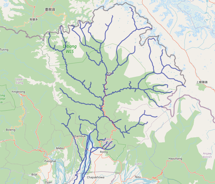
Dibang River, also known as Sikang by the Adi and Talo in Idu, is an upstream tributary river of the Brahmaputra in the Indian state of Arunachal Pradesh. It originates and flows through the Mishmi Hills in the (Upper) Dibang Valley and Lower Dibang Valley districts.R. S. Envirolink Technologies (July 2016)''Cumulative Impact & Carrying Capacity Study of Dibang Sub Basin on Brahmaputra River Valley.''Volume I. Prepared for Ministry of Environment, Forest and Climate Change. Accessed on 16 June 2021Archivedon 16 June 2021. Course The Dibang originates near Keya pass on the Indo-Chinese border in the Upper Dibang Valley district of Arunachal Pradesh. The drainage basin of the river within Arunachal Pradesh covers the districts of Upper Dibang Valley and Lower Dibang Valley. The Mishmi Hills lie in the upper course of the Dibang which enters the plains at Bomjir, Dambuk etc. Between Bomjir (Nizamghat) and Sadiya the Dibang has a steep river gradient and exhibits braided cha ... [...More Info...] [...Related Items...] OR: [Wikipedia] [Google] [Baidu] |


.jpg)
.jpg)

.jpg)