|
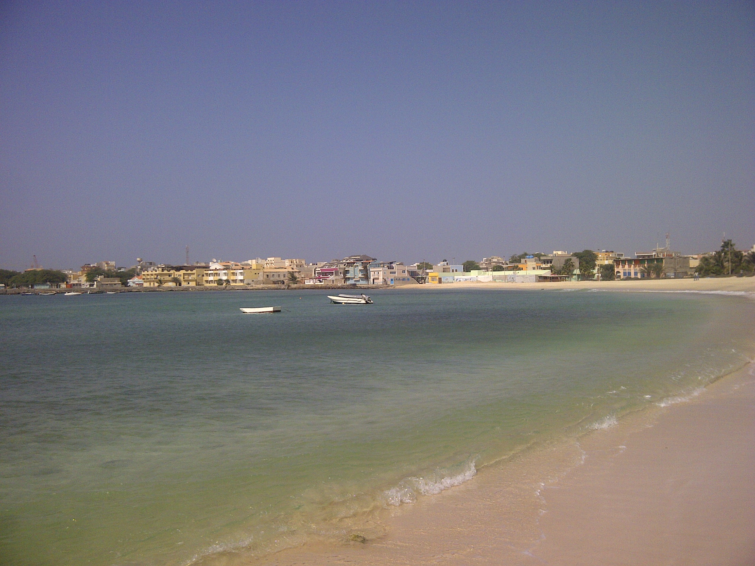
Estância De Baixo , west of the Deserto de Viana, on the eastern bank of Ribeira do Rabil.
Estância de Baixo is a settlement in the western part of the island of Boa Vista, Cape Verde. Its population was 578 in 2010, making it the island's third most populated place. The village is around 6 km southeast of the island capital of Sal Rei Sal Rei is a cityCabo Verde, Statistical Yearbook 2015 See also *[...More Info...] [...Related Items...] OR: [Wikipedia] [Google] [Baidu] |
Boa Vista, Cape Verde
Boa Vista (Portuguese for "good view"), also written as Boavista, is a desert-like island that belongs to the Cape Verde Islands. At , it is the third largest island of the Cape Verde archipelago. The island of Boa Vista is closer to the African continent than all the other islands in Cape Verde, being the easternmost island of all. The distance between Boa Vista and Senegal is only 450 km. The capital of Boa Vista, Sal Rei, is located in the north-western part of the island. Boa Vista is mainly known for its beaches, turtles and traditional music. Geography Boa Vista is the third largest island after Santo Antão and Santiago, with an area of 631.1 square kilometres. It is situated south of Sal and north of Maio. The island is generally flat, but it has numerous hills like Monte Estância (the highest point of the island at 387 m), [...More Info...] [...Related Items...] OR: [Wikipedia] [Google] [Baidu] |
Cape Verde
, national_anthem = () , official_languages = Portuguese , national_languages = Cape Verdean Creole , capital = Praia , coordinates = , largest_city = capital , demonym = Cape Verdean or Cabo Verdean , ethnic_groups_year = 2017 , government_type = Unitary semi-presidential republic , leader_title1 = President , leader_name1 = José Maria Neves , leader_title2 = Prime Minister , leader_name2 = Ulisses Correia e Silva , legislature = National Assembly , area_rank = 166th , area_km2 = 4033 , area_sq_mi = 1,557 , percent_water = negligible , population_census = 561,901 , population_census_rank = 172nd , population_census_year = 2021 , population_density_km2 = 123.7 , population_density_sq_mi = 325.0 , population_density_rank = 89th , GDP_PPP ... [...More Info...] [...Related Items...] OR: [Wikipedia] [Google] [Baidu] |
Sal Rei
Sal Rei is a cityCabo Verde, Statistical Yearbook 2015 Instituto Nacional de Estatística, p. 32-33 on the northwestern coast of the island of Boa Vista in eastern . Sal Rei is the island's main urban settlement, and the seat of the Boa Vista Municipality. In 2010 i ... [...More Info...] [...Related Items...] OR: [Wikipedia] [Google] [Baidu] |
Deserto De Viana
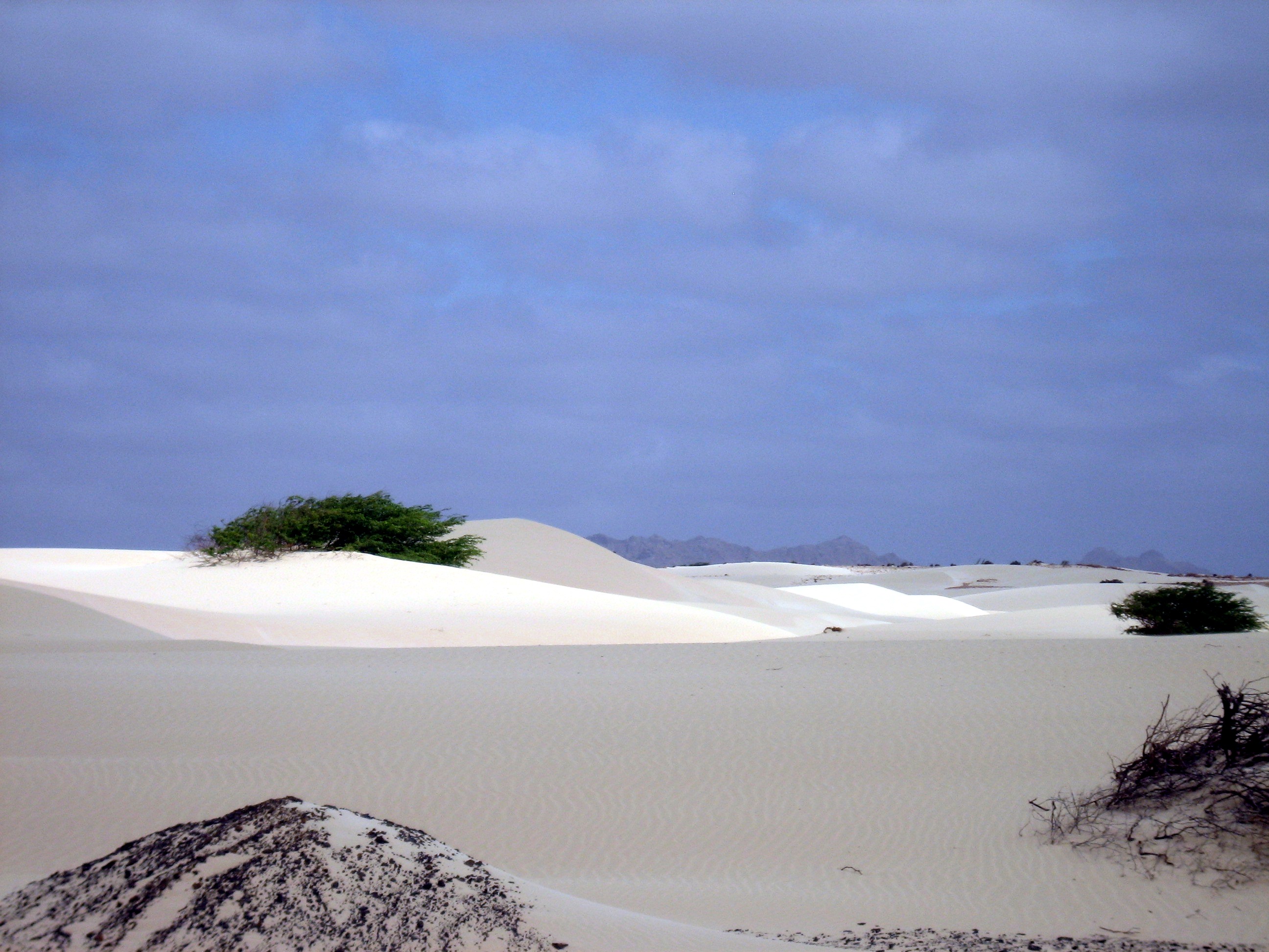
The Deserto de Viana is a sand desert in the northwestern part of the island of Boa Vista, Cape Verde. It is situated east of the towns Rabil and Sal Rei, and west of Bofarreira. The desert itself is not a protected area, but it is adjacent to the nature reserve ''Boa Esperança'', which includes the Lagoa do Rabil The Lagoa do Rabil (Rabil lagoon) is a wetland site in the Cape Verde archipelago, on the island of Boa Vista. It has been recognised as a wetland of international importance by designation under the Ramsar Convention since 2005. The site lies at ... and the Praia de Atalanta.Protected areas in the island of Boa Vista - Municipality of Boa Vista, March 2013 See also *[...More Info...] [...Related Items...] OR: [Wikipedia] [Google] [Baidu] |
Ribeira Do Rabil
Ribeira do Rabil is a seasonal stream in the central and western part of the island of Boa Vista in Cape Verde. It is 27 km long, and its basin area is . , p. 22 Its source is in the southeastern part of the island, north of the island's highest point Monte Estância. It flows generally northwest, passes east of the town |
List Of Villages And Settlements In Cape Verde
This is a list of villages and smaller settlements in Cape Verde: Boa Vista * Bofarreira * Cabeça dos Tarrafes * Curral Velho - abandoned settlement * Espingueira - abandoned settlement * Estância de Baixo * Fundo das Figueiras * João Galego * Povoação Velha * Prazeres - abandoned settlement Brava * Cachaço * Campo Baixo * Cova Joana * Cova Rodela * Fajã de Água * João da Noly * Lem * Mato * Mato Grande * Nossa Senhora do Monte * Santa Bárbara * Tantum * Tomé Barraz * Vinagre Fogo * Achada Furna * Achada Grande * Atalaia * Cabeça Fundão * Campanas Baixo * Chã das Caldeiras * Corvo * Curral Grande * Estância Roque * Fajãzinha * Feijoal * Figueira Pavão * Fonte Aleixo * Galinheiro * As Hortas * Lagariça * Lomba * Miguel Gonçalves * Monte Grande * Patim * Ponta Verde * Relva * Ribeira do Ilhéu * Salto * Santo António * São Filipe * São Jorge * Tinteira * Vicente Dias Maio * Alcatraz * Barreiro * Calheta * Cascabulho * Figueir ... [...More Info...] [...Related Items...] OR: [Wikipedia] [Google] [Baidu] |


