|
Eriospermum Capense
''Eriospermum capense'' is a species of geophytic plant of the genus ''Eriospermum'', indigenous to the Western Cape Province, South Africa. Description The leaf is heart-shaped (7,5 cm long, 6 cm wide), suberect-to-spreading, and appears from April to October (Winter in southern hemisphere). The leaf is dark-green above, and red on its underside. Sometimes the upper side also has reddish ridges. The tuber is irregular-to-pear-shaped, with reddish-purple flesh. This species flowers from November to March. Related species Several related species, such as '' Eriospermum breviscapum'', '' Eriospermum pubescens'' and '' Eriospermum zeyheri'', have a similar heart-shaped leaf. However, the leaf of these species is usually prostrate; while the leaf of ''E.capense'' is more erect and spreading. The leaf of ''E.capense'' is also distinctly reddish on its underside, and slightly longer (75mm) than that of the other species (60mm) listed above. There are other specific dist ... [...More Info...] [...Related Items...] OR: [Wikipedia] [Google] [Baidu] |
Eriospermum
''Eriospermum'' is a genus of tuberous flowering plants. It contains about 80-100 species, native to sub-Saharan Africa. Name The name "Eriospermum" is from the Greek ''erion'' for "wool" and ''sperma'' for "seed". In the APG III classification system, the genus is placed in the family Asparagaceae, subfamily Nolinoideae (formerly the family Ruscaceae). It was formerly placed in its own family, Eriospermaceae. Selected speciesPerry, P.L. (1994) ''A Revision of the Genus Eriospermum (Eriospermaceae)''. Bolus Herbarium, University of Cape Town, 1: 1-320. *''Eriospermum aphyllum'' *''Eriospermum bayeri'' *''Eriospermum bowieanum'' *'' Eriospermum breviscapum'' *''Eriospermum capense'' *'' Eriospermum cooperi'' *'' Eriospermum dregei'' *'' Eriospermum exile'' *''Eriospermum graminifolium'' *''Eriospermum lanceifolium'' *'' Eriospermum paradoxum'' *''Eriospermum proliferum'' *'' Eriospermum pubescens'' *'' Eriospermum zeyheri'' Gallery File:Eriospermum abyssinicum 1DS-II ... [...More Info...] [...Related Items...] OR: [Wikipedia] [Google] [Baidu] |
Western Cape Province
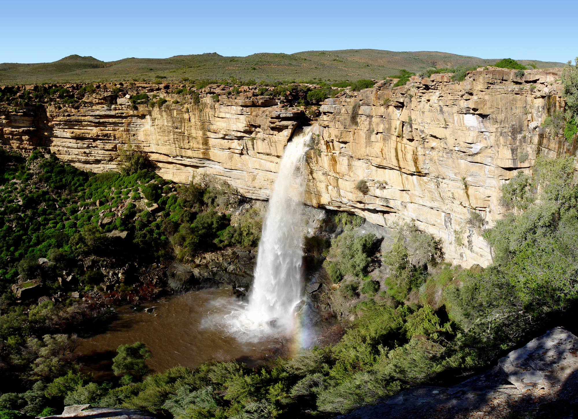
The Western Cape is a province of South Africa, situated on the south-western coast of the country. It is the fourth largest of the nine provinces with an area of , and the third most populous, with an estimated 7 million inhabitants in 2020. About two-thirds of these inhabitants live in the metropolitan area of Cape Town, which is also the provincial capital. The Western Cape was created in 1994 from part of the former Cape Province. The two largest cities are Cape Town and George. Geography The Western Cape Province is roughly L-shaped, extending north and east from the Cape of Good Hope, in the southwestern corner of South Africa. It stretches about northwards along the Atlantic coast and about eastwards along the South African south coast (Southern Indian Ocean). It is bordered on the north by the Northern Cape and on the east by the Eastern Cape. The total land area of the province is , about 10.6% of the country's total. It is roughly the size of England or the St ... [...More Info...] [...Related Items...] OR: [Wikipedia] [Google] [Baidu] |
South Africa
South Africa, officially the Republic of South Africa (RSA), is the southernmost country in Africa. It is bounded to the south by of coastline that stretch along the South Atlantic and Indian Oceans; to the north by the neighbouring countries of Namibia, Botswana, and Zimbabwe; and to the east and northeast by Mozambique and Eswatini. It also completely enclaves the country Lesotho. It is the southernmost country on the mainland of the Old World, and the second-most populous country located entirely south of the equator, after Tanzania. South Africa is a biodiversity hotspot, with unique biomes, plant and animal life. With over 60 million people, the country is the world's 24th-most populous nation and covers an area of . South Africa has three capital cities, with the executive, judicial and legislative branches of government based in Pretoria, Bloemfontein, and Cape Town respectively. The largest city is Johannesburg. About 80% of the population are Black South Afri ... [...More Info...] [...Related Items...] OR: [Wikipedia] [Google] [Baidu] |
Eriospermum Breviscapum
''Eriospermum breviscapum'' is a species of geophytic plant of the genus ''Eriospermum'', indigenous to South Africa. Description This species has a fleshy, prostrate, heart-shaped-to-rounded leaf (60mm x 80mm). Its leaf resembles that of ''Eriospermum zeyheri'', which has a different distribution range, occurring in the southern Karoo between Barrydale and Grahamstown. It has a short peduncle, compact inflorescence and fragrant, star-like white flowers that appear on the short, conical raceme in February to March. Several related species, such as ''Eriospermum capense'', ''Eriospermum pubescens'' and ''Eriospermum zeyheri'', have a similar heart-shaped leaf. Distribution and habitat It is a winter rainfall species, endemic to South Africa. It is indigenous to flat rocky shale or clay areas in the Robertson Karoo, and from Robertson as far as Still Bay in the south east. It occurs in Renosterveld and Succulent Karoo The Succulent Karoo is a ecoregion defined by the Wor ... [...More Info...] [...Related Items...] OR: [Wikipedia] [Google] [Baidu] |
Eriospermum Pubescens
''Eriospermum pubescens'' is a species of geophytic plant of the genus ''Eriospermum'', indigenous to the southern Cape, South Africa. Description The leaf is heart-shaped (7 cm long, 6 cm wide), relatively hairless (sometimes with straight hairs pressed flat against the leaf surface, especially on the underside), and held prostrate against the ground. Several related species, such as ''Eriospermum capense'', '' Eriospermum breviscapum'' and '' Eriospermum zeyheri'', have a similar heart-shaped leaf. The tuber is irregular shaped, with reddish-purple flesh, and the plants can offset and form clusters. This species flowers from February to April. Distribution and habitat ''Eriospermum pubescens'' occurs in renosterveld vegetation, in clay-rich soils across the southern Cape, South Africa South Africa, officially the Republic of South Africa (RSA), is the southernmost country in Africa. It is bounded to the south by of coastline that stretch along the South A ... [...More Info...] [...Related Items...] OR: [Wikipedia] [Google] [Baidu] |
Eriospermum Zeyheri
''Eriospermum zeyheri'' is a species of geophytic plant of the genus ''Eriospermum'', indigenous to South Africa. Description The leaf is a rounded heart-shape (), and is prostrate, held flat against the ground. Several related species, such as ''Eriospermum capense'', '' Eriospermum breviscapum'' and ''Eriospermum pubescens ''Eriospermum pubescens'' is a species of geophytic plant of the genus ''Eriospermum'', indigenous to the southern Cape, South Africa. Description The leaf is heart-shaped (7 cm long, 6 cm wide), relatively hairless (sometimes with str ...'', have a similar heart-shaped leaf. However, the leaf of ''E.zeyheri'' is generally a lighter green above, and not a reddish colour below. It is also always pressed flat against the ground. The irregular-shaped tuber of ''E.zeyheri'' is white-ish inside. The pale, greenish-cream-coloured, fragrant, star-shaped flowers appear on a tall, thin inflorescence in December to March. Distribution This species occ ... [...More Info...] [...Related Items...] OR: [Wikipedia] [Google] [Baidu] |
Namaqualand
Namaqualand (khoekhoe: "Nama-kwa" meaning Nama Khoe people's land) is an arid region of Namibia and South Africa, extending along the west coast over and covering a total area of . It is divided by the lower course of the Orange River into two portions – Little Namaqualand to the south and Great Namaqualand to the north. Little Namaqualand is within the Namakwa District Municipality, forming part of Northern Cape Province, South Africa. It is geographically the largest district in the country, spanning over 26,836 km2. A typical municipality is Kamiesberg Local Municipality. The semidesert Succulent Karoo region experiences hot summers, sparse rainfall, and cold winters.Discover South Africa: Your Online Travel Directory. Discover Namakwa. Great Namaqualand in the Karas Region of Namibia, is sparsely populated by the Namaqua, a Khoikhoi people who have traditionally inhabited the Namaqualand region. Tourism The area’s landscape ranges from an unexploited coast ... [...More Info...] [...Related Items...] OR: [Wikipedia] [Google] [Baidu] |
Grahamstown
Makhanda, also known as Grahamstown, is a town of about 140,000 people in the Eastern Cape province of South Africa. It is situated about northeast of Port Elizabeth and southwest of East London, Eastern Cape, East London. Makhanda is the largest town in the Makana Local Municipality, and the seat of the municipal council. It also hosts Rhodes University, the Eastern Cape Division of the High Court of South Africa, High Court, the South African Library for the Blind (SALB), Diocese of Grahamstown, a diocese of the Anglican Church of Southern Africa, and 6 South African Infantry Battalion. Furthermore, located approximately 3 km south-east of the town lies the world renowned Waterloo Farm lagerstätte, Waterloo Farm, the only estuarine fossil site in the world from 360 million years ago with exceptional soft-tissue preservation. The town's name-change from Grahamstown to Makhanda was officially gazetted on 29 June 2018. The town was officially renamed to Makhanda in memory ... [...More Info...] [...Related Items...] OR: [Wikipedia] [Google] [Baidu] |
Cape Peninsula
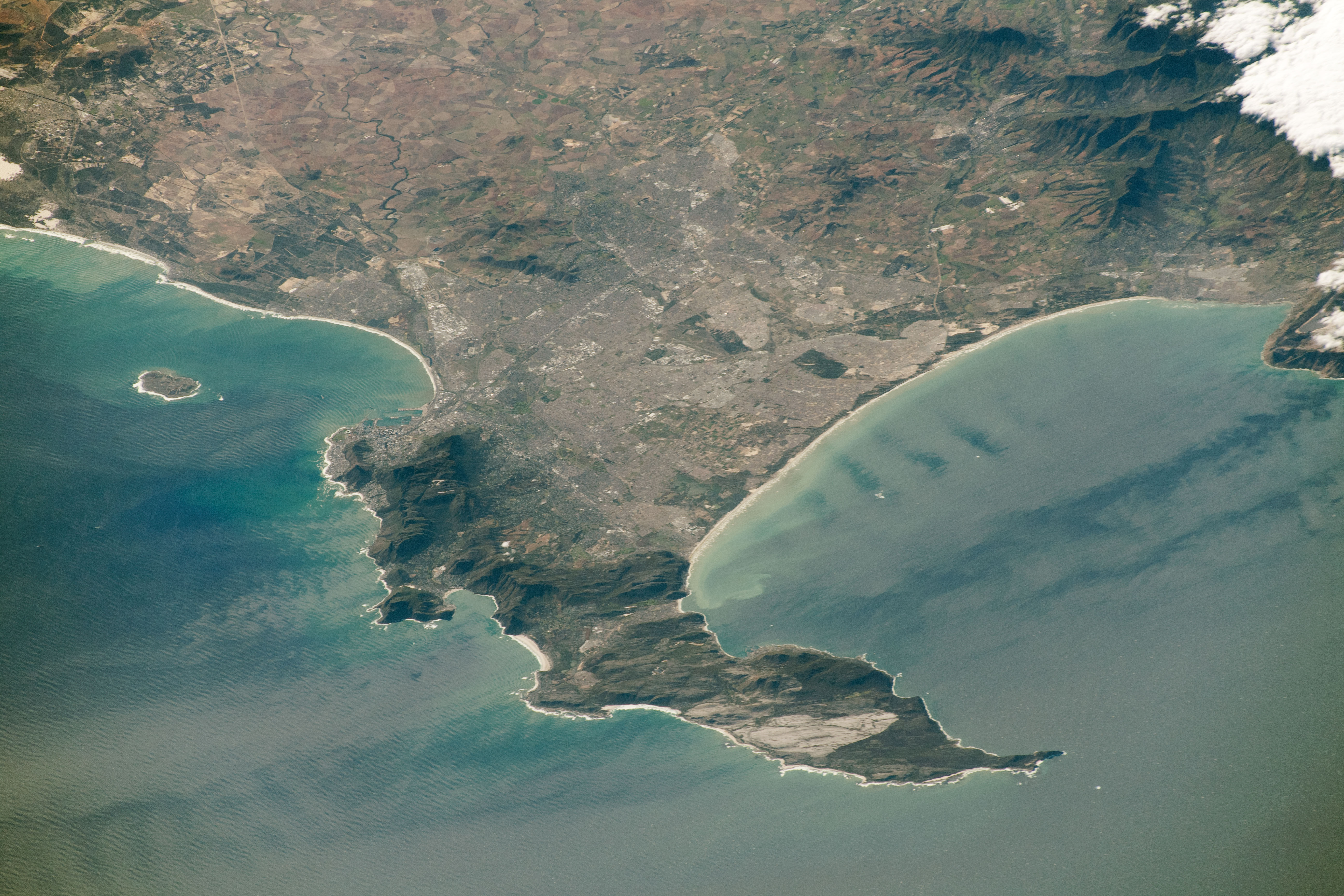
The Cape Peninsula ( af, Kaapse Skiereiland) is a generally mountainous peninsula that juts out into the Atlantic Ocean at the south-western extremity of the African continent. At the southern end of the peninsula are Cape Point and the Cape of Good Hope. On the northern end is Table Mountain, overlooking Table Bay and the city bowl of Cape Town, South Africa. The peninsula is 52 km long from Mouille point in the north to Cape Point in the south. The Peninsula has been an island on and off for the past 5 million years, as sea levels fell and rose with the Glacial period, ice age and interglacial global warming cycles of, particularly, the Pleistocene. The last time that the Peninsula was an island was about 1.5 million years ago. Soon afterwards it was joined to the mainland by the Geology of Cape Town#Tertiary to Recent events, emergence from the sea of the sandy area now known as the Cape Flats. The towns and villages of the Cape Peninsula and Cape Flats, and the ... [...More Info...] [...Related Items...] OR: [Wikipedia] [Google] [Baidu] |

_-_Copy.jpg)
