|
Eridania Quadrangle
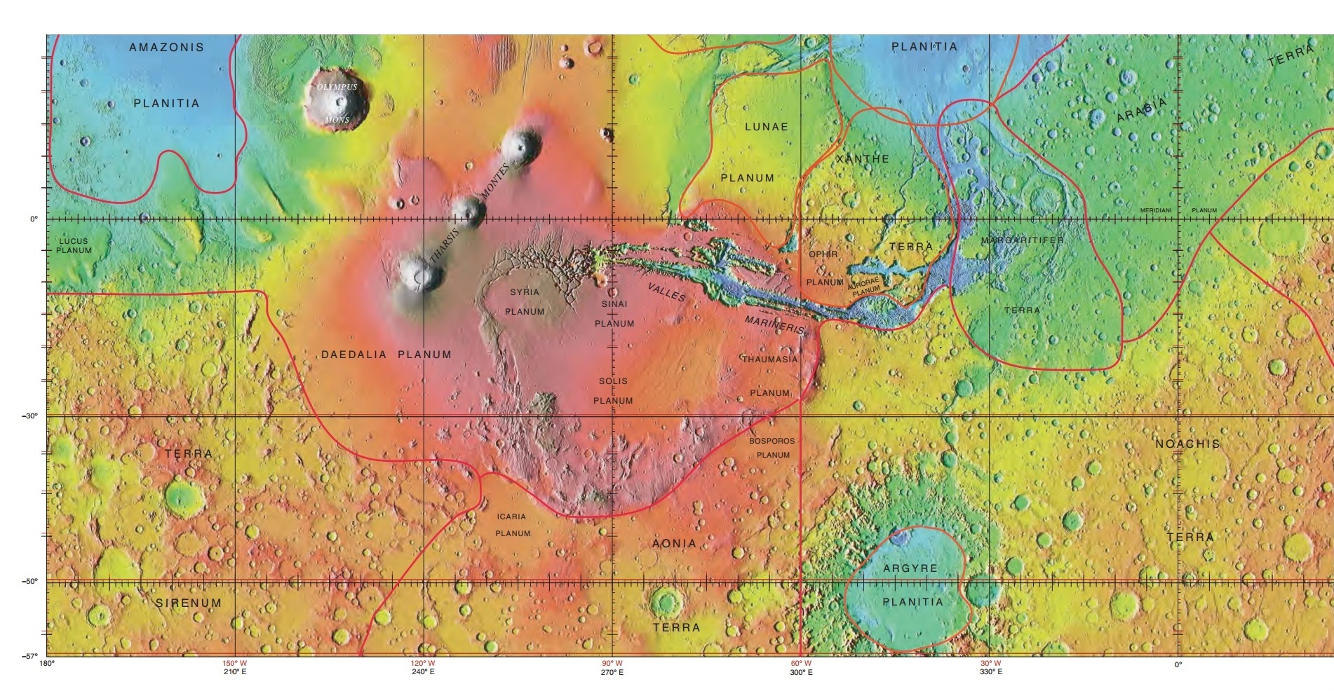
The Eridania quadrangle is one of a series of 30 quadrangle maps of Mars used by the United States Geological Survey (USGS) Astrogeology Research Program. The Eridania quadrangle is also referred to as MC-29 (Mars Chart-29). The Eridania quadrangle lies between 30° and 65° south latitude and 180° and 240° west longitude on the planet Mars. Most of the classic region named Terra Cimmeria is found within this quadrangle. Part of the Electris deposits, a 100–200 meters thick, light-toned deposit covers the Eridania quadrangle. Many slopes in Eridania contain gullies, which are believed to be caused by flowing water. Martian Gullies The Eridania quadrangle is the location of gullies that may be due to recent flowing water. Gullies occur on steep slopes, especially on the walls of craters. Gullies are believed to be relatively young because they have few, if any craters. Moreover, they lie on top of sand dunes which themselves are considered to be quite young. Usually, eac ... [...More Info...] [...Related Items...] OR: [Wikipedia] [Google] [Baidu] |
Quadrangle (geography)
A "quadrangle" is a topographic map produced by the United States Geological Survey (USGS) covering the United States. The maps are usually named after local physiographic features. The shorthand "quad" is also used, especially with the name of the map; for example, "the Ranger Creek, Texas quad". From approximately 1947-1992, the USGS produced the 7.5 minute series, with each map covering an area one-quarter of the older 15-minute quad series, which it replaced. A 7.5 minute quadrangle map covers an area of . Both map series were produced via photogrammetric analysis of aerial photography using stereoplotters supplemented by field surveys. These maps employ the 1927 North American Datum (NAD27); conversion or a change in settings is necessary when using a GPS which by default employ the WGS84 geodetic datum. Beginning in 2009, the USGS made available digital versions of 7.5 minute quadrangle maps based on GIS data that use the NAD83 datum, which is typically within one met ... [...More Info...] [...Related Items...] OR: [Wikipedia] [Google] [Baidu] |
HiRISE
High Resolution Imaging Science Experiment is a camera on board the ''Mars Reconnaissance Orbiter'' which has been orbiting and studying Mars since 2006. The 65 kg (143 lb), US$40 million instrument was built under the direction of the University of Arizona's Lunar and Planetary Laboratory by Ball Aerospace & Technologies Corp. It consists of a 0.5m (19.7 in) aperture reflecting telescope, the largest so far of any deep space mission, which allows it to take pictures of Mars with resolutions of 0.3m/pixel (1ft/pixel), resolving objects below a meter across. HiRISE has imaged Mars exploration rovers on the surface, including the ''Opportunity'' rover and the ongoing ''Curiosity'' mission. History In the late 1980s, of Ball Aerospace & Technologies began planning the kind of high-resolution imaging needed to support sample return and surface exploration of Mars. In early 2001 he teamed up with Alfred McEwen of the University of Arizona to propose such ... [...More Info...] [...Related Items...] OR: [Wikipedia] [Google] [Baidu] |
Hematite
Hematite (), also spelled as haematite, is a common iron oxide compound with the formula, Fe2O3 and is widely found in rocks and soils. Hematite crystals belong to the rhombohedral lattice system which is designated the alpha polymorph of . It has the same crystal structure as corundum () and ilmenite (). With this it forms a complete solid solution at temperatures above . Hematite naturally occurs in black to steel or silver-gray, brown to reddish-brown, or red colors. It is mined as an important ore mineral of iron. It is electrically conductive. Hematite varieties include ''kidney ore'', ''martite'' ( pseudomorphs after magnetite), ''iron rose'' and ''specularite'' ( specular hematite). While these forms vary, they all have a rust-red streak. Hematite is not only harder than pure iron, but also much more brittle. Maghemite is a polymorph of hematite (γ-) with the same chemical formula, but with a spinel structure like magnetite. Large deposits of hematite are ... [...More Info...] [...Related Items...] OR: [Wikipedia] [Google] [Baidu] |
Plate Tectonics
Plate tectonics (from the la, label= Late Latin, tectonicus, from the grc, τεκτονικός, lit=pertaining to building) is the generally accepted scientific theory that considers the Earth's lithosphere to comprise a number of large tectonic plates which have been slowly moving since about 3.4 billion years ago. The model builds on the concept of '' continental drift'', an idea developed during the first decades of the 20th century. Plate tectonics came to be generally accepted by geoscientists after seafloor spreading was validated in the mid to late 1960s. Earth's lithosphere, which is the rigid outermost shell of the planet (the crust and upper mantle), is broken into seven or eight major plates (depending on how they are defined) and many minor plates or "platelets". Where the plates meet, their relative motion determines the type of plate boundary: '' convergent'', '' divergent'', or '' transform''. Earthquakes, volcanic activity, mountain-building, and ocea ... [...More Info...] [...Related Items...] OR: [Wikipedia] [Google] [Baidu] |
Terra Sirenum
Terra Sirenum is a large region in the southern hemisphere of the planet Mars. It is centered at and covers 3900 km at its broadest extent. It covers latitudes 10 to 70 South and longitudes 110 to 180 W. Terra Sirenum is an upland area notable for massive cratering including the large Newton Crater. Terra Sirenum is in the Phaethontis quadrangle and the Memnonia quadrangle of Mars. A low area in Terra Sirenum is believed to have once held a lake that eventually drained through Ma'adim Vallis. Terra Sirenum is named after the Sirens, who were birds with the heads of girls. In the ''Odyssey'' these girls captured passing seamen and killed them. Chloride deposits Evidence of deposits of chloride based minerals in Terra Sirenum was discovered by the 2001 Mars Odyssey orbiter's Thermal Emission Imaging System in March 2008. The deposits are approximately 3.5 to 3.9 billion years old. This suggests that near-surface water was widespread in early Martian history, w ... [...More Info...] [...Related Items...] OR: [Wikipedia] [Google] [Baidu] |
Kepler (Martian Crater)
Johannes Kepler (; ; 27 December 1571 – 15 November 1630) was a German astronomer, mathematician, astrologer, natural philosopher and writer on music. He is a key figure in the 17th-century Scientific Revolution, best known for his laws of planetary motion, and his books ''Astronomia nova'', ''Harmonice Mundi'', and ''Epitome Astronomiae Copernicanae''. These works also provided one of the foundations for Newton's theory of universal gravitation. Kepler was a mathematics teacher at a seminary school in Graz, where he became an associate of Prince Hans Ulrich von Eggenberg. Later he became an assistant to the astronomer Tycho Brahe in Prague, and eventually the imperial mathematician to Emperor Rudolf II and his two successors Matthias and Ferdinand II. He also taught mathematics in Linz, and was an adviser to General Wallenstein. Additionally, he did fundamental work in the field of optics, invented an improved version of the refracting (or Keplerian) telescope, and w ... [...More Info...] [...Related Items...] OR: [Wikipedia] [Google] [Baidu] |
Mars Orbiter Camera
The Mars Orbiter Camera and Mars Observer Camera (MOC) were scientific instruments on board the Mars Observer and Mars Global Surveyor spacecraft. The camera was built by Malin Space Science Systems (MSSS) for NASA and the cost of the whole MOC scientific investigation project was about US$44 million, higher than anticipated in the budget. Design Originally named Mars Observer Camera, it was selected by NASA in 1986 for the Mars Observer mission, but it returned only three images of planet Mars before the loss of the spacecraft in 1993. A second camera of the same specifications, renamed to Mars Orbiter Camera (MOC), was built (with assistance by California Institute of Technology) and launched on board the Mars Global Surveyor (MGS) spacecraft in 1996. The camera returned 243,668 images while in orbit around Mars, before the loss of the MGS spacecraft in 2006. Mars Orbiter Camera was operated by its manufacturer, Malin Space Science Systems, from its facilities in San Diego, ... [...More Info...] [...Related Items...] OR: [Wikipedia] [Google] [Baidu] |
High Resolution Stereo Camera
High Resolution Stereo Camera (HRSC) is a camera experiment on ''Mars Express''.DLR - HRSC on Mars Express A version for called HRSC-AX was also developed, as was a version for . It has four main parts: camera head, super resolution channel, instrument frame, and digital unit. At an altitude of 250 km from , SRC can produce images with a resolution of 2.3 |
Mars Exploration Rover
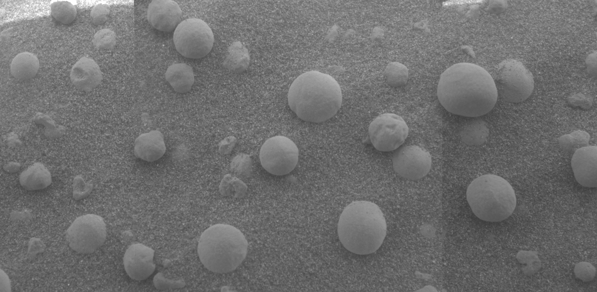
NASA's Mars Exploration Rover (MER) mission was a robotic space mission involving two Mars rovers, '' Spirit'' and '' Opportunity'', exploring the planet Mars. It began in 2003 with the launch of the two rovers to explore the Martian surface and geology; both landed on Mars at separate locations in January 2004. Both rovers far outlived their planned missions of 90 Martian solar days: MER-A ''Spirit'' was active until March 22, 2010, while MER-B ''Opportunity'' was active until June 10, 2018. Objectives The mission's scientific objective was to search for and characterize a wide range of rocks and soils that hold clues to past water activity on Mars. The mission is part of NASA's Mars Exploration Program, which includes three previous successful landers: the two Viking program landers in 1976 and Mars Pathfinder probe in 1997. The total cost of building, launching, landing and operating the rovers on the surface for the initial 90-sol primary mission was US$820 mill ... [...More Info...] [...Related Items...] OR: [Wikipedia] [Google] [Baidu] |
Solar Panels
A solar cell panel, solar electric panel, photo-voltaic (PV) module, PV panel or solar panel is an assembly of photovoltaic solar cells mounted in a (usually rectangular) frame, and a neatly organised collection of PV panels is called a photovoltaic system or solar array. Solar panels capture sunlight as a source of radiant energy, which is converted into electric energy in the form of direct current (DC) electricity. Arrays of a photovoltaic system can be used to generate solar electricity that supplies electrical equipment directly, or feeds power back into an alternate current (AC) grid via an inverter system. History In 1839, the ability of some materials to create an electrical charge from light exposure was first observed by the French physicist Edmond Becquerel. Though these initial solar panels were too inefficient for even simple electric devices, they were used as an instrument to measure light. The observation by Becquerel was not replicated again un ... [...More Info...] [...Related Items...] OR: [Wikipedia] [Google] [Baidu] |
Dust Devils
A dust devil is a strong, well-formed, and relatively short-lived whirlwind. Its size ranges from small (half a metre wide and a few metres tall) to large (more than 10 m wide and more than 1 km tall). The primary vertical motion is upward. Dust devils are usually harmless, but can on rare occasions grow large enough to pose a threat to both people and property. They are comparable to tornadoes in that both are a weather phenomenon involving a vertically oriented rotating column of wind. Most tornadoes are associated with a larger parent circulation, the mesocyclone on the back of a supercell thunderstorm. Dust devils form as a swirling updraft under sunny conditions during fair weather, rarely coming close to the intensity of a tornado. Formation Dust devils form when a pocket of hot air near the surface rises quickly through cooler air above it, forming an updraft. If conditions are just right, the updraft may begin to rotate. As the air rapidly rises, the colu ... [...More Info...] [...Related Items...] OR: [Wikipedia] [Google] [Baidu] |
Gasa Crater
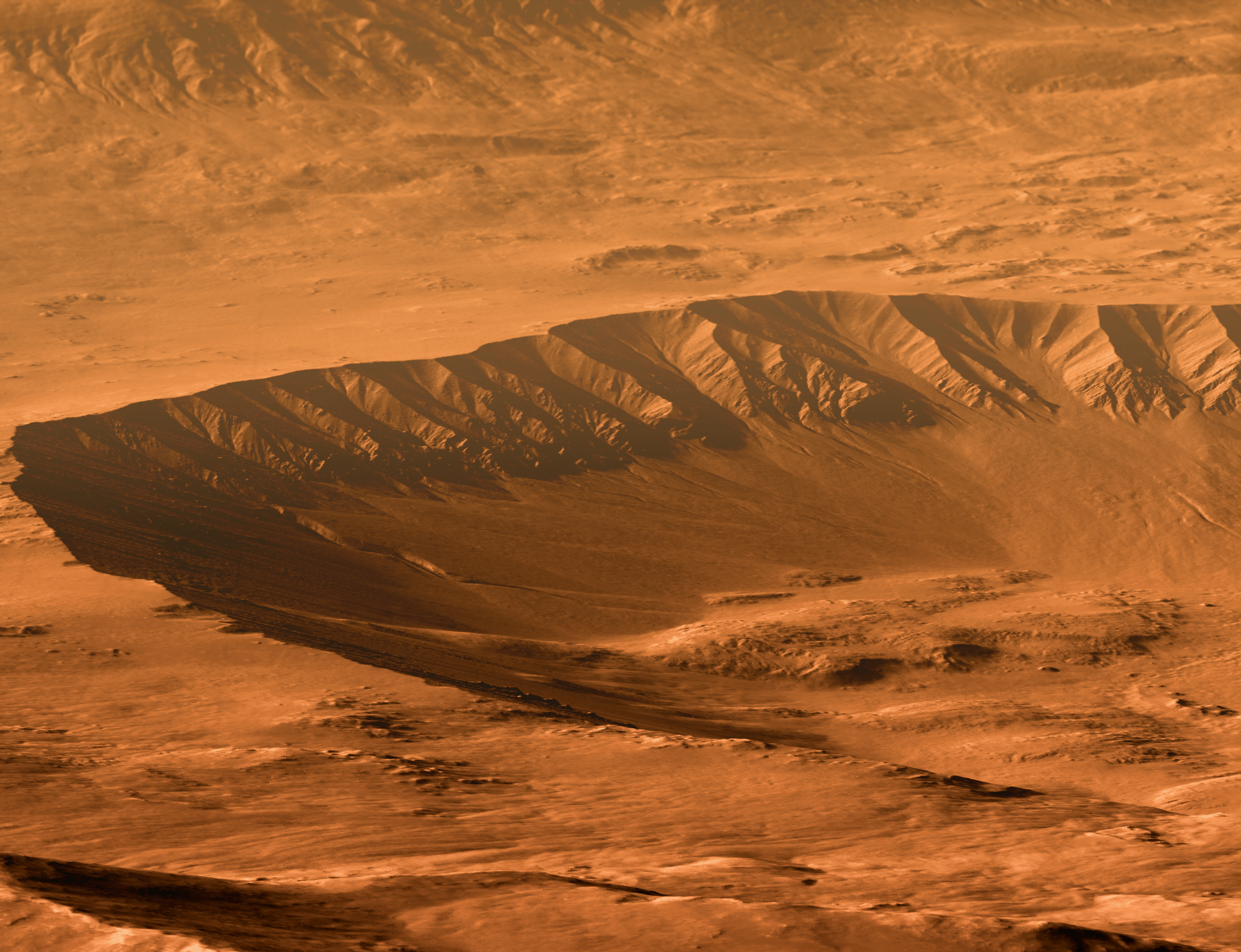
Gasa is an impact rayed crater in the Eridania quadrangle on Mars at 35.68° S and 230.72° W. and is 6.5 km in diameter. Its name was approved in 2009, and it was named after a place in Bhutan. Gullies are evident in the images. It is now believed that the impact that created Gasa happened in a larger crater whose floor was covered with debris-covered glaciers. The larger crater is known as Cilaos, it is located at 35.71° S and 230.52° W. and is 21.4 km in diameter. Its name was approved on 15 August 2016, and it was named after a place in the island of Réunion. Gullies Gasa Crater contains many gullies. Gullies occur on steep slopes, especially on the walls of craters. Gullies are believed to be relatively young because they have few, if any craters. Moreover, they lie on top of sand dunes which themselves are considered to be quite young. Usually, each gully has an alcove, channel, and apron. Some studies have found that gullies occur on slopes that fac ... [...More Info...] [...Related Items...] OR: [Wikipedia] [Google] [Baidu] |


