|
Erebus And Terror Gulf
Erebus and Terror Gulf is a gulf on the southeast side of the tip of the Antarctic Peninsula, bordered on the northeast by the Joinville Island group and on the southwest by the James Ross Island group. It was named for HMS ''Erebus'' and HMS ''Terror'', the vessels used by Sir James Clark Ross in exploring these waters in 1842–43 This region contains tabular icebergs. See also *Barker Bank Ula Point () is a low ice-covered point in the Erebus and Terror Gulf, on the northeast coast of James Ross Island, 5 miles (8 km) northwest of Cape Gage. First seen and roughly surveyed by Swedish Antarctic Expedition, 1901–04, under Otto ... References Bays of the James Ross Island group Landforms of the Joinville Island group {{JoinvilleIsland-geo-stub ... [...More Info...] [...Related Items...] OR: [Wikipedia] [Google] [Baidu] |
Adélie Penguin
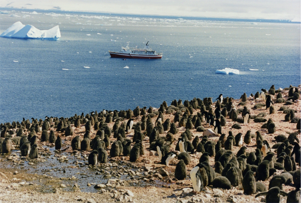
The Adélie penguin (''Pygoscelis adeliae'') is a species of penguin common along the entire coast of the Antarctic continent, which is the only place where it is found. It is the most widespread penguin species, and, along with the emperor penguin, is the most southerly distributed of all penguins. It is named after Adélie Land, in turn named for Adèle Dumont d'Urville, who was married to French explorer Jules Dumont d'Urville, who first discovered this penguin in 1840. Adélie penguins obtain their food by both predation and foraging, with a diet of mainly krill and fish. Taxonomy and systematics The first Adélie penguin specimens were collected by crew members of French explorer Jules Dumont d'Urville on his expedition to Antarctica in the late 1830s and early 1840s. Jacques Bernard Hombron and Honoré Jacquinot, two French surgeons who doubled as naturalists on the journey, described the bird for science in 1841, giving it the scientific name ''Catarrhactes adeli� ... [...More Info...] [...Related Items...] OR: [Wikipedia] [Google] [Baidu] |
Paulet Island
Paulet Island is a circular island about in diameter, lying south-east of Dundee Island, off the north-eastern end of the Antarctic Peninsula. Because of its large penguin colony, it is a popular destination for sightseeing tours. Description The island is composed of lava flows capped by a cinder cone with a small summit crater. Geothermal heat keeps parts of the island ice-free, and the youthful morphology of the volcano suggests that it was last active within the last 1,000 years. The island is part of the James Ross Island Volcanic Group. Historic monuments Paulet Island was discovered by a British expedition (1839–1843) under James Clark Ross and named by him for Captain the Right Honorable Lord George Paulet, Royal Navy. In 1903 during the Swedish Antarctic Expedition led by Otto Nordenskiöld his ship ''Antarctic'' was crushed and sunk by the ice off the coast of the island. A stone hut built in February 1903 by shipwreck survivors, together with the grave of an ... [...More Info...] [...Related Items...] OR: [Wikipedia] [Google] [Baidu] |
Weddell Sea
The Weddell Sea is part of the Southern Ocean and contains the Weddell Gyre. Its land boundaries are defined by the bay formed from the coasts of Coats Land and the Antarctic Peninsula. The easternmost point is Cape Norvegia at Princess Martha Coast, Queen Maud Land. To the east of Cape Norvegia is the King Haakon VII Sea. Much of the southern part of the sea is covered by a permanent, massive ice shelf field, the Filchner-Ronne Ice Shelf. The sea is contained within the two overlapping Antarctic territorial claims of Argentine Antarctica, the British Antarctic Territory, and also resides partially within the Antarctic Chilean Territory. At its widest the sea is around across, and its area is around . Various ice shelves, including the Filchner-Ronne Ice Shelf, fringe the Weddell sea. Some of the ice shelves on the east side of the Antarctic Peninsula, which formerly covered roughly of the Weddell Sea, had completely disappeared by 2002. The Weddell Sea has been deemed by ... [...More Info...] [...Related Items...] OR: [Wikipedia] [Google] [Baidu] |
Antarctic Peninsula
The Antarctic Peninsula, known as O'Higgins Land in Chile and Tierra de San Martín in Argentina, and originally as Graham Land in the United Kingdom and the Palmer Peninsula in the United States, is the northernmost part of mainland Antarctica. The Antarctic Peninsula is part of the larger peninsula of West Antarctica, protruding from a line between Cape Adams (Weddell Sea) and a point on the mainland south of the Eklund Islands. Beneath the ice sheet that covers it, the Antarctic Peninsula consists of a string of bedrock islands; these are separated by deep channels whose bottoms lie at depths considerably below current sea level. They are joined by a grounded ice sheet. Tierra del Fuego, the southernmost tip of South America, is about away across the Drake Passage. The Antarctic Peninsula is in area and 80% ice-covered. The marine ecosystem around the western continental shelf of the Antarctic Peninsula (WAP) has been subjected to rapid climate change. Over the past 50 ... [...More Info...] [...Related Items...] OR: [Wikipedia] [Google] [Baidu] |
Joinville Island Group
Joinville Island group is a group of antarctic islands, lying off the northeastern tip of the Antarctic Peninsula, from which Joinville Island group is separated by the Antarctic Sound. Joinville Island, located at , is the largest island of the Joinville Island group. Immediately north of Joinville Island and separated by Larsen Channel lies D'Urville Island, Antarctica, the northernmost island of the Joinville Island group, being located at . The Joinville Island group was discovered in 1838 by a French expedition under Captain Jules Dumont d'Urville. See also * Composite Antarctic Gazetteer * List of Antarctic and sub-Antarctic islands * List of Antarctic islands south of 60° S * SCAR * Territorial claims in Antarctica Seven sovereign states – Argentina, Australia, Chile, France, New Zealand, Norway, and the United Kingdom – have made eight territorial claims in Antarctica. These countries have tended to place their Antarctic scientific observation and st ... ... [...More Info...] [...Related Items...] OR: [Wikipedia] [Google] [Baidu] |
James Ross Island Group
The James Ross Island group is a group of islands located close to the northeastern tip of the Antarctic Peninsula. The largest islands in the group are James Ross Island, Snow Hill Island, Vega Island, and Seymour Island. The islands lie to the south of the Joinville Island group. The groups contains several scientific bases, notably Marambio Base ("Antarctica's Entrance Door") , motto = , anthem = , pushpin_map = Antarctica , pushpin_map_alt = Location within Antarctica , pushpin_map_caption = Location within Antarctica , ..., and numerous important palaeontological sites. See also * List of Antarctic and sub-Antarctic islands Islands of Graham Land {{GrahamLand-geo-stub ... [...More Info...] [...Related Items...] OR: [Wikipedia] [Google] [Baidu] |
HMS Erebus (1826)
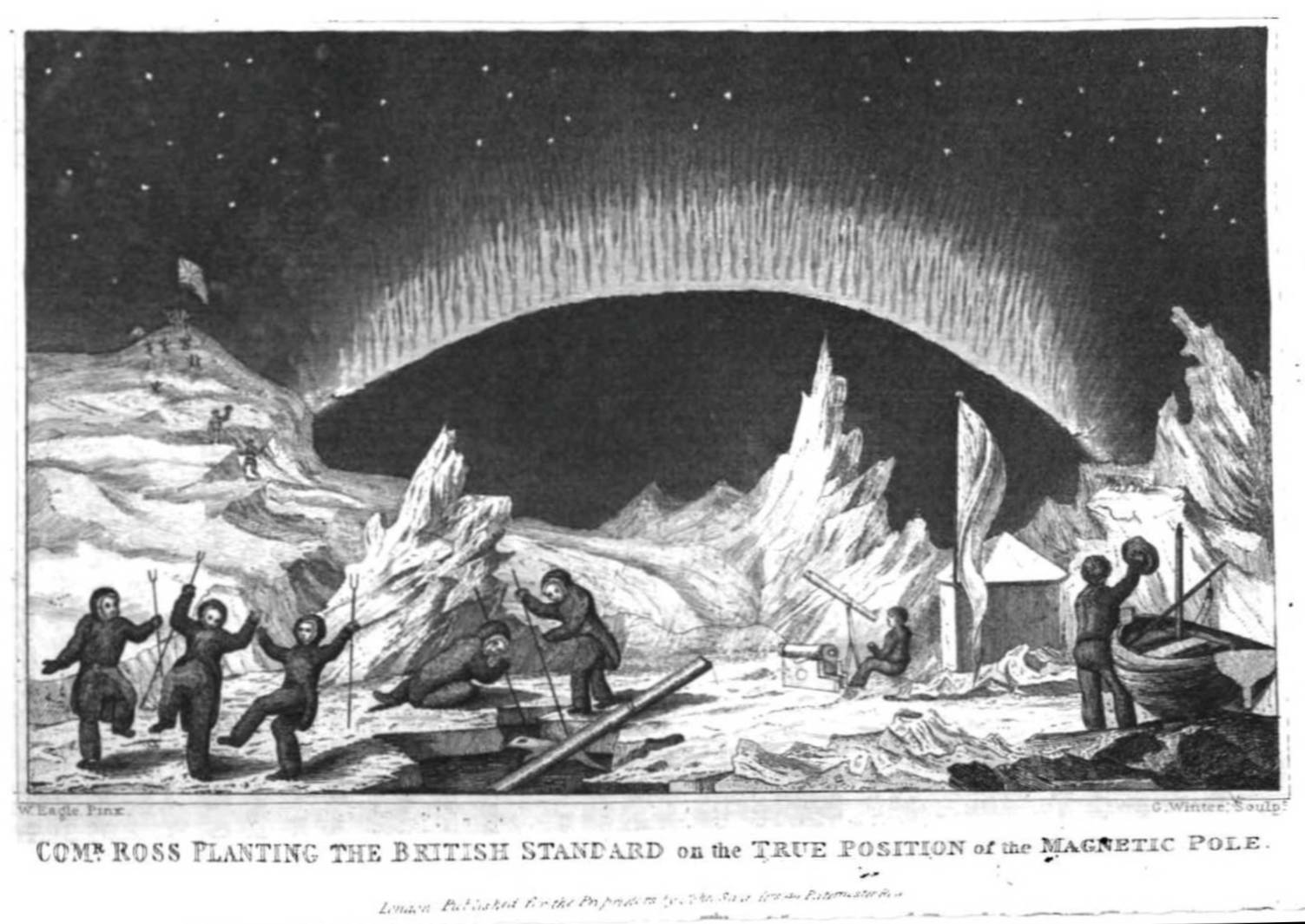
HMS ''Erebus'' was a constructed by the Royal Navy in Pembroke dockyard, Wales, in 1826. The vessel was the second in the Royal Navy named after Erebus, the personification of darkness in Greek mythology. The 372-ton ship was armed with two mortars – one and one – and 10 guns. The ship took part in the Ross expedition of 1839–1843, and was abandoned in 1848 during the third Franklin expedition. The sunken wreck was discovered by the Canadian Victoria Strait expedition in September 2014. Ross expedition After two years' service in the Mediterranean Sea, ''Erebus'' was refitted as an exploration vessel for Antarctic service, and on 21 November 1840 – captained by James Clark Ross – she departed from Van Diemen's Land (now Tasmania) for Antarctica in company with HMS ''Terror''. In January 1841, the crews of both ships landed on Victoria Land, and proceeded to name areas of the landscape after British politicians, scientists, and acquaintances. Mount E ... [...More Info...] [...Related Items...] OR: [Wikipedia] [Google] [Baidu] |
HMS Terror (1813)
HMS ''Terror'' was a specialised warship and a newly developed bomb vessel constructed for the Royal Navy in 1813. She participated in several battles of the War of 1812, including the Battle of Baltimore with the bombardment of Fort McHenry. She was converted into a polar exploration ship two decades later, and participated in George Back's Arctic expedition of 1836–1837, the successful Ross expedition to the Antarctic of 1839 to 1843, and Sir John Franklin's ill-fated attempt to force the Northwest Passage in 1845, during which she was lost with all hands along with . On 12 September 2016, the Arctic Research Foundation announced that the wreck of ''Terror'' had been found in Nunavut's Terror Bay, off the southwest coast of King William Island. The wreck was discovered south of the location where the ship was reported abandoned, and some from the wreck of HMS ''Erebus'', discovered in 2014. Early history and military service HMS ''Terror'' was a bomb ship built over ... [...More Info...] [...Related Items...] OR: [Wikipedia] [Google] [Baidu] |
James Clark Ross
Sir James Clark Ross (15 April 1800 – 3 April 1862) was a British Royal Navy officer and polar explorer known for his explorations of the Arctic, participating in two expeditions led by his uncle John Ross, and four led by William Edward Parry, and, in particular, for his own Antarctic expedition from 1839 to 1843. Biography Early life Ross was born in London, the son of George Ross and nephew of John Ross, under whom he entered the Royal Navy on 5 April 1812. Ross was an active participant in the Napoleonic Wars, being present at an action where HMS ''Briseis'', commanded by his uncle, captured ''Le Petit Poucet'' (a French privateer) on 9 October 1812. Ross then served successively with his uncle on HMS ''Actaeon'' and HMS ''Driver''. Arctic exploration Ross participated in John's unsuccessful first Arctic voyage in search of a Northwest Passage in 1818 aboard ''Isabella''. Between 1819 and 1827 Ross took part in four Arctic expeditions under William Ed ... [...More Info...] [...Related Items...] OR: [Wikipedia] [Google] [Baidu] |
Tabular Iceberg
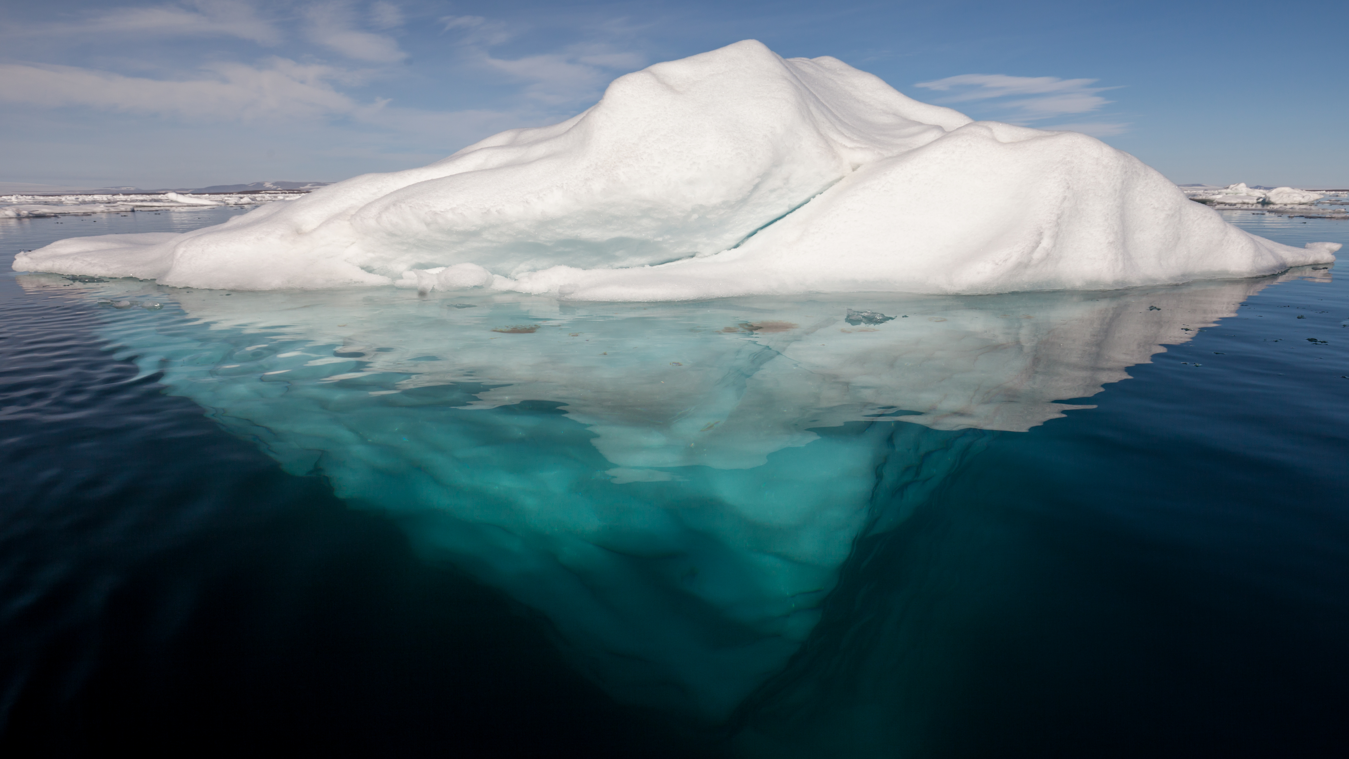
An iceberg is a piece of freshwater ice more than 15 m long that has broken off a glacier or an ice shelf and is floating freely in open (salt) water. Smaller chunks of floating glacially-derived ice are called "growlers" or "bergy bits". The sinking of the ''Titanic'' in 1912 led to the formation of the International Ice Patrol in 1914. Much of an iceberg is below the surface, which led to the expression "tip of the iceberg" to illustrate a small part of a larger unseen issue. Icebergs are considered a serious maritime hazard. Icebergs vary considerably in size and shape. Icebergs that calve from glaciers in Greenland are often irregularly shaped while Antarctic ice shelves often produce large tabular (table top) icebergs. The largest iceberg in recent history (2000), named B-15, measured nearly 300 km × 40 km. The largest iceberg on record was an Antarctic tabular iceberg of over [] sighted west of Scott Island, in the South Pacific Ocean, by the USS Glacier ( ... [...More Info...] [...Related Items...] OR: [Wikipedia] [Google] [Baidu] |
Barker Bank
Ula Point () is a low ice-covered point in the Erebus and Terror Gulf, on the northeast coast of James Ross Island, 5 miles (8 km) northwest of Cape Gage. First seen and roughly surveyed by Swedish Antarctic Expedition, 1901–04, under Otto Nordenskjold. It was resurveyed by Falkland Islands Dependencies Survey (FIDS) in 1945. Named by United Kingdom Antarctic Place-Names Committee (UK-APC) for Anton Olsen Ula, boatswain on the ''Antarctic'' the ship of the above Swedish expedition. Barker Bank is a submarine bank extending north from Ula Point into the Erebus and Terror Gulf. It has a least depth of . Its limits are not precisely defined. It was charted from HMS ''Endurance'', 1981–82, and named by the UK Antarctic Place-Names Committee after Captain Nicholas J. Barker, Royal Navy The Royal Navy (RN) is the United Kingdom's naval warfare force. Although warships were used by English and Scottish kings from the early medieval period, the first major maritime engagem ... [...More Info...] [...Related Items...] OR: [Wikipedia] [Google] [Baidu] |
Bays Of The James Ross Island Group
A bay is a recessed, coastal body of water that directly connects to a larger main body of water, such as an ocean, a lake, or another bay. A large bay is usually called a gulf, sea, sound, or bight. A cove is a small, circular bay with a narrow entrance. A fjord is an elongated bay formed by glacial action. A bay can be the estuary of a river, such as the Chesapeake Bay, an estuary of the Susquehanna River. Bays may also be nested within each other; for example, James Bay is an arm of Hudson Bay in northeastern Canada. Some large bays, such as the Bay of Bengal and Hudson Bay, have varied marine geology. The land surrounding a bay often reduces the strength of winds and blocks waves. Bays may have as wide a variety of shoreline characteristics as other shorelines. In some cases, bays have beaches, which "are usually characterized by a steep upper foreshore with a broad, flat fronting terrace".Maurice Schwartz, ''Encyclopedia of Coastal Science'' (2006), p. 129. Bays were sig ... [...More Info...] [...Related Items...] OR: [Wikipedia] [Google] [Baidu] |


.jpg)


