|
Equatorial Atlantic Magmatic Province
The Equatorial Atlantic Magmatic Province (EQUAMP) is a Cretaceous large igneous province (LIP) in South America covering . The break-up of the supercontinent Gondwana resulted in a series of large volcanic eruptions, but EQUAMP is the only Gondwanan LIP composed exclusively of intrusive rock, making it a Large Plutonic Province (LPP). During the Pan-African- Brasiliano orogenies the São Francisco- Congo craton collided with the West African craton to form the Borborema Province in northeastern Brazil. Neoproterozoic shear zones divide this province into terranes that merged during the formation of West Gondwana (South America and Africa). Intracontinental rifts developed in the early Palaeozoic and when the central Atlantic opened during the late Mesozoic dike swarms and sills were emplaced, including the hundreds of kilometres long Rio Ceará-Mirim dike swarm. These dikes have been dated to 145–110 . On the Amazonian craton west of the Borborema Province, a sedi ... [...More Info...] [...Related Items...] OR: [Wikipedia] [Google] [Baidu] |
Large Igneous Province
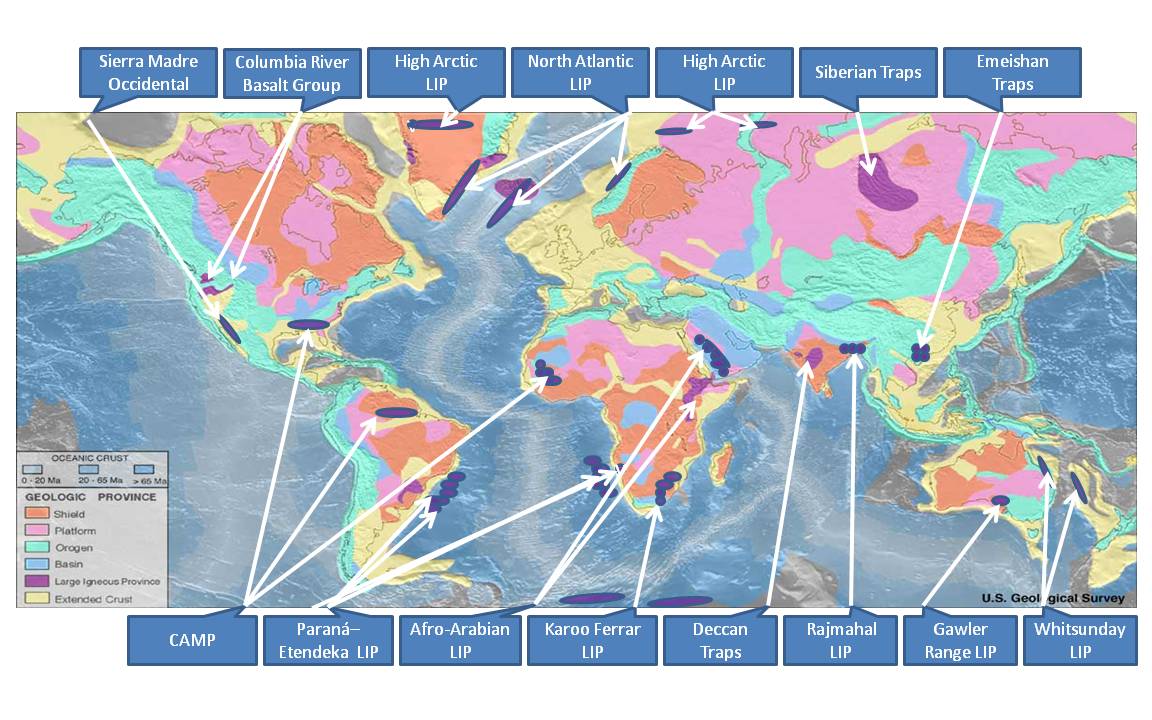
A large igneous province (LIP) is an extremely large accumulation of igneous rocks, including intrusive (sills, dikes) and extrusive (lava flows, tephra deposits), arising when magma travels through the crust towards the surface. The formation of LIPs is variously attributed to mantle plumes or to processes associated with divergent plate tectonics. The formation of some of the LIPs in the past 500 million years coincide in time with mass extinctions and rapid climatic changes, which has led to numerous hypotheses about causal relationships. LIPs are fundamentally different from any other currently active volcanoes or volcanic systems. Definition In 1992 researchers first used the term ''large igneous province'' to describe very large accumulations—areas greater than 100,000 square kilometers (approximately the area of Iceland)—of mafic igneous rocks that were erupted or emplaced at depth within an extremely short geological time interval: a few million years or less. Maf ... [...More Info...] [...Related Items...] OR: [Wikipedia] [Google] [Baidu] |
Dike Swarm
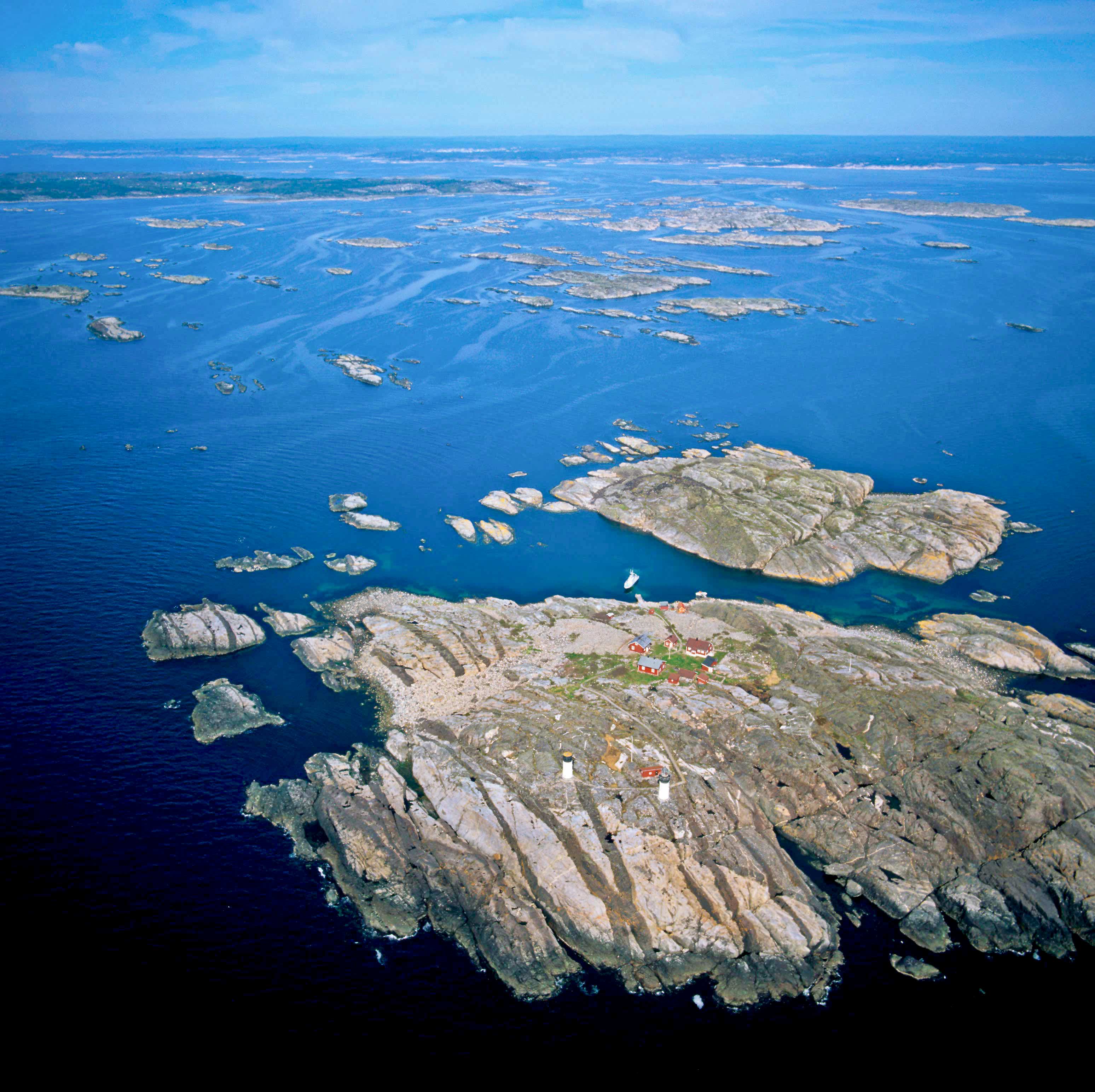
A dike swarm (American spelling) or dyke swarm (British spelling) is a large geological structure consisting of a major group of parallel, linear, or radially oriented magmatic dikes intruded within continental crust or central volcanoes in rift zones. Examples exist in Iceland and near other large volcanoes, (stratovolcanoes, calderas, shield volcanoes and other fissure systems) around the world. They consist of several to hundreds of dikes emplaced more or less contemporaneously during a single intrusive event, are magmatic and stratigraphic, and may form a large igneous province. The occurrence of mafic dike swarms in Archean and Paleoproterozoic terrains is often cited as evidence for mantle plume activity associated with abnormally high mantle potential temperatures. Dike swarms may extend over in width and length. The largest dike swarm known on Earth is the Mackenzie dike swarm in the western half of the Canadian Shield in Canada, which is more than wide and ... [...More Info...] [...Related Items...] OR: [Wikipedia] [Google] [Baidu] |
Hotspot (geology)
In geology, hotspots (or hot spots) are volcanic locales thought to be fed by underlying mantle that is anomalously hot compared with the surrounding mantle. Examples include the Hawaii, Iceland, and Yellowstone hotspots. A hotspot's position on the Earth's surface is independent of tectonic plate boundaries, and so hotspots may create a chain of volcanoes as the plates move above them. There are two hypotheses that attempt to explain their origins. One suggests that hotspots are due to mantle plumes that rise as thermal diapirs from the core–mantle boundary. The alternative plate theory is that the mantle source beneath a hotspot is not anomalously hot, rather the crust above is unusually weak or thin, so that lithospheric extension permits the passive rising of melt from shallow depths. Origin The origins of the concept of hotspots lie in the work of J. Tuzo Wilson, who postulated in 1963 that the formation of the Hawaiian Islands resulted from the slow movement of a tecton ... [...More Info...] [...Related Items...] OR: [Wikipedia] [Google] [Baidu] |
Rio Grande Rise
The Rio Grande Rise, also called the Rio Grande Elevation or Bromley Plateau, is an aseismic ocean ridge in the southern Atlantic Ocean off the coast of Brazil. Together with the Walvis Ridge off Africa, the Rio Grande Rise forms a V-shaped structure of mirrored hotspot tracks or seamount chains across the northern South Atlantic. In 2013, Brazilian scientists announced that they found granite boulders on the Rio Grande Rise and speculated that it could be the remains of a submerged continent, which they called the "Brazilian Atlantis". Other researchers, however, noted that such boulders can end-up on the ocean floor by less speculative means. Geology The Rio Grande Rise separates the Santos and Pelotas Basins and is composed of western and eastern areas, which have different geological backgrounds. The western area has numerous guyots and seamounts and a basement dated to . The eastern area is covered by fracture zones and may represent an abandoned spreading centre. In the ... [...More Info...] [...Related Items...] OR: [Wikipedia] [Google] [Baidu] |
Walvis Ridge
The Walvis Ridge (''walvis'' means whale in Dutch and Afrikaans) is an aseismic ocean ridge in the southern Atlantic Ocean. More than in length, it extends from the Mid-Atlantic Ridge, near Tristan da Cunha and the Gough Islands, to the African coast (at 18°S in northern Namibia). The Walvis Ridge is one of few examples of a hotspot seamount chain that links a flood basalt province to an active hotspot. It is also considered one of the most important hotspot tracks because the Tristan Hotspot is one of few primary or deep mantle hotspots. Geology Apart from the Mid-Atlantic Ridge, the Walvis Ridge and the Rio Grande Rise are the most distinctive feature of the South Atlantic sea floor. They originated from hotspot volcanism and together they form a mirrored symmetry across the Mid-Atlantic Ridge, with the Tristan Hotspot at its centre. Two of the distinct sections in the Walvis Ridge have similar mirrored regions in the Rio Grande Rise; for example, the eastern section of the ... [...More Info...] [...Related Items...] OR: [Wikipedia] [Google] [Baidu] |
Paraná And Etendeka Traps
The Paraná-Etendeka traps (or Paraná and Etendeka Plateau; or Paraná and Etendeka Province) comprise a large igneous province that includes both the main Paraná traps (in Paraná Basin, a South American geological basin) as well as the smaller severed portions of the flood basalts at the Etendeka traps (in northwest Namibia and southwest Angola). The original basalt flows occurred 138 to 128 million years ago. The province had a post-flow surface area of and an original volume projected to be in excess of 2.3 x 10⁶ km³. Geodynamics The basalt samples at Paraná and Etendeka have an age of about 132 Ma, during the Valanginian stage of the Early Cretaceous. Indirectly, the rifting and extension are probably the origin of the Paraná and Etendeka traps and it could be the origin of the Gough and Tristan da Cunha Islands as well, as they are connected by the Walvis Ridge (Gough/Tristan hotspot). The seamounts of the Rio Grande Rise (25°S to 35°S) that go eastwards fro ... [...More Info...] [...Related Items...] OR: [Wikipedia] [Google] [Baidu] |
Central Atlantic Magmatic Province
The Central Atlantic magmatic province (CAMP) is the Earth's largest continental large igneous province, covering an area of roughly 11 million km2. It is composed mainly of basalt that formed before Pangaea broke up in the Mesozoic Era, near the end of the Triassic and the beginning of the Jurassic periods. The subsequent breakup of Pangaea created the Atlantic Ocean, but the massive igneous upwelling provided a legacy of basaltic dikes, sills, and lavas now spread over a vast area around the present central North Atlantic Ocean, including large deposits in northwest Africa, southwest Europe, as well as northeast South and southeast North America (found as continental tholeiitic basalts in subaerial flows and intrusive bodies). The name and CAMP acronym were proposed by Andrea Marzoli (Marzoli et al. 1999) and adopted at a symposium held at the 1999 Spring Meeting of the American Geophysical Union. The CAMP volcanic eruptions occurred about 201 million years ago and split into ... [...More Info...] [...Related Items...] OR: [Wikipedia] [Google] [Baidu] |
Parnaíba Basin
The Parnaíba Basin (Portuguese: ''Bacia do Parnaíba'') is a large cratonic sedimentary basin located in the North and Northeast portion of Brazil Brazil ( pt, Brasil; ), officially the Federative Republic of Brazil (Portuguese: ), is the largest country in both South America and Latin America. At and with over 217 million people, Brazil is the world's fifth-largest country by area .... About 50% of its areal distribution occurs in the state of Maranhão, and the other 50% occurring in the state of Pará, Piauí, Tocantins, and Ceará, Cearâ. It is one of the largest Paleozoic basins in the South American Plate, South American Platform. The basin has a roughly Ellipse, ellipsoidal shape, occupies over 600,000 km2, and is composed of ~3.4 km of mainly Paleozoic sedimentary rock that overlies localized rifts. The basin as named after the Parnaíba River, which is approximately 1,400 km (870 mi) long, and runs relatively parallel to the major axis ... [...More Info...] [...Related Items...] OR: [Wikipedia] [Google] [Baidu] |
Sedimentary Basin
Sedimentary basins are region-scale depressions of the Earth's crust where subsidence has occurred and a thick sequence of sediments have accumulated to form a large three-dimensional body of sedimentary rock. They form when long-term subsidence creates a regional depression that provides Accommodation (geology), accommodation space for accumulation of sediments. Over millions or tens or hundreds of millions of years the deposition of sediment, primarily gravity-driven transportation of water-borne eroded material, acts to fill the depression. As the sediments are buried, they are subject to increasing pressure and begin the processes of compaction (geology), compaction and lithification that transform them into sedimentary rock. Sedimentary basins are created by deformation of Earth's lithosphere in diverse geological settings, usually as a result of plate tectonics, plate tectonic activity. Mechanisms of crustal deformation that lead to subsidence and sedimentary basin formati ... [...More Info...] [...Related Items...] OR: [Wikipedia] [Google] [Baidu] |
Amazonian Craton
The Amazonian Craton is a geologic province located in South America. It occupies a large portion of the central, north and eastern part of the continent and represents one of Earth's largest cratonic regions. The Guiana Shield and Central Brazil Shield (Guaporé Shield) constitute respectively the northern and southern exhumed parts of the craton. Between the two shields lies the Amazon Rift, a zone of weakness within the craton. Smaller cratons of Precambrian rocks south of the Amazonian Shield are the Río de la Plata Craton and the São Francisco Craton, which lies to the east. The Río Apa Craton at the Paraguay-Brazil border is considered be likely just the southern part of the Amazonian Craton. The rocks of Río Apa were deformed during the Sunsás orogeny. It has been suggested that the Late Mesoproterozoic– Early Neoproterozoic aged Sveconorwegian Orogen in Fennoscandia could have been caused by a continent–continent collision between the Amazonia and Balti ... [...More Info...] [...Related Items...] OR: [Wikipedia] [Google] [Baidu] |


