|
Entre Ríos, Tarija
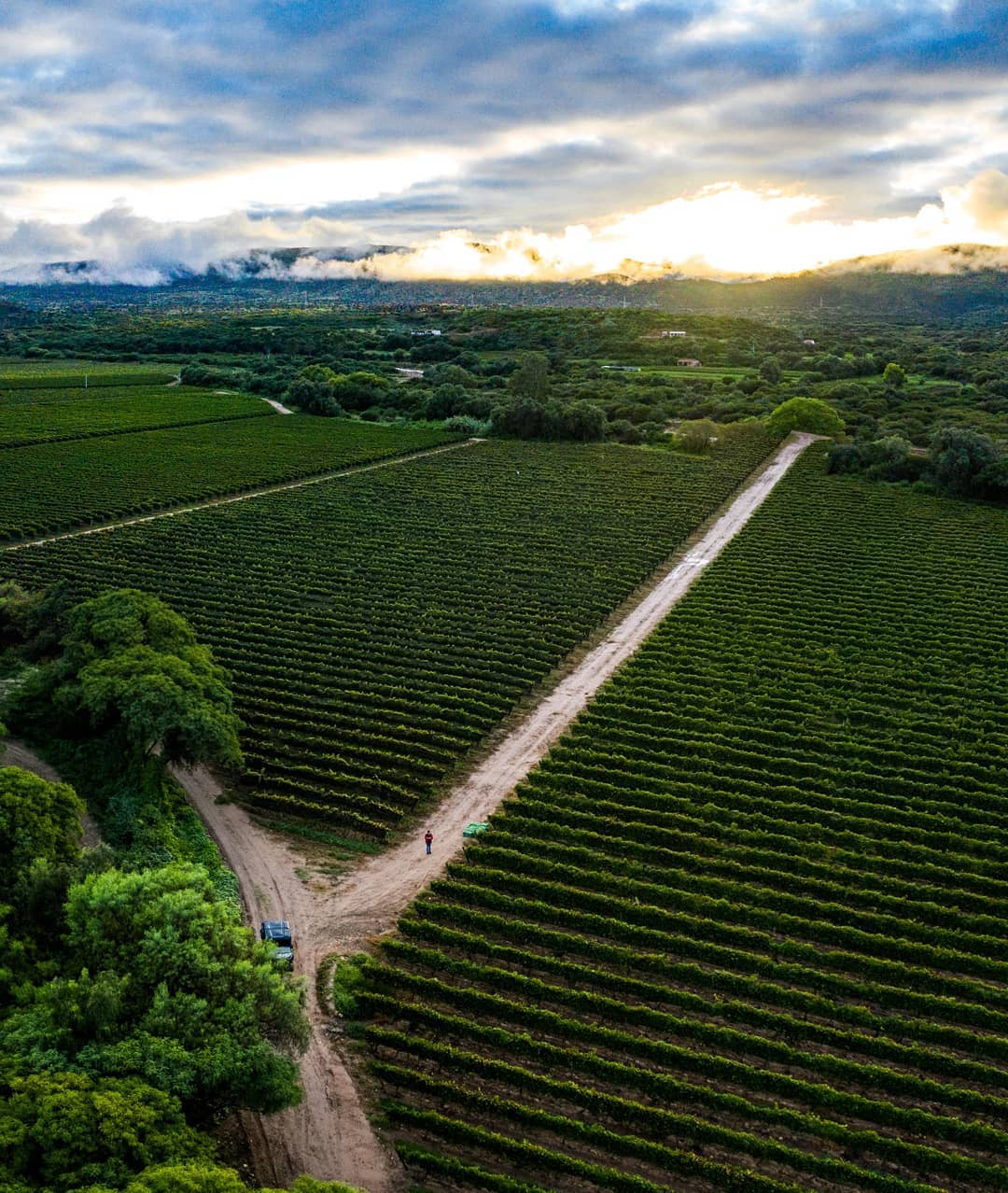
Entre Ríos (Spanish: "''Between the rivers''") is a town in the Bolivian Tarija Department. Location Entre Ríos is the administrative center of Burdett O'Connor Province. It is located at an altitude of at the confluence of Río Tambo and one of its tributaries, and a three-hour ride east of Tarija, the departmental capital. The town is bordered by north-southerly mountain ranges and situated in an elongated triangular hollow of length. It was previously called San Luis. Climate The average yearly temperature of Entre Ríos is 20.9 °C, the yearly precipitation of 1,300 mm appears mainly in the summer's wet season from January to March. Population Entre Ríos' population at the 2001 census was 2,413 and rose to circa 2,800 people in 2007. The Entre Ríos region is still one of the main settlement areas of the Guaraní people who have inhabited the Paraná Basin The Paraná Basin ( pt, Bacia do Paraná, es, Cuenca del Paraná) is a large cratonic sedimentary b ... [...More Info...] [...Related Items...] OR: [Wikipedia] [Google] [Baidu] |
Flag Of Bolivia
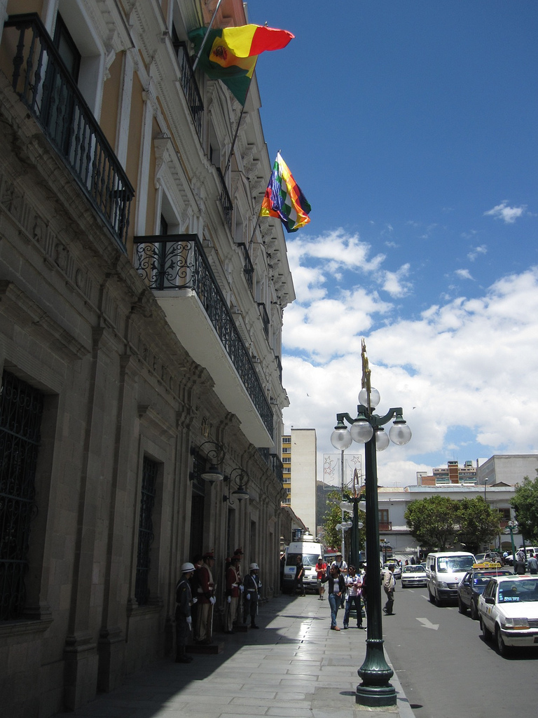
The flag of Bolivia is the national flag of the Bolivia, Plurinational State of Bolivia. It was originally adopted in 1851. The state and war flag is a horizontal tricolour (flag), tricolor of red, yellow and green with the Coat of Arms of Bolivia, Bolivian coat of arms in the center. According to one source, the red stands for Bolivia's brave soldiers, while the green symbolizes soil fertility, fertility and yellow the nation's mineral deposits. Since 2009 the Wiphala also holds the status of ''dual flag'' in the country. According to the revised Constitution of Bolivia of 2009, the Wiphala is considered a national symbol of Bolivia (along with the flag, national anthem, Coat of arms of Bolivia, coat of arms, the cockade; Cantua buxifolia, kantuta flower and patujú flower). Despite its landlocked status, Bolivia has a naval ensign used by navy vessels on rivers and lakes. It consists of a blue field with the state flag in the Flag terminology, canton bordered by nine small y ... [...More Info...] [...Related Items...] OR: [Wikipedia] [Google] [Baidu] |
Bolivia
, image_flag = Bandera de Bolivia (Estado).svg , flag_alt = Horizontal tricolor (red, yellow, and green from top to bottom) with the coat of arms of Bolivia in the center , flag_alt2 = 7 × 7 square patchwork with the (top left to bottom right) diagonals forming colored stripes (green, blue, purple, red, orange, yellow, white, green, blue, purple, red, orange, yellow, from top right to bottom left) , other_symbol = , other_symbol_type = Dual flag: , image_coat = Escudo de Bolivia.svg , national_anthem = " National Anthem of Bolivia" , image_map = BOL orthographic.svg , map_width = 220px , alt_map = , image_map2 = , alt_map2 = , map_caption = , capital = La Paz Sucre , largest_city = , official_languages = Spanish , languages_type = Co-official languages , languages ... [...More Info...] [...Related Items...] OR: [Wikipedia] [Google] [Baidu] |
Departments Of Bolivia
Bolivia is a unitary state consisting of nine departments ( es, departamentos). Departments are the primary subdivisions of Bolivia, and possess certain rights under the Constitution of Bolivia. Each department is represented in the Plurinational Legislative Assembly—a bicameral legislature consisting of the Senate and the Chamber of Deputies. Each department is represented by four Senators, while Deputies are awarded to each department in proportion to their total population. Out of the nine departments, La Paz was originally the most populous, with 2,706,351 inhabitants as of 2012 but the far eastern department of Santa Cruz has since surpassed it by 2020; Santa Cruz also claims the title as the largest, encompassing . Pando is the least populated, with a population of 110,436. The smallest in area is Tarija, encompassing . Departments Former Departments By population Notes See also * ISO 3166-2:BO, the ISO codes for the departments of Bolivia. * Bolivi ... [...More Info...] [...Related Items...] OR: [Wikipedia] [Google] [Baidu] |
Tarija Department
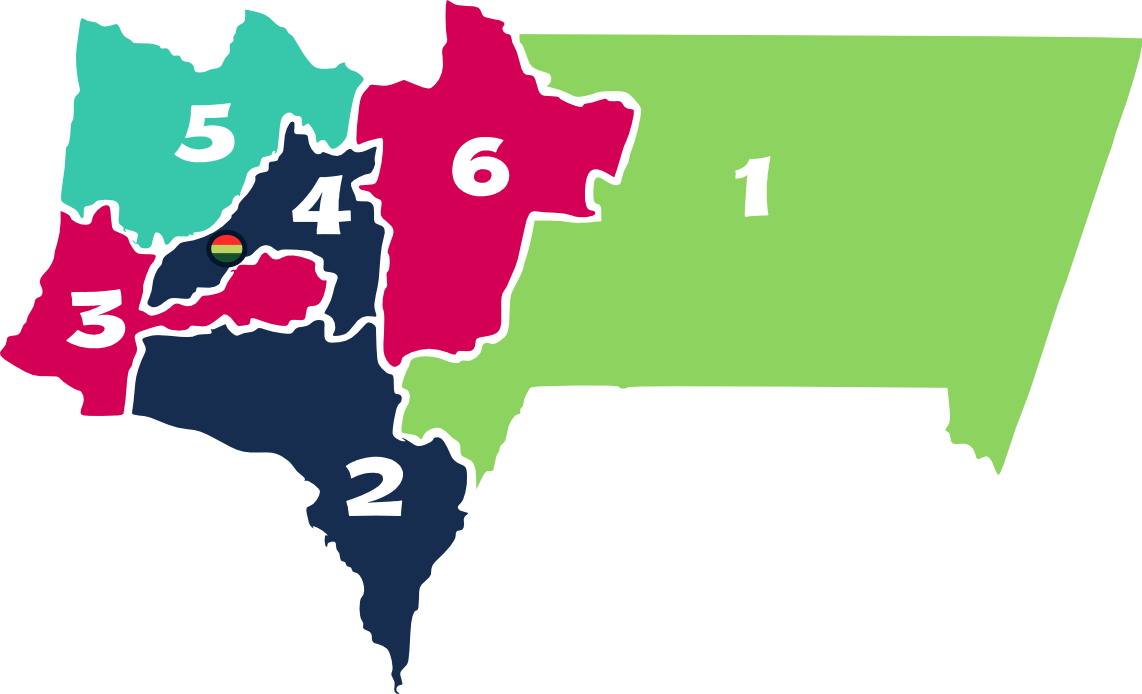
Tarija () is a department in Bolivia. It is located in south-eastern Bolivia bordering with Argentina to the south and Paraguay to the east. According to the 2012 census, it has a population of 482,196 inhabitants. It has an area of . The city of Tarija is the capital of the department. Subdivisions The department is divided into five provinces and one autonomous region: # Gran Chaco Province (autonomous region) # Aniceto Arce Province # José María Avilés Province # Cercado Province # Eustaquio Méndez Province # Burdett O'Connor Province Notable places in Tarija include: * Villamontes in the department's oil-producing eastern scrubland. Villamontes has recorded the hottest temperature ever in Bolivia, , several times, most recently on 29 October 2010. * Bermejo, a border town adjoining Aguas Blancas, Argentina * Yacuiba, a border town with Argentina. The Department of Tarija is renowned for its mild, pleasant climate, and comprises one of the country's foremost agric ... [...More Info...] [...Related Items...] OR: [Wikipedia] [Google] [Baidu] |
Provinces Of Bolivia
A province is the second largest administrative division in Bolivia, after a department. Each department is divided into provinces. There are 112 provinces. The country's provinces are further divided into 337 municipalities which are administered by an alcalde and municipal council. List of provinces Beni Department Chuquisaca Department Cochabamba Department La Paz Department Oruro Department Pando Department Potosí Department Santa Cruz Department Tarija Department See also * Departments of Bolivia * Municipalities of Bolivia Municipalities in Bolivia are administrative divisions of the entire national territory governed by local elections. Municipalities are the third level of administrative divisions, below departments and provinces. Some of the provinces consist of ... Sources Instituto Nacional de Estadística - Bolivia(Spanish) {{Articles on second-level administrative divisions of South American countries Subd ... [...More Info...] [...Related Items...] OR: [Wikipedia] [Google] [Baidu] |
Burdett O'Connor Province
Burdett O'Connor is a province in the northern part of Tarija Department in Bolivia. The province is also known as Burdett O'Connor and is named after Francisco Burdett O'Connor, a chronicler of the South American War of Independence and the making of Tarija. Location Burdett O'Connor province is one of six provinces in the Tarija Department. It is located between 20° 53' and 21° 58' south and between 63° 36' and 64° 26' west. The province borders Chuquisaca Department in the north, Eustaquio Méndez Province in the north-west, Cercado Province in the west, Aniceto Arce Province in the south-west, and Gran Chaco Province in the south and east. The province extends over from north to south, and from east to west. Population The main language of the province is Spanish, spoken by 98.4%, while 10.3% of the population speak Guaraní, also 1.8 speak Quechua, and 0.3% Aymara (by western immigrants). The population increased from 17,763 inhabitants (1992 census) to 19,33 ... [...More Info...] [...Related Items...] OR: [Wikipedia] [Google] [Baidu] |
Spanish Language
Spanish ( or , Castilian) is a Romance languages, Romance language of the Indo-European language family that evolved from colloquial Latin spoken on the Iberian peninsula. Today, it is a world language, global language with more than 500 million native speakers, mainly in the Americas and Spain. Spanish is the official language of List of countries where Spanish is an official language, 20 countries. It is the world's list of languages by number of native speakers, second-most spoken native language after Mandarin Chinese; the world's list of languages by total number of speakers, fourth-most spoken language overall after English language, English, Mandarin Chinese, and Hindustani language, Hindustani (Hindi-Urdu); and the world's most widely spoken Romance languages, Romance language. The largest population of native speakers is in Mexico. Spanish is part of the Iberian Romance languages, Ibero-Romance group of languages, which evolved from several dialects of Vulgar Latin in I ... [...More Info...] [...Related Items...] OR: [Wikipedia] [Google] [Baidu] |
Tarija, Bolivia
Tarija or San Bernardo de la Frontera de Tarixa is a city in southern Bolivia. Founded in 1574, Tarija is the largest city and capital and municipality within the Tarija Department, with an airport (Capitán Oriel Lea Plaza Airport, (TJA)) offering regular service to primary Bolivian cities, as well as a regional bus terminal with domestic and international connections. Its climate is semi-arid (BSh) with generally mild temperatures in contrast to the harsh cold of the Altiplano (e.g., La Paz) and the year-round humid heat of the Amazon Basin (e.g., Santa Cruz de la Sierra). Tarija has a population of 234,442. History The name of ''Tarija'' is said to come from Francisco de Tarija or Tarifa. However, researched information disproves that probability. Members of the first group of Spaniards to enter the valley where present-day Tarija is situated, stated that the name of Tarija was already in use. This group did not include anyone by the name of Francisco de Tarija. Similar-s ... [...More Info...] [...Related Items...] OR: [Wikipedia] [Google] [Baidu] |
Wet Season
The wet season (sometimes called the Rainy season) is the time of year when most of a region's average annual rainfall occurs. It is the time of year where the majority of a country's or region's annual precipitation occurs. Generally, the season lasts at least a month. The term ''green season'' is also sometimes used as a euphemism by tourist authorities. Areas with wet seasons are dispersed across portions of the tropics and subtropics. Under the Köppen climate classification, for tropical climates, a wet season month is defined as a month where average precipitation is or more. In contrast to areas with savanna climates and monsoon regimes, Mediterranean climates have wet winters and dry summers. Dry and rainy months are characteristic of tropical seasonal forests: in contrast to tropical rainforests, which do not have dry or wet seasons, since their rainfall is equally distributed throughout the year.Elisabeth M. Benders-Hyde (2003)World Climates.Blue Planet Biomes. Retr ... [...More Info...] [...Related Items...] OR: [Wikipedia] [Google] [Baidu] |
Census
A census is the procedure of systematically acquiring, recording and calculating information about the members of a given population. This term is used mostly in connection with national population and housing censuses; other common censuses include censuses of agriculture, traditional culture, business, supplies, and traffic censuses. The United Nations (UN) defines the essential features of population and housing censuses as "individual enumeration, universality within a defined territory, simultaneity and defined periodicity", and recommends that population censuses be taken at least every ten years. UN recommendations also cover census topics to be collected, official definitions, classifications and other useful information to co-ordinate international practices. The UN's Food and Agriculture Organization (FAO), in turn, defines the census of agriculture as "a statistical operation for collecting, processing and disseminating data on the structure of agriculture, covering th ... [...More Info...] [...Related Items...] OR: [Wikipedia] [Google] [Baidu] |
Guarani People
Guarani, Guaraní or Guarany may refer to Ethnography * Guaraní people, an indigenous people from South America's interior (Brazil, Argentina, Paraguay and Bolivia) * Guaraní language, or Paraguayan Guarani, an official language of Paraguay * Guarani dialects, spoken in Argentina, Brazil, Bolivia, and Paraguay * Guarani languages, a group of languages, including Guarani, in the Tupí-Guaraní language subfamily * Eastern Bolivian Guarani, historically called Chiriguanos, living in the eastern Bolivian foothills of the Andes. Also called Ava Guarani. Economics * Paraguayan guaraní, the currency of Paraguay Education * The Guarini School of Graduate and Advanced Studies, a subunit of Dartmouth College Geography * Guarani, Minas Gerais, Brazil * Guarani de Goiás, Brazil * Guarani das Missões, Rio Grande do Sul, Brazil * Guarani Aquifer, a large underground water reservoir in South America Literature and music * ''The Guarani'', an 1857 novel by José de Alencar * ''I ... [...More Info...] [...Related Items...] OR: [Wikipedia] [Google] [Baidu] |
Paraná Basin
The Paraná Basin ( pt, Bacia do Paraná, es, Cuenca del Paraná) is a large cratonic sedimentary basin situated in the central-eastern part of South America. About 75% of its areal distribution occurs in Brazil, from Mato Grosso to Rio Grande do Sul states. The remainder area is distributed in eastern Paraguay, northeastern Argentina and northern Uruguay. The shape of the depression is roughly Ellipse, elliptical and covers an area of about . The Paraná River, from which the Paraná Basin derived its name, flows along the central axis of the Paraná Basin and drains it. Description The Paraná Basin stretches from the Brazilian state of Mato Grosso in the north to northern Argentina and Uruguay in the south. The southern portion in Uruguay is locally known as Norte Basin.De Santa Ana et al., 2004, p.88Daners et al., 2006, p.148 Pioneer studies The first study on the Brazilian side of the Paraná Basin dates from 1841, when a Brazilian Empire, Brazilian Imperial Govern ... [...More Info...] [...Related Items...] OR: [Wikipedia] [Google] [Baidu] |


