|
Enterprise, Oklahoma
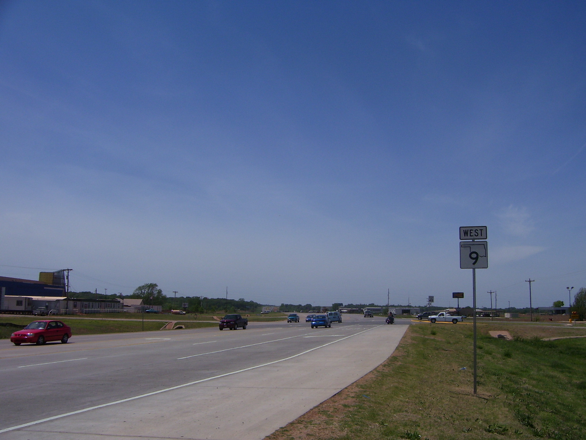
Enterprise is an unincorporated community and census-designated place (CDP) in Haskell County, Oklahoma, United States. It was first listed as a CDP following the 2010 census. The CDP is in western Haskell County. State highways 9 and 71 intersect in the northern part of the community. Highway 9 leads east to Whitefield and west to Eufaula, while Highway 71 leads northeast across Eufaula Dam to Porum and south to Quinton. Enterprise is in the valley of Brooken Creek, which flows north to the Canadian River The Canadian River is the longest tributary of the Arkansas River in the United States. It is about long, starting in Colorado and traveling through New Mexico, the Texas Panhandle, and Oklahoma. The drainage area is about .Foots ... [...More Info...] [...Related Items...] OR: [Wikipedia] [Google] [Baidu] |
Census-designated Place
A census-designated place (CDP) is a Place (United States Census Bureau), concentration of population defined by the United States Census Bureau for statistical purposes only. CDPs have been used in each decennial census since 1980 as the counterparts of incorporated places, such as self-governing city (United States), cities, town (United States), towns, and village (United States), villages, for the purposes of gathering and correlating statistical data. CDPs are populated areas that generally include one officially designated but currently unincorporated area, unincorporated community, for which the CDP is named, plus surrounding inhabited countryside of varying dimensions and, occasionally, other, smaller unincorporated communities as well. CDPs include small rural communities, Edge city, edge cities, colonia (United States), colonias located along the Mexico–United States border, and unincorporated resort and retirement community, retirement communities and their environs. ... [...More Info...] [...Related Items...] OR: [Wikipedia] [Google] [Baidu] |
Footsie Blair
Clarence Vick "Footsie" Blair (July 13, 1900 – July 1, 1982) was an American second baseman in Major League Baseball (MLB). He played three seasons in the majors, from 1929 to 1931, for the Chicago Cubs. In a 246 game major league career, Blair posted a .273 batting average (243-for-890) with 138 runs, 10 home runs and 96 RBIs. Playing at first, second and third base, he recorded a .960 fielding percentage In baseball statistics, fielding percentage, also known as fielding average, is a measure that reflects the percentage of times a baseball positions, defensive player properly handles a batted or thrown ball. It is calculated by the sum of putout .... External links 1900 births 1982 deaths Major League Baseball second basemen Baseball players from Oklahoma People from Haskell County, Oklahoma Chicago Cubs players 20th-century American sportsmen {{US-baseball-second-baseman-stub ... [...More Info...] [...Related Items...] OR: [Wikipedia] [Google] [Baidu] |
Canadian River
The Canadian River is the longest tributary of the Arkansas River in the United States. It is about long, starting in Colorado and traveling through New Mexico, the Texas Panhandle, and Oklahoma. The drainage area is about .Dianna Everett, "Canadian River." ''Encyclopedia of Oklahoma History and Culture''. Retrieved October 7, 2013. The Canadian is sometimes referred to as the South Canadian River to differentiate it from the that flows into it. Etymology On |
Porum, Oklahoma
Porum is a town in Muskogee County, Oklahoma, United States. It was named for John Porum Davis, a rancher, Civil War veteran, and Cherokee Nation councilman from the Canadian District in Indian Territory. The community was first known as Porum Gap, which united with another village named Starvilla in 1905. The product of this union became the present town of Porum. The population was 727 at the 2010 census, an increase of 0.3 percent from the figure of 725 recorded in 2000.Ellen Collins Johnson, "Porum," ''Encyclopedia of Oklahoma History and Culture''. Accessed May 2, 2015. History The area is rich in history, including that of the Starr clan who were of the Cherokee "Treaty faction" and became immersed in troubles during the ...[...More Info...] [...Related Items...] OR: [Wikipedia] [Google] [Baidu] |
Eufaula Dam
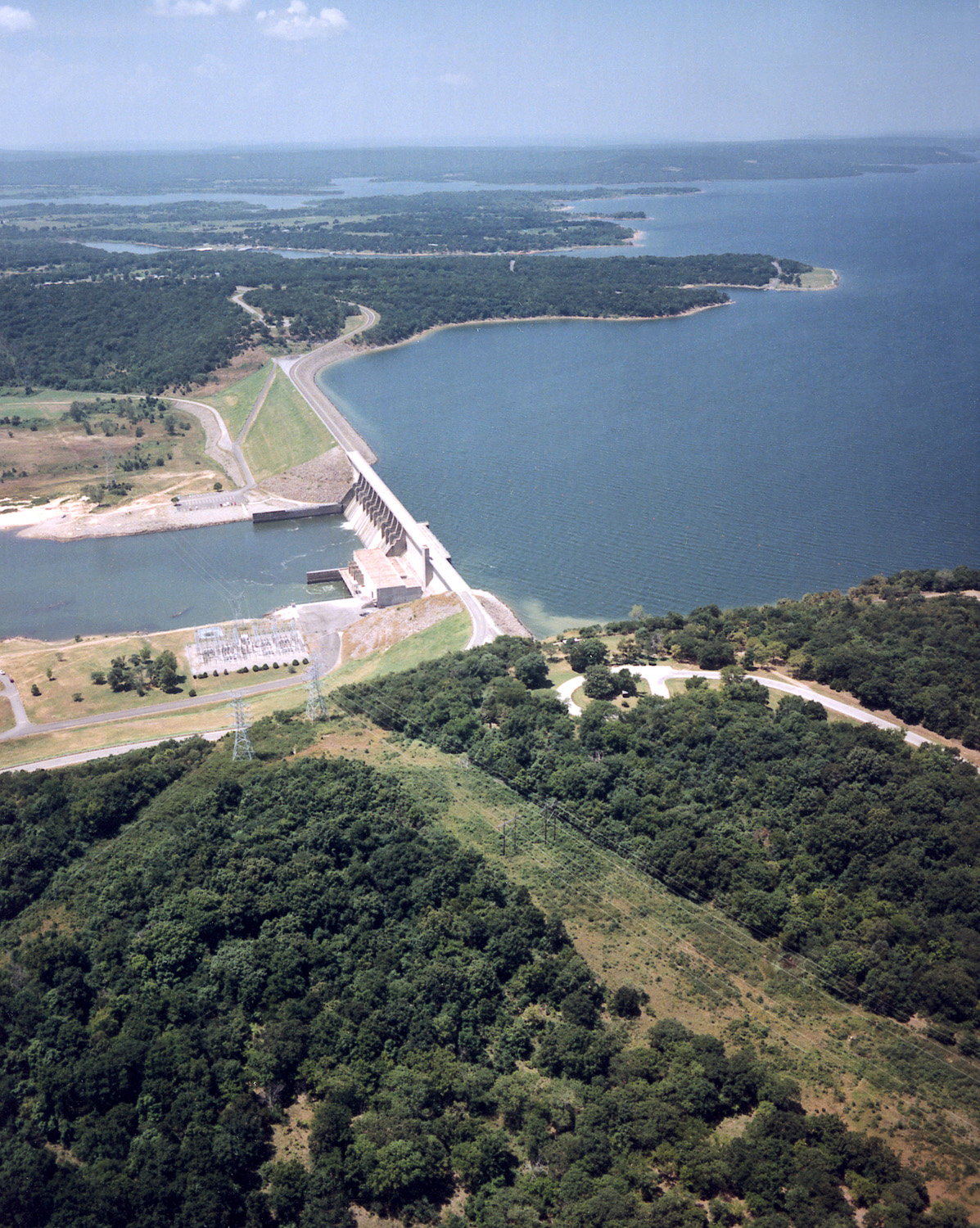
Eufaula Dam is a dam across the Canadian River in Oklahoma. Completed in 1964, it impounds Eufaula Lake, one of the world's largest man-made lakes, covering 102,500 acres (41,500 hectares). The dam serves to provide flood control, water supply, navigation and hydroelectric power generation. It supports a 90 MW power station; three generators produce 30 MW each.Corey JonesState to mark 50 years since Lake Eufaula's dedication by LBJ ''Tulsa World'' (September 24, 2014). History State Highway 71 runs across the top of the dam. The dam was approved by Rivers and Harbors Act of 1946 and construction began in December 1956. The cost of the project, completed by the U.S. Army Corps of Engineers, was $121,735,000. The flood-control operations of the dam were in place by February 1964, and the dam dedicated by President Lyndon B. Johnson on September 25, 1964. Heavy rains in the spring of 2015, caused Eufaula Lake to rise so rapidly that the Corps of Engineers had to open the flood gate ... [...More Info...] [...Related Items...] OR: [Wikipedia] [Google] [Baidu] |
Eufaula, Oklahoma
Eufaula is a city in and the county seat of McIntosh County, Oklahoma, McIntosh County, Oklahoma, United States. The population was 2,813 at the 2010 census, an increase of 6.6 percent from 2,639 in 2000. Eufaula is in the southern part of the county, north of McAlester, Oklahoma, McAlester and south of Muskogee, Oklahoma, Muskogee.John C. Harkey and Mary C. Harkey, "Eufaula," ''Encyclopedia of Oklahoma History and Culture''. Accessed March 10, 2015. The name "Eufaula" comes from the Eufaula tribe, part of the Muscogee Creek confederacy, Musogee Creek confederacy. The town and county are within the jurisdiction of the federally recognized Muscogee Nation, descendants of the tribe who were Indian Removal ... [...More Info...] [...Related Items...] OR: [Wikipedia] [Google] [Baidu] |
Whitefield, Oklahoma
Whitefield is a town in northwestern Haskell County, Oklahoma, United States. The population was 377 at the 2020 census, compared with the figure of 391 recorded in 2010. It was named for Methodist bishop George Whitefield (1714 - 1770).Hyder, Glenn O. "Whitefield." ''Encyclopedia of Oklahoma History and Culture.'' Accessed October 18, 2016. History At the time of its founding, the community that became Whitefield was located in the of the |
Oklahoma State Highway 71
State Highway 71 (abbreviated as SH-71 or OK-71) is a state highway in eastern Oklahoma. It runs from State Highway 31 in Quinton north to intersect State Highway 9 near Enterprise. It then continues north to Lake Eufaula Dam, and then turns east to end at State Highway 2. It has no lettered spur routes. Route description State Highway 71 begins at SH-31 on the west side of Quinton in northeast Pittsburg County. The highway initially follows the Quinton street grid, which takes it in a north-northwest direction. As the grid peters out on the outskirts of town, SH-71 breaks away to the west and then to the northwest to avoid Beaver Mountain, gradually curving around to a northerly heading as it approaches the county line. The route crosses into Haskell County about three miles north of Quinton. The road continues north in Haskell County until it veers northeast and crosses Longtown Creek. The road then turns back north, passing through rural parts of the county. SH-71 i ... [...More Info...] [...Related Items...] OR: [Wikipedia] [Google] [Baidu] |
Oklahoma State Highway 9
State Highway 9, abbreviated as SH-9, OK-9, or simply Highway 9, is a major east–west highway in the U.S. state of Oklahoma. Spanning across the central part of the state, SH-9 begins at the Texas state line west of Vinson, Oklahoma, and ends at the Arkansas state line near Fort Smith, Arkansas. State Highway 9 is a major highway around the Norman area. At , SH-9 is Oklahoma's second-longest state highway (second to State Highway 3). Route description West of Interstate 35 From the western terminus at State Highway 203 along the Texas border, the highway travels due east for and intersects with SH-30 between Madge and Vinson. SH-9 continues east for without intersecting another highway until meeting US-283 and SH-34 north of Mangum. The highway overlaps the other two routes for , going north, before splitting off and heading east again through Granite and Lone Wolf. East of Lone Wolf, the highway forms a concurrency with SH-44. Near Hobart, SH-9 overlaps US-183 ... [...More Info...] [...Related Items...] OR: [Wikipedia] [Google] [Baidu] |
Census-designated Place
A census-designated place (CDP) is a Place (United States Census Bureau), concentration of population defined by the United States Census Bureau for statistical purposes only. CDPs have been used in each decennial census since 1980 as the counterparts of incorporated places, such as self-governing city (United States), cities, town (United States), towns, and village (United States), villages, for the purposes of gathering and correlating statistical data. CDPs are populated areas that generally include one officially designated but currently unincorporated area, unincorporated community, for which the CDP is named, plus surrounding inhabited countryside of varying dimensions and, occasionally, other, smaller unincorporated communities as well. CDPs include small rural communities, Edge city, edge cities, colonia (United States), colonias located along the Mexico–United States border, and unincorporated resort and retirement community, retirement communities and their environs. ... [...More Info...] [...Related Items...] OR: [Wikipedia] [Google] [Baidu] |


