|
Elk Neck State Forest
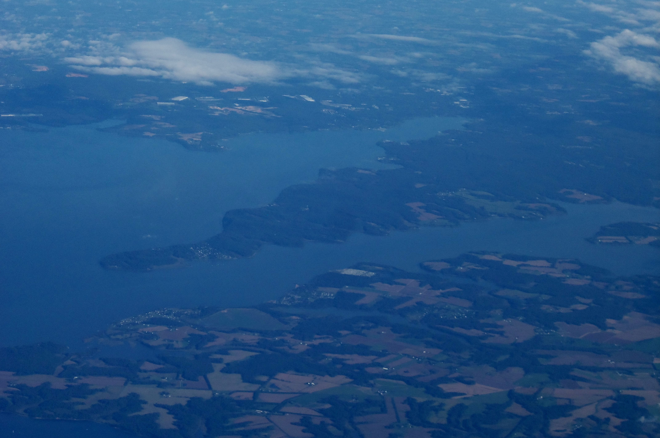
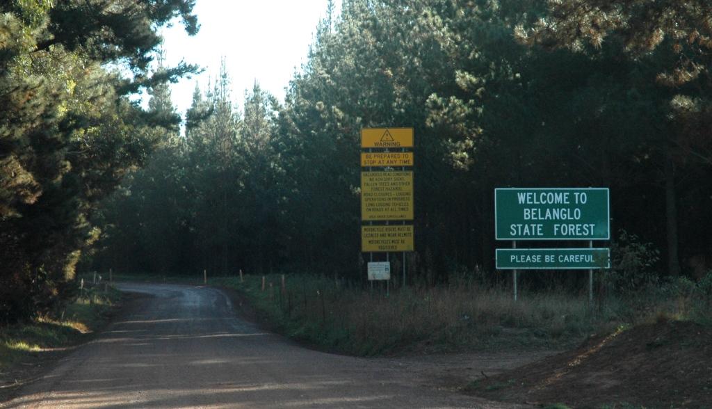
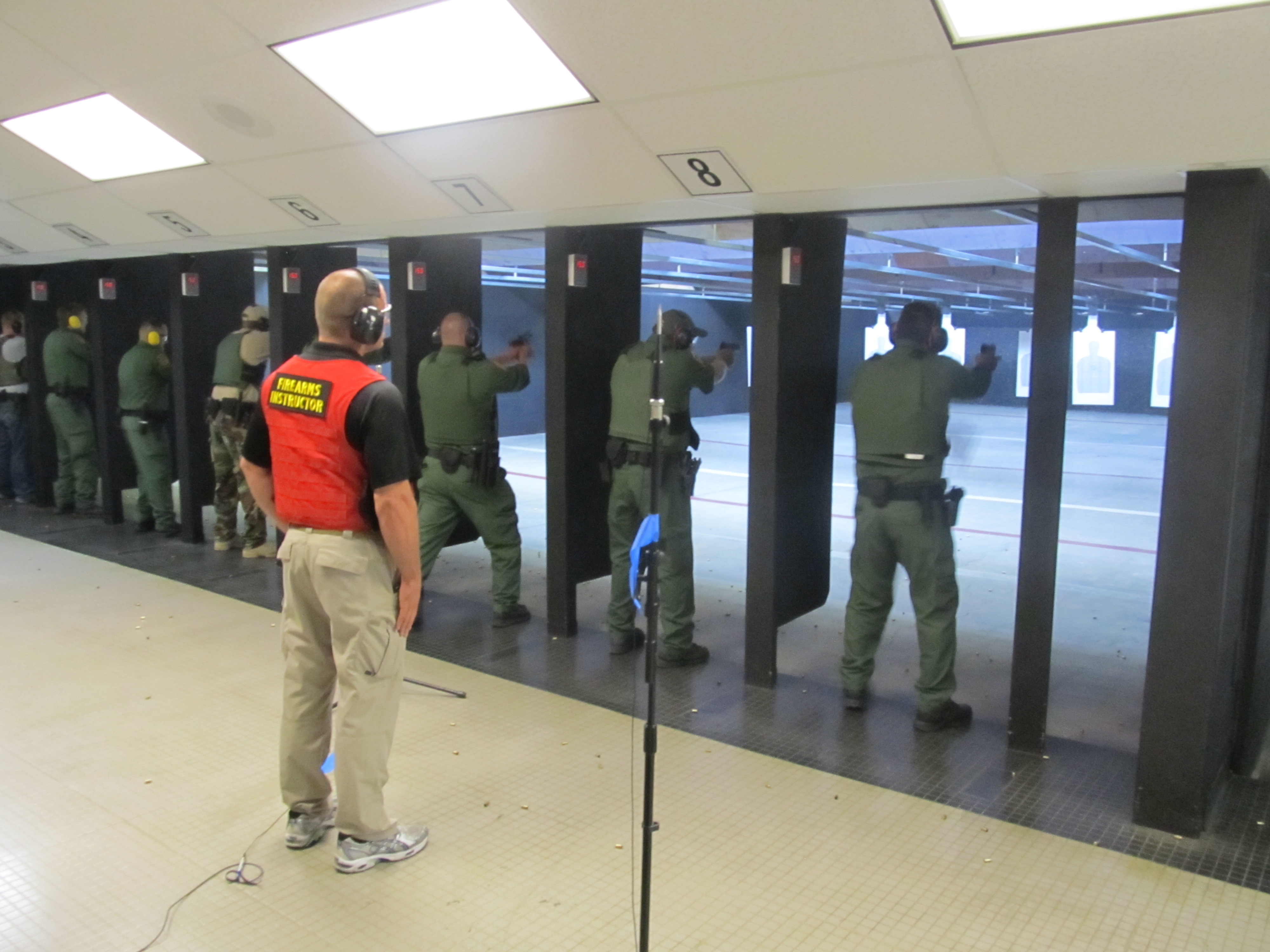
Elk Neck State Forest belongs to the Maryland Department of Natural Resources and is managed by the Maryland Forest Service, and is adjacent to the town of North East, in Cecil County. It is often confused with Elk Neck State Park, which lies further south, near the end of the same peninsula. The main entrance to the state forest (with a parking lot and office) runs north off of Irishtown Road. Other entrances, blocked by gates (to deter vehicles), are located on Huminski Road and Starkey Lane. Visitors to the state forest who are not using the shooting-ranges can park for free. Users of the shooting-ranges need to acquire permits under a self-service honor-system. This nature area, consisting of , provides hiking trails, hunting opportunities (during legally established hunting seasons), and ranges for archery and for handgun- and rifle-shooting. A portion of the Mason-Dixon Trail runs through this state forest. Although there ia reduced-size area-map of the state foresto ... [...More Info...] [...Related Items...] OR: [Wikipedia] [Google] [Baidu] |
Cecil County, Maryland
Cecil County () is a county located in the U.S. state of Maryland at the northeastern corner of the state, bordering both Pennsylvania and Delaware. As of the 2020 census, the population was 103,725. The county seat is Elkton. The county was named for Cecil Calvert, 2nd Baron Baltimore (1605–1675), the first Proprietary Governor of the Province (colony) of Maryland. With the eastern part of the county being closer to Philadelphia than to Baltimore, it is part of the Philadelphia-Camden-Wilmington, PA-NJ-DE-MD Metropolitan Statistical Area. The county is located in Wilmington's Radio Market and Baltimore's Designated Market Area. History The area now known as Cecil County was an important trading center long before the county's official organization in 1674 by proclamation of Lord Baltimore. It had previously been a northeastern part of a much larger Baltimore County, in the northeastern portion of the Province. This had included present-day Baltimore City and county, ... [...More Info...] [...Related Items...] OR: [Wikipedia] [Google] [Baidu] |
United States
The United States of America (U.S.A. or USA), commonly known as the United States (U.S. or US) or America, is a country primarily located in North America. It consists of 50 states, a federal district, five major unincorporated territories, nine Minor Outlying Islands, and 326 Indian reservations. The United States is also in free association with three Pacific Island sovereign states: the Federated States of Micronesia, the Marshall Islands, and the Republic of Palau. It is the world's third-largest country by both land and total area. It shares land borders with Canada to its north and with Mexico to its south and has maritime borders with the Bahamas, Cuba, Russia, and other nations. With a population of over 333 million, it is the most populous country in the Americas and the third most populous in the world. The national capital of the United States is Washington, D.C. and its most populous city and principal financial center is New York City. Paleo-Americ ... [...More Info...] [...Related Items...] OR: [Wikipedia] [Google] [Baidu] |
North East, Maryland
North East is a town in Cecil County, Maryland, Cecil County, Maryland, United States. It is located between Philadelphia and Baltimore. The population was 3,572 at the 2010 United States Census, 2010 census. The Turkey Point Light, Turkey Point Light Station was listed on the National Register of Historic Places in 2002. The Gilpin's Falls Covered Bridge was listed in 2008. Geography North East is located at . According to the United States Census Bureau, the town has a total area of , of which is land and is water. Demographics 2010 census As of the census of 2010, there were 3,572 people, 1,433 households, and 901 families living in the town. The population density was . There were 1,651 housing units at an average density of . The racial makeup of the town was 87.2% White (U.S. Census), White, 7.6% African American (U.S. Census), African American, 0.4% Native American (U.S. Census), Native American, 1.5% Asian (U.S. Census), Asian, 1.0% from Race (U.S. Census), other rac ... [...More Info...] [...Related Items...] OR: [Wikipedia] [Google] [Baidu] |
Maryland Department Of Natural Resources
The Maryland Department of Natural Resources (DNR) is a government agency in the state of Maryland charged with maintaining natural resources including state parks, public lands, state forests, state waterways, wildlife, and recreation areas. Its headquarters is in Annapolis. Department responsibilities The Department's principal functions are: * Managing over of public lands * Protecting over of waterways * Lead agency for restoration of the Chesapeake Bay and coastal bays.''Annual Report 2007-2008'' MdDNR; PDF download; (2007); Document no. DNR01-1242007-184; pp. 5-6 DNR does not issue or enforce environmental permits under the federal Clean Air Act, |
List Of Maryland State Forests ...
The State of Maryland contains of designated state forest which are managed by the Maryland Forest Service. The following is a list of Maryland state forests. Maryland State Forests Maryland Demonstration Forests Maryland Forest Lands * Chesapeake Forest Lands See also *List of U.S. National Forests *List of Maryland wildlife management areas References External links * Maryland's State Forestsat Maryland Department of Natural Resources Forest Service {{DEFAULTSORT:Maryland state forests * Maryland Maryland ( ) is a state in the Mid-Atlantic region of the United States. It shares borders with Virginia, West Virginia, and the District of Columbia to its south and west; Pennsylvania to its north; and Delaware and the Atlantic Ocean to ... [...More Info...] [...Related Items...] OR: [Wikipedia] [Google] [Baidu] |
Elk Neck State Park
Elk Neck State Park is a public recreation area located between Chesapeake Bay and the Elk River near the southern tip of the Elk Neck Peninsula in Cecil County, Maryland. The state park is home to the historic Turkey Point Light and offers land-based and water-based recreation. The park is located on MD 272, eight miles (13 km) south of the town of North East, and south of exit 100 on I-95. It is operated by the Maryland Department of Natural Resources. History The park had its genesis when, in 1936, naturalist Dr. William Abbott bequeathed his holdings along the Elk River to the state for use as a state park. Although he originally intended the land to be a gift to the Boy Scouts, a meeting with State Forester Fred W. Besley in 1935 persuaded Abbott to change the terms of his will. Following the state's purchase of additional acreage, the Civilian Conservation Corps created park improvements from 1937 to 1941. Activities and amenities ;Turkey Point Lighthouse Datin ... [...More Info...] [...Related Items...] OR: [Wikipedia] [Google] [Baidu] |
State Forest
A state forest or national forest is a forest that is administered or protected by some agency of a sovereign or federated state, or territory. Background The precise application of the terms vary by jurisdiction. For example: * In Australia, a state forest is a forest that is protected by state laws, rather than by the Government of Australia. * In Austria, the state forests are managed by the * In Brazil, a national forest is a protected area for sustainablility * In Canada, provinces administer provincial forests * In France, a national forest is a forest owned by the French state * In Germany, state forests are either federal forest called the ''Bundesforst'', which is controlled by the Institute for Federal Real Estate (''Bundesforstverwaltung''), or forest of the ''Länder'' called ''Landesforste'' * In Iceland, forests managed by the Icelandic Forest Service are classified as national forests. * In New Zealand, a state forest is a forest that is controlled by the Mini ... [...More Info...] [...Related Items...] OR: [Wikipedia] [Google] [Baidu] |
Shooting-ranges
A shooting range, firing range, gun range or shooting ground is a specialized facility, venue or field designed specifically for firearm usage qualifications, training, practice or competitions. Some shooting ranges are operated by military or law enforcement agencies, though the majority of ranges are privately owned by civilians and sporting clubs and cater mostly to recreational shooters. Each facility is typically overseen by one or more supervisory personnel, variously called a ''range master'' or "Range Safety Officer" (RSO) in the United States, or a ''range conducting officer'' (RCO) in the United Kingdom. Supervisory personnel are responsible for ensuring that all weapon safety rules and relevant government regulations are followed at all times. Shooting ranges can be indoor or outdoor, and may be restricted to certain types of firearm that can be used such as handguns or long guns, or they can specialize in certain Olympic disciplines such as trap/skeet shooting ... [...More Info...] [...Related Items...] OR: [Wikipedia] [Google] [Baidu] |
Archery
Archery is the sport, practice, or skill of using a bow to shoot arrows.Paterson ''Encyclopaedia of Archery'' p. 17 The word comes from the Latin ''arcus'', meaning bow. Historically, archery has been used for hunting and combat. In modern times, it is mainly a competitive sport and recreational activity. A person who practices archery is typically called an archer, bowman, or toxophilite. History Origins and ancient archery The oldest known evidence of the bow and arrow comes from South African sites such as Sibudu Cave, where the remains of bone and stone arrowheads have been found dating approximately 72,000 to 60,000 years ago.Backwell L, d'Errico F, Wadley L.(2008). Middle Stone Age bone tools from the Howiesons Poort layers, Sibudu Cave, South Africa. Journal of Archaeological Science, 35:1566–1580. Backwell L, Bradfield J, Carlson KJ, Jashashvili T, Wadley L, d'Errico F.(2018). The antiquity of bow-and-arrow technology: evidence from Middle Stone Age layers ... [...More Info...] [...Related Items...] OR: [Wikipedia] [Google] [Baidu] |
Mason-Dixon Trail
The Mason-Dixon Trail is a hiking trail that begins at the Appalachian Trail in south-central Pennsylvania, continues through northeastern Maryland and northern Delaware, and re-enters Pennsylvania shortly before ending at Chadds Ford. It is named for the historic Mason–Dixon line, which it crosses twice. About one-third of the route follows roads through rural areas, but the rest is on traditional footpaths. The trail also traverses many tracts of private land, at which passage for hikers has been arranged with owners. This results in occasional relocations. The trail takes hikers through a variety or rural and semi-urban landscapes, with most of the route in Pennsylvania featuring farmlands and forested areas, and most of the route in Maryland and Delaware featuring historic sites and small towns. Route The Mason-Dixon Trail begins near Boiling Springs, Pennsylvania, at a junction with the Appalachian Trail on South Mountain. Heading east, the Mason-Dixon Trail soon descend ... [...More Info...] [...Related Items...] OR: [Wikipedia] [Google] [Baidu] |
Northeastern Coastal Forests
The Northeastern coastal forests are a temperate broadleaf and mixed forests ecoregion of the northeast and middle Atlantic region of the United States. The ecoregion covers an area of 34,630 sq miles (89,691 km2) encompassing the Piedmont and coastal plain of seven states, extending from coastal southwestern Maine, southeastern New Hampshire, eastern Massachusetts, and Rhode Island, southward through Connecticut, New York State, New Jersey, southeast Pennsylvania, Delaware and Maryland. The ecoregion is bounded on the east by the Atlantic Ocean. To the north, it transitions to the New England-Acadian forests, which cover most of northern and inland New England. To the west, the ecoregion transitions to Allegheny Highlands forests and the Appalachian-Blue Ridge forests of the Appalachian Mountains. To the south lie the Southeastern mixed forests and the Middle Atlantic coastal forests. The ecoregion surrounds the distinct Atlantic coastal pine barrens ecoregion, which cover ... [...More Info...] [...Related Items...] OR: [Wikipedia] [Google] [Baidu] |
Ecoregion
An ecoregion (ecological region) or ecozone (ecological zone) is an ecologically and geographically defined area that is smaller than a bioregion, which in turn is smaller than a biogeographic realm. Ecoregions cover relatively large areas of land or water, and contain characteristic, geographically distinct assemblages of natural communities and species. The biodiversity of flora, fauna and ecosystems that characterise an ecoregion tends to be distinct from that of other ecoregions. In theory, biodiversity or conservation ecoregions are relatively large areas of land or water where the probability of encountering different species and communities at any given point remains relatively constant, within an acceptable range of variation (largely undefined at this point). Three caveats are appropriate for all bio-geographic mapping approaches. Firstly, no single bio-geographic framework is optimal for all taxa. Ecoregions reflect the best compromise for as many taxa as possible. Se ... [...More Info...] [...Related Items...] OR: [Wikipedia] [Google] [Baidu] |
.png)


.jpg)

