|
Electoral District Of Traeger
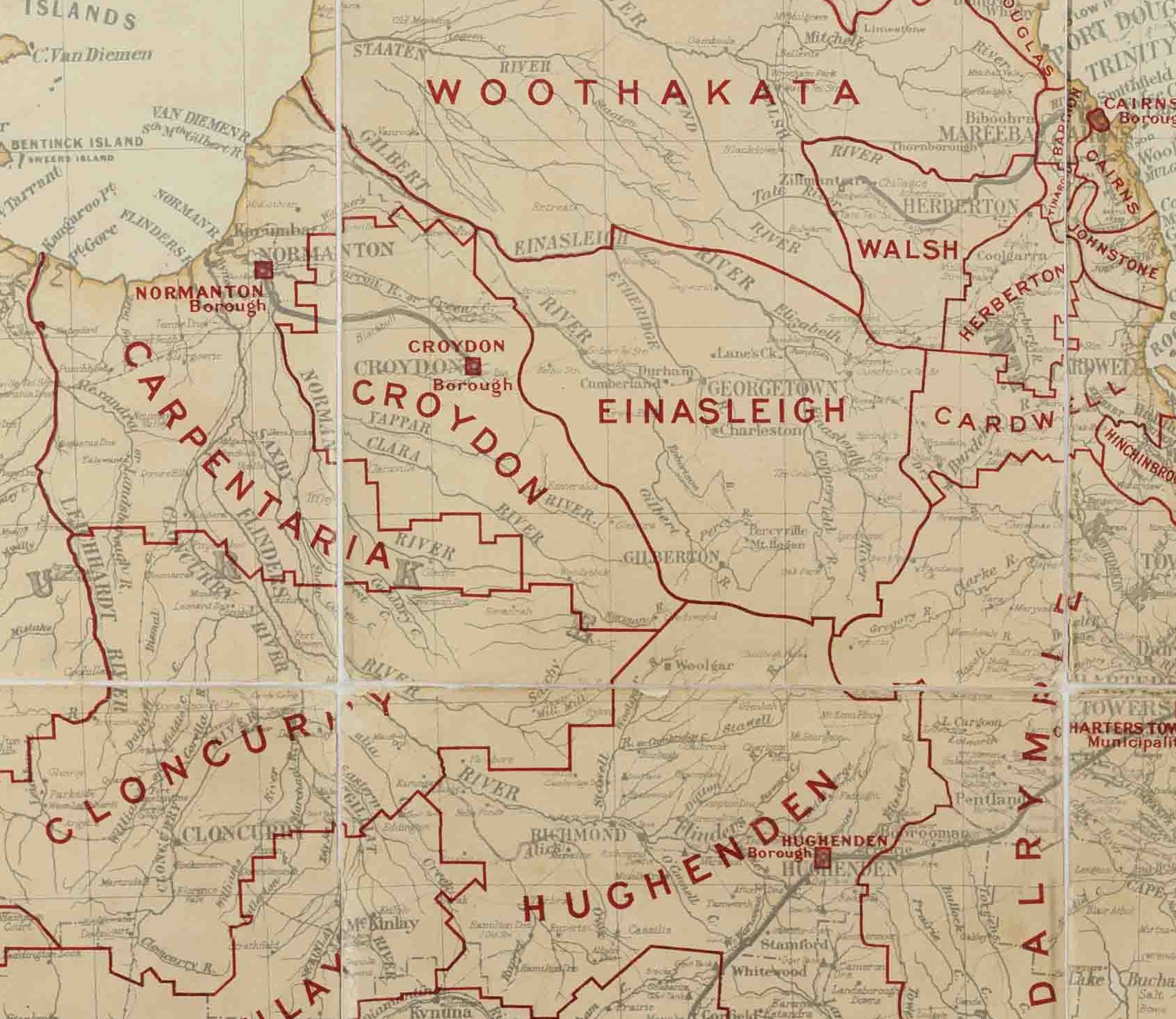
Traeger is an electoral district of the Legislative Assembly in the Australian state of Queensland. It was created in the 2017 redistribution, and was named after Alfred Traeger, inventor of the pedal-powered radio, which was a significant contribution to people living in remote and rural communities in Queensland, such as those within Traeger. It takes in most of the urbanised portions of the abolished districts of Mount Isa and Dalrymple. It includes the local government areas of Burke, Doomadgee, Carpentaria, Croydon, Etheridge, Charters Towers, Mount Isa, Cloncurry, McKinlay, Richmond and Flinders. From results of the previous 2015 election, Traeger was estimated to be a safe seat for the Katter's Australian Party with a margin of 16.1%. Robbie Katter, the last member for Mount Isa and the Queensland leader of Katter's Australian Party, opted to follow most of his constituents into Traeger. He won the seat with an increased majority. Members for Traeger Election re ... [...More Info...] [...Related Items...] OR: [Wikipedia] [Google] [Baidu] |
Robbie Katter
Robert Carl Ignatius Katter (born 3 March 1977) is an Australian politician. He serves as the member of the Legislative Assembly of Queensland for Traeger, having previously represented Mount Isa from 2012 to 2017. He is the leader of Katter's Australian Party, having taken over from his father Bob Katter in February 2020. Biography Early life Katter was born on 3 March 1977 in North Queensland. His father is Bob Katter, the federal member for Kennedy and founder of Katter's Australian Party, and his grandfather Bob Katter Sr. was also a federal MP. He received a Bachelor of Applied Science in Property Economics from the Queensland University of Technology. Early career Katter started his career as a mine worker in Mount Isa, before working as a property valuer for fifteen years and running a small business in Mount Isa. Political career (2012–present) He won Mount Isa at the 2012 state election, pushing Labor incumbent Betty Kiernan into third place. He capitalised ... [...More Info...] [...Related Items...] OR: [Wikipedia] [Google] [Baidu] |
Shire Of Burke
The Shire of Burke is a local government area in North West Queensland, Australia. The shire lies on the south coast of the Gulf of Carpentaria and abuts the border with the Northern Territory. It covers an area of , and has existed as a local government entity since 1885. The major town and administrative centre of the shire is Burketown. The shire and town are named in honour of ill-fated explorer Robert O'Hara Burke. The Gangalidda name for Burketown is ''Mungibi'' meaning ‘little Island’ for the fact that flooding in the wet season often isolates the town. From the months of August to November, a rare meteorological phenomenon known as "Morning Glory" – long, tubular clouds, some up to 1000 km in length – are often observed in the skies above Burke Shire. The shire contains Boodjamulla National Park (formerly called Lawn Hill National Park) and the World Heritage Site Riversleigh fossil fields. The Aboriginal Shire of Doomadgee lies inside Burke Shire to the ... [...More Info...] [...Related Items...] OR: [Wikipedia] [Google] [Baidu] |
Members Of The Queensland Legislative Assembly
This is a list of members of the Legislative Assembly of Queensland, the state parliament of Queensland, sorted by parliament. See also * Queensland Legislative Assembly electoral districts This is a list of current and former electoral divisions for the Legislative Assembly of Queensland, the state legislature for Queensland, Australia. Current Districts by region Districts in Far North Queensland * Barron River * Cairns * Co ... {{Members of the Parliament of Queensland ... [...More Info...] [...Related Items...] OR: [Wikipedia] [Google] [Baidu] |
Electoral Districts Of Queensland
This is a list of current and former electoral divisions for the Legislative Assembly of Queensland, the state legislature for Queensland, Australia. Current Districts by region Districts in Far North Queensland * Barron River *Cairns *Cook *Hill * Mulgrave Districts in North Queensland *Burdekin * Hinchinbrook * Mundingburra * Thuringowa *Townsville * Traeger *Whitsunday Districts in Central Queensland *Bundaberg * Burnett * Callide *Gladstone * Gregory *Hervey Bay * Keppel *Mackay * Maryborough * Mirani *Rockhampton Districts in South-West Queensland * Condamine *Southern Downs * Toowoomba North * Toowoomba South * Warrego Districts in South East Queensland Greater Brisbane – Northern Districts * Aspley * Bancroft – (part of Moreton Bay) * Clayfield * Cooper * Everton * Ferny Grove – (mostly Moreton Bay) * Kurwongbah – (part of Moreton Bay) * McConnel * Morayfield – (part of Moreton Bay) * Murrumba – (part of Moreton Bay) * Nudgee * Pine Riv ... [...More Info...] [...Related Items...] OR: [Wikipedia] [Google] [Baidu] |
2015 Queensland State Election
The 2015 Queensland state election was held on 31 January 2015 to elect all 89 members of the unicameral Legislative Assembly of Queensland. The centre-right Liberal National Party (LNP), led by Premier Campbell Newman, attempted to win a second term but was defeated by the opposition centre-left Australian Labor Party (ALP), led by Opposition Leader Annastacia Palaszczuk. Labor formed a minority government with the support of the lone independent MP in the chamber, Peter Wellington. It is only the seventh change of government in Queensland since 1915, and only the third time since 1932 that a sitting government in the state has failed to win a second term. Furthermore, Annastacia Palaszczuk became the first woman to win government from opposition in a state election (eventual Chief Minister Clare Martin led the Labor Party to victory from opposition in 2001 at an election in the Northern Territory). The previous election saw Labor, which had governed the state for all b ... [...More Info...] [...Related Items...] OR: [Wikipedia] [Google] [Baidu] |
Shire Of Flinders (Queensland)
The Shire of Flinders is a local government area in north-western Queensland, Australia. It covers an area of , and has existed as a local government entity since 1882. The Shire, named for the Flinders River, is predominantly a grazing area with cattle in the north of the shire and mixed grazing to the south in the black soil area. History Jirandali (also known as Yirandali, Warungu, Yirandhali) is an Australian Aboriginal language of North-West Queensland, particularly the Hughenden area. The language region includes the local government area of the Shire of Flinders, including Dutton River, Flinders River, Mount Sturgeon, Caledonia, Richmond, Corfield, Winton, Torrens, Tower Hill, Landsborough Creek, Lammermoor Station, Hughenden, and Tangorin. The Hughenden Division was established on 20 July 1882 under the ''Divisional Boards Act 1879''. On 20 April 1887, the Borough of Hughenden was constituted separately as a municipality for the emerging town of Hughenden. On ... [...More Info...] [...Related Items...] OR: [Wikipedia] [Google] [Baidu] |
Shire Of Richmond
The Shire of Richmond is a local government area in north western Queensland, Australia. It covers an area of , and has existed as a local government entity since 1916. It is part of the Gulf Country. History '' Wanamarra'' (also known as ''Maykulan'' and ''Wunumura'' is an Australian Aboriginal language in North West Queensland. The language region includes areas within the Shire of McKinlay, Shire of Cloncurry and Shire of Richmond, including the Flinders River area, and the towns of Kynuna and Richmond. The Shire of Wyangarie, named for a prominent grazing homestead in the area, was created on 1 January 1916 out of part of the Shire of Flinders under the ''Local Authorities Act 1902''. On 24 July 1930, it lost part of its area to Shire of McKinlay. On 31 July 1954, it was renamed Richmond. Towns and localities The Shire of Richmond includes the following settlements: * Richmond * Albion * Burleigh * Cambridge Cambridge ( ) is a College town, university ... [...More Info...] [...Related Items...] OR: [Wikipedia] [Google] [Baidu] |
Shire Of Cloncurry
The Shire of Cloncurry is a Local government in Australia, local government area in North West Queensland, Australia. It covers an area of , and has existed as a local government entity since 1884. The major town and administrative centre of the shire is Cloncurry, Queensland, Cloncurry. Prior to European settlement the area was home to the Mitakoodi, Kalkatungu, Kalkadoon and Pitta Pitta Indigenous Australians, Aboriginal people. The ghost town of Mary Kathleen, Queensland, Mary Kathleen, a town servicing a uranium mine since closed, is in the shire. History ''Wanamara language, Wanamarra'' (also known as ''Maykulan'' and ''Wunumura'' is an Australian Aboriginal language in North West Queensland. The language region includes areas within the Shire of Mckinlay, Shire of McKinlay, Shire of Cloncurry and Shire of Richmond, including the Flinders River area, and the towns of Kynuna and Richmond, Queensland, Richmond. Yulluna language, ''Yulluna'' (also known as ''Yalarnga'', ''Ya ... [...More Info...] [...Related Items...] OR: [Wikipedia] [Google] [Baidu] |
City Of Mount Isa
The City of Mount Isa is a local government area in north west Queensland. The City covers the urban locality of Mount Isa, the administrative centre, and surrounding area, sharing a boundary with the Northern Territory to the west. Mount Isa is a reasonably affluent district. The largest industry in the city is the Mount Isa Mines, a source of lead, copper, silver and zinc. Cattle grazing and tourism are other industries of note. History The city was inhabited by the Kalkadoon and Indjilandji people, whose livelihood depended on hunting and gathering, fishing and trade for several thousands of years, before the European settlers arrived here. The Kalkadoon craftsmen were known for their stone implements and handmade tools which were traded with other Aboriginal groups spread all over the western Queensland. Kalkatunga (also known as Kalkadoon, Kalkadunga, Kalkatungu) is an Australian Aboriginal language. The Kalkatunga language region is North-West Queensland including t ... [...More Info...] [...Related Items...] OR: [Wikipedia] [Google] [Baidu] |
Charters Towers Region
The Charters Towers Region is a local government area in North Queensland, Australia southwest of, and inland from the city of Townsville, based in Charters Towers. Established in 2008, it was preceded by two previous local government areas which dated back to the 1870s. It has an estimated operating budget of A$27.5 m. History ''Gugu Badhun'' (also known as ''Koko-Badun'' and ''Kokopatun'') is an Australian Aboriginal language of North Queensland. The language region includes areas within the local government area of Charters Towers Region, particularly the localities of Greenvale and the Valley of Lagoons, and in the Upper Burdekin River area and in Abergowrie. Prior to 2008, the Charters Towers Region was an entire area of two previous and distinct local government areas: * the City of Charters Towers; * and the Shire of Dalrymple. The City of Charters Towers had its beginning in the Charters Towers Municipality which was proclaimed on 21 June 1877 under the ''Munici ... [...More Info...] [...Related Items...] OR: [Wikipedia] [Google] [Baidu] |
Shire Of Etheridge
The Shire of Etheridge is a local government area in Far North Queensland, Australia in what is known as the Savannah Gulf region. Its economy is based on cattle grazing and mining. It covers an area of , and has existed as a local government entity since 1882. History The Einasleigh Division was created on 11 November 1879 as one of 74 divisions around Queensland under the ''Divisional Boards Act 1879'' with a population of 720. In 1891 it was reported that the divisional board had made no progress, perhaps because it covered a large area that was sparsely settled. With the passage of the ''Local Authorities Act 1902'', Einasleigh Division became the Shire of Einasleigh on 31 March 1903. On 15 March 1919, it was renamed Shire of Etheridge. Towns and localities The Shire of Etheridge includes the following settlements: * Georgetown * Einasleigh * Forsayth * Gilbert River * Mount Surprise * Abingdon Downs * Conjuboy * Gilberton * Lyndhurst * Northhead * Strat ... [...More Info...] [...Related Items...] OR: [Wikipedia] [Google] [Baidu] |

.jpg)


