|
Eldikan
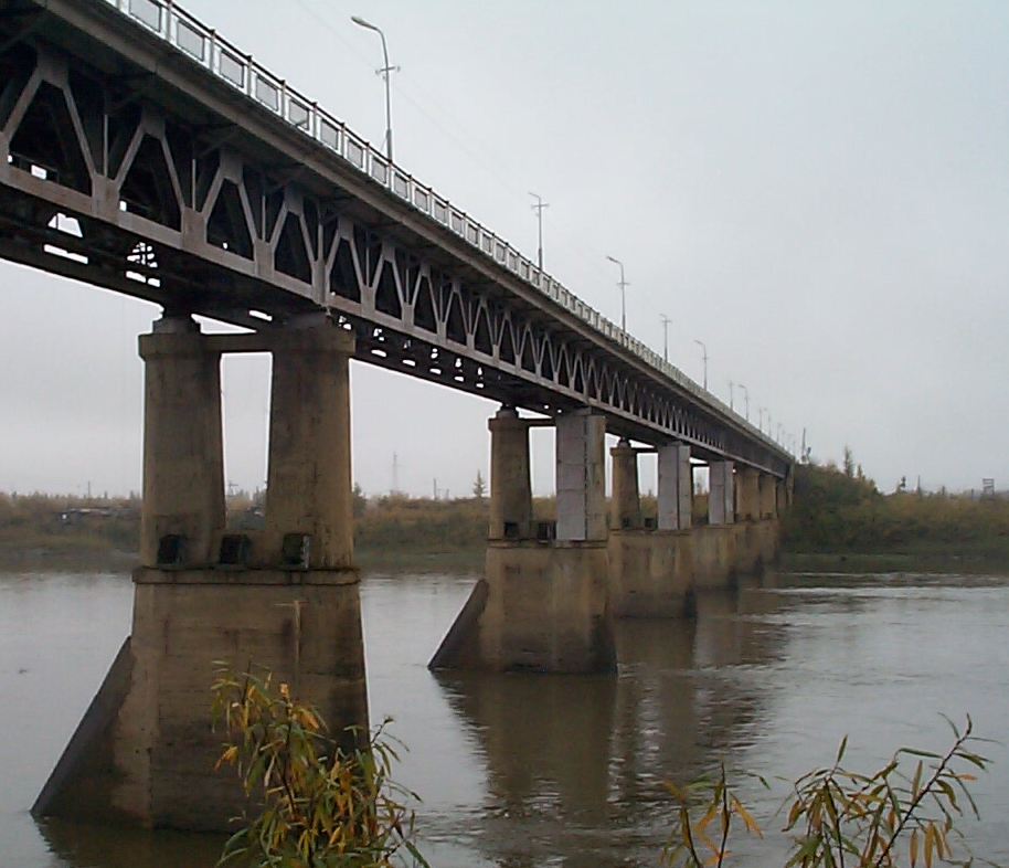
Eldikan (russian: Эльдикан; sah, Элдьикээн, ''Elcikeen'') is an urban locality (an urban-type settlement) in Ust-Maysky District of the Sakha Republic, Russia, located on the right bank of the Aldan River, northeast of Ust-Maya, the administrative center of the district. As of the 2010 Census, its population was 1,515. History It was established in 1941 as a river port, as a base for the developing gold mining activities on the Yudoma and Allakh-Yun Rivers. Urban-type settlement status was granted to it in 1948,''Registry of the Administrative-Territorial Divisions of the Sakha Republic'' when it became the administrative center of Allakh-Yunsky District. It lost this role again in 1953 with the merger of the district back into Ust-Maysky District. Administrative and municipal status Within the framework of administrative divisions, the urban-type settlement of Eldikan,According to Article 7 of the Law #77-I, lower-level administrative divisions w ... [...More Info...] [...Related Items...] OR: [Wikipedia] [Google] [Baidu] |
8-y Km
8-y km (russian: 8-й км) is a rural locality (a '' selo'') under the administrative jurisdiction of the Settlement of Eldikan of Ust-Maysky District in the Sakha Republic, Russia, located from Ust-Maya, the administrative center of the district, and, as the name suggests, from Eldikan.''Registry of the Administrative-Territorial Divisions of the Sakha Republic'' Its population as of the 2010 Census was 0;Sakha Republic Territorial Branch of the Federal State Statistics Service The Federal State Statistics Service (russian: Федеральная служба государственной статистики (Росстат), ''Federal'naya sluzhba gosudarstvennoi statistiki (Rosstat)'') is the governmental statistics .... Results of the 2010 All-Russian CensusЧисленность населения по районам, городским и сельским населённым пунктам (''Population Counts by Districts, Urban and Rural Inhabited Localities'') d ... [...More Info...] [...Related Items...] OR: [Wikipedia] [Google] [Baidu] |
Allakh-Yun River
The Allakh-Yun (russian: Аллах-Юнь, sah, Ааллаах Үүн, ''Aallaax Üün'') is a river in Sakha Republic and Khabarovsk Krai, Russia. It is a right tributary of the Aldan. It is long, and has a drainage basin of . Geography The Allakh-Yun arises at an elevation of around as the outflow from the mountain lake Amparyndzha, in the south-eastern Verkhoyansk Range. It flows generally in a south-westerly direction through a narrow valley along the Yudoma-Maya Highlands, to the east of the Sette-Daban range. The river cuts through the Ulakhan-Bom Ridge, before flowing into the Aldan by the southern end of the Kyllakh Range, at an elevation of , approximately from the settlement of Eldikan. Google Earth At its mouth, the Allakh-Yun is about wide and deep. The Allakh-Yun freezes over from mid-October until late May. Local economy and infrastructure The river is navigable on its lower and middle sections. The surrounding area is very sparsely settled, with the fe ... [...More Info...] [...Related Items...] OR: [Wikipedia] [Google] [Baidu] |
Ust-Maysky District
Ust-Maysky District (russian: Усть-Ма́йский улу́с; sah, Уус-Маайа улууһа, ''Uus-Maaya uluuha'', ) is an administrativeConstitution of the Sakha Republic and municipalLaw #172-Z #351-III district (raion, or ''ulus''), one of the thirty-four in the Sakha Republic, Russia. It is located in the east of the republic and borders with Oymyakonsky District in the northeast, Okhotsky District and Ayano-Maysky District of Khabarovsk Krai in the east and south, Aldansky District in the southwest, Amginsky District in the west, Churapchinsky and Tattinsky Districts in the northwest, and with Tomponsky District in the north. The area of the district is .Registry of the Administrative-Territorial Divisions of the Sakha Republic Its administrative center is the urban locality (a settlement) of Ust-Maya. Population: 11,568 ( 2002 Census); The population of Ust-Maya accounts for 33.9% of the district's total population. Geography The main rivers in the district ... [...More Info...] [...Related Items...] OR: [Wikipedia] [Google] [Baidu] |
Kyllakh Range
The Kyllakh Range (russian: Кыллахский хребет; sah, Кыыллаах) is a range of mountains in the Russian Federation. Administratively the mountain chain belongs to the Sakha Republic. It is the smallest of the ranges which are part of the southern prolongation of the Verkhoyansk Range, East Siberian System. Geography The Kyllakh Range stretches roughly from north to south for about to the southwest of the Ulakhan-Bom, one of the three longer parallel ranges that form a group to the east. It is bound in the north by the Khanda river. To the west it is limited by the banks of the Aldan River and to the south by the Allakh-Yun river. The highest point of the mountain chain is an unnamed high summit.Google Earth Flora The slopes of the range are largely bare, but may be covered by larch taiga in slopes just above valleys, as well as birch in slopes facing the Aldan. Most of the river valleys are swampy with widespread moss growth. See also *List of mountains ... [...More Info...] [...Related Items...] OR: [Wikipedia] [Google] [Baidu] |
Aldan River
The Aldan (russian: Алдан) is the second-longest, right tributary of the Lena in the Sakha Republic in eastern Siberia.Алдан (река в Якут. АССР) The river is long, of which around is navigable. It has a drainage basin of . The river was part of the River Route to . In 1639 |
Yugoryonok
Yugoryonok (russian: Югорёнок) is an urban locality (an urban-type settlement) in Ust-Maysky District of the Sakha Republic, Russia, located from Ust-Maya, the administrative center of the district,''Registry of the Administrative-Territorial Divisions of the Sakha Republic'' in a highly isolated region on the right bank of the Yudoma River. As of the 2010 Census, its population was 272. History It was founded in 1940 at a river port on the Yudoma, for use as a service base for the nearby goldfields. It was initially administered from Yur, located about away. With the cessation of gold mining in the 1970s, Yur was abandoned, and Yugoryonok was granted urban-type settlement status in 1978. With the cessation of mining activities in the 1990s, its population has decreased dramatically. Geography Climate Administrative and municipal status Within the framework of administrative divisions, the urban-type settlement of YugoryonokAccording to Article 7 of the ... [...More Info...] [...Related Items...] OR: [Wikipedia] [Google] [Baidu] |
Yudoma River
The Yudoma (russian: Юдома) is a river in eastern Siberia in the Yudoma-Maya Highlands near the Okhotsk Coast. It joins the Maya which joins the Aldan which joins the Lena which flows into the Arctic Ocean. Its northern headwaters are in the Suntar-Khayata Range. To the east is the Yudoma Range and then the Okhota, to the south the Maya and to the northwest, the Allakh-Yun, another tributary of the Aldan. Geography Its length in and its basin is (about the size of Switzerland). Its source is above sea level and its mouth, . It is fed by snowmelt and summer rains. It is frozen from mid-October to late May. At its mouth the minimum water flow is in March, and the maximum is in June. At its mouth it is wide and deep. The lower are considered navigable. The Yudoma limits the southern end of the Ulakhan-Bom range. Google Earth Infrastructure and local economy The area is largely unsettled and there is hardly any infrastructure. The only significant settlement is Yugory ... [...More Info...] [...Related Items...] OR: [Wikipedia] [Google] [Baidu] |
Village
A village is a clustered human settlement or community, larger than a hamlet but smaller than a town (although the word is often used to describe both hamlets and smaller towns), with a population typically ranging from a few hundred to a few thousand. Though villages are often located in rural areas, the term urban village is also applied to certain urban neighborhoods. Villages are normally permanent, with fixed dwellings; however, transient villages can occur. Further, the dwellings of a village are fairly close to one another, not scattered broadly over the landscape, as a dispersed settlement. In the past, villages were a usual form of community for societies that practice subsistence agriculture, and also for some non-agricultural societies. In Great Britain, a hamlet earned the right to be called a village when it built a church. [...More Info...] [...Related Items...] OR: [Wikipedia] [Google] [Baidu] |
Dzhebariki-Khaya
Dzhebariki-Khaya (russian: Джебарики-Хая; sah, Дьабарыкы-Хайа, ''Cabarıkı Xaya'') is an urban locality (an urban-type settlement) in Tomponsky District of the Sakha Republic, Russia, located from Khandyga, the administrative center of the district.''Registry of the Administrative-Territorial Divisions of the Sakha Republic'' As of the 2010 Census, its population was 1,694. History Urban-type settlement status was granted to it in 1974. Administrative and municipal status Within the framework of administrative divisions, the urban-type settlement of Dzhebariki-KhayaAccording to Article 7 of the Law #77-I, lower-level administrative divisions with the status of a settlement have their administrative centers in an inhabited locality with the status of an urban-type settlement. According to the ''Registry of the Administrative-Territorial Divisions of the Sakha Republic'', Dzhebariki-Khaya is the administrative center of the Settlement of Dzh ... [...More Info...] [...Related Items...] OR: [Wikipedia] [Google] [Baidu] |
R504 Kolyma Highway
The R504 Kolyma Highway (russian: Федеральная автомобильная дорога «Колыма», ''Federal'naya Avtomobil'naya Doroga «Kolyma»,'' "Federal Automobile Highway 'Kolyma'"), part of the M56 route, is a road through the Russian Far East. It connects Magadan with the town of Nizhny Bestyakh, located on the eastern bank of Lena River, opposite of Yakutsk. At Nizhny Bestyakh the Kolyma Highway connects to the Lena Highway. The Kolyma Highway is colloquially known as the Road of Bones (Russian: Дорога Костей, transliteration: ''Doróga Kostyéy''), in reference to the hundreds of thousands of forced laborers who were interred in the pavement after dying during its construction. Locally, the road is known as the Kolyma Route (Russian: Колымская трасса, transliteration: ''Kolýmskaya trássa''). History The Dalstroy construction directorate built the Kolyma Highway during the Soviet Union's Stalinist era. Inmates of the ... [...More Info...] [...Related Items...] OR: [Wikipedia] [Google] [Baidu] |
Khandyga
Khandyga (russian: Хандыга; sah, Хаандыга) is an urban locality (an urban-type settlement) and the administrative center of Tomponsky District in the Sakha Republic, Russia, northeast of Yakutsk, the capital of the republic. As of the 2010 Census, its population was 6,638. Geography Khandyga is located on the northeast corner of the Aldan River, by a bend where the river turns from north to west. The R504 Kolyma Highway passes through the town and the Ulakhan-Bom and Sette-Daban mountain ranges rise to the east. History It was founded in 1938 as a base for the construction of the Kolyma Highway towards Magadan. During World War II, an airfield was built here for the Alaska-Siberian air route used to ferry American Lend-Lease aircraft to the Eastern Front.Lebedev, pp. 44–49 From 1951 until 1954, it served as a base for Yanstroy forced-labor camp of the gulag network. In 1954, Khandyga became the administrative center of Tomponsky District. It was ... [...More Info...] [...Related Items...] OR: [Wikipedia] [Google] [Baidu] |
Yakutsk
Yakutsk (russian: Якутск, p=jɪˈkutsk; sah, Дьокуускай, translit=Djokuuskay, ) is the capital city of the Sakha Republic, Russia, located about south of the Arctic Circle. Fueled by the mining industry, Yakutsk has become one of Russia's most rapidly growing regional cities, with a population of 355,443 at the 2021 Census. Yakutsk — where the average annual temperature is , winter high temperatures are consistently well below , and the record low is ,Погода в Якутске. Температура воздуха и осадки. Июль 2001 г. (in Russian) — is the coldest city in the world. Yakutsk is also the largest city located in |


