|
El Paso BOTA Port Of Entry
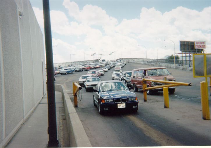
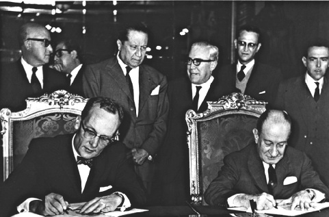
The El Paso BOTA Port of Entry, located at the Bridge of the Americas (BOTA), connecting Mexican Federal Highway 45 to the south and Interstate 110 to the north, is El Paso's highest volume border crossing, carrying more than half the vehicles (trucks and passenger cars) entering El Paso, Texas from Mexico. This is due in large part to the fact that BOTA is the only bridge in between Mexico and Texas that does not charge a toll. It is a "Class A" service port with a full range of cargo processing functions, and it is open for passenger vehicle traffic 24/7. It is available from 6:00 AM to 6:00 PM for commercial truck inspections. 6:00 AM to 2:00 PM on weekdays Saturdays. Construction on the BOTA crossing was completed in 1967 as part of the Chamizal Treaty between the US and Mexico signed in 1963 that involved a land exchange between the two countries. The El Paso property where the US border inspection station at BOTA is located was Mexican land prior to the execution of ... [...More Info...] [...Related Items...] OR: [Wikipedia] [Google] [Baidu] |
United States
The United States of America (U.S.A. or USA), commonly known as the United States (U.S. or US) or America, is a country primarily located in North America. It consists of 50 states, a federal district, five major unincorporated territories, nine Minor Outlying Islands, and 326 Indian reservations. The United States is also in free association with three Pacific Island sovereign states: the Federated States of Micronesia, the Marshall Islands, and the Republic of Palau. It is the world's third-largest country by both land and total area. It shares land borders with Canada to its north and with Mexico to its south and has maritime borders with the Bahamas, Cuba, Russia, and other nations. With a population of over 333 million, it is the most populous country in the Americas and the third most populous in the world. The national capital of the United States is Washington, D.C. and its most populous city and principal financial center is New York City. Paleo-Americ ... [...More Info...] [...Related Items...] OR: [Wikipedia] [Google] [Baidu] |
El Paso, Texas
El Paso (; "the pass") is a city in and the county seat, seat of El Paso County, Texas, El Paso County in the western corner of the U.S. state of Texas. The 2020 population of the city from the United States Census Bureau, U.S. Census Bureau was 678,815, making it the List of United States cities by population, 23rd-largest city in the U.S., the List of cities in Texas by population, sixth-largest city in Texas, and the second-largest city in the Southwestern United States behind Phoenix, Arizona. The city is also List of U.S. cities with large Hispanic populations, the second-largest majority-Hispanic city in the U.S., with 81% of its population being Hispanic. Its metropolitan statistical area covers all of El Paso and Hudspeth County, Texas, Hudspeth counties in Texas, and had a population of 868,859 in 2020. El Paso has consistently been ranked as one of the safest large cities in America. El Paso stands on the Rio Grande across the Mexico–United States border from Ciuda ... [...More Info...] [...Related Items...] OR: [Wikipedia] [Google] [Baidu] |
Bridge Of The Americas (El Paso–Ciudad Juárez)
The Bridge of the Americas (BOTA) is a group of international bridges which cross the Rio Grande (Río Bravo) and Texas State Highway Loop 375, connecting the Mexico–United States border cities of Ciudad Juárez, Chihuahua and El Paso, Texas, via the MX 45 (known as Avenida de las Américas in its Ciudad Juárez section) from the south and the I-110 from the north, crossing the El Paso BOTA Port of Entry. The bridge is known colloquially as "Puente Libre" ("Free Bridge") in Ciudad Juárez, officially as "Puente Internacional Córdova-Las Américas" ("Córdova-The Americas International Bridge") or "Puente Internacional Córdova de las Américas" ("Córdova of the Americas International Bridge"), and also as "Puente Río Bravo" ("Rio Bravo Bridge"), "Cordova Bridge", and "Free Bridge". Description The Bridge of the Americas consists of two bridges comprising four separate structures: two two-lane bridges for truck traffic, northbound and southbound; and two four-lane br ... [...More Info...] [...Related Items...] OR: [Wikipedia] [Google] [Baidu] |
Mexican Federal Highway 45
Federal Highway 45 (''La Carretera Federal 45'') (Fed. 45) is the free (libre) part of the federal highways corridors (los corredores carreteros federales), and connects Ciudad Juárez, Chihuahua through the Chihuahuan Desert to Panales, Hidalgo. It is operated under the management of the . Custody is the responsibility of "The Federal Highway Police", which in turn is part of the |
Interstate 110 (Texas)
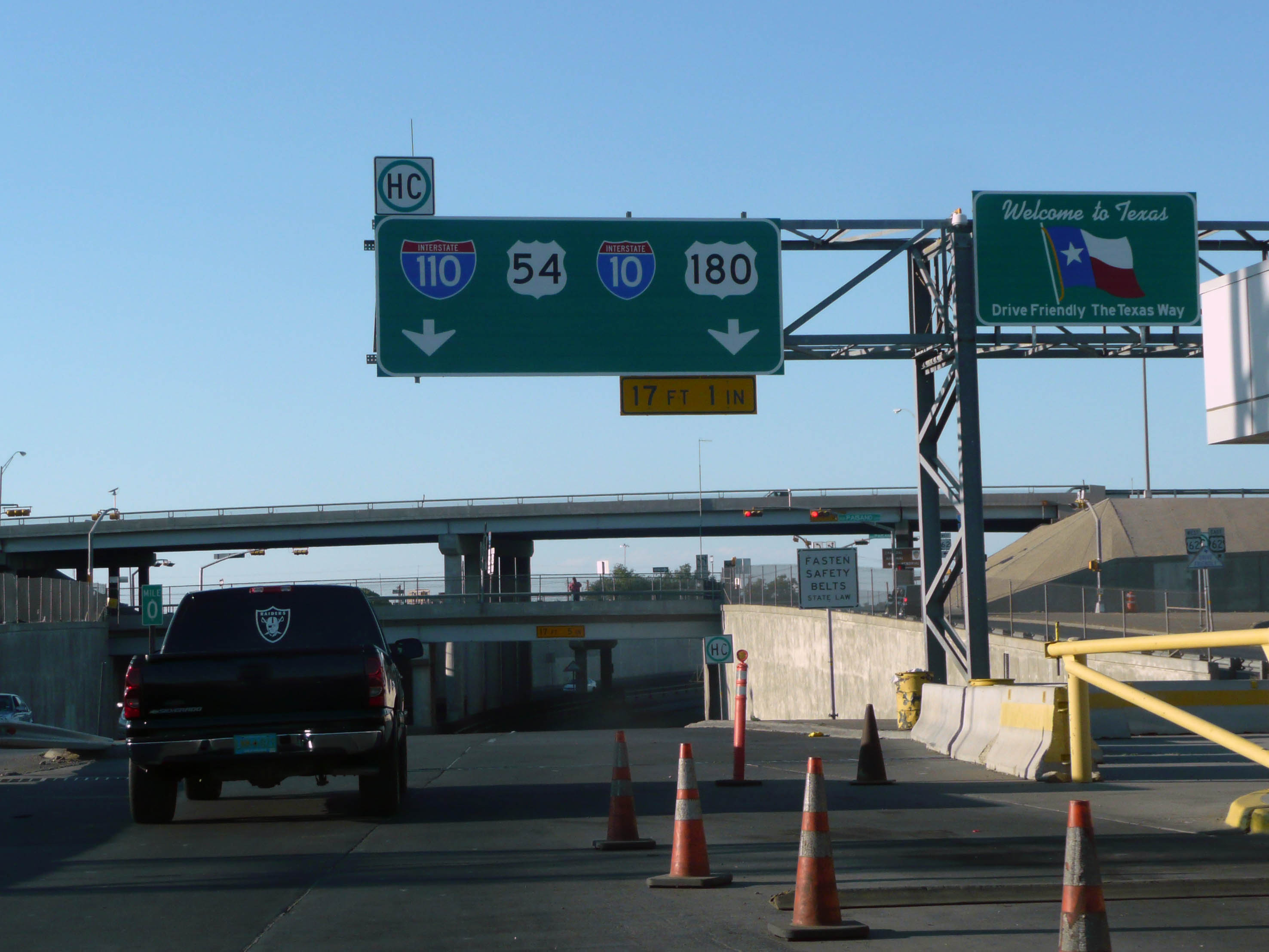
Interstate 110 (I-110) is a interstate spur route in El Paso extending from I-10 (I-10), south along U.S. Route 54 (US 54), turns west then turns south into Mexico. I-110 provides access from I-10 to the Bridge of the Americas, which spans the Rio Grande to connect with Avenida Abraham Lincoln in Ciudad Juárez, Mexico. I-110 is currently the only three-digit interstate to connect directly with Mexico, and one of only two to connect to an international border, the other being I-190 in New York. Route description I-110 is a short spur route of I-10 in El Paso that connects I-10 with the Cordova International Bridge at the United States–Mexico border. The highway begins at its southern terminus, the beginning of the Bridge of the Americas, which spans the Rio Grande and connects to Mexican Federal Highway 45 (Fed 45). The route proceeds north, crossing over all six lanes of Texas State Highway Loop 375 (Loop 375), the Cesar E. Chavez B ... [...More Info...] [...Related Items...] OR: [Wikipedia] [Google] [Baidu] |
Mexico
Mexico (Spanish: México), officially the United Mexican States, is a country in the southern portion of North America. It is bordered to the north by the United States; to the south and west by the Pacific Ocean; to the southeast by Guatemala, Belize, and the Caribbean Sea; and to the east by the Gulf of Mexico. Mexico covers ,Mexico ''''. . making it the world's 13th-largest country by are ... [...More Info...] [...Related Items...] OR: [Wikipedia] [Google] [Baidu] |
Chamizal Dispute
The Chamizal dispute was a border conflict over around on the Mexico–United States border between El Paso, Texas, and Ciudad Juárez, Chihuahua. It was caused by a shift in the Rio Grande, as a survey presented in 1852 marked differences between the bed of the Rio Grande (in es, Río Bravo del Norte) and the present channel of the river.''Los Angeles Times'' (December 22, 1963) "End to the El Chamizal Affair". Tensions over the territory during the historic Taft– Diaz summit almost resulted in the attempted assassination of both presidents on October 16, 1909. The Spanish word ''chamizal'' comes from ''chamizo'', the common name for the four-wing saltbush ('' Atriplex canescens'') which covered the disputed land near the present-day park. Origins (1848–1899) The Treaty of Guadalupe Hidalgo (which officially ended the Mexican–American War) defined the international border as the line along the middle of the deepest channel in the Rio Grande, continuously in tandem with ... [...More Info...] [...Related Items...] OR: [Wikipedia] [Google] [Baidu] |
List Of Mexico–United States Border Crossings
There are 50 places where people can legally cross the Mexico–United States border. Several large border cities have multiple crossings, often including one or more that bypass the center of the city and are designated for truck traffic. For planned crossings, see the Proposed crossings section below. For former border crossings, see the Closed crossings section below. Details on each of the US ports of entry are provided using the links in the table. On the U.S. side, each crossing has a three-letter Port of Entry code. This code is also seen on passport entry stamp or parole stamp. The list of codes is administered by the Department of State. Note that one code may correspond to multiple crossings. __TOC__ Vehicle and pedestrian crossings Proposed crossings This section lists crossings of the US-Mexico Border that are in the planning or construction phases. Closed crossings This table includes only those roads where the governments of either the US or Mexico ... [...More Info...] [...Related Items...] OR: [Wikipedia] [Google] [Baidu] |
List Of Canada–United States Border Crossings
This article includes lists of border crossings, ordered from west to east (north to south for Alaska crossings), along the Canada–United States border, International Boundary between Canada and the United States. Each port of entry (POE) in the tables below links to an article about that crossing. On the U.S. side, each crossing has a three-letter Port of entry, Port of Entry code. This code is also seen on Passport stamp#United States, passport entry stamp or Parole (United States immigration), parole stamp. The list of codes is administered by the United States Department of State, Department of State. Note that one code may correspond to multiple crossings. Land ports of entry Port of entry hours of service for road crossings, except where noted, are open year-round during the day. Unstaffed road crossings This is a list of roads that cross the U.S.-Canada border that do not have border inspection services, but where travelers are legally allowed to cross the border ... [...More Info...] [...Related Items...] OR: [Wikipedia] [Google] [Baidu] |
Transportation In El Paso, Texas
Transport (in British English), or transportation (in American English), is the intentional movement of humans, animals, and goods from one location to another. Modes of transport include air, land (rail and road), water, cable, pipeline, and space. The field can be divided into infrastructure, vehicles, and operations. Transport enables human trade, which is essential for the development of civilizations. Transport infrastructure consists of both fixed installations, including roads, railways, airways, waterways, canals, and pipelines, and terminals such as airports, railway stations, bus stations, warehouses, trucking terminals, refueling depots (including fueling docks and fuel stations), and seaports. Terminals may be used both for interchange of passengers and cargo and for maintenance. Means of transport are any of the different kinds of transport facilities used to carry people or cargo. They may include vehicles, riding animals, and pack animals. Vehicles may inclu ... [...More Info...] [...Related Items...] OR: [Wikipedia] [Google] [Baidu] |
1967 Establishments In Texas
Events January * January 1 – Canada begins a year-long celebration of the 100th anniversary of Confederation, featuring the Expo 67 World's Fair. * January 5 ** Spain and Romania sign an agreement in Paris, establishing full consular and commercial relations (not diplomatic ones). ** Charlie Chaplin launches his last film, ''A Countess from Hong Kong'', in the UK. * January 6 – Vietnam War: United States Marine Corps, USMC and Army of the Republic of Vietnam, ARVN troops launch ''Operation Deckhouse Five'' in the Mekong Delta. * January 8 – Vietnam War: Operation Cedar Falls starts. * January 13 – A military coup occurs in Togo under the leadership of Étienne Eyadema. * January 14 – The Human Be-In takes place in Golden Gate Park, San Francisco; the event sets the stage for the Summer of Love. * January 15 ** Louis Leakey announces the discovery of pre-human fossils in Kenya; he names the species ''Proconsul nyanzae, Kenyapithecus africanus''. ** American football ... [...More Info...] [...Related Items...] OR: [Wikipedia] [Google] [Baidu] |


_from_U.S._(Blaine%2C_WA).jpg)
