|
El-Mo'alla
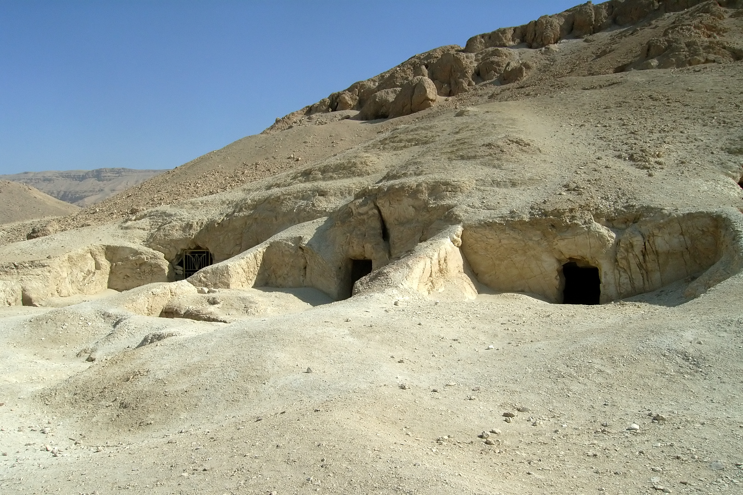
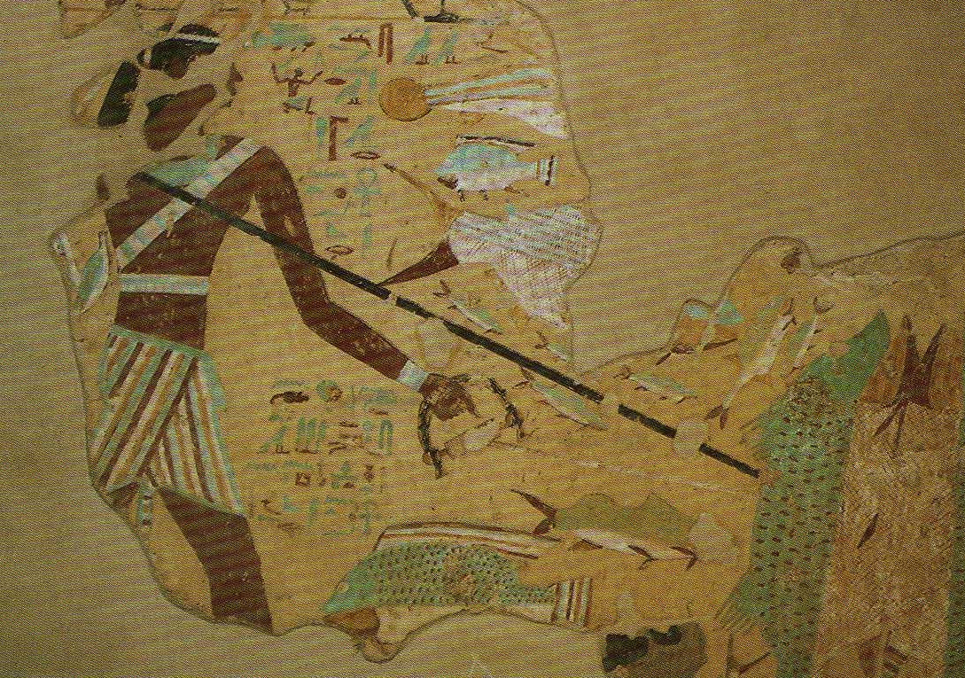
El Mo'alla ( ar, المعلّى) is a town in Upper Egypt located about 35 km south of Luxor, on the east bank of the Nile. Known as Hefat by ancient Egyptians, it served as a necropolis for the nearby city of Djerty (nowadays El-Tod) since the early First Intermediate Period. Two rock-cut tombs within it, datable to this period, are particularly remarkable because of their decorations, that of the two nomarchs Ankhtifi Ankhtifi (or Ankhtify) was a nomarch of Hierakonpolis and a supporter of the pharaoh in Herakleopolis Magna (10th Dynasty), which was locked in a conflict with the Theban based 11th Dynasty kingdom for control of Egypt. Hence, Ankhtifi was poss ... and Sobekhotep. References External links Egyptsites page on el-Mo'alla Towns in Egypt Populated places in Luxor Governorate {{egypt-geo-stub ... [...More Info...] [...Related Items...] OR: [Wikipedia] [Google] [Baidu] |
Ankhtifi
Ankhtifi (or Ankhtify) was a nomarch of Hierakonpolis and a supporter of the pharaoh in Herakleopolis Magna (10th Dynasty), which was locked in a conflict with the Theban based 11th Dynasty kingdom for control of Egypt. Hence, Ankhtifi was possibly a rival to the Theban rulers Mentuhotep I and Intef I. He lived during the First Intermediate Period, after the Egyptian Old Kingdom state had collapsed, and at a time when economic hardship, political instability, and foreign invasion challenged the fabric of Egyptian society. Biography The precise pharaoh under whom Ankhtifi served is anything but certain; the sequence and number of kings in the 9th and 10th dynasties is a matter of widely varying conjecture. Only a few of the many names on the much later king-lists have had their reigns or existence corroborated through scattered archaeological finds. The only pharaoh mentioned in Ankhtifi's tomb is in the following isolated inscription: "Horus brings/brought (or may Horus bring) a ( ... [...More Info...] [...Related Items...] OR: [Wikipedia] [Google] [Baidu] |
Upper Egypt
Upper Egypt ( ar, صعيد مصر ', shortened to , , locally: ; ) is the southern portion of Egypt and is composed of the lands on both sides of the Nile that extend upriver from Lower Egypt in the north to Nubia in the south. In ancient Egypt, Upper Egypt was known as ''tꜣ šmꜣw'', literally "the Land of Reeds" or "the Sedgeland". It is believed to have been united by the rulers of the supposed Thinite Confederacy who absorbed their rival city states during the Naqada III period (c. 3200–3000 BC), and its subsequent unification with Lower Egypt ushered in the Early Dynastic period. Upper and Lower Egypt became intertwined in the symbolism of pharaonic sovereignty such as the Pschent double crown. Upper Egypt remained as a historical region even after the classical period. Geography Upper Egypt is between the Cataracts of the Nile beyond modern-day Aswan, downriver (northward) to the area of El-Ayait, which places modern-day Cairo in Lower Egypt. The northern (d ... [...More Info...] [...Related Items...] OR: [Wikipedia] [Google] [Baidu] |
Luxor
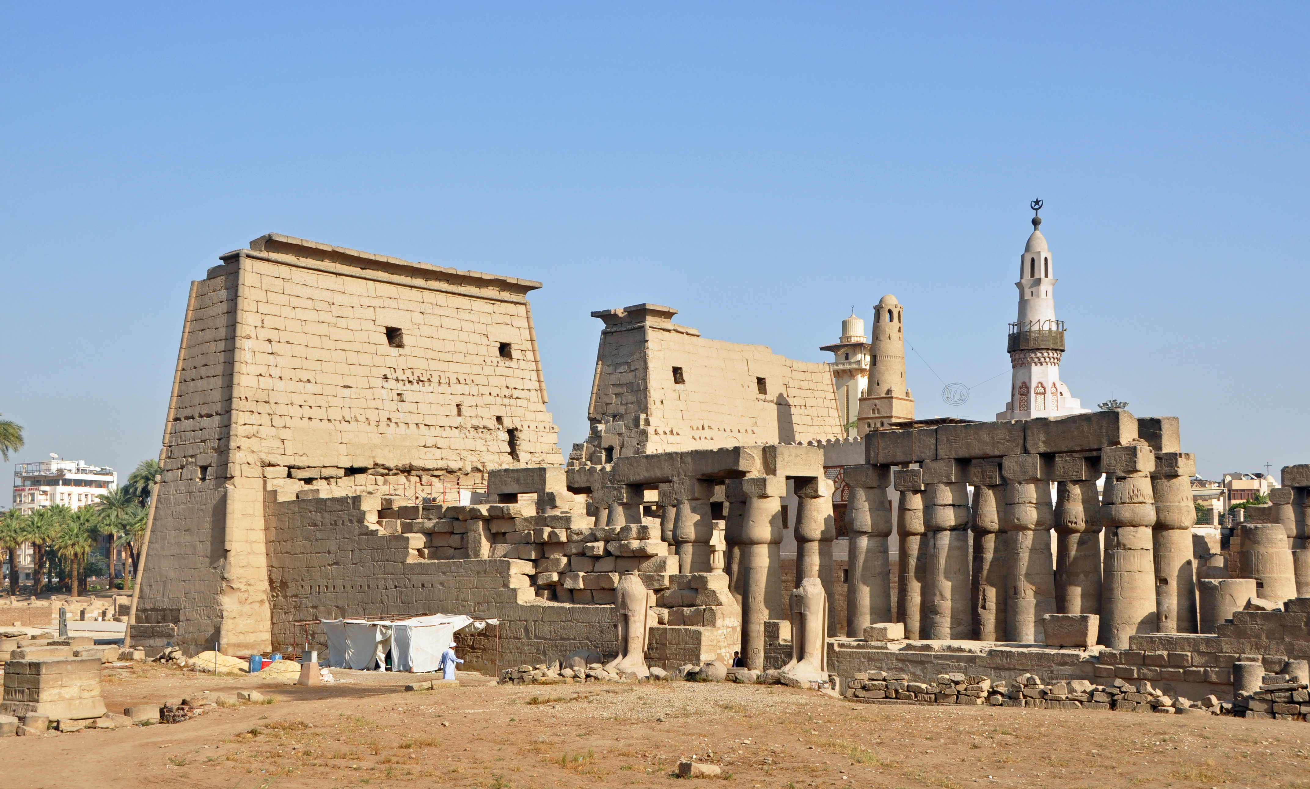
Luxor ( ar, الأقصر, al-ʾuqṣur, lit=the palaces) is a modern city in Upper (southern) Egypt which includes the site of the Ancient Egyptian city of ''Thebes''. Luxor has frequently been characterized as the "world's greatest open-air museum", as the ruins of the Egyptian temple complexes at Karnak and Luxor stand within the modern city. Immediately opposite, across the River Nile, lie the monuments, temples and tombs of the west bank Theban Necropolis, which includes the Valley of the Kings and Valley of the Queens. Thousands of tourists from all around the world arrive annually to visit Luxor's monuments, contributing greatly to the economy of the modern city. The population of Luxor is 422,407 (2021), with an area of approximately . It is the capital of Luxor Governorate. It is among the oldest inhabited cities in the world. Etymology The name ''Luxor'' ( ar, الأقصر, al-ʾuqṣur, lit=the palace, pronounced , , Upper Egyptian: ) derives from the Arabic ... [...More Info...] [...Related Items...] OR: [Wikipedia] [Google] [Baidu] |
Nile
The Nile, , Bohairic , lg, Kiira , Nobiin language, Nobiin: Áman Dawū is a major north-flowing river in northeastern Africa. It flows into the Mediterranean Sea. The Nile is the longest river in Africa and has historically been considered the List of rivers by length, longest river in the world, though this has been contested by research suggesting that the Amazon River is slightly longer.Amazon Longer Than Nile River, Scientists Say Of the world's major rivers, the Nile is one of the smallest, as measured by annual flow in cubic metres of water. About long, its drainage basin covers eleven countries: the Democratic Republic of the Congo, Tanzania, Burundi, Rwanda, Uganda, Kenya, Ethiopia, Erit ... [...More Info...] [...Related Items...] OR: [Wikipedia] [Google] [Baidu] |
Necropolis
A necropolis (plural necropolises, necropoles, necropoleis, necropoli) is a large, designed cemetery with elaborate tomb monuments. The name stems from the Ancient Greek ''nekropolis'', literally meaning "city of the dead". The term usually implies a separate burial site at a distance from a city, as opposed to tombs within cities, which were common in various places and periods of history. They are different from grave fields, which did not have structures or markers above the ground. While the word is most commonly used for ancient sites, the name was revived in the early 19th century and applied to planned city cemeteries, such as the Glasgow Necropolis. Necropoli in the ancient world Egypt Ancient Egypt is noted for multiple necropoleis. Ancient Egyptian funerary practices and beliefs about the afterlife led to the construction of several extensive necropoleis to secure and provision the dead in the hereafter. These necropoleis are therefore major archaeological si ... [...More Info...] [...Related Items...] OR: [Wikipedia] [Google] [Baidu] |
El-Tod
El-Tod ( ar, طود , from , , , ) was the site of an ancient Egyptian town and a temple to the Egyptian god Montu. It is located southwest of Luxor, Egypt, near the settlement of Hermonthis. A modern village now surrounds the site. History The history of the site can be traced to the Old Kingdom period of Egyptian history. A granite pillar of the Fifth dynasty pharaoh, Userkaf, is the oldest object found at El-Tod. It was this same pharaoh who ordered that the temple to Montu be enlarged. Evidence of Eleventh dynasty building is shown in the discovery of blocks bearing the names of Mentuhotep II and Mentuhotep III. Under Senwosret I, these buildings were replaced with a new temple. Further additions to this temple were made under Ptolemy VIII. Culture Aside from Montu, to whom a temple was dedicated, the Egyptian goddess Iunit was of local importance. According to Flinders Petrie, the god of Tuphium was Hemen. As part of the Thebaid, the area also saw the worship of Sebak (S ... [...More Info...] [...Related Items...] OR: [Wikipedia] [Google] [Baidu] |
First Intermediate Period
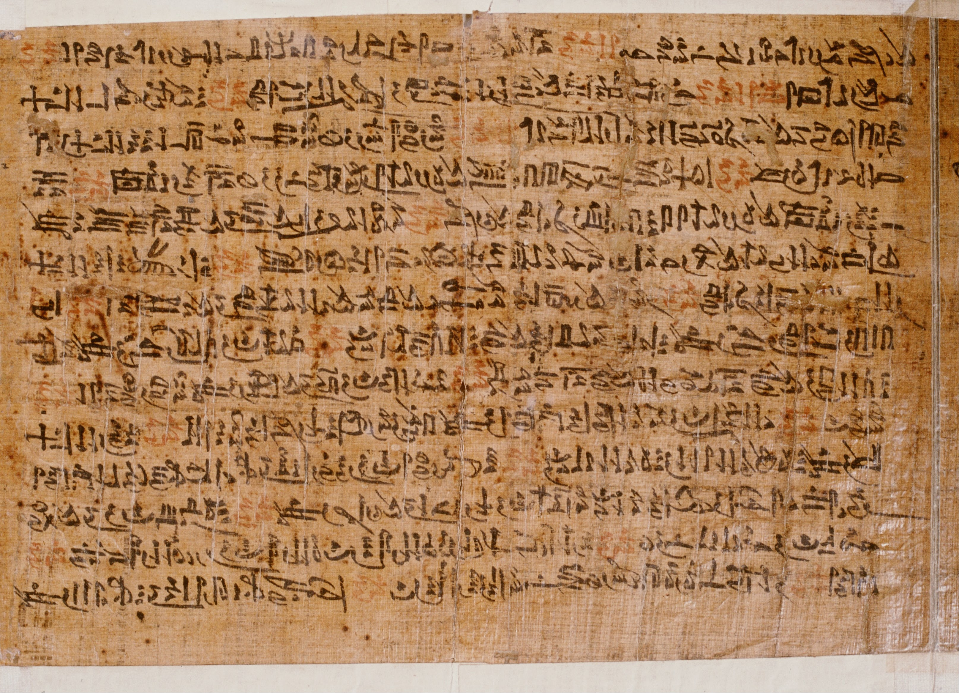
The First Intermediate Period, described as a 'dark period' in ancient Egyptian history, spanned approximately 125 years, c. 2181–2055 BC, after the end of the Old Kingdom. It comprises the Seventh (although this is mostly considered spurious by Egyptologists), Eighth, Ninth, Tenth, and part of the Eleventh Dynasties. The concept of a "First Intermediate Period" was coined in 1926 by Egyptologists Georg Steindorff and Henri Frankfort. Very little monumental evidence survives from this period, especially from the beginning of the era. The First Intermediate Period was a dynamic time in which rule of Egypt was roughly equally divided between two competing power bases. One of the bases was at Heracleopolis in Lower Egypt, a city just south of the Faiyum region, and the other was at Thebes, in Upper Egypt. It is believed that during that time, temples were pillaged and violated, artwork was vandalized, and the statues of kings were broken or destroyed as a result of the pos ... [...More Info...] [...Related Items...] OR: [Wikipedia] [Google] [Baidu] |
Rock-cut Tomb
A rock-cut tomb is a burial chamber that is cut into an existing, naturally occurring rock formation, so a type of rock-cut architecture. They are usually cut into a cliff or sloping rock face, but may go downward in fairly flat ground. It was a common form of burial for the wealthy in ancient times in several parts of the world. Important examples are found in Egypt, most notably in the town of Deir el-Medina (Seet Maat), located between the Valley of the Kings and the Valley of the Queens. Other notable clusters include numerous rock-cut tombs in modern Israel, at Naghsh-e Rostam necropolis in Iran, at Myra in Turkey, Petra in modern Jordan, Mada'in Saleh in Saudi Arabia, Sicily (Pantalica) and Larnaca. Indian rock-cut architecture is very extensive, but does not feature tombs. Chronology * Egyptian rock-cut tombs (1450 BCE, Thebes, Egypt). * Phrygian rock-cut tombs such as the Midas monument (700 BCE). * Etruscan rock-cut tombs, Etruria, Italy (500 BCE). * Tomb of Darius I (N ... [...More Info...] [...Related Items...] OR: [Wikipedia] [Google] [Baidu] |
Nomarch
A nomarch ( grc, νομάρχης, egy, ḥrj tp ꜥꜣ Great Chief) was a provincial governor in ancient Egypt; the country was divided into 42 provinces, called nomes (singular , plural ). A nomarch was the government official responsible for a nome. Etymology The term ''nome'' is derived from grc, νομός ''nomós'' "province, district". ''Nomarch'' is derived from ''nomárkhēs'': "province" + "ruler". Egyptian history The division of the Egyptian kingdom into nomes can be documented as far back as the reign of Djoser of the 3rd Dynasty in the early Old Kingdom, c. 2670 BCE, and potentially dates even further back to the Predynastic kingdoms of the Nile valley. The earliest topographical lists of the nomes of Upper and Lower Egypt date back to the reign of Nyuserre Ini, of the mid 5th Dynasty, from which time the nomarchs no longer lived at royal capital but stayed in their nomes. The power of the nomarchs grew with the reforms of Nyuserre's ... [...More Info...] [...Related Items...] OR: [Wikipedia] [Google] [Baidu] |
Towns In Egypt
A town is a human settlement. Towns are generally larger than villages and smaller than cities, though the criteria to distinguish between them vary considerably in different parts of the world. Origin and use The word "town" shares an origin with the German word , the Dutch word , and the Old Norse . The original Proto-Germanic word, *''tūnan'', is thought to be an early borrowing from Proto-Celtic *''dūnom'' (cf. Old Irish , Welsh ). The original sense of the word in both Germanic and Celtic was that of a fortress or an enclosure. Cognates of ''town'' in many modern Germanic languages designate a fence or a hedge. In English and Dutch, the meaning of the word took on the sense of the space which these fences enclosed, and through which a track must run. In England, a town was a small community that could not afford or was not allowed to build walls or other larger fortifications, and built a palisade or stockade instead. In the Netherlands, this space was a garden, more ... [...More Info...] [...Related Items...] OR: [Wikipedia] [Google] [Baidu] |


.jpg)