|
Ediz Hook
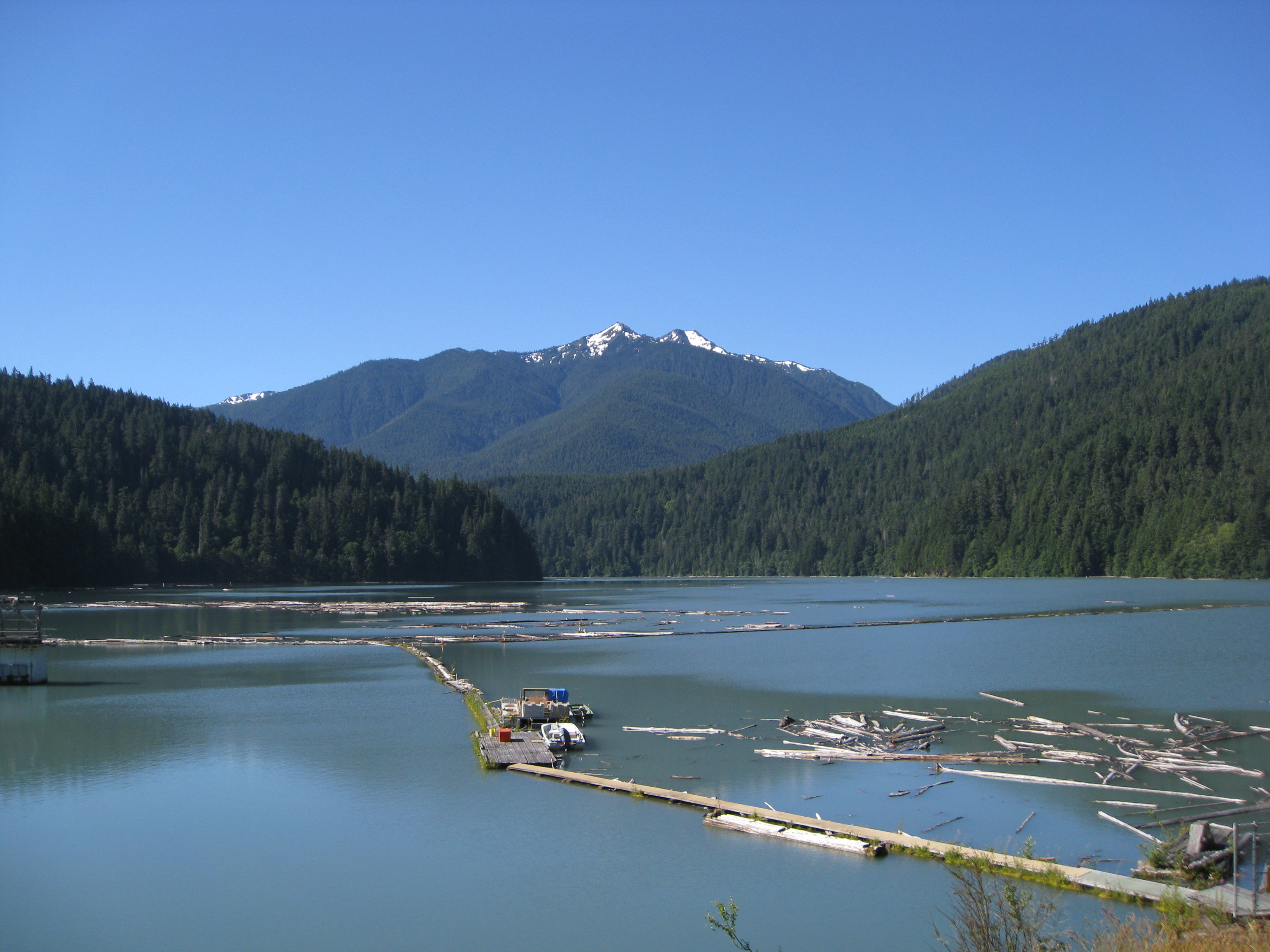
Ediz Hook is a sand spit that extends from northern shore of the Olympic Peninsula at Port Angeles in northcentral Clallam County, Washington, USA, northeasterly into the Strait of Juan de Fuca, located about west of the larger Dungeness Spit. It is relatively narrow at points, but broader toward the base and the northeast tip. Much of the spit is accessible by car on the Ediz Hook Road (1.5 to 2 miles), which passes several turnouts and picnic areas, with broad views of Port Angeles and the Olympic Mountains, notably the peaks of Mount Angeles and Klahhane Ridge. To the north marine traffic can be observed, and orca pods, harbor seals and other marine life can be spotted. Several long stretches of public beach facilitate beachcombing and birdwatching. The end of the spit is used by the Coast Guard and not accessible to visitors. "The Hook" was created by wind and tidal action along the southern edge of the Strait, that carried sediment from the delta of the Elwha River ea ... [...More Info...] [...Related Items...] OR: [Wikipedia] [Google] [Baidu] |
EDIZ HOOK AND LOG RAFTS - NARA - 552170
Edis, EDIS or Ediz may also refer to: * Edis (name) * Electronic Distributorless Ignition System ** Ford EDIS * Emergency Disaster Information Service, a global natural disaster tracking service in Hungary * Emergency Digital Information Service, a public information system run by the State of California * Emily Dickinson International Society, society to study the American poet * Environmental Data and Information Service The National Oceanic and Atmospheric Administration (abbreviated as NOAA ) is an United States scientific and regulatory agency within the United States Department of Commerce that forecasts weather, monitors oceanic and atmospheric conditio ... * European Deposit Insurance Scheme, proposed part of the Economic and Monetary Union of the European Union See also * Edisa, a settlement in South Ossetia, Georgia {{disambiguation ... [...More Info...] [...Related Items...] OR: [Wikipedia] [Google] [Baidu] |
Harbor Seal
The harbor (or harbour) seal (''Phoca vitulina''), also known as the common seal, is a true seal found along temperate and Arctic marine coastlines of the Northern Hemisphere. The most widely distributed species of pinniped (walruses, eared seals, and true seals), they are found in coastal waters of the northern Atlantic, Pacific Oceans, Baltic and North Seas. Harbor seals are brown, silvery white, tan, or gray, with distinctive V-shaped nostrils. An adult can attain a length of 1.85 m (6.1 ft) and a mass of up to . Blubber under the seal's skin helps to maintain body temperature. Females outlive males (30–35 years versus 20–25 years). Harbor seals stick to familiar resting spots or haulout sites, generally rocky areas (although ice, sand, and mud may also be used) where they are protected from adverse weather conditions and predation, near a foraging area. Males may fight over mates under water and on land. Females bear a single pup after a nine-month gestation, w ... [...More Info...] [...Related Items...] OR: [Wikipedia] [Google] [Baidu] |
Elwha Ecosystem Restoration
The Elwha Ecosystem Restoration Project is a 21st-century project of the U.S. National Park Service to remove two dams on the Elwha River on the Olympic Peninsula in Washington state, and restore the river to a natural state. It is the largest dam removal project in history and the second largest ecosystem restoration project in the history of the National Park Service, after the Restoration of the Everglades. The controversial project, costing about $351.4 million, has been contested and periodically blocked for decades. It has been supported by a major collaboration among the Lower Elwha Klallam Tribe, and federal and state agencies. The removal of the first of the two dams, the Elwha Dam, began in September 2011 and was completed ahead of schedule in March 2012. Removal of the second dam, the Glines Canyon Dam, was completed on August 26, 2014. History of the Elwha River Historically, the Elwha River was one of the few rivers in the contiguous United States that supported ... [...More Info...] [...Related Items...] OR: [Wikipedia] [Google] [Baidu] |
Coast Guard Air Station Port Angeles
US Coast Guard Air Station Sector Field Office Port Angeles is located at the end of the Ediz Hook peninsula in Port Angeles, Washington. History The Coast Guard's presence in Port Angeles began on August 1, 1862 with the arrival of the SHUBRICK, the first Revenue Cutter to be home ported on the Olympic Peninsula. Ediz Hook, a level sand spit extending from the mainland north and east into the Strait of Juan de Fuca, was declared a Federal Lighthouse Reservation by President Lincoln in 1863. The first lighthouse was commissioned on 1 April 1865. The Air Station was commissioned on 1 June 1935, becoming the first permanent Coast Guard Air Station on the Pacific Coast. Its location was chosen for its strategic position for coastal defense of the Northwest. The first aircraft, a Douglas RD-4 amphibian, arrived 11 June 1935 and flew the first "mercy hop" on August 1935. The 75-foot patrol boats were also stationed at the new unit. During World War II, the Air Station exp ... [...More Info...] [...Related Items...] OR: [Wikipedia] [Google] [Baidu] |
Ediz Hook Light
Ediz Hook Lighthouse was a lighthouse in Port Angeles, Washington, United States. Originally constructed in 1865, the lighthouse structure was later replaced in 1908 by a new structure, and finally in 1946 by an automated beacon on the United States Coast Guard air station on the end of Ediz Hook. History Ediz Hook is a three-mile-long sand spit that juts north and east into the Strait of Juan de Fuca and forms the natural harbor at Port Angeles. Private operators built navigational warning fires on the spit as early as 1861. The first Ediz Hook lighthouse was built near the tip of the spit in 1865. It was a two-story, schoolhouse-type building with a lighthouse tower arising at one end of its gabled roof. Its first keeper was George Smith, the father of Port Angeles's prime promoter, Victor Smith. In 1908, a second Ediz Hook lighthouse was constructed near the first lighthouse, with the two buildings existing in close proximity to each other. The new lighthouse used the same C ... [...More Info...] [...Related Items...] OR: [Wikipedia] [Google] [Baidu] |
Klallam
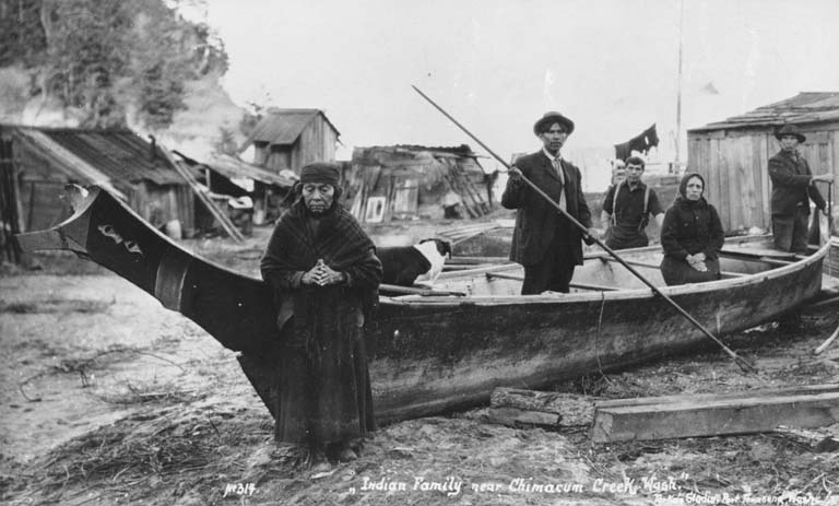
Klallam (also Clallam, although the spelling with "K" is preferred in all four modern Klallam communities) refers to four related indigenous Native American/First Nations communities from the Pacific Northwest of North America. The Klallam culture is classified ethnographically and linguistically in the Coast Salish subgroup. Two Klallam bands live on the Olympic Peninsula and one on the Kitsap Peninsula in Washington state, and one is based at Becher Bay on southern Vancouver Island in British Columbia. Name variants and usage The indigenous Klallam language name for the tribe is ''nəxʷsƛ̕ay̕əm'' (meaning "strong people"). The word "Klallam" comes from the North Straits Salish language name for the Klallam people, . This has had a wide variety of English spellings including "Chalam", "Clalam", "Clallem", "Clallum", "Khalam", "Klalam", "Noodsdalum", "Nooselalum", "Noostlalum", "Tlalum", "Tlalam", "Wooselalim", "S'Klallam", "Ns'Klallam", "Klallam" and "Clallam". "Clallam" ... [...More Info...] [...Related Items...] OR: [Wikipedia] [Google] [Baidu] |
Tse-whit-zen
Tse-whit-zen (''č̕ixʷícən'' in the Klallam language, meaning "inner harbor") is a 1,700- to 2,700-year-old village of the Lower Elwha Klallam Tribe located along the Port Angeles, Washington waterfront. It is located at the base of Ediz Hook on the Olympic Peninsula. During construction in August 2003 of a graving dock associated with replacement of the Hood Canal Bridge, the village's cemetery and other prehistoric remains were discovered. The construction project was abandoned at this site because of the importance of the find, as the village was intact. It is the largest pre-European contact village site excavated in Washington State. Archaeological excavation has revealed more than 10,000 artifacts and more than 335 intact skeletons. The Washington State Department of Transportation decided to halt all construction efforts related to the graving dock on December 21, 2004. Since then it has worked to ensure the preservation of remains and artifacts already uncovered by th ... [...More Info...] [...Related Items...] OR: [Wikipedia] [Google] [Baidu] |
Elwha River
The Elwha River is a river on the Olympic Peninsula in the U.S. state of Washington (state), Washington. From its source at Elwha snowfinger in the Olympic Mountains, it flows generally north to the Strait of Juan de Fuca. Most of the river's course is within the Olympic National Park. The Elwha is one several rivers in the Pacific Northwest that hosts all five species of native Pacific salmon (Chinook salmon, chinook, coho salmon, coho, chum salmon, chum, sockeye salmon, sockeye, and pink salmon), plus four Fish migration, anadromous trout species (Rainbow trout, steelhead, coastal cutthroat trout, bull trout, and Dolly Varden char). From 1911 to 2014, dams blocked fish passage on the lower Elwha River. Before the dams, 400,000 adult salmon returned yearly to spawn in of river habitat. Prior to dam removal, fewer than 4,000 salmon returned each year in only of habitat below the lower dam. The National Park Service removed the two dams as part of the $325 million Elwha Ecosyste ... [...More Info...] [...Related Items...] OR: [Wikipedia] [Google] [Baidu] |
Coast Guard Air Station Port Angeles Fog
The coast, also known as the coastline or seashore, is defined as the area where land meets the ocean, or as a line that forms the boundary between the land and the coastline. The Earth has around of coastline. Coasts are important zones in natural ecosystems, often home to a wide range of biodiversity. On land, they harbor important ecosystems such as freshwater or estuarine wetlands, which are important for bird populations and other terrestrial animals. In wave-protected areas they harbor saltmarshes, mangroves or seagrasses, all of which can provide nursery habitat for finfish, shellfish, and other aquatic species. Rocky shores are usually found along exposed coasts and provide habitat for a wide range of sessile animals (e.g. mussels, starfish, barnacles) and various kinds of seaweeds. Along tropical coasts with clear, nutrient-poor water, coral reefs can often be found between depths of . According to a United Nations atlas, 44% of all people live within 5 km (3.3mi) ... [...More Info...] [...Related Items...] OR: [Wikipedia] [Google] [Baidu] |
Orca
The orca or killer whale (''Orcinus orca'') is a toothed whale belonging to the oceanic dolphin family, of which it is the largest member. It is the only Extant taxon, extant species in the genus ''Orcinus'' and is recognizable by its black-and-white patterned body. A cosmopolitan species, orcas can be found in all of the world's oceans in a variety of marine environments, from Arctic Ocean, Arctic and Southern Ocean, Antarctic regions to tropical seas. Orcas have a diverse diet, although individual populations often specialize in particular types of prey. Some feed exclusively on fish, while others hunt marine mammals such as Pinniped, seals and other species of dolphin. They have been known to attack baleen whale calves, and even adult whales. Orcas are apex predators, as they have no natural predators. They are highly Social animal, social; some populations are composed of very stable matrilineal family groups (pods) which are the most stable of any animal species. Their ... [...More Info...] [...Related Items...] OR: [Wikipedia] [Google] [Baidu] |
Spit (landform)
A spit or sandspit is a deposition bar or beach landform off coasts or lake shores. It develops in places where re-entrance occurs, such as at a cove's headlands, by the process of longshore drift by longshore currents. The drift occurs due to waves meeting the beach at an oblique angle, moving sediment down the beach in a zigzag pattern. This is complemented by longshore currents, which further transport sediment through the water alongside the beach. These currents are caused by the same waves that cause the drift. Hydrology and geology Where the direction of the shore inland ''re-enters'', or changes direction, for example at a headland, the longshore current spreads out or dissipates. No longer able to carry the full load, much of the sediment is dropped. This is called deposition. This submerged bar of sediment allows longshore drift or littoral drift to continue to transport sediment in the direction the waves are breaking, forming an above-water spit. Without the co ... [...More Info...] [...Related Items...] OR: [Wikipedia] [Google] [Baidu] |
Mount Angeles
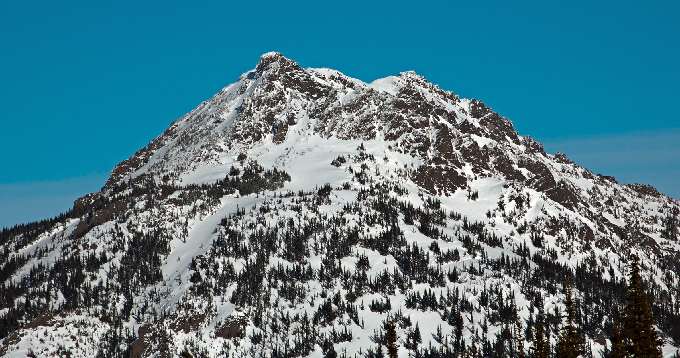
Mount Angeles is located just south of Port Angeles, Washington in the Olympic National Park. It is the highest peak in the Hurricane Ridge area. The summit, which offers panoramic views of the Strait of Juan de Fuca and many of the peaks of the interior Olympic Mountains can be climbed from the Klahane Ridge trail. The southeast side of Mount Angeles drains into Morse Creek, thence into the Strait of Juan de Fuca a couple of miles east of Port Angeles. The northeast side of Mount Angeles drains into Ennis Creek, thence into Port Angeles Harbor. The north and west sides of Mount Angeles drain into the South Branch of Little River, thence into the Juan de Fuca Strait via the Elwha River, whose mouth is located in the Lower Elwha Indian Reservation, a few miles west of Port Angeles. Climate Mount Angeles is located in the marine west coast climate zone of western North America. Most weather fronts originate in the Pacific Ocean, and travel northeast toward the Olympic Mo ... [...More Info...] [...Related Items...] OR: [Wikipedia] [Google] [Baidu] |


