|
Eastside Trail
The Eastside Trail is a walking and biking trail stretching northwest to southeast on the Eastside of Atlanta, part of the BeltLine ring of trails and parks. It is lined with numerous notable industrial buildings adapted into restaurants, shops, apartments, condos, and two major food halls and mixed-use developments. The first stretch opened in October 2012, from Piedmont Park to the Krog Street Tunnel. It was extended from Krog Street to Kirkwood Avenue in November 2017. A second extension brought it to Memorial Drive in July 2019. Route and Points of Interest Gallery File:AnsleyMall.jpg, Ansley Mall File:Beltline from Woodward Bridge in Piedmont Park.JPG, Interim trail adjacent to Piedmont Park File:Amsterdam Walk 3.jpg, Amsterdam Walk File:Ponce_City_Market_1.JPG, Ponce City Market seen from BeltLine File:Ford Factory Lofts Atlanta.JPG, Ford Factory Lofts seen from BeltLine, 2012 File:Masq atlanta.jpg, DuPre Excelsior Mill File:Historic Fourth Ward Park retention pond.JP ... [...More Info...] [...Related Items...] OR: [Wikipedia] [Google] [Baidu] |
Eastside, Atlanta
Eastside refers to the city district comprising the easternmost portion of Atlanta, Georgia, United States. The Eastside generally encompasses the area bounded on the west by Midtown Atlanta and Downtown Atlanta and on the east by the city limits. The central corridor of the district is the BeltLine Eastside Trail, which connects northern Eastside neighborhoods with those to the south. The Eastside is known for its nightlife establishments, craftsman architecture, local eateries, and quirky public art. History The area that is now the Eastside was the site of the Battle of Atlanta, which was part of the Atlanta Campaign and sealed the fate of the Confederacy. Indeed, Lemuel P. Grant designed the city's fortifications to protect his plantation on what is now the Eastside neighborhood of Grant Park. General James B. McPherson placed his Yankee forces on high ground a mile east of Grant's plantation, in the neighborhood today known as East Atlanta. Beginning in the 1890s, ... [...More Info...] [...Related Items...] OR: [Wikipedia] [Google] [Baidu] |
Ponce City Market
Ponce City Market is a mixed-use development located in a former Sears catalogue facility in Atlanta, with national and local retail anchors, restaurants, a food hall, boutiques and offices, and residential units. It is located adjacent to the intersection of the BeltLine with Ponce de Leon Avenue in the Old Fourth Ward near Virginia Highland, Poncey-Highland and Midtown neighborhoods. The building, one of the largest by volume in the Southeast United States, was used by Sears, Roebuck and Co. from 1926–1987 and later by the City of Atlanta as "City Hall East". The building's lot covers . Ponce City Market officially opened on August 25, 2014. It was listed on the National Register of Historic Places in 2016. Occupants The complex contains offices, apartments, a gourmet food hall, retail stores, educational facilities, and a rooftop amusement park. Larger retail stores include Anthropologie, Citizen Supply, J. Crew, Williams Sonoma, and West Elm. Ponce City Market sta ... [...More Info...] [...Related Items...] OR: [Wikipedia] [Google] [Baidu] |
Decatur Street (Atlanta)
Decatur Street is one of the original 7 streets of Atlanta, Georgia; it was also a famous (and infamous) entertainment area from the 1850s through the early 20th century. History In 1854 the first theater in the city, the Athenaeum, opened on Decatur near Peachtree Street. In the early 20th century, it included an African American entertainment district. In 1906 it was the trigger point of the Atlanta Race Riot; allegations that the street's dive bars, frequented by blacks, were showing nude pictures of white women and "troublesome Negro vagrants" were hanging around there were among the allegations whipping up anti-black sentiment among poor whites. After the riot, the ''Atlanta Constitution'' regularly ran stories documenting city efforts to clean up the street's dance halls, saloons, and dives; ragtime music; whiskey and drug peddling. In 1909 the city nearly changed the name of the street to East Main Street in an effort to clean up the street's reputation.''Atlanta Constit ... [...More Info...] [...Related Items...] OR: [Wikipedia] [Google] [Baidu] |
Edgewood Avenue
Edgewood Avenue is a street in Atlanta, Georgia, United States which runs from Five Points in Downtown Atlanta, eastward through the Old Fourth Ward. The avenue runs in the direction of the Edgewood neighborhood, and stops just short of it in Inman Park. Edgewood Avenue was first important as the route of a streetcar line to Inman Park, Atlanta's first garden suburb and home to many of its most prominent citizens. Today, the avenue is known for its restaurants and nightlife around its intersection with Boulevard. History Edgewood Avenue has its origins with the Atlanta & Edgewood Street Railroad Company, originally authorized to run horsecars along Foster Street to what was then the separate village of Edgewood. The company, owned by Joel Hurt, introduced Atlanta's first electric streetcar service in 1889. The streetcar was designed to make Hurt's garden suburb, Inman Park, easily and comfortably accessible. At the time, on the present route of Edgewood Avenue, there exis ... [...More Info...] [...Related Items...] OR: [Wikipedia] [Google] [Baidu] |
Krog Street Market
Krog Street Market is a mixed-use development in Atlanta, located along the BeltLine trail at Edgewood Avenue in Inman Park which opened in Summer 2014. The complex is centered on a , west coast-style market and restaurants, and also includes up to 300 apartments (of which 225 in Phase I). The marketplace has been planned to have four or five restaurants and merchants such as florists, cheesemakers, butchers, and bakers under one roof. It is to incorporate two existing parcels on either side of Krog Street: The Stove Works on the west side and the former Tyler Perry Studios at 99 Krog Street, on the east side. The conversion to Krog Street Market is to cost $70 million. The Stove Works is to remain unaltered. Illustrations in the plans show the existing bridge over Krog Street renovated as a pedestrian bridge and incorporated as part of the complex. Site history The Atlanta Stove Works, a former pot-belly stove and iron-pan factory opened in 1889, and flourished in the 1920s when ... [...More Info...] [...Related Items...] OR: [Wikipedia] [Google] [Baidu] |
Inman Park
Inman Park is an intown neighborhood on the east side of Atlanta, Georgia, and its first planned suburb. It was named for Samuel M. Inman. History Today's neighborhood of Inman Park includes areas that were originally designated * Inman Park proper (today the Inman Park Historic District) * Moreland Park (today the Inman Park-Moreland Historic District) * part of Copenhill Park (properties on Atlantis, the south side of Highland, and the north sides of Sinclair and a block of Austin) * former industrial areas on the western side, now mixed-use developments including Inman Park Village and North Highland Steel The area was part of the battlefield in the Battle of Atlanta in 1864. Atlanta's first streetcar suburb Inman Park (proper) was planned in the late 1880s by Joel Hurt, a civil engineer and real-estate developer who intended to create a rural oasis connected to the city by the first of Atlanta's electric streetcar lines, along Edgewood Avenue. The East Atlanta Land C ... [...More Info...] [...Related Items...] OR: [Wikipedia] [Google] [Baidu] |
Freedom Parkway
Freedom Park is one of the largest city parks in Atlanta, Georgia, United States. The park forms a cross shape with the axes crossing at the Carter Center. The park stretches west-east from Parkway Drive, just west of Boulevard, to the intersection with the north-south BeltLine Eastside Trail, to Candler Park, and north-south from Ponce de Leon Avenue to the Inman Park/Reynoldstown MARTA station. Freedom Parkway, rededicated John Lewis Freedom Parkway in 2018 in honor of local U.S. Congressman and civil rights icon John Lewis, is a four-lane limited-access road. It is the westernmost portion of Georgia State Route 10 (SR 10). It travels through the park west-to-east from the Downtown Connector to the Carter Center, where the main road turns north towards Ponce de Leon Avenue, with a branch continuing east towards Moreland Avenue. History In the 1960s, the Georgia Department of Transportation began acquiring land for two east-side freeways. The north-south route would h ... [...More Info...] [...Related Items...] OR: [Wikipedia] [Google] [Baidu] |
Carter Center
The Carter Center is a nongovernmental, not-for-profit organization founded in 1982 by former U.S. President Jimmy Carter. He and his wife Rosalynn Carter partnered with Emory University just after his defeat in the 1980 United States presidential election. The center is located in a shared building adjacent to the Jimmy Carter Library and Museum on of parkland, on the site of the razed neighborhood of Copenhill, two miles (3 km) from downtown Atlanta, Georgia. The library and museum are owned and operated by the United States National Archives and Records Administration, while the center is governed by a Board of Trustees, consisting of business leaders, educators, former government officials, and philanthropists. The Carter Center's goal is to advance human rights and alleviate human suffering, including helping improve the quality of life for people in more than 80 countries. The center has many projects including election monitoring, supporting locally led state-build ... [...More Info...] [...Related Items...] OR: [Wikipedia] [Google] [Baidu] |
Telephone Factory Lofts
The Telephone Factory Lofts is a mixed-use loft building along the BeltLine trail in the Poncey-Highland neighborhood of Atlanta. It is listed on the National Register of Historic Places as the Western Electric Company Building. Layout The main entrance is via a -high Art Deco-style tower. There is a four-story main building, which once housed the factory floor, offices and cafeteria, as well as a single-story building, formerly a warehouse that housed the shipping and receiving areas of the factory."History and currency", Telephone Factory Lofts site There are 66 loft units ranging from to . History Western Electric factory and repair center The building was constructed in 1938 and was a |
Historic Fourth Ward Park
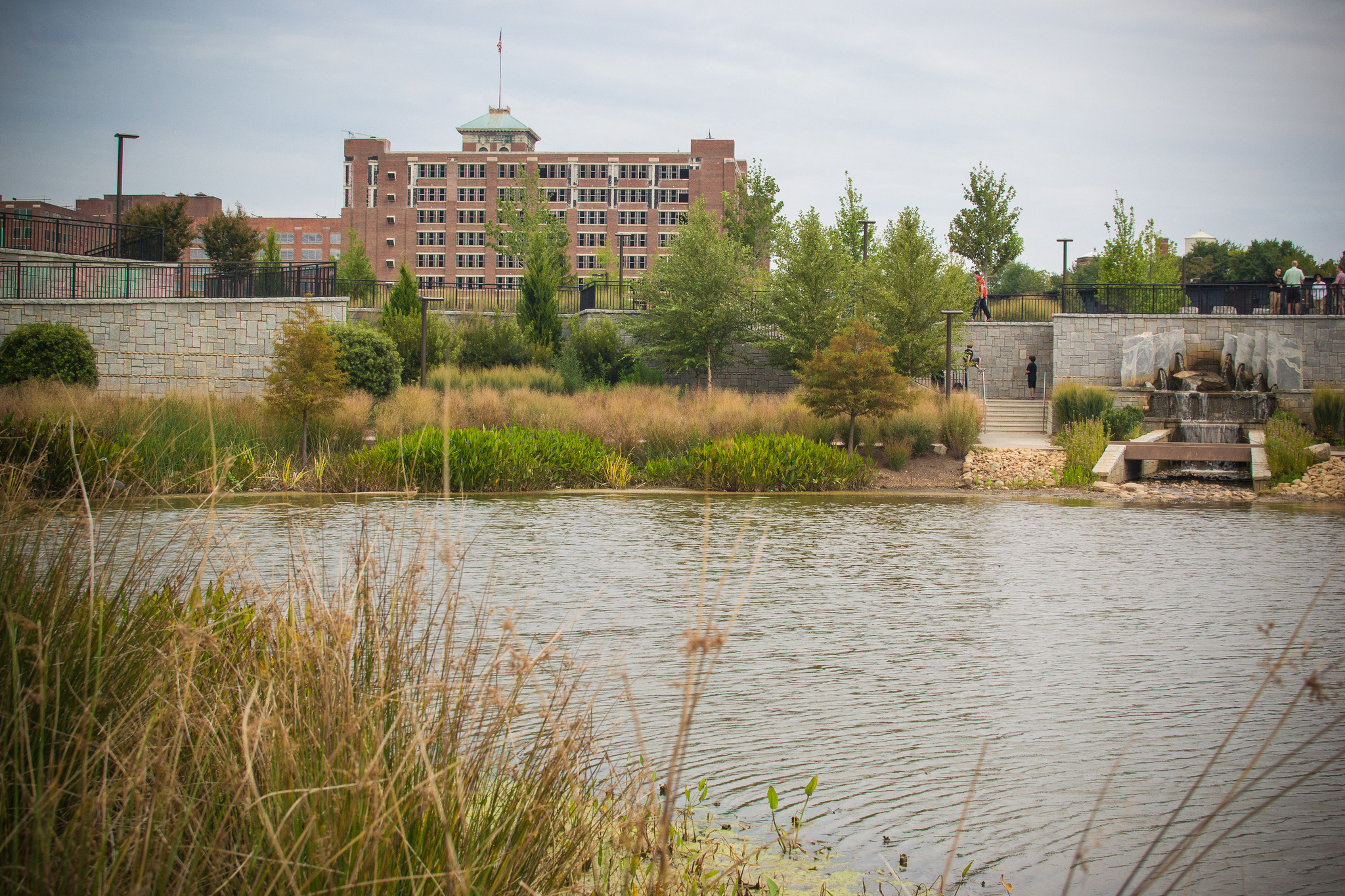
Historic Fourth Ward Park is a park built on the site of the old Ponce de Leon amusement park, in the Old Fourth Ward of Atlanta, just south of Ponce City Market and just west of the BeltLine Eastside Trail. Currently the park covers in two separate sections. History In Atlanta's Old Fourth Ward neighborhood, flooding from nearby Clear Creek has always been an issue. In the late 1980s and early 90s, the city drafted a $40 million plan to dig a massive underground tunnel in order to channel excess stormwater to a processing plant, where it would be cleaned and discharged into the Chattachoochee River. However, engineer-economist and environmentalist Bill Eisenhauer had a better idea. Eisenhauer believed that a solution utilizing green infrastructure could provide more benefits to both the ecosystem, and local residents. Eisenhauer created a plan for Historic Fourth Ward Park, a recreational area surrounding a 5-acre stormwater retention pond. The new plan, costing only $23 milli ... [...More Info...] [...Related Items...] OR: [Wikipedia] [Google] [Baidu] |
DuPre Excelsior Mill
Located at 695 North Avenue in Atlanta, the Dupre Excelsior Mill (the actual name as of 1911 was "Du Pree Manufacturing Company Excelsior Factory")Insurance maps of Atlanta, Georgia, Volume 2, 1911, Sanborn-Perris Map Co. Limited, http://dlgcsm.galib.uga.edu/StyleServer/calcrgn?browser=ns&cat=sanb&wid=380&hei=400&style=sanborn/sanb.xsl&item=atlanta-fulton-ga-1911-s-250.sid may have been built as early as 1890 by DuPre (also spelled Du Pree) Manufacturing Company. However, the mill fails to appear on Atlanta city maps in 1892 and 1899, which both show the property as vacant. The first possible reference to the mill exists in the report of the death of Hubert Neal on July 17, 1899. According to the report, his accident occurred at the Atlanta Excelsior Works, which may or may not be the same facility since at the time there were three excelsior factories in Atlanta. The earliest concrete confirmation of the mill seems to be three lawsuits filed against Dupre in 1907 for accident ... [...More Info...] [...Related Items...] OR: [Wikipedia] [Google] [Baidu] |


