|
Eastern Iran
Eastern Iran consists of the Lut Desert, the mountains ranges bordering Turkmenistan, Afghanistan and Pakistan, and the coastal strip of the Gulf of Oman. It includes the provinces of North Khorasan, Razavi Khorasan, South Khorasan and Sistan and Baluchestan sharing border with Turkmenistan, Afghanistan and Pakistan. Some references also count Kerman Province to this region. The major cities are Mashhad, Zahedan, Bojnurd, Birjand, Zabol, Chabahar and Neyshabur and sometimes Kerman. Climate *Hot desert climate in the plains and the south. *Cold desert climate in the north. *cold semi-arid climate in the mountain ranges. See also * Northern Iran * Western Iran * Southern Iran * Central Iran * Northwestern Iran Azerbaijan or Azarbaijan ( fa, آذربایجان, ''Āzarbāijān'' ; az-Arab, آذربایجان, ''Āzerbāyjān'' ), also known as Iranian Azerbaijan, is a historical region in northwestern Iran that borders Iraq, Turkey, the Nakhchivan ... References {{Ref ... [...More Info...] [...Related Items...] OR: [Wikipedia] [Google] [Baidu] |
Zahedan
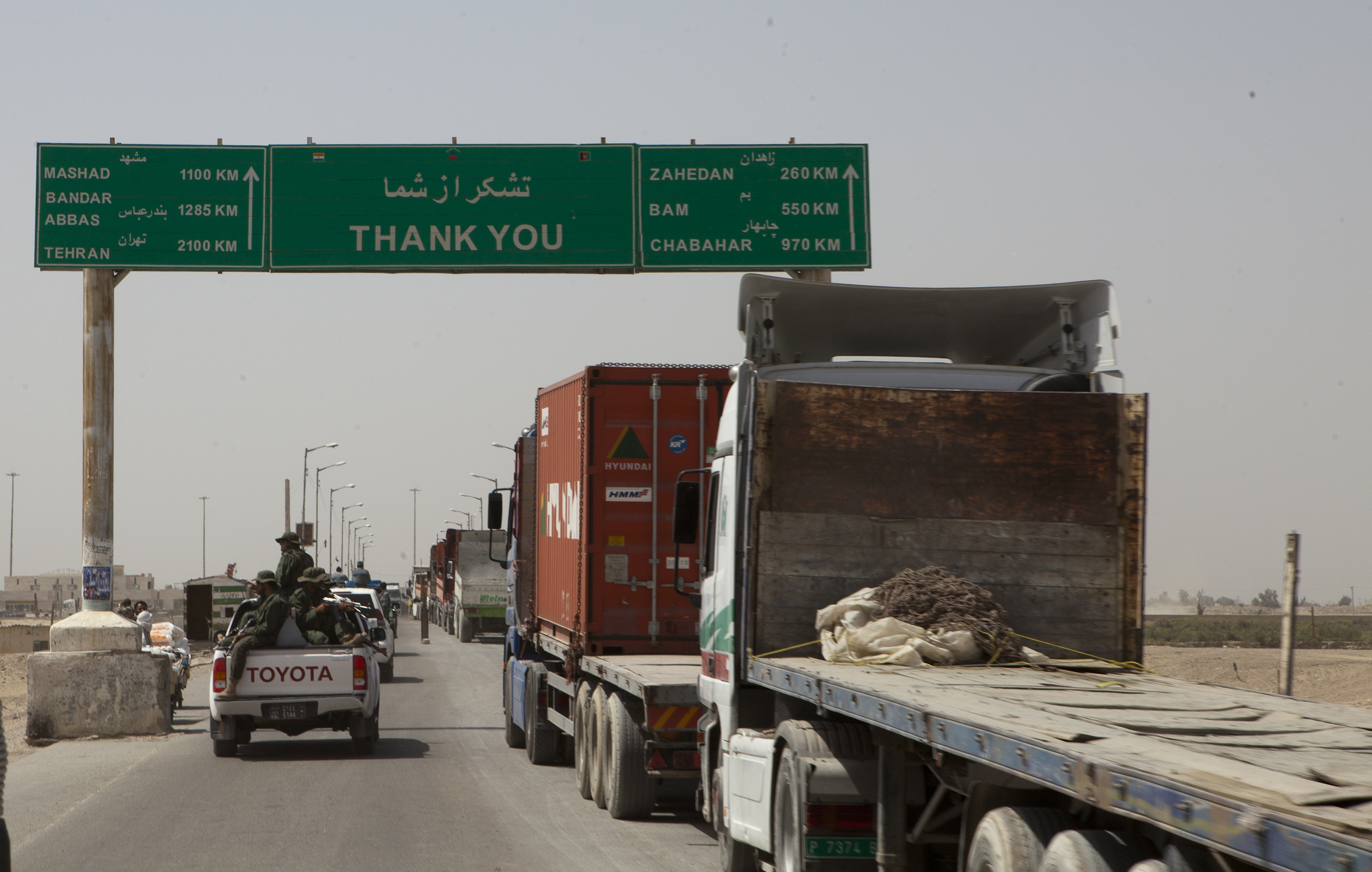
Zahedan ( Balochi and fa, , ' ) is a city and capital of Sistan and Baluchestan Province, Iran. At the 2016 census, its population was 587,730. The city was the site of a deadly crackdown in October 2022, with dozens citizens killed by pro-governmental forces. Over 90 people were killed. Two senior police officials were fired in the aftermath of the crackdown. On 28 October, there were protests in Zahedan and security forces fired on protestors, killing 1 and injuring 14. On 3 November 2022, the Shi'i cleric and Khamenei loyalist Sajjad Shahraki was assassinated in Zahedan. The next day, there were widespread protests in the city and Revolutionary Guards and other armed forces fired on protestors. Name The original name of the city was Duzzap (Persian: ''Duzdab'', meaning "Water Stolen"), which it had received due to the abrupt floods into the valley. The name was later changed to Zahedan (Persian for "hermits") during Reza Shah's visit in 1929. History Mention of Zahe ... [...More Info...] [...Related Items...] OR: [Wikipedia] [Google] [Baidu] |
Central Iran ...
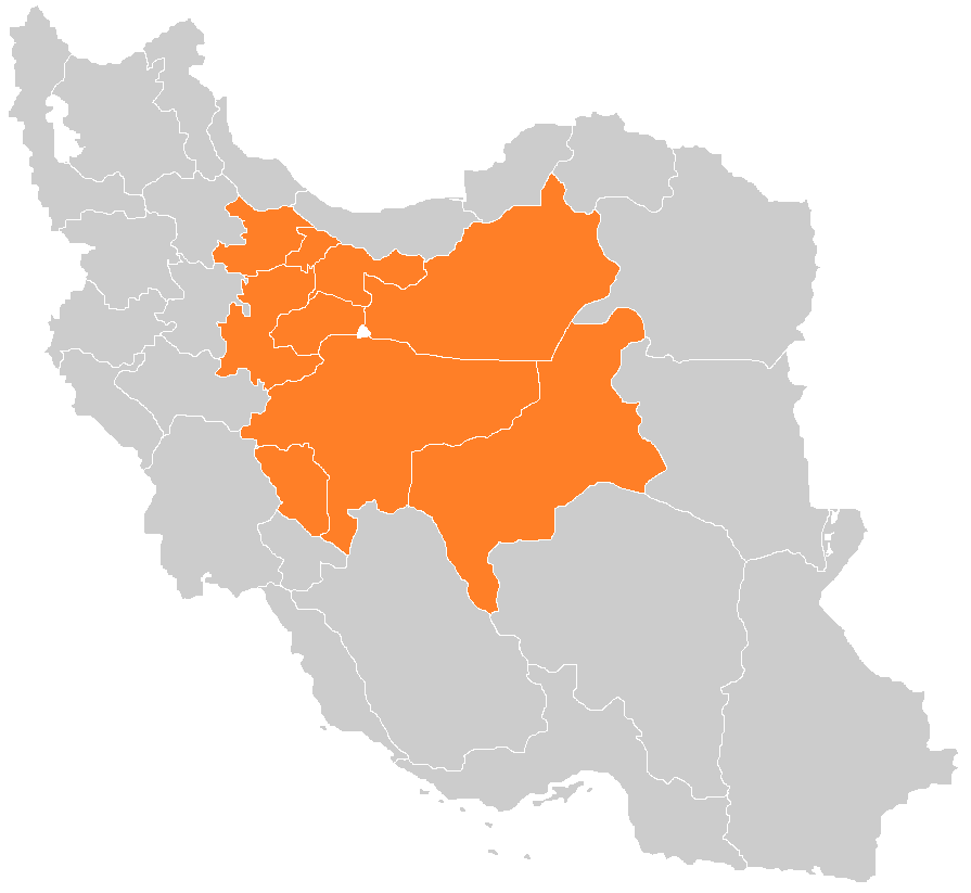
Central Iran consists of the southern slopes of the Alborz Mountains in the north, the Zagros Mountains in south, the Central Iranian Range, and the desert of Dasht-e Kavir. It includes the provinces of Esfahan, Yazd, Chahar Mahal and Bakhtiari, Markazi, Qazvin, Alborz, Tehran, Qom and Semnan. The major cities are Tehran, Isfahan, Arak, Yazd, Karaj, Qazvin, Qom, Kashan, Saveh and Shahr-e Kord. Climate *Hot desert climate in the deserts. *Cold desert climate in the central mountains. *Humid continental climate on the few rivers. *cold semi-arid climate in the high mountains. See also * Northern Iran * Western Iran * Northwestern Iran * Eastern Iran * Southern Iran References {{Reflist Subdivisions of Iran Iran Iran, officially the Islamic Republic of Iran, and also called Persia, is a country located in Western Asia. It is bordered by Iraq and Turkey to the west, by Azerbaijan and Armenia to the northwest, by the Caspian Sea and Turkmeni ... [...More Info...] [...Related Items...] OR: [Wikipedia] [Google] [Baidu] |
Southern Iran
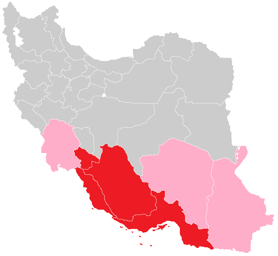
Southern Iran consists of the southern mountain ranges of Zagros and Central Iranian Range, Khuzestan Plain and the northern coasts of Persian Gulf and Straight of Hormuz. It includes the provinces of Fars Province, Fars, Kohgiluyeh and Buyer Ahmad Province, Kohgiluyeh and Buyer Ahmad, Hormozgan and Bushehr Province, Bushehr. Sometimes Khuzestan and Kerman Province, Kerman are also included in this region. The major cities are Shiraz, Bandarabbas, Bushehr, Marvdasht, Jahrom, Yasuj, Fasa and Borazjan. Southern Iran is ethnically diverse, including Persian people, Persians, Lurs, Bakhtiaris, Qashqai people, Qashqais, Achomi people, Achomians, Basseri, Basseries, Baloch people, Baloch, Iranian Arabs, Arabs, Iranian Armenians, Armenians, Afro-Iranians and Persian Jews, Jews. Southern Iran is the homeland of the Persian people. Most people in southern Iran are ethnically Persian (including Persian subgroups like Lurs and Bakhtiaris). Most people in Southern Iran are part of the Ir ... [...More Info...] [...Related Items...] OR: [Wikipedia] [Google] [Baidu] |
Western Iran
Western Iran consists of Armenian Highlands, Northern Zagros and the rich agricultural area of the Khuzestan Plain in the south. It includes the provinces of Kordestan, Kermanshah, Ilam, Hamadan and Lorestan. Some references also count West Azerbaijan Province and Khuzestan Province to this region. The major cities are Sanandaj, Kermanshah, Ilam, Hamadan, Khorramabad sometimes Urmia and Ahvaz. Climate *Humid continental climate in the north. *Hot-summer Mediterranean climate in the north. *cold semi-arid climate in the Zagros mountains. * Warm summer continental climate all over the central mountain ranges. *Hot desert climate in Khuzestan. See also * Northern Iran * Southern Iran * Eastern Iran * Central Iran * Northwestern Iran Azerbaijan or Azarbaijan ( fa, آذربایجان, ''Āzarbāijān'' ; az-Arab, آذربایجان, ''Āzerbāyjān'' ), also known as Iranian Azerbaijan, is a historical region in northwestern Iran that borders Iraq, Turkey, the Nakhch ... [...More Info...] [...Related Items...] OR: [Wikipedia] [Google] [Baidu] |
Northern Iran
Northern Iran consists of the southern border of the Caspian Sea and the Alborz mountains. It includes the provinces of Gilan, Mazandaran, and Golestan. (Ancient kingdom of Hyrcania, medieval region of Tabaristan). The major provinces, Gilan and Mazandaran, are covered with dense forests, snow-covered mountains and impressive sea shores. The major cities are Rasht, Gorgan, Sâri, Bâbol, Amol, Qaem Shahr, Gonbad-e Kavus, Anzali, and Lahijan. Northern Iran has numerous villages, particularly Massulé, appreciated by travellers. Northern Iran was a trendy spot during the Pahlavi era, especially among foreign tourists. It was a luxurious place that provided all types of modern recreational facilities as well as tourism infrastructure. Today, it's mostly visited by domestic tourists. Language Iran is a very diverse country. "Dialect wise" there are different sub-languages and dialects of native speakers in the north of Iran as well the rest of the country. From the east ... [...More Info...] [...Related Items...] OR: [Wikipedia] [Google] [Baidu] |
Kerman
Kerman ( fa, كرمان, Kermân ; also romanization of Persian, romanized as Kermun and Karmana), known in ancient times as the satrapy of Carmania, is the capital city of Kerman Province, Iran. At the 2011 census, its population was 821,394, in 221,389 households, making it the 10th most populous city of Iran. It is the largest and most developed city in Kerman Province and one of the most important cities in the southeast of Iran. It is also one of the largest cities of Iran in terms of area. Kerman is famous for its long history and strong cultural heritage. The city is home to many historic mosques and Zoroastrian fire temples. Kerman became the capital city of Iranian dynasties several times during its history. It is located on a large, flat plain, 800 km (500 mi) south-east of Tehran, the capital of Iran. History Kerman was founded as a defensive outpost, with the name Veh-Ardashir, by Ardashir I, founder of the Sasanian Empire, in the 3rd century AD. After th ... [...More Info...] [...Related Items...] OR: [Wikipedia] [Google] [Baidu] |
Neyshabur
Nishapur or officially Romanized as Neyshabur ( fa, ;Or also "نیشاپور" which is closer to its original and historic meaning though it is less commonly used by modern native Persian speakers. In Persian poetry, the name of this city is written and pronounced as "نِشابور" (without the usage of "پ" or "ب"). In modern times and among the general public and the Persian mass media, "نیشابور" is the most commonly used style of pronunciation and spelling of this city though "نیشاپور" is also correct. Nišâpur, Nişapur, Nīshābūr, or Neyshapur are also the other Romanizations of this city. from Middle Persian ''"New-Shapuhr"'', meaning: "The New City of Shapur", "The Fair Shapur", or "The Perfect built of Shapur") is the second-largest city of Razavi Khorasan Province in the Northeast of Iran. Nishapur is situated in a fertile plain at the foot of Binalud Mountain Range and has been the historic capital of the Western Quarter of Greater Khorasan, the ... [...More Info...] [...Related Items...] OR: [Wikipedia] [Google] [Baidu] |
Chabahar
Chābahār ( fa, چابهار, bal, چھبار, čahbàr; ; formerly ''Bandar Beheshtī'') is the capital city of Chabahar County, Sistan and Baluchestan Province, Iran. It is a free port (free-trade zone) situated on the coast of the Gulf of Oman, and is Iran's southernmost city. The sister port city of Gwadar in Balochistan, Pakistan, is located about to the east of Chabahar. The city is situated on the Makran Coast of the Iranian province of Sistan and Baluchestan, and is officially designated as a "Free Trade and Industrial Zone" by the Iranian government. Due to its free-trade zone status, the city has increased in significance in international trade. The overwhelming majority of the city's inhabitants are ethnic Baloch people, who speak their native Balochi language in addition to Persian. Etymology The name Chabahar is a shortened form of the Balochi phrase ''chahar bahar'' (Persian: چهاربهار), where ''chahar'' means "four" and ''bahar'' means "spring". Hen ... [...More Info...] [...Related Items...] OR: [Wikipedia] [Google] [Baidu] |
Zabol
Zabol ( fa, , also transliterated as Zâbol or Zābul) is a city and capital of Zabol County, Sistan and Baluchestan Province, Iran. Zabol is near the border with Afghanistan. Referred to as Sistan until the late 1920s, the city was renamed Zabol by Reza Shah Pahlavi. At the 2006 census, its population was 130,642, in 27,867 families. Zabol is located near Lake Hamun and the region is irrigated by the Helmand River. Lake Hamun is a seasonal lake that is often dry. The people of Zabol are mixed of Persians who speak a variant of the Persian language and known as '' Sistani'' or Seistani which is very similar to Dari, also known as Afghan Persian, and a small minority of Baloch who speak Balochi, a Northwestern Iranian language. The city is home to Zabol University, the largest university in the city, as well as the Zabol Medical Science University and the Sistan Museum of Anthropology. Zabol has a regional airport. Zabol is connected by road to Milak and Zaranj (across the ... [...More Info...] [...Related Items...] OR: [Wikipedia] [Google] [Baidu] |
Birjand
Birjand ( fa, بیرجند , also Romanized as Bīrjand and Birdjand) is the capital of the Iranian province of South Khorasan. The city is known for its saffron, barberry, jujube, and handmade carpet exports. Birjand had a population of 187,020 in 2013. History The first citation of the city in the historical literature belongs to the famous book '' Mojem Alboldan'', by Yaqut Homavi (13th century) which introduces the Birjand as the most beautiful town in the Qohestan. Before this, Birjand had been probably not as big and important as a municipality but rather as a rural community. However, the Birjand geographical area had its historical and political importance long before the emergence of the city of Birjand. Many citations of the region are available in the original literature like ''Ehya -ol- Molook'' of the once important localities in the area. Apart from literature, the oldest evidence on the history of the region is the ancient Lakh-Mazar inscription in the Kooch ... [...More Info...] [...Related Items...] OR: [Wikipedia] [Google] [Baidu] |
Bojnurd
Bojnord ( fa, ; also romanized Bojnūrd, Bujnūrd, Bojnoord, Bojnord or Bujnurd), known in the Middle Ages as Buzanjird, is the capital city of North Khorasan Province, Iran. It is about from Tehran. and It is located 237 km away from Mashhad, the capital of Khorasan Razavi province. History According to local tradition, the whole area was controlled by the Qarai Turks since the Mongol invasion in the 13th century. Bojnurd is of recent origin and possibly built by the Safavids for the Kurdish Şadiyan tribe who had been settled there to strengthen the Safavid borders against hostile Turkics. Traditionally, the city was surrounded by a defensive wall and consisted of eleven quarters, bazaars and four mosques. In 1849, the city saw a revolt which destroyed the city. When traveller G. C. Napier visited the city in 1876, it was noted that the chief of Bojnurd was a Kurd who governed the city without taxation in exchange for military support to the central government in Tehran. ... [...More Info...] [...Related Items...] OR: [Wikipedia] [Google] [Baidu] |


