|
East Sioux Falls, South Dakota
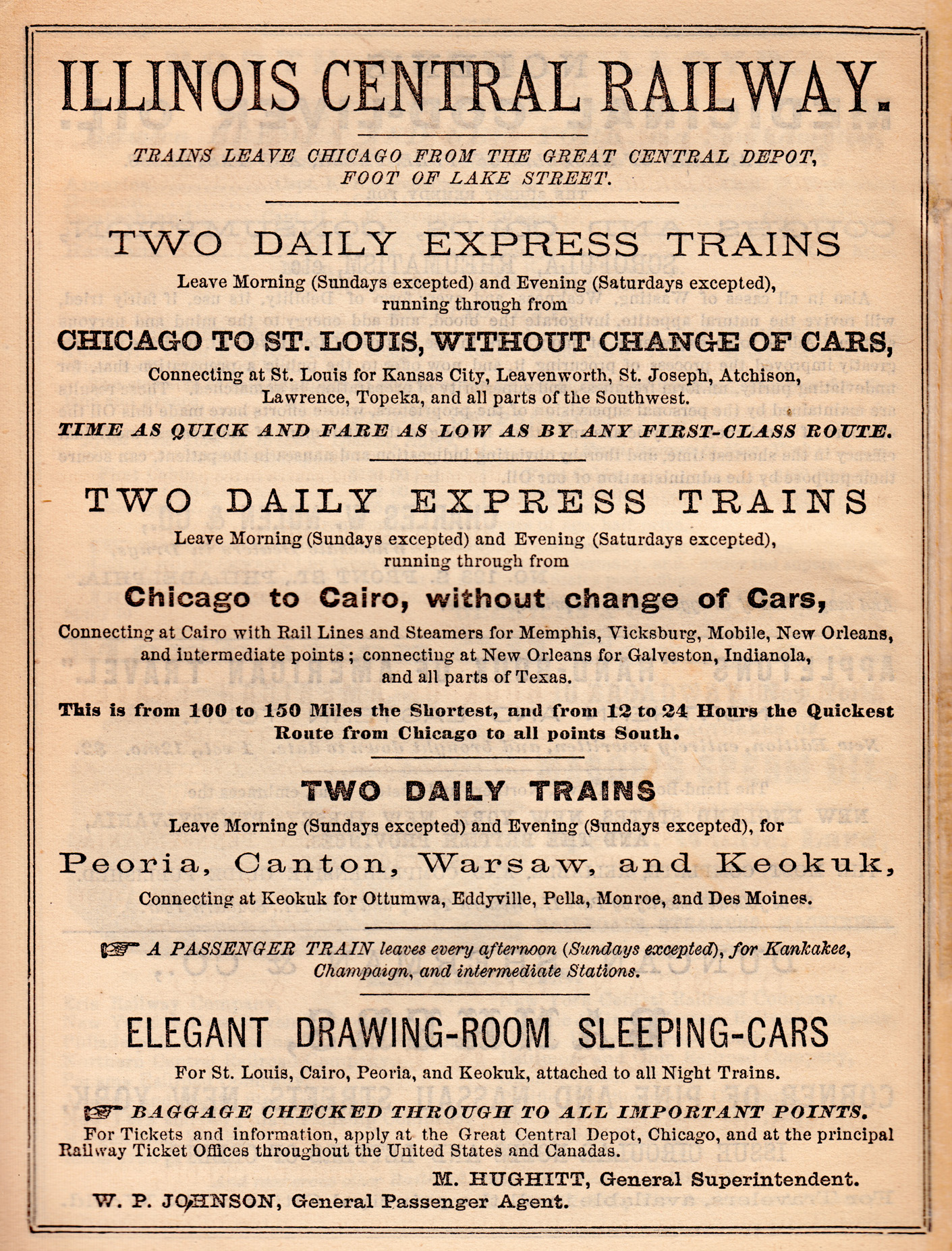
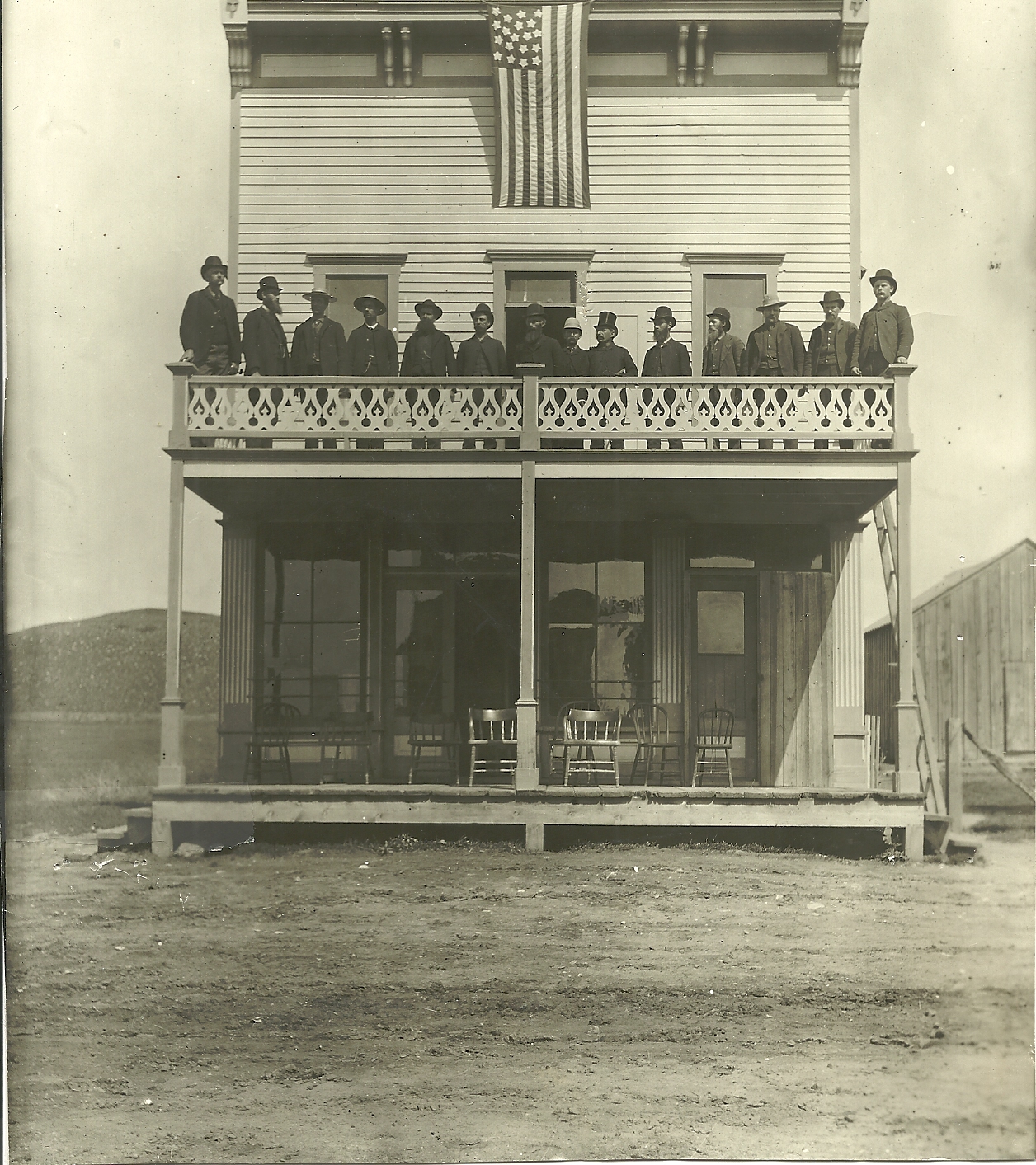
East Sioux Falls was a city located in southeastern Minnehaha County, South Dakota located about 6 miles east of Sioux Falls along South Dakota Highway 42 on the Big Sioux River. History During the 1880s, the quarrying of a distinctive pink stone known as jasper or quartzite had developed into a successful business in Sioux Falls. In 1887, the Sioux Falls Granite Company opened four quarries six miles due east of downtown Sioux Falls in Split Rock Township. This area had an abundance of quartzite along the bluffs overlooking the Big Sioux River and exposure to the Earth's surface ensured that the stone could be easily mined. Hundreds of workers and their families settled in a nearby community known at the time as Ives. In 1888, Sioux Falls officials convinced the Illinois Central Railroad The Illinois Central Railroad , sometimes called the Main Line of Mid-America, was a railroad in the Central United States, with its primary routes connecting Chicago, Illinois, with New O ... [...More Info...] [...Related Items...] OR: [Wikipedia] [Google] [Baidu] |
Minnehaha County
Minnehaha County is a county on the eastern border of the state of South Dakota. As of the 2020 census, the population was 197,214, making it the state's most populous county. It contains over 20% of the state's population. Its county seat is Sioux Falls, South Dakota's largest city. The county was created in 1862 and organized in 1868. Its name was derived from the Sioux word ''Mnihaha,'' meaning "rapid water," or "waterfall" (often incorrectly translated as "laughing water"). Minnehaha County is part of the Sioux Falls Metropolitan Statistical Area, the state's largest. Geography Minnehaha County lies on the east side of South Dakota. Its eastern boundary abuts Minnesota as well as the northern and western boundaries of Iowa. The Big Sioux River flows south-southeast through the east central part of the county. Its terrain consists of rolling hills, devoted to agriculture except around built-up areas, and dotted with lakes and ponds in its western portion. Its terrain gene ... [...More Info...] [...Related Items...] OR: [Wikipedia] [Google] [Baidu] |
South Dakota
South Dakota (; Sioux language, Sioux: , ) is a U.S. state in the West North Central states, North Central region of the United States. It is also part of the Great Plains. South Dakota is named after the Lakota people, Lakota and Dakota people, Dakota Sioux Native Americans in the United States, Native American tribes, who comprise a large portion of the population with nine Indian reservation, reservations currently in the state and have historically dominated the territory. South Dakota is the List of U.S. states and territories by area, seventeenth largest by area, but the List of U.S. states and territories by population, 5th least populous, and the List of U.S. states and territories by population density, 5th least densely populated of the List of U.S. states, 50 United States. As the southern part of the former Dakota Territory, South Dakota became a state on November 2, 1889, simultaneously with North Dakota. They are the 39th and 40th states admitted to the union; Pr ... [...More Info...] [...Related Items...] OR: [Wikipedia] [Google] [Baidu] |
Sioux Falls, South Dakota
Sioux Falls () is the most populous city in the U.S. state of South Dakota and the 130th-most populous city in the United States. It is the county seat of Minnehaha County and also extends into Lincoln County to the south, which continues up to the Iowa state line. As of 2020, Sioux Falls had a population of 192,517, which was estimated in 2022 to have increased to 202,600. The Sioux Falls metro area accounts for more than 30% of the state's population. Chartered in 1856 on the banks of the Big Sioux River, the city is situated in the rolling hills at the junction of interstates 29 and 90. History The history of Sioux Falls revolves around the cascades of the Big Sioux River. The falls were created about 14,000 years ago during the last ice age. The lure of the falls has been a powerful influence. Ho-Chunk, Ioway, Otoe, Missouri, Omaha (and Ponca at the time), Quapaw, Kansa, Osage, Arikira, Dakota, and Cheyenne people inhabited and settled the region previous to Europea ... [...More Info...] [...Related Items...] OR: [Wikipedia] [Google] [Baidu] |
South Dakota Highway 42
South Dakota Highway 42 (SD 42) is a segmented state highway in southeastern South Dakota, United States. The first segment is a highway in Aurora County. The second and longest is long and connects Ethan and Sioux Falls. The final segment connects Sioux Falls to Iowa Highway 9 southeast of Rowena. Route description The westernmost segment of SD 42 begins at a junction with U.S. Route 281 (US 281) and travels east through open farmland. This is the shortest of the three segments; it is only about long, and it ends as the roadway crosses from Aurora County into Davison County. The central segment of the highway begins at an intersection with SD 37 in rural Davison County. It heads east and crosses the BNSF Railway. Just east of the railroad, the route passes through the town of Ethan, then enters Hanson County. About farther east, SD 42 bends slightly to the south and crosses the James River. The highway continues east through the flat prairie ... [...More Info...] [...Related Items...] OR: [Wikipedia] [Google] [Baidu] |
Big Sioux River
The Big Sioux River is a tributary of the Missouri River in eastern South Dakota and northwestern Iowa in the United States. It flows generally southwardly for ,U.S. Geological Survey. National Hydrography Dataset high-resolution flowline dataThe National Map, accessed March 30, 2011 and its watershed is . The United States Board on Geographic Names settled on "Big Sioux River" as the stream's name in 1931. The river was named after the Lakota people (Sioux Natives) which was known by them as Tehankasandata, or Thick Wooded River. The Big Sioux River rises in Roberts County, South Dakota on a low plateau known as the Coteau des Prairies and flows generally southwardly through Grant, Codington, Hamlin, Brookings, Moody, and Minnehaha counties, past the communities of Watertown, Castlewood, Bruce, Flandreau, Egan, Trent, Dell Rapids, and Baltic to Sioux Falls, where it passes over a waterfall in Falls Park, which gives that city its name. Downstream of Sioux Fall ... [...More Info...] [...Related Items...] OR: [Wikipedia] [Google] [Baidu] |
Illinois Central Railroad
The Illinois Central Railroad , sometimes called the Main Line of Mid-America, was a railroad in the Central United States, with its primary routes connecting Chicago, Illinois, with New Orleans, Louisiana, and Mobile, Alabama. A line also connected Chicago with Sioux City, Iowa (1870). There was a significant branch to Omaha, Nebraska (1899), west of Fort Dodge, Iowa, and another branch reaching Sioux Falls, South Dakota (1877), starting from Cherokee, Iowa. The Sioux Falls branch has been abandoned in its entirety. The Canadian National Railway acquired control of the IC in 1998, and merged its operations in 1999. Illinois Central continues to exist as a paper railroad. History The IC was one of the oldest Class I railroads in the United States. The company was incorporated by the Illinois General Assembly on January 16, 1836. Within a few months Rep. Zadok Casey (D-Illinois) introduced a bill in the U.S. House of Representatives authorizing a land grant to the com ... [...More Info...] [...Related Items...] OR: [Wikipedia] [Google] [Baidu] |
East Sioux Falls, SD 1
East or Orient is one of the four cardinal directions or points of the compass. It is the opposite direction from west and is the direction from which the Sun rises on the Earth. Etymology As in other languages, the word is formed from the fact that east is the direction where the Sun rises: ''east'' comes from Middle English ''est'', from Old English ''ēast'', which itself comes from the Proto-Germanic *''aus-to-'' or *''austra-'' "east, toward the sunrise", from Proto-Indo-European *aus- "to shine," or "dawn", cognate with Old High German ''*ōstar'' "to the east", Latin ''aurora'' 'dawn', and Greek ''ēōs'' 'dawn, east'. Examples of the same formation in other languages include Latin oriens 'east, sunrise' from orior 'to rise, to originate', Greek ανατολή anatolé 'east' from ἀνατέλλω 'to rise' and Hebrew מִזְרָח mizraḥ 'east' from זָרַח zaraḥ 'to rise, to shine'. ''Ēostre'', a Germanic goddess of dawn, might have been a personification ... [...More Info...] [...Related Items...] OR: [Wikipedia] [Google] [Baidu] |
Geography Of Minnehaha County, South Dakota
Geography (from Greek: , ''geographia''. Combination of Greek words ‘Geo’ (The Earth) and ‘Graphien’ (to describe), literally "earth description") is a field of science devoted to the study of the lands, features, inhabitants, and phenomena of Earth. The first recorded use of the word γεωγραφία was as a title of a book by Greek scholar Eratosthenes (276–194 BC). Geography is an all-encompassing discipline that seeks an understanding of Earth and its human and natural complexities—not merely where objects are, but also how they have changed and come to be. While geography is specific to Earth, many concepts can be applied more broadly to other celestial bodies in the field of planetary science. One such concept, the first law of geography, proposed by Waldo Tobler, is "everything is related to everything else, but near things are more related than distant things." Geography has been called "the world discipline" and "the bridge between the human and th ... [...More Info...] [...Related Items...] OR: [Wikipedia] [Google] [Baidu] |
Ghost Towns In South Dakota
This is an incomplete list of ghost towns in South Dakota, United States of America. Classification Ghost towns can include sites in various states of disrepair and abandonment. Some sites no longer have any trace of civilization and have reverted to pasture land or empty fields. Other sites are unpopulated but still have standing buildings. Barren site * Sites no longer in existence or have been destroyed * Deserted or barren * Covered with water * Reverted to pasture * May have a few difficult-to-find foundations/footings at most Neglected site * Only rubble left * Buildings or houses still standing, but majority are roofless Abandoned site * Building or houses still standing but all abandoned * No population, except possibly a caretaker * Site no longer in existence except for one or two buildings Ghost towns A through B C through D E through H I through L M through O P through R S through T V through Z Notes References * * * * * {{DEF ... [...More Info...] [...Related Items...] OR: [Wikipedia] [Google] [Baidu] |


