|
East Selino
East Selino ( el, Ανατολικό Σέλινο) is a former municipality in the Chania regional unit, Crete, Greece. Since the 2011 local government reform it is part of the municipality Kantanos-Selino, of which it is a municipal unit. The municipal unit has an area of . It is situated on the south-west coast of the island of Crete. It was part of the former Selino Province which covered the mountain and coastal region west of Sfakia. The seat of the municipality was Kampanos. The municipal unit is subdivided into the following communities (constituent villages in brackets): * Epanochori (Epanochori, Agia Eirini, Prines, Seliniotikos Gyros, Tsiskiana) * Kampanos (Kampanos, Maralia) * Rodovani (Rodovani, Agriles, Kamaria, Livada, Maza) * Skafi (Skafi, Argastiri, Pera Skafi) *Sougia (Sougia, Koustogerako, Livadas, Moni) * Temenia (Temenia, Pappadiana, Stratoi) Within Anatoliko Selino lies the Agia Eirini Gorge, the ruins of the ancient cities of Elyros, Lissos, Yrtakina and ... [...More Info...] [...Related Items...] OR: [Wikipedia] [Google] [Baidu] |
Crete
Crete ( el, Κρήτη, translit=, Modern: , Ancient: ) is the largest and most populous of the Greek islands, the 88th largest island in the world and the fifth largest island in the Mediterranean Sea, after Sicily, Sardinia, Cyprus, and Corsica. Crete rests about south of the Greek mainland, and about southwest of Anatolia. Crete has an area of and a coastline of 1,046 km (650 mi). It bounds the southern border of the Aegean Sea, with the Sea of Crete (or North Cretan Sea) to the north and the Libyan Sea (or South Cretan Sea) to the south. Crete and a number of islands and islets that surround it constitute the Region of Crete ( el, Περιφέρεια Κρήτης, links=no), which is the southernmost of the 13 top-level administrative units of Greece, and the fifth most populous of Greece's regions. Its capital and largest city is Heraklion, on the north shore of the island. , the region had a population of 636,504. The Dodecanese are located to the no ... [...More Info...] [...Related Items...] OR: [Wikipedia] [Google] [Baidu] |
Sougia
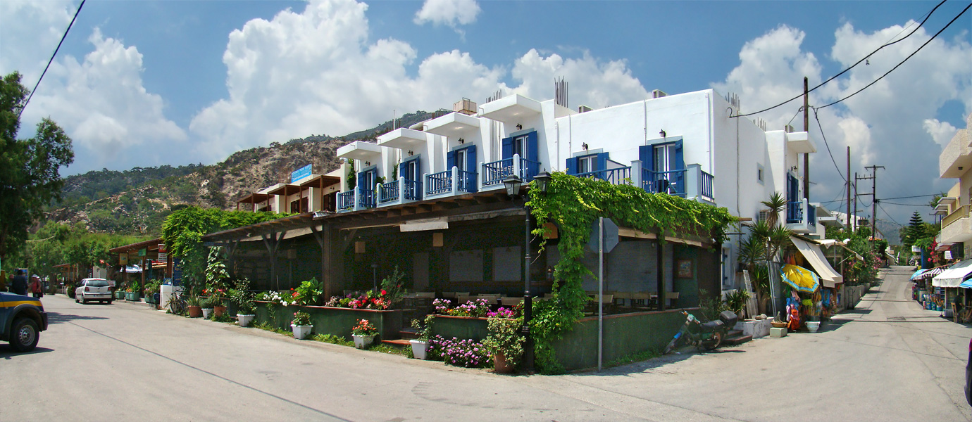
Sougia ( el, Σούγια) is a community and a small village in Chania regional unit on the island of Crete, Greece. It is part of the municipal unit of East Selino (''Anatoliko Selino''). It is located on the south coast of the island, 70 km south of Chania. The community consists of the following villages (population in 2011): *Sougia, pop. 136 * Koustogerako, pop. 44 *Livadas, pop. 17 *Moni, pop. 23 Sougia is reached from Chania by car in 2 hours or by ferry boats from Palaiochora, Agia Roumeli, Loutro and Hora Sfakion. Although it is not one of the larger towns of the province of Selino, Sougia is interesting to the tourist, providing a beach, walkways, mountains and interesting remains of an ancient city and old Byzantine churches. Sougia has some tourist services, such as small hotels, rooms to rent and a few taverns, cafes and bars. Sougia was the ancient city of Syia, a harbour of Elyros. In the village church, an important basilica of the Byzantine era, was found ... [...More Info...] [...Related Items...] OR: [Wikipedia] [Google] [Baidu] |
Taverna
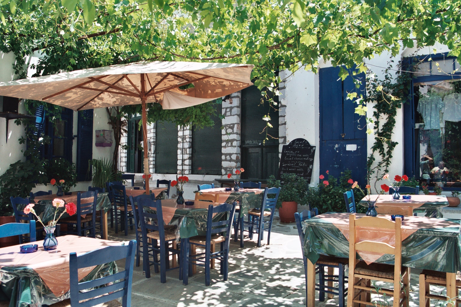
A taverna (Greek: ταβέρνα) is a small Greek restaurant that serves Greek cuisine. The taverna is an integral part of Greek culture and has become familiar to people from other countries who visit Greece, as well as through the establishment of tavernes (ταβέρνες, plural) in countries such as the United States and Australia by expatriate Greeks. Etymology and History ''Taverna'' (in Greek ταβέρνα), is a word taken from the Latin ''taberna'' (in plural ''tabernae''), meaning “shop” (see Roman taberna). The Latin word derived from ''tabula'', meaning “table”. The earliest evidence of a Greek restaurant was discovered at the Agora of Athens during excavations conducted by the American School of Classical Studies in the early 1970s.. Large quantities of cooking and eating utensils were found at the taverna such as plates, mixing bowls, lidded casseroles, spits for broiling meat, mortars for chopping and grinding, as well as a cooking bell and a variety o ... [...More Info...] [...Related Items...] OR: [Wikipedia] [Google] [Baidu] |
Olive Oil
Olive oil is a liquid fat obtained from olives (the fruit of ''Olea europaea''; family Oleaceae), a traditional tree crop of the Mediterranean Basin, produced by pressing whole olives and extracting the oil. It is commonly used in cooking: for frying foods or as a salad dressing. It can be found in some cosmetics, pharmaceuticals, soaps, and fuels for traditional oil lamps. It also has additional uses in some religions. The olive is one of three core food plants in Mediterranean cuisine; the other two are wheat and grapes. Olive trees have been grown around the Mediterranean since the 8th millennium BC. In 2019–2020, world production of olive oil was . Spain was the largest producer followed by Italy, Tunisia, Greece, Turkey and Morocco. San Marino has by far the largest per capita consumption of olive oil worldwide. The composition of olive oil varies with the cultivar, altitude, time of harvest, and extraction process. It consists mainly of oleic acid (up to 83%), with ... [...More Info...] [...Related Items...] OR: [Wikipedia] [Google] [Baidu] |
Syia
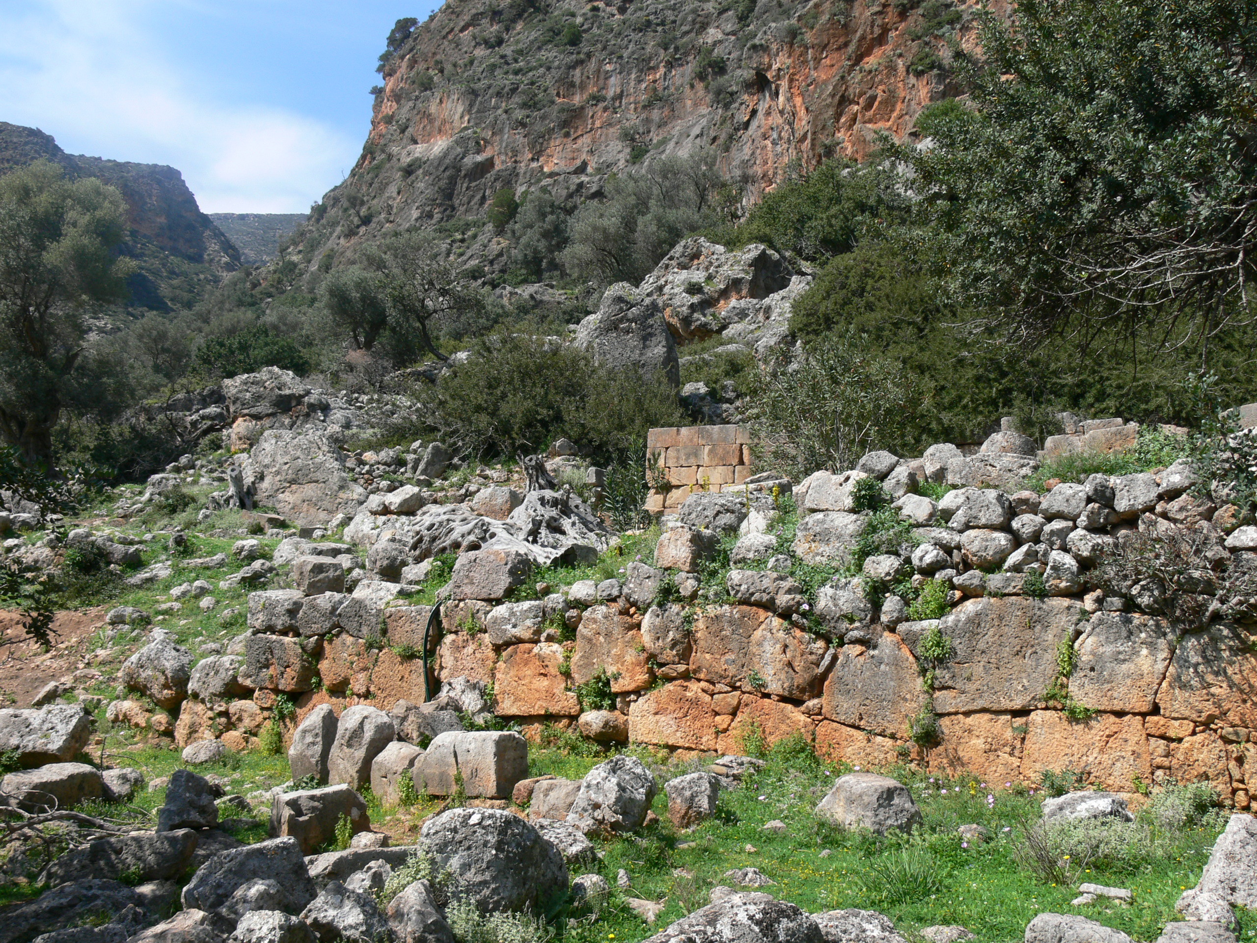
Syia or Suia ( grc, Συῒά), also Syba (Σύβα),''Stadiasmus Maris Magni'' §§ 321-322. was a maritime town of ancient Crete. It was located on the south coast of Crete and functioned as the harbour of Elyrus. According to the ''Stadiasmus Maris Magni'', written during Roman times, the town was located 50 stadia to the west of Poecilassus, situated on a plain. It probably existed as late as the time of Hierocles (6th century), though now entirely uninhabited. It is located in Sougia village, 70 km south of Chania. Archaeology Robert Pashley, visiting in the 19th century, found remains of the city walls as well as other public buildings, but not more ancient than the time of the Roman Empire. Several tombs were found, as was an aqueduct.Robert Pashley, ''Travels'', vol. ii. p. 100. Syia flourished in the Roman and the 1st Byzantine period. There are Roman ruins and three large Palaiochristian Basilicas. Syia had set up monetary union with Yrtakina, Elyrus, Lissus, an ... [...More Info...] [...Related Items...] OR: [Wikipedia] [Google] [Baidu] |
Yrtakina
Hyrtacina or Hyrtakina ( grc, Ὑρτακίνα), also written as Hyrsacina or Hyrsakina (Ὑρσακίνα),''Periplus of Pseudo-Scylax'' p. 18. or Artacina or Artakina (Ἀρτάκινα), was a city of ancient Crete, which, little as we learn of its position from Ptolemy and Stephanus of Byzantium, yet we may safely infer from the former's words that it was situated to the southeast of Polyrrhenia, and to the west of Lappa. The ''Periplus of Pseudo-Scylax'' teaches us more respecting its site; it places it on the south of the island, and to the south of the Dictynnean temple of Artemis and the Pergamian district. These indications agree well with the situation of the ruins discovered by Robert Pashley on Kastri hill between the existing villages Temenia and Papadiana.Robert Pashley, ''Travels'' vol. ii. p. 111. History Its history is related to the proximate settlement of Lissus, which is also situated in the Agia Eirini Gorge. It has characteristics of other Archaic Period h ... [...More Info...] [...Related Items...] OR: [Wikipedia] [Google] [Baidu] |
Lissus (Crete)
Lissus or Lissos ( grc, Λίσσος) was a town on the south coast of ancient Crete, which the anonymous ''Stadiasmus Maris Magni'' places between Syia and Calamyde. The Peutinger Table gives 16 M.P. as the distance between Cantanum and Lissus (there recorded as Liso). It was one of the harbours (the other was Syia) of Elyrus. It was established in the Classical period and flourished until the Late Antiquity. Its name was made certain by inscriptions. The early history of the city is unknown. Based on inscriptions and coins of the 3rd century BCE, we know the city allied with King Magas of Cyrene, and joined the League of Oreians. The koinon of the Oreians consisted of the cities Lissus, Syia, Poikilassos, Tarrha, Yrtakina and Elyrus. Lissus had powerful trading and fishing fleets. This Cretan city was an episcopal see in the time of Hierocles. The order in which Flaminius Cornelius mentions it with the other bishoprics in the west part of the island agrees very well ... [...More Info...] [...Related Items...] OR: [Wikipedia] [Google] [Baidu] |
Elyros
Elyrus or Elyros ( grc, Ἔλυρος) was a town of ancient Crete, which the ''Periplus of Pseudo-Scylax'' places between Cydonia and Lissus. It had a harbour, Syia (Συΐα), situated on the south coast of the island, 60 stadia west of Poecilassus.''Stadiasmus Maris Magni'', p. 299 ed. Hoffmann Pausanias states that the city existed in his time in the mountains of Crete. He adds that he had seen at Delphi the bronze goat which the Elyrians had dedicated, and which was represented in the act of giving suckle to Phylacis and Phylander, children of Apollo and the nymph Acacallis, whose love had been won by the youthful god at the house of Casmanor at Tarrha. It was the birthplace of Thaletas, who was considered as the inventor of the Cretic rhythm, the national paeans and songs, with many of the institutions of his country. Elyrus appears in Hierocles' list of Cretan cities, then reduced in number to twenty-one. The coins of this city have the type of a bee upon them. Its sit ... [...More Info...] [...Related Items...] OR: [Wikipedia] [Google] [Baidu] |
Agia Eirini Gorge
Agia Eirini Gorge (Greek ''Φαράγγι Αγίας Ειρήνης''), sometimes called St. Irene Gorge, is located in the south-west of the island of Crete, Greece, in Lefka Ori. The gorge starts near the village of Agia Eirini and it ends near the village of Sougia Sougia ( el, Σούγια) is a community and a small village in Chania regional unit on the island of Crete, Greece. It is part of the municipal unit of East Selino (''Anatoliko Selino''). It is located on the south coast of the island, 70 ..., on the south coast. It is long and deep, in a forested area with steep mountain cliffs. In 1866, 1,000 women and children escaped from the Ottomans through this gorge. References Gorges of Crete Landforms of Chania (regional unit) {{Crete-geo-stub ... [...More Info...] [...Related Items...] OR: [Wikipedia] [Google] [Baidu] |
Temenia
Temenia (Greek: Τεμένια) is a community and a small village in Chania regional unit on the island of Crete, Greece. It is part of the municipal unit of East Selino (''Anatoliko Selino''). The community consists of the following villages (population in 2011): *Temenia, pop. 49 *Pappadiana, pop. 3 *Stratoi, pop. 15 Near Temenia is located the ancient city of Yrtakina Hyrtacina or Hyrtakina ( grc, Ὑρτακίνα), also written as Hyrsacina or Hyrsakina (Ὑρσακίνα),''Periplus of Pseudo-Scylax'' p. 18. or Artacina or Artakina (Ἀρτάκινα), was a city of ancient Crete, which, little as we learn of .... In Temenia also there is a spring-spa. Because of the healthy water, there is a small hotel and a refreshments factory in Temenia. References {{Kantanos-Selino div Populated places in Chania (regional unit) ... [...More Info...] [...Related Items...] OR: [Wikipedia] [Google] [Baidu] |
Koustogerako
Koustogerako (Greek: Κουστογέρακο) is a small village in Chania regional unit on the island of Crete, Greece. It has 76 residents (2001 censu and it belongs to the municipal unit of East Selino (''Anatoliko Selino''). The village is built in a wild, beautiful position, at an elevation of 510m. Deep gorges and steep mountain cliffs surround the village. Southwest of the village at a height of 200 m. is the cave of Cyclops, possibly related to the namesake tale found in Homer's Odyssey. Koustogerako has a notable history. It was burned twice by the Venetians for being the birthplace of Kantanoleon (a famous rebel who fought against the Venetians) and once again in 1821 by the Turks. Finally, the Nazis razed Koustogerako, because it was a partizan resistance center against the Germans in World War II. The villagers of Koustogerako gave some of the fiercest and most renowned guerrilla fights, resisting the Nazi occupation. In 1943, the Germans scourged the villages of Moni, ... [...More Info...] [...Related Items...] OR: [Wikipedia] [Google] [Baidu] |
Argastiri
Argastiri ( Greek Αργαστήρι) is a small village in Chania regional unit on the island of Crete, Greece. It has 19 residents (2011 census), its elevation is 650 meters above sea level and it lies 48 km south of Chania. It is within the municipality of Kantanos-Selino. A battle took place in Argastiri during the Greek War of Independence The Greek War of Independence, also known as the Greek Revolution or the Greek Revolution of 1821, was a successful war of independence by Greek revolutionaries against the Ottoman Empire between 1821 and 1829. The Greeks were later assisted by ... against the Turks. 450 Greeks under Nikiforos Hatzidakis lost the battle by 2000 Turks under Kaouris, the aga of Kantanos. Nikiforos Hatzidakis was killed. References External linksDetailed blog about Argastiri (in Greek).Argastiri in Google Maps. {{Coord, 35, 20, N, 23, 48, E, region:GR_type:city_source:enwiki-GNS, display=title Populated places in Chania (regional unit) ... [...More Info...] [...Related Items...] OR: [Wikipedia] [Google] [Baidu] |


