|
Earlston
Earlston ( sco, Yerlston; gd, Dùn Airchill) is a civil parish and market town in the county of Berwickshire, within the Scottish Borders. It is on the River Leader in Lauderdale, Scotland. Early history Earlston was originally called ''Arcioldun'' or ''Prospect Fort'', with reference to Black Hill (), on the top of which can still be traced the concentric rings of the British fort for which it was named. It is also said to be possible to make out the remains of the cave-dwellings of the Votadini, the tribal confederation in this part of Scotland. In the 12th and 13th centuries the Lindsays and the Earls of March and Dunbar were the chief baronial families. Also of historical interest is the ivy-clad ruin of the ''Rhymer's Tower'', a keep said to date from as early as the 13th century. It is the traditional residence of Thomas Learmonth, commonly called Thomas of Ercildoune, or Thomas the Rhymer, poet, prophet, and legendary friend of the Elves, who was born here about ... [...More Info...] [...Related Items...] OR: [Wikipedia] [Google] [Baidu] |
Earlston RFC
Earlston RFC is a rugby union club, based at Earlston in the Scottish Borders (formerly Berwickshire). Earlston is in the of the East Regional League. It is the largest Scottish Borders club not to participate in the Border League. It takes part in the Borders Sevens Circuit each May, which is the oldest tournament of its kind in the world. Rugby sevens were invented at Melrose nearby. Strip Earlston RFC play in blue hoops on white shirts, navy shorts and red socks. The current kit is manufactured by Samurai. The shirt sponsor of the club are locally based solicitor and estate agent company 'Cullen Kilshaw'. History No written records are available concerning the origins of the Club but it is believed that it was formed in the 1870s by two Yorkshiremen who were installing machinery in the local woollen mill. (The same men are supposed to have started the Langholm Club.) Kelso Rugby Club was formed in 1876 and one of their first games was against Earlston, the result bei ... [...More Info...] [...Related Items...] OR: [Wikipedia] [Google] [Baidu] |
Thomas The Rhymer
Sir Thomas de Ercildoun, better remembered as Thomas the Rhymer (fl. c. 1220 – 1298), also known as Thomas Learmont or True Thomas, was a Scottish laird and reputed prophet from Earlston (then called "Erceldoune") in the Borders. Thomas' gift of prophecy is linked to his poetic ability. He is often cited as the author of the English ''Sir Tristrem'', a version of the Tristram legend, and some lines in Robert Mannyng's ''Chronicle'' may be the source of this association. It is not clear if the name ''Rhymer'' was his actual surname or merely a sobriquet. In literature, he appears as the protagonist in the tale about Thomas the Rhymer carried off by the " Queen of Elfland" and returned having gained the gift of prophecy, as well as the inability to tell a lie. The tale survives in a medieval verse romance in five manuscripts, as well as in the popular ballad "Thomas Rhymer" (Child Ballad number 37).Child Ballad #37. "Thomas the Rymer", The romance occurs as "Thomas off ... [...More Info...] [...Related Items...] OR: [Wikipedia] [Google] [Baidu] |
Scottish Borders
The Scottish Borders ( sco, the Mairches, 'the Marches'; gd, Crìochan na h-Alba) is one of 32 council areas of Scotland. It borders the City of Edinburgh, Dumfries and Galloway, East Lothian, Midlothian, South Lanarkshire, West Lothian and, to the south-west, south and east, the English counties of Cumbria and Northumberland. The administrative centre of the area is Newtown St Boswells. The term Scottish Borders, or normally just "the Borders", is also used to designate the areas of southern Scotland and northern England that bound the Anglo-Scottish border. Geography The Scottish Borders are in the eastern part of the Southern Uplands. The region is hilly and largely rural, with the River Tweed flowing west to east through it. The highest hill in the region is Broad Law in the Manor Hills. In the east of the region, the area that borders the River Tweed is flat and is known as 'The Merse'. The Tweed and its tributaries drain the entire region with the river flowi ... [...More Info...] [...Related Items...] OR: [Wikipedia] [Google] [Baidu] |
River Leader
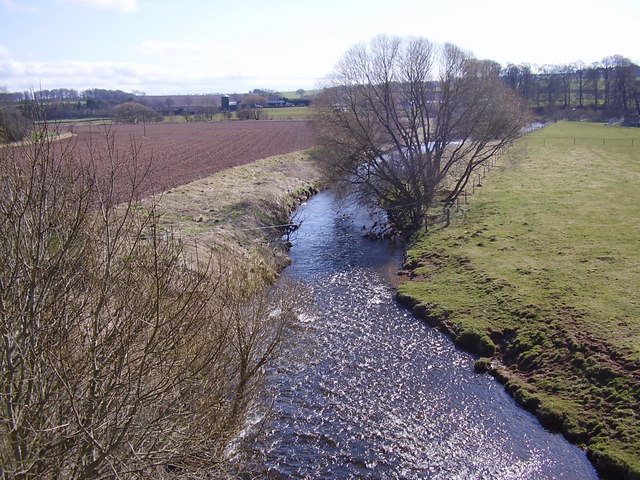
The River Leader, or Leader Water, is a small tributary of the River Tweed in Lauderdale in the Scottish Borders. It flows southwards from the Lammermuir Hills through the towns of Lauder and Earlston, joining the River Tweed at Leaderfoot. Course The feeder burns of the Leader Water are the Headshaw Burn, the Hillhouse Burn and the Kelphope Burn. They combine at the Carfrae mill hotel and the village of Oxton. The river is now sandwiched between the A68 and the A697, and it has absorbed the Cleekhimin Burn, Harry Burn, Washing Burn and Earnscleugh Burn. The Leader Water now passes to the east of the town of Lauder, by Thirlestane Castle. The A679 bridges the river which continues past Lauder Barns, West Mains and St. Leonards where the Leader receives his final feeder burn, the Boondreigh Burn. It now sticks closely by the A68, near the Whitslaid Tower, the Blainslies, Galadean, Birkhill, Chapel-on-Leader and Leadervale. After passing through the outskirts of Earlston, the ... [...More Info...] [...Related Items...] OR: [Wikipedia] [Google] [Baidu] |
Scott's View
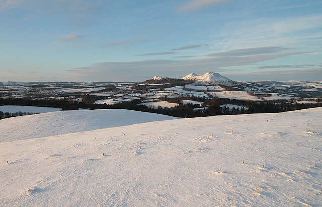
Scott's View is a viewpoint in the Scottish Borders, overlooking the valley of the River Tweed, which is reputed to be one of the favourite views of Sir Walter Scott. The viewpoint can be located directly from a minor road leading south from Earlston just off the A68 and by travelling north from the village of St. Boswells up the slope of Bemersyde Hill. The view is around 3 miles east of Melrose. The view is to the west, and is dominated by the three peaks of the Eildon Hills. To the south west the view is extensive and open, taking in rolling farmland beyond the village of Newtown St Boswells. Immediately below the viewer is a meander of the Tweed itself, enclosing a peninsula of land on which stood the ancient monastery of Old Melrose, referred to in Bede, where St Boisil welcomed the young St Cuthbert to train following his vision of St Aidan of Lindisfarne in 651ad. Often a fly fisherman can be seen fishing the river. To the north west the viewer looks along the Tweed va ... [...More Info...] [...Related Items...] OR: [Wikipedia] [Google] [Baidu] |
William Mair (moderator)
William Mair (1830–1920) was a Scottish minister who served as Moderator of the General Assembly of the Church of Scotland in 1897/98. Life He spent most of his life as minister of Earlston Church in the Scottish Borders. In 1897 he was elected Moderator. He was succeeded in 1898 by Rev Thomas Leishman Thomas Leishman (7 May 1825 – 13 July 1904) was a Scottish minister and liturgical scholar. Life Born into a clerical family at his father's manse on 7 May 1825, he was the eldest son, in a family of 13 children, of Matthew Leishman, D.D., mini .... Publications *''My Life'' (1911) autobiography References 1830 births 1920 deaths 19th-century Ministers of the Church of Scotland Moderators of the General Assembly of the Church of Scotland 20th-century Ministers of the Church of Scotland {{Scotland-reli-bio-stub ... [...More Info...] [...Related Items...] OR: [Wikipedia] [Google] [Baidu] |
Berwickshire
Berwickshire ( gd, Siorrachd Bhearaig) is a historic county, registration county and lieutenancy area in south-eastern Scotland, on the English border. Berwickshire County Council existed from 1890 until 1975, when the area became part of the Borders region, with most of the historic county becoming part of the lower-tier Berwickshire district. Berwickshire district was abolished in 1996, when all the districts in the Borders region merged to become the Scottish Borders council area. The county takes its name from Berwick-upon-Tweed, its original county town, which was part of Scotland at the time of the county's formation in the twelfth century, but became part of England in 1482 after several centuries of swapping back and forth between the two kingdoms. After the loss of Berwick, Duns and Greenlaw both served as county town at different periods. The low-lying part of Berwickshire between the Tweed and the Lammermuirs is known as "the Merse", from an old Scots word for a ... [...More Info...] [...Related Items...] OR: [Wikipedia] [Google] [Baidu] |
Lauderdale
Lauderdale is the valley of the Leader Water (a tributary of the Tweed) in the Scottish Borders. It contains the town of Lauder, as well as Earlston. The valley is traversed from end to end by the A68 trunk road, which runs from Darlington to Edinburgh. Roman road Many ancient camps, and many ''tumuli'', are found in Lauderdale. The Roman road into Scotland, Dere Street, which means "the road into the country of the wild animals", crossed a ford at Newstead, near Melrose, where there had been a Roman fort and garrison, and entered Lauderdale. Dere Street is said to have been reconditioned by King Malcolm Canmore and probably used by him in his almost constant warfare against England. The Roman road has now been traced from the Tweed through Lauderdale to Soutra. Etymology Lauderdale's name comes from the town of Lauder rather than the Leader Water. The relationship between the names "Leader" and "Lauder" is very obscure; despite their similarity, they may have different orig ... [...More Info...] [...Related Items...] OR: [Wikipedia] [Google] [Baidu] |
Black Hill (Earlston)
Black Hill may refer to: Australia * Black Hill, Ballarat, an area of Ballarat, Victoria * Black Hill Conservation Park, near Adelaide * Black Hill, South Australia, formerly known as Friedensthal in South Australia * Black Hill, New South Wales, near Newcastle * Black Hill, Victoria, a locality near Ballarat Hong Kong * Black Hill, Hong Kong, a hill in Hong Kong India * Kalo Dungar also known as Black Hill in Kutch, India Ireland * Black Hill (Wicklow Mountains), 602 m peak in County Wicklow United Kingdom England * Black Hill (Northwest Dartmoor) (584m), a hill in northwestern Dartmoor * Black Hill (East Dartmoor) (412m), a hill on the eastern edge of Dartmoor * Black Hill (East Sussex) (223 m), second highest point in East Sussex * Black Hill (Herefordshire) (640m), a mountain near Craswall in the Black Mountains * Black Hill (Peak District) (582m), a Marilyn and the highest point in West Yorkshire * Black Hill (Quantocks) (358m), a prominent high point in th ... [...More Info...] [...Related Items...] OR: [Wikipedia] [Google] [Baidu] |
Carolside, Scottish Borders
Carolside is an estate by the Leader Water, in the Scottish Borders. It is located north of Earlston, in the former county of Berwickshire. The house and estate The late-18th-century house is a category B listed building, and is set in a former deer park. It was based on a design for Chesterfield House, Mayfair, London by the architect Isaac Ware. The drawing room contains a fireplace designed by Pietro Bossi, taken from Baronscourt, Co. Tyrone, around 1948. The walled gardens include a national collection of pre-1900 Gallica roses, and are open to the public in July each year, as part of the Scotland's Gardens scheme. The grounds of the site are in size with a wide variety of trees, some oak and chestnuts being over 200 years old. Also on the estate is Park Bridge, a balustraded arch bridge linking the policies of Carolside House and those of Leadervale on the other side of the Leader. The bridge dates to the late 18th century, and has been compared with other bridge ... [...More Info...] [...Related Items...] OR: [Wikipedia] [Google] [Baidu] |
Bemersyde
Bemersyde is a hamlet in the Mertoun parish of Berwickshire, in the Scottish Borders. It sits on the left bank of the River Tweed, about three miles east of Melrose. Bemersyde House, the ancestral home of the Haig family, is the most notable feature. Other places nearby include Scott's View, Earlston, St. Boswells, Eildon, Dryburgh, Maxton, Smailholm, Smailholm Tower, and Brotherstone Hill. See also *Bemersyde Moss Scottish Wildlife Trust reserve *List of places in the Scottish Borders *List of places in Scotland This list of places in Scotland is a complete collection of lists of places in Scotland. *List of burghs in Scotland *List of census localities in Scotland *List of islands of Scotland **List of Shetland islands **List of Orkney islands **List o ... External links SCRAN resources on Bemersyde [...More Info...] [...Related Items...] OR: [Wikipedia] [Google] [Baidu] |
Midlothian South, Tweeddale And Lauderdale (Scottish Parliament Constituency)
Midlothian South, Tweeddale and Lauderdale is a constituency of the Scottish Parliament ( Holyrood) covering parts of the council areas of Midlothian and Scottish Borders. Created for the 2011 election, it elects one Member of the Scottish Parliament (MSP) by the plurality (first past the post) method of election. It is one of nine constituencies in the South Scotland electoral region, which elects seven additional members, in addition to nine constituency MSPs, to produce a form of proportional representation for the region as a whole. The constituency covers parts of the former constituencies of Midlothian and Tweeddale, Ettrick and Lauderdale. The remainder of Midlothian council area lies within the constituency of Midlothian North and Musselburgh, whilst the remainder of Scottish Borders forms the Ettrick, Roxburgh and Berwickshire constituency. Electoral region The other eight constituencies of the South Scotland region are Ayr, Carrick, Cumnock and Doon Valley ... [...More Info...] [...Related Items...] OR: [Wikipedia] [Google] [Baidu] |


