|
Eagle Lake (Maine)
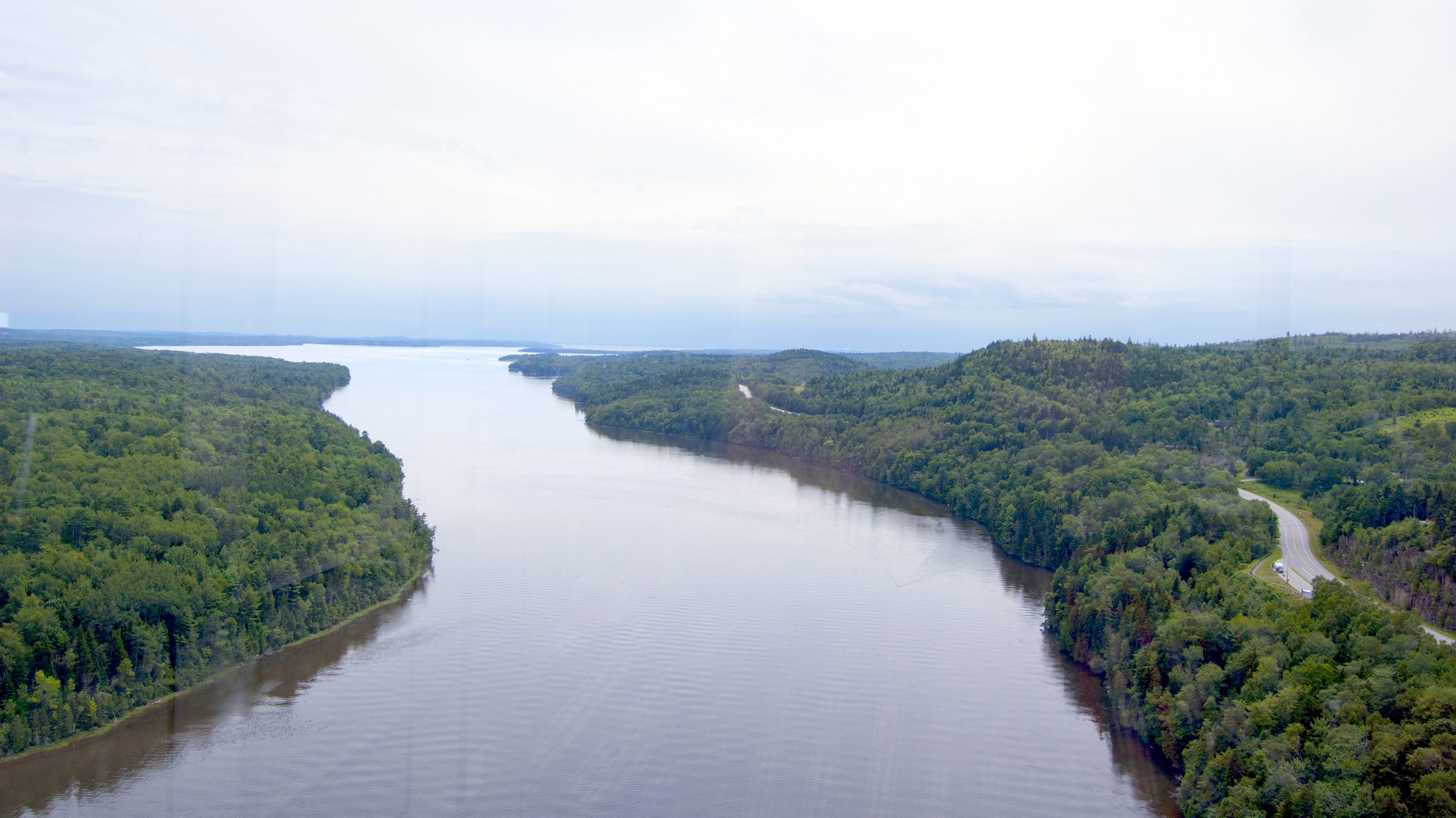
Eagle Lake is the first, largest, and deepest lake of the Allagash Wilderness Waterway in the North Maine Woods. The lake covers the eastern side of Eagle Lake township. The southern end of the lake extends into Maine township 7, range 12, where it receives overflow from Indian Pond, and into Soper Mountain township where it receives overflow from Haymock Lake via Smith Brook. Other ponds in the Eagle Lake watershed include Woodman Pond via Woodman Brook, Pillsbury Pond and Little Pillsbury Pond via Smith Brook, Soper Pond and Upper Soper Pond via Soper Brook, and the Russell Ponds via Russell Brook. Eagle Lake originally received overflow from Chamberlain Lake, but Lock Dam has diverted most Chamberlain Lake overflow through Telos Cut to the Penobscot River since the 1850s. Churchill Lake Dam A dam in Maine township 10, range 12, has raised the level of Churchill Lake from the adjoining range 12 township 9 into the north end of Eagle Lake in adjoining range 13 of township 9. The d ... [...More Info...] [...Related Items...] OR: [Wikipedia] [Google] [Baidu] |
Piscataquis County, Maine
Piscataquis County is a county located in the U.S. state of Maine. As of the 2020 census, its population was 16,800, making it Maine's least-populous county. Its county seat is Dover-Foxcroft. The county was incorporated on March 23, 1838, taken from the western part of Penobscot County and the eastern part of Somerset County. It is named for an Abenaki word meaning "branch of the river" or "at the river branch." It is located at the geographic center of Maine. Originally it extended north to the Canada–US border, but in 1844 its northern portion was annexed by Aroostook County. In land area, Piscataquis is one of the largest U.S. counties east of the Mississippi River. It is also one of two counties in the Northeast (and seven counties east of the Mississippi River) that meet Frederick Jackson Turner's requirements for "frontier" country – that is, having fewer than six inhabitants per square mile, the other being Hamilton County, New York. Baxter State Park, a lar ... [...More Info...] [...Related Items...] OR: [Wikipedia] [Google] [Baidu] |
University Of Maine
The University of Maine (UMaine or UMO) is a Public university, public Land-grant university, land-grant research university in Orono, Maine. It was established in 1865 as the land-grant college of Maine and is the Flagship universities, flagship university of the University of Maine System. It is Carnegie Classification of Institutions of Higher Education, classified by Carnegie as among "R1: Doctoral Universities – Very high research activity". With an enrollment of approximately 11,500 students, UMaine is the state's largest college or university. The University of Maine's athletic teams, nicknamed the Maine Black Bears, Black Bears, are Maine's only NCAA Division I, Division I athletics program. Maine Black Bears men's ice hockey, Maine's men's ice hockey team has won two national championships. History The University of Maine was founded in 1862 as a function of the Morrill Land-Grant Colleges Act, Morrill Act, signed by President Abraham Lincoln. Established in 1865 as ... [...More Info...] [...Related Items...] OR: [Wikipedia] [Google] [Baidu] |
Allagash Wilderness Waterway
The Allagash Wilderness Waterway is a protected area extending from Aroostook County, Maine into Piscataquis County, Maine. It is a ribbon of lakes, ponds, rivers, and streams of the Maine North Woods that includes much of the Allagash River The Allagash River is a tributary of the Saint John River, approximately long,U.S. Geological Survey. National Hydrography Dataset high-resolution flowline dataThe National Map, accessed June 22, 2011 in northern Maine in the United States. It d .... Canoeing, fishing, hunting, and camping are among the activities permitted. References External linksAllagash Wilderness WaterwayDepartment of Agriculture, Conservation and ForestryAllagash Wilderness Waterway MapDepartment of Agriculture, Conservation and Forestry State parks of Maine Allagash River North Maine Woods Northern Forest Canoe Trail Water trails Protected areas of Aroostook County, Maine Protected areas of Piscataquis County, Maine Protected areas established in 19 ... [...More Info...] [...Related Items...] OR: [Wikipedia] [Google] [Baidu] |
North Maine Woods
The North Maine Woods is the northern geographic area of the state of Maine in the United States. The thinly populated region is overseen by a combination of private individual and private industrial owners and state government agencies, and is divided into 155 unincorporated townships within the NMW management area. There are no towns or paved roads. The region covers more than of forest land bordered by Canada to the west and north and by the early 20th century transportation corridors of the Canadian Pacific International Railway of Maine to the south and the Bangor and Aroostook Railroad Ashland branch to the east. It includes western Aroostook and northern Somerset, Penobscot, and Piscataquis counties. Much of the woods are currently owned by timber corporations, including Seven Islands Land Company, Plum Creek, Maibec, Orion Timberlands and J. D. Irving. Ownership changes hands quite frequently and is often difficult to determine. Its main products are timber for pulp ... [...More Info...] [...Related Items...] OR: [Wikipedia] [Google] [Baidu] |
Maine
Maine () is a state in the New England and Northeastern regions of the United States. It borders New Hampshire to the west, the Gulf of Maine to the southeast, and the Canadian provinces of New Brunswick and Quebec to the northeast and northwest, respectively. The largest state by total area in New England, Maine is the 12th-smallest by area, the 9th-least populous, the 13th-least densely populated, and the most rural of the 50 U.S. states. It is also the northeasternmost among the contiguous United States, the northernmost state east of the Great Lakes, the only state whose name consists of a single syllable, and the only state to border exactly one other U.S. state. Approximately half the area of Maine lies on each side of the 45th parallel north in latitude. The most populous city in Maine is Portland, while its capital is Augusta. Maine has traditionally been known for its jagged, rocky Atlantic Ocean and bayshore coastlines; smoothly contoured mountains; heavily f ... [...More Info...] [...Related Items...] OR: [Wikipedia] [Google] [Baidu] |
Chamberlain Lake
Chamberlain Lake is one of the largest and deepest lakes in the North Maine Woods. The lake originally drained north through Eagle Lake and Churchill Lake into the Allagash River tributary to the Saint John River. Nineteenth-century logging operations diverted the lake into the Penobscot River before designation of the Allagash Wilderness Waterway in 1966. History Telos Lake drained into the south end of Chamberlain Lake until the Telos Cut was excavated in 1841 to allow Telos Lake to drain east into Webster Lake and the Penobscot River. In the 1850s Eben S. Coe built the timber crib Lock Dam across the outlet from Chamberlain Lake causing Chamberlain Lake to overflow southward through Round Pond, Telos Lake, Webster Lake and Webster Brook into the East Branch Penobscot River in Baxter State Park. These changes allowed logs harvested in the upper Saint John River watershed to be floated to Bangor sawmills. The combined level of Chamberlain Lake, Round Pond, and Telos Lake has su ... [...More Info...] [...Related Items...] OR: [Wikipedia] [Google] [Baidu] |
Penobscot River
The Penobscot River (Abenaki: ''Pαnawάhpskewtəkʷ'') is a U.S. Geological Survey. National Hydrography Dataset high-resolution flowline dataThe National Map, accessed June 22, 2011 river in the U.S. state of Maine. Including the river's West Branch and South Branch increases the Penobscot's length to , making it the second-longest river system in Maine and the longest entirely in the state. Its drainage basin contains . It arises from four branches in several lakes in north-central Maine, which flow generally east. After the uniting of the West Branch with the East Branch at Medway (), the Penobscot flows south, past the city of Bangor, where it becomes navigable. Also at Bangor is the tributary Kenduskeag Stream. It empties into the Atlantic Ocean in Penobscot Bay. It is home to the Penobscot people that live on Indian Island, and considered to be The People's lifeblood. History Norumbega Most historians have accepted the Penobscot region as Jean Allefonsce's ... [...More Info...] [...Related Items...] OR: [Wikipedia] [Google] [Baidu] |
Allagash River
The Allagash River is a tributary of the Saint John River, approximately long,U.S. Geological Survey. National Hydrography Dataset high-resolution flowline dataThe National Map, accessed June 22, 2011 in northern Maine in the United States. It drains in a remote and scenic area of wilderness in the Maine North Woods north of Mount Katahdin. The name "Allagash" comes from the Abenaki language, a dialect of the Algonquin languages, spoken by the Penobscot Tribe. The word, ''/walakéskʸihtəkʸ/'', means "bark stream". The Allagash issues from Churchill Lake (formerly known as Heron Lake) at Churchill Depot in northern Piscataquis County. In its natural state, it also drained Allagash, Chamberlain, and Telos lakes, but in the 1840s dams were built which diverted their drainage into the East Branch of the Penobscot River, to facilitate the shipping of logs south to coastal Maine. Lock Dam drains some water from Chamberlain Lake into the south end of Eagle Lake, which then flows o ... [...More Info...] [...Related Items...] OR: [Wikipedia] [Google] [Baidu] |
Saint John River (Bay Of Fundy)
The Saint John River (french: Fleuve Saint-Jean; Maliseet-Passamaquoddy: ''Wolastoq'') is a long river that flows from Northern Maine into Canada, and runs south along the western side of New Brunswick, emptying into the Atlantic Ocean in the Bay of Fundy. Eastern Canada's longest river, its drainage basin is one of the largest on the east coast at about . A part of the border between New Brunswick and Maine follows 130 km (80 miles) of the river. A tributary forms 55 km (35 miles) of the border between Quebec and Maine. New Brunswick settlements through which it passes include, moving downstream, Edmundston, Fredericton, Oromocto, and Saint John. It is regulated by hydro-power dams at Mactaquac, Beechwood, and Grand Falls, New Brunswick. Hydronym Samuel de Champlain visited the mouth of the river on the feast day of John the Baptist in 1604 and renamed it the Rivière Saint-Jean or Saint John River in English. Many waterways in the system retain their origi ... [...More Info...] [...Related Items...] OR: [Wikipedia] [Google] [Baidu] |
Lake Trout
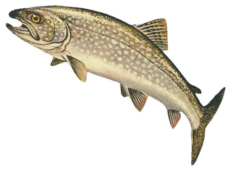
The lake trout (''Salvelinus namaycush'') is a freshwater char living mainly in lakes in northern North America. Other names for it include mackinaw, namaycush, lake char (or charr), touladi, togue, and grey trout. In Lake Superior, it can also be variously known as siscowet, paperbelly and lean. The lake trout is prized both as a game fish and as a food fish. Those caught with dark coloration may be called ''mud hens''. Taxonomy It is the only member of the subgenus ''Cristovomer'', which is more derived than the subgenus '' Baione'' (the most basal clade of ''Salvelinus'', containing the brook trout (''S. fontinalis'') and silver trout (''S. agasizii'')) but still basal to the other members of ''Salvelinus''. Range From a zoogeographical perspective, lake trout have a relatively narrow distribution. They are native only to the northern parts of North America, principally Canada, but also Alaska and, to some extent, the northeastern United States. Lake trout have been wide ... [...More Info...] [...Related Items...] OR: [Wikipedia] [Google] [Baidu] |
Brook Trout
The brook trout (''Salvelinus fontinalis'') is a species of freshwater fish in the char genus ''Salvelinus'' of the salmon family Salmonidae. It is native to Eastern North America in the United States and Canada, but has been introduced elsewhere in North America, as well as to Iceland, Europe, and Asia. In parts of its range, it is also known as the eastern brook trout, speckled trout, brook charr, squaretail, brookie or mud trout, among others. A potamodromous population in Lake Superior, as well as an anadromous population in Maine, is known as coaster trout or, simply, as coasters. The brook trout is the state fish of nine U.S. states: Michigan, New Hampshire, New Jersey, New York, North Carolina, Pennsylvania, Vermont, Virginia, and West Virginia, and the Provincial Fish of Nova Scotia in Canada. Systematics and taxonomy The brook trout was first scientifically described as ''Salmo fontinalis'' by the naturalist Samuel Latham Mitchill in 1814. The specific epithet "''fontina ... [...More Info...] [...Related Items...] OR: [Wikipedia] [Google] [Baidu] |
Burbot
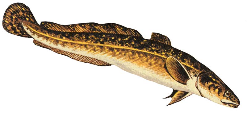
The burbot (''Lota lota'') is the only gadiform (cod-like) freshwater fish Freshwater fish are those that spend some or all of their lives in fresh water, such as rivers and lakes, with a salinity of less than 1.05%. These environments differ from marine conditions in many ways, especially the difference in levels of .... It is also known as bubbot, mariah, loche, cusk, freshwater cod, freshwater ling, freshwater cusk, the lawyer, coney-fish, lingcod, and eelpout. The species is closely related to the marine common ling and the cusk (fish), cusk. It is the monotypic, only member of the genus ''Lota''. For some time of the year, the burbot lives under ice, and it requires frigid temperatures to breed. Etymology The name burbot comes from the Latin word ''barba'', meaning beard, referring to its single chin whisker, or barbel (anatomy), barbel. Its generic and specific names, ''Lota lota'', comes from the old French ''lotte'' fish, which is also named "barbot" in Old French. ... [...More Info...] [...Related Items...] OR: [Wikipedia] [Google] [Baidu] |


