|
Duluth
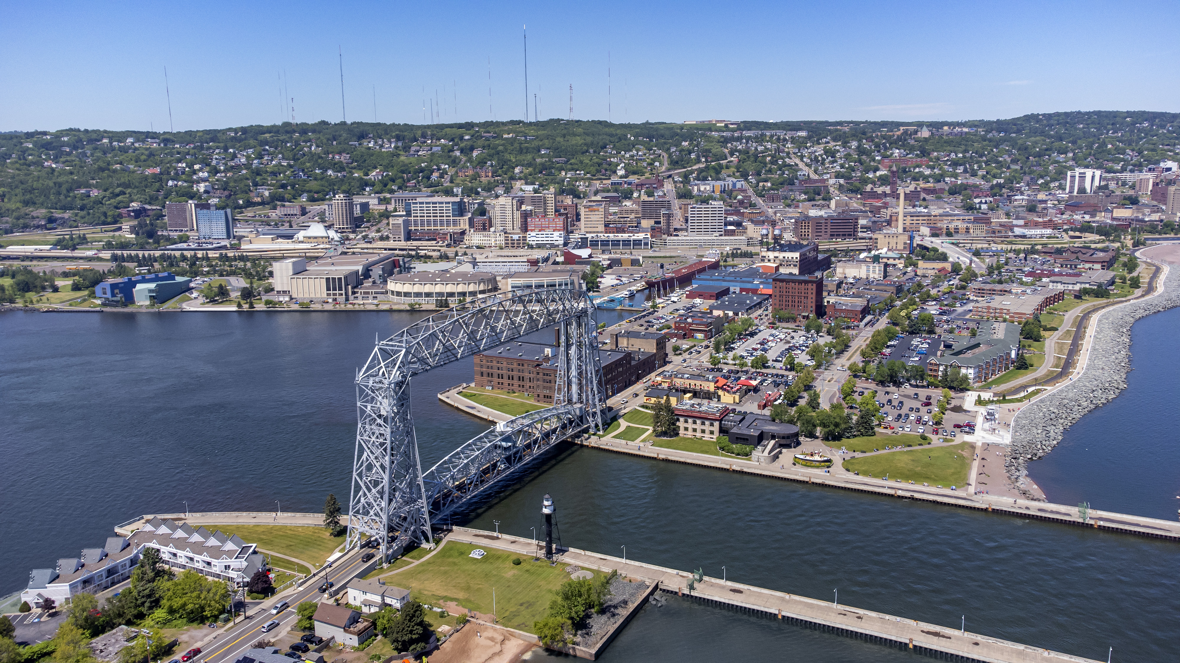
, settlement_type = City , nicknames = Twin Ports (with Superior), Zenith City , motto = , image_skyline = , image_caption = Clockwise from top: urban Duluth skyline; Minnesota Point beach; Duluth Ship Canal and Aerial Lift Bridge with Canal Park in background; and North Pier Lighthouse with freighter arriving , image_flag = Flag_of_Duluth,_Minnesota.svg , flag_alt = Flag of Duluth (gold star on a light blue banner with white, green, and dark blue waves below) , image_map = St. Louis County Minnesota Incorporated and Unincorporated areas Duluth Highlighted.svg , mapsize = 250x200px , map_caption = Location of the city of Duluthwithin St. Louis County, Minnesota , image_map1 = , mapsize1 = , map_caption1 = , pushpin_map = Minnesota#USA , pushpin_label = Duluth , pushp ... [...More Info...] [...Related Items...] OR: [Wikipedia] [Google] [Baidu] |
Emily Larson
Emily Larson (born 1973) is an American politician and the current mayor of Duluth, Minnesota. She is a member of the Minnesota Democratic-Farmer-Labor Party. Larson was elected Mayor of Duluth in November 2015 and inaugurated on January 4th, 2016, the first female mayor in the city's history. She won reelection in 2019. Prior to becoming Mayor, she was a member of the Duluth City Council. Life and education Emily Larson was born and raised in St. Paul, Minnesota, St. Paul, the youngest of three children. Her mother, a poet, and her father, an information technology worker, divorced when she was 10 years old, but both later remarried. She graduated with a Bachelor's Degree in social work from the College of St. Scholastica and later earned a Master's Degree from the University of Minnesota-Duluth. A graduate of the Intermedia Arts Creative Community Leadership Institute, Larson served on the advisory committee that developed the Duluth Energy Efficiency Program (DEEP). She has w ... [...More Info...] [...Related Items...] OR: [Wikipedia] [Google] [Baidu] |
Downtown Duluth
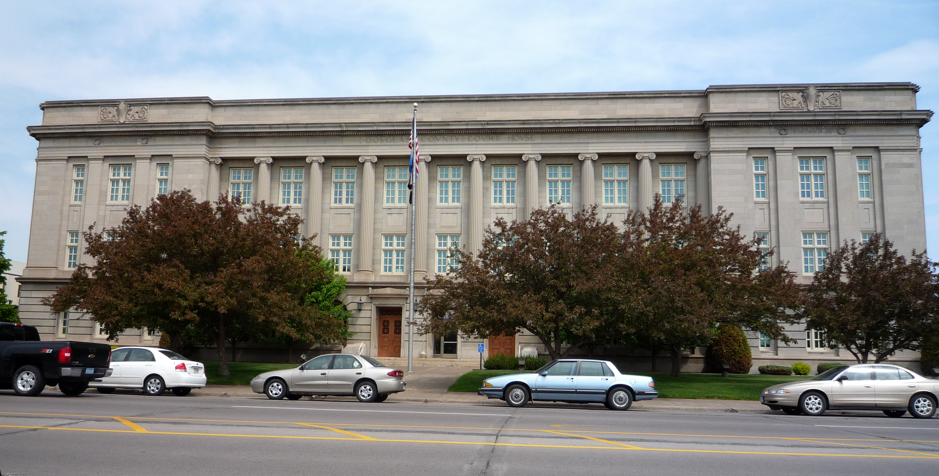
The downtown of Duluth, Minnesota, Duluth, Minnesota, United States, is situated between Mesaba Avenue (Minnesota State Highway 194, Highway 194) and 4th Avenue East; and located on Michigan, Superior, First, Second, and Third streets. The downtown area is home to a number of the city's cultural and social attractions, as well as government offices and business centers. Duluth's main library is located in downtown, as is the city's foremost museum, the courthouse, city hall, several local restaurants and bars with live music venues, and many of the larger business offices. Stores and places to eat and drink tend to be locally or regionally owned and operated, with most chain and franchise establishments having located (or re-located) themselves in the "Miller Hill area" around the Miller Trunk Corridor. A large portion of the eastern section of downtown is oriented around Essentia Health–St. Mary's Medical Center and Miller-Dwan Medical Center. The downtown area is easily access ... [...More Info...] [...Related Items...] OR: [Wikipedia] [Google] [Baidu] |
Duluth Ship Canal
The Duluth Ship Canal is an artificial canal cut through Minnesota Point, providing direct access to Duluth harbor from Lake Superior. Begun privately in 1871, it was put under federal supervision and maintenance several years later. It is still an important component of the harbor facilities. In its current configuration, the canal is defined by a pair of breakwaters long and apart, constructed of concrete set on timber and stone cribbing. HAER No. MN-10 The canal is maintained at wide and LWD, allowing passage of ocean-going ships. Three lighthouses are placed on the sides of the canal: the Duluth North Pier Light and the Duluth South Breakwater Outer Light mark the lake ends of the canal, while the Duluth South Breakwater Inner Light functions with the south breakwater light as a range light. At the harbor end, the canal is straddled by the Aerial Lift Bridge which connects Minnesota Point to the rest of the city. On the north side, there is a building housing the local Co ... [...More Info...] [...Related Items...] OR: [Wikipedia] [Google] [Baidu] |
Aerial Lift Bridge
The Aerial Lift Bridge, earlier known as the Aerial Bridge or Aerial Ferry Bridge, is a landmark in the port city of Duluth, Minnesota. The span began life in 1905 as the United States' first transporter bridge: Only one other was ever constructed in the country, Sky Ride in Chicago. The span was converted in 1929–1930 to a vertical-lift bridge – also rather uncommon, although there are six such bridges along Ontario's Welland Canal – and continues to operate today. The bridge was added to the National Register of Historic Places on May 22, 1973. The bridge is owned and operated by the City of Duluth. The United States Army Corps of Engineers maintains a nearby maritime museum. Bridge history The bridge spans the Duluth Ship Canal, which was put through the miles-long sand spit named Minnesota Point – commonly called Park Point by locals – in 1870–1871. The natural mouth of the Saint Louis River is about farther southeast, and is split between ... [...More Info...] [...Related Items...] OR: [Wikipedia] [Google] [Baidu] |
Canal Park, Duluth
Canal Park is a tourist and recreation-oriented district of Duluth, Minnesota, Duluth, Minnesota, United States. Situated across the Interstate 35 in Minnesota, Interstate 35 freeway from Downtown Duluth, it is connected by the Aerial Lift Bridge across the Duluth Ship Canal to the Minnesota Point, Park Point sandbar and Neighborhoods of Duluth, Minnesota, neighborhood. Canal Park Drive and Lake Avenue South serve as the main routes in Canal Park. History Canal Park is largely a conversion of an old warehouse district into restaurants, shops (especially those dealing in antiques and other novelties), cafés, and hotels. This conversion began in the 1980s as an attempt to use Duluth's rich Industrial sector, industrial past, the decline of which had left the city in economic turmoil at the time, as an asset in a prospective tourist industry. Attractions Many annual events are held in the Canal Park area, such as the Bayfront Blues Festival and Grandma's Marathon, which starts in Tw ... [...More Info...] [...Related Items...] OR: [Wikipedia] [Google] [Baidu] |
Minnesota Point
Minnesota Point, also known as the Park Point neighborhood of Duluth, Minnesota, United States; is a long, narrow sand spit that extends out from the Canal Park tourist recreation-oriented district of the city of Duluth. The Point separates Lake Superior from Superior Bay and the Duluth Harbor Basin. Lake Avenue South / Minnesota Avenue serves as a main route in the community. Near the end of Minnesota Point is a small airport, Sky Harbor Airport. Beyond the airport, approximately 3/4 mile, is an old growth red and white pine forest. Within the forest is a Minnesota Department of Natural Resources designated area, the ''Minnesota Point Pine Forest Scientific and Natural Area'', which encompasses 18 acres. Minnesota Point is approximately 7 miles in length, and when included with adjacent Wisconsin Point, which extends 3 miles out from the city of Superior, Wisconsin, totals 10 miles. History Due to the short and easy portage across Minnesota Point, the Ojibwa name for t ... [...More Info...] [...Related Items...] OR: [Wikipedia] [Google] [Baidu] |
Minnesota
Minnesota () is a state in the upper midwestern region of the United States. It is the 12th largest U.S. state in area and the 22nd most populous, with over 5.75 million residents. Minnesota is home to western prairies, now given over to intensive agriculture; deciduous forests in the southeast, now partially cleared, farmed, and settled; and the less populated North Woods, used for mining, forestry, and recreation. Roughly a third of the state is covered in forests, and it is known as the "Land of 10,000 Lakes" for having over 14,000 bodies of fresh water of at least ten acres. More than 60% of Minnesotans live in the Minneapolis–Saint Paul metropolitan area, known as the "Twin Cities", the state's main political, economic, and cultural hub. With a population of about 3.7 million, the Twin Cities is the 16th largest metropolitan area in the U.S. Other minor metropolitan and micropolitan statistical areas in the state include Duluth, Mankato, Moorhead, Rochester, and ... [...More Info...] [...Related Items...] OR: [Wikipedia] [Google] [Baidu] |
Superior, Wisconsin
, native_name_lang = oj , nickname = , total_type = , motto = , image_skyline = Tower Avenue.jpg , imagesize = , image_caption = Downtown Superior , image_flag = , flag_size = , image_seal = , seal_size = , image_shield = , shield_size = , image_blank_emblem = , blank_emblem_type = , blank_emblem_size = , pushpin_map = Wisconsin , pushpin_label_position = , pushpin_map_caption = Location of the city of Superiorin Douglas County, Wisconsin , pushpin_mapsize = , subdivision_type = Country , subdivision_name = United States , subdivision_type1 = U.S. state, State , subdivision_name1 = Wisconsin , subdivision_type2 = List of counties in Wisconsin, County , subdivision_name2 = Douglas County, Wisconsin, Douglas , seat_ty ... [...More Info...] [...Related Items...] OR: [Wikipedia] [Google] [Baidu] |
Duluth Harbor North Pier Light
The Duluth Harbor North Pier Light is a lighthouse on the north breakwater of the Duluth Ship Canal in Duluth, Minnesota, United States. History An 1896 project to improve harbor facilities resulted in the reconstruction of the sides of the Duluth Ship Canal, bracketing it in the two concrete piers which define its channel to the present. While the south pier had been equipped with a light from 1874, the north pier was unlit, and given the difficult approach (highlighted by the notorious wreck of the '' SS Mataafa'' in 1905), calls for aids were soon made. A 1908 Lighthouse Board report, in recommending the construction of a light on the north pier, noted that a private aid was already being placed on the pier. Appropriation was made in 1909, and a tower was erected and lit the following year. The design was based on that of the Peche Island Rear Range Light, featuring a short round tower built of steel plates. A fifth-order Fresnel lens from France was installed and lit with a ... [...More Info...] [...Related Items...] OR: [Wikipedia] [Google] [Baidu] |
Lake Freighter
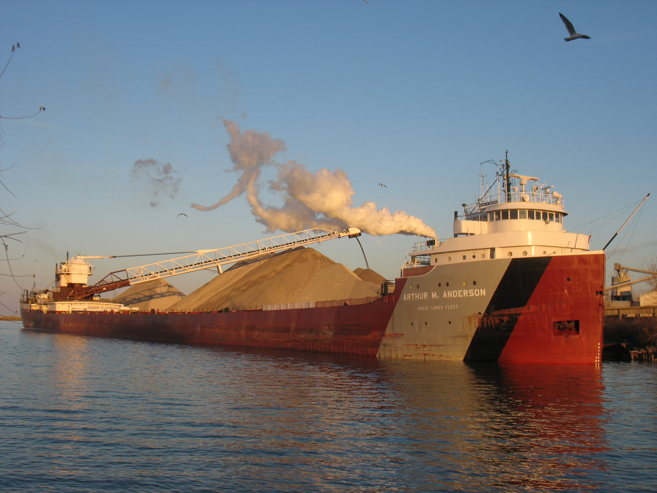
Lake freighters, or lakers, are bulk carrier vessels that operate on the Great Lakes of North America. These vessels are traditionally called boats, although classified as ships. Since the late 19th century, lakers have carried bulk cargoes of materials such as limestone, iron ore, grain, coal, or salt from the mines and fields of the upper Great Lakes to the populous industrial areas farther east. The 63 commercial ports handled 173 million tons of cargo in 2006. Because of winter ice on the lakes, the navigation season is not usually year-round. The Soo Locks and Welland Canal close from mid-January to late March, when most boats are laid up for maintenance. Crew members spend these months ashore. Depending on their application, lakers may also be referred to by their types, such as ''oreboats'' or ''ironboats'' (primarily for iron ore), ''straight deckers'' (no self-unloading gear), ''bulkers'' (carry bulk cargo), ''sternenders'' (all cabins aft), ''self unloaders'' (with sel ... [...More Info...] [...Related Items...] OR: [Wikipedia] [Google] [Baidu] |
Lake Superior
Lake Superior in central North America is the largest freshwater lake in the world by surface areaThe Caspian Sea is the largest lake, but is saline, not freshwater. and the third-largest by volume, holding 10% of the world's surface fresh water. The northern and westernmost of the Great Lakes of North America, it straddles the Canada–United States border with the province of Ontario to the north and east, and the states of Minnesota to the northwest and Wisconsin and Michigan to the south. It drains into Lake Huron via St. Marys River, then through the lower Great Lakes to the St. Lawrence River and the Atlantic Ocean. Name The Ojibwe name for the lake is ''gichi-gami'' (in syllabics: , pronounced ''gitchi-gami'' or ''kitchi-gami'' in different dialects), meaning "great sea". Henry Wadsworth Longfellow wrote this name as "Gitche Gumee" in the poem ''The Song of Hiawatha'', as did Gordon Lightfoot in his song " The Wreck of the ''Edmund Fitzgerald''". According to oth ... [...More Info...] [...Related Items...] OR: [Wikipedia] [Google] [Baidu] |
Iron Range
The term Iron Range refers collectively or individually to a number of elongated iron-ore mining districts around Lake Superior in the United States and Canada. Much of the ore-bearing region lies alongside the range of granite hills formed by the Giants Range batholith. These cherty iron ore deposits are Precambrian in the Vermilion Range and middle Precambrian in the Mesabi and Cuyuna ranges, all in Minnesota. The Gogebic Range in Wisconsin and the Marquette Iron Range and Menominee Range in Michigan have similar characteristics and are of similar age. Natural ores and concentrates were produced from 1848 until the mid-1950s, when taconites and jaspers were concentrated and pelletized, and started to become the major source of iron production. The mining districts are in Minnesota's Arrowhead region. The region's far eastern area, containing the Duluth Complex along the shore of Lake Superior, and the far northern area, along the Canada–U.S. border, are not associated w ... [...More Info...] [...Related Items...] OR: [Wikipedia] [Google] [Baidu] |

.jpg)


