|
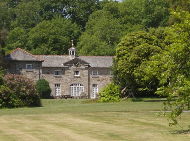
Drym
Drym is a hamlet in the parish of Crowan (where the 2011 census population was included ), Cornwall Cornwall (; kw, Kernow ) is a historic county and ceremonial county in South West England. It is recognised as one of the Celtic nations, and is the homeland of the Cornish people. Cornwall is bordered to the north and west by the Atlantic ..., England. Explore Britain References Hamlets in Cornwall {{Cornwall-geo-stub ...[...More Info...] [...Related Items...] OR: [Wikipedia] [Google] [Baidu] |
Crowan
Crowan ( kw, Egloskrewen (village), Pluw Grewen (parish)) is a village and civil parish in Cornwall, United Kingdom. It is about three-and-a-half miles (6 km) south of Camborne.Ordnance Survey: Landranger map sheet 203 ''Land's End'' A former mining parish, all of the mines had shut by 1880. Geography Crowan had a population of 2,375 (2001) which had increased to 2,454 in the 2011 census. Crowan Churchtown is not the largest settlement: there are villages at Praze-an-Beeble, Nancegollan, Bolitho and Leedstown and a hamlet at Black Rock (on the B3280 road four miles (6.5 km) south of Camborne and five miles (8 km) north of Helston). The hamlets of Carzise, Clowance Wood, Drym, Fraddam, Gwinear Downs, Horsedowns, Nine Maidens Downs, Noonvares, Paul's Green, Releath, Townshend and Tremayne are also in the parish. The River Hayle rises near Crowan and flows through the village and the railway branch to Helston passed nearby. Notable buildings and antiquities ... [...More Info...] [...Related Items...] OR: [Wikipedia] [Google] [Baidu] |
Cornwall Council
Cornwall Council ( kw, Konsel Kernow) is the unitary authority for Cornwall in the United Kingdom, not including the Isles of Scilly, which has its own unitary council. The council, and its predecessor Cornwall County Council, has a tradition of large groups of independent councillors, having been controlled by independents in the 1970s and 1980s. Since the 2021 elections, it has been under the control of the Conservative Party. Cornwall Council provides a wide range of services to the approximately half a million people who live in Cornwall. In 2014 it had an annual budget of more than £1 billion and was the biggest employer in Cornwall with a staff of 12,429 salaried workers. It is responsible for services including: schools, social services, rubbish collection, roads, planning and more. History Establishment of the unitary authority On 5 December 2007, the Government confirmed that Cornwall was one of five councils that would move to unitary status. This was enacted by st ... [...More Info...] [...Related Items...] OR: [Wikipedia] [Google] [Baidu] |
Cornwall
Cornwall (; kw, Kernow ) is a historic county and ceremonial county in South West England. It is recognised as one of the Celtic nations, and is the homeland of the Cornish people. Cornwall is bordered to the north and west by the Atlantic Ocean, to the south by the English Channel, and to the east by the county of Devon, with the River Tamar forming the border between them. Cornwall forms the westernmost part of the South West Peninsula of the island of Great Britain. The southwesternmost point is Land's End and the southernmost Lizard Point. Cornwall has a population of and an area of . The county has been administered since 2009 by the unitary authority, Cornwall Council. The ceremonial county of Cornwall also includes the Isles of Scilly, which are administered separately. The administrative centre of Cornwall is Truro, its only city. Cornwall was formerly a Brythonic kingdom and subsequently a royal duchy. It is the cultural and ethnic origin of the Cornish dias ... [...More Info...] [...Related Items...] OR: [Wikipedia] [Google] [Baidu] |
Hayle
Hayle ( kw, Heyl, "estuary") is a port town and civil parish in west Cornwall, England. It is situated at the mouth of the Hayle River (which discharges into St Ives Bay) and is approximately seven miles (11 km) northeast of Penzance. Hayle parish was created in 1888 from part of the now defunct Phillack parish, with which it was later combined in 1935, and incorporated part of St Erth in 1937. The modern parish shares boundaries with St Ives to the west, St Erth to the south, Gwinear and Gwithian in the east, and is bounded to the north by the Celtic Sea. History Early history Although there is a long history of settlement in the Hayle Estuary area dating from the Bronze Age, the modern town of Hayle was built predominantly during the 18th century industrial revolution. Evidence of Iron Age settlement exists at the fort on the hill above Carnsew Pool where the Plantation now stands. It is thought that Hayle was an important centre for the neolithic tin industry ... [...More Info...] [...Related Items...] OR: [Wikipedia] [Google] [Baidu] |
Hamlet (place)
A hamlet is a human settlement that is smaller than a town or village. Its size relative to a Parish (administrative division), parish can depend on the administration and region. A hamlet may be considered to be a smaller settlement or subdivision or satellite entity to a larger settlement. The word and concept of a hamlet has roots in the Anglo-Norman settlement of England, where the old French ' came to apply to small human settlements. Etymology The word comes from Anglo-Norman language, Anglo-Norman ', corresponding to Old French ', the diminutive of Old French ' meaning a little village. This, in turn, is a diminutive of Old French ', possibly borrowed from (West Germanic languages, West Germanic) Franconian languages. Compare with modern French ', Dutch language, Dutch ', Frisian languages, Frisian ', German ', Old English ' and Modern English ''home''. By country Afghanistan In Afghanistan, the counterpart of the hamlet is the Qila, qala (Dari language, Dari: ... [...More Info...] [...Related Items...] OR: [Wikipedia] [Google] [Baidu] |


