|
Draycott, Gloucestershire
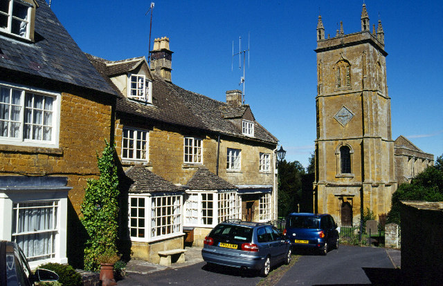
Draycott is a small hamlet in north Gloucestershire between Moreton-in-Marsh and Blockley, within Blockley civil parish. It is not mentioned in Domesday Book Domesday Book () – the Middle English spelling of "Doomsday Book" – is a manuscript record of the "Great Survey" of much of England and parts of Wales completed in 1086 by order of King William I, known as William the Conqueror. The manusc ... but was in existence by 1182. Draycott has a green and each summer a barbecue is held there for the locals. External links References in history of Blockley parish, at www.british-history.ac.uk(2007-05-23)Brief reference at www.british-history.ac.uk Villages in Gl ... [...More Info...] [...Related Items...] OR: [Wikipedia] [Google] [Baidu] |
Blockley
Blockley is a village, civil parish and ecclesiastical parish in the Cotswold district of Gloucestershire, England, about northwest of Moreton-in-Marsh. Until 1931 Blockley was an exclave of Worcestershire. The civil and ecclesiastical parish boundaries are roughly coterminous, and include the hamlets of Draycott, Paxford and Aston Magna, the residential development at Northwick and the deserted hamlets of Upton and Upper Ditchford. Blockley village is on Blockley Brook, a tributary of Knee Brook. Knee Brook forms the northeastern boundary of the parish and is a tributary of the River Stour. History Manor In AD 855 King Burgred of Mercia granted a monastery at Blockley to Ealhhun, Bishop of Worcester for the price of 300 solidi.''Victoria County History'', 1913, pages 265-276 In 1086 the Domesday Book recorded that the Bishop of Worcester held an estate of 38 hides at Blockley. The Bishops of Worcester retained the estate until 1648, during the English Civil War, when t ... [...More Info...] [...Related Items...] OR: [Wikipedia] [Google] [Baidu] |
Gloucestershire
Gloucestershire ( abbreviated Glos) is a county in South West England. The county comprises part of the Cotswold Hills, part of the flat fertile valley of the River Severn and the entire Forest of Dean. The county town is the city of Gloucester and other principal towns and villages include Cheltenham, Cirencester, Kingswood, Bradley Stoke, Stroud, Thornbury, Yate, Tewkesbury, Bishop's Cleeve, Churchdown, Brockworth, Winchcombe, Dursley, Cam, Berkeley, Wotton-under-Edge, Tetbury, Moreton-in-Marsh, Fairford, Lechlade, Northleach, Stow-on-the-Wold, Chipping Campden, Bourton-on-the-Water, Stonehouse, Nailsworth, Minchinhampton, Painswick, Winterbourne, Frampton Cotterell, Coleford, Cinderford, Lydney and Rodborough and Cainscross that are within Stroud's urban area. Gloucestershire borders Herefordshire to the north-west, Worcestershire to the north, Warwickshire to the north-east, Oxfordshire to the east, Wiltshire to the south, Bristol and Somerset ... [...More Info...] [...Related Items...] OR: [Wikipedia] [Google] [Baidu] |
The Cotswolds (UK Parliament Constituency)
The Cotswolds is a constituency represented in the House of Commons of the UK Parliament by Sir Geoffrey Clifton-Brown, a Conservative, since its 1997 creation. Members of Parliament Constituency profile The Cotswolds is a safe Conservative seat. The largest town in the constituency is Cirencester, a compact traditional town. Other settlements include Andoversford, Bourton-on-the-Water, Chipping Campden, Fairford, Lechlade, Moreton-in-Marsh, Northleach, Stow-on-the-Wold, Tetbury (and the neighbouring village of Doughton, location of Highgrove, the Prince of Wales's estate), and Wotton-under-Edge. The seat has the highest number of listed buildings of any constituency in Britain. It also contains eight of the 20 most popular attractions in Gloucestershire, including Westonbirt Arboretum, Hidcote Manor, and Chedworth Roman Villa. Workless claimants, registered jobseekers, were in November 2012 significantly lower than the national average of 3.8%, at 1.6% of the population ... [...More Info...] [...Related Items...] OR: [Wikipedia] [Google] [Baidu] |
Cotswold District
Cotswold is a local government district in Gloucestershire, England. It is named after the wider Cotswolds region. Its main town is Cirencester. Other notable towns include Tetbury, Moreton-in-Marsh, Stow-on-the-Wold and Chipping Campden. Notable villages in the district include Bourton-on-the-Water, Blockley, Kemble and Upper Rissington among other villages and hamlets in the district. Cotswold District Council is composed of 34 councillors elected from 32 wards. It was formed on 1 April 1974 by the merger of the urban district of Cirencester with Cirencester Rural District, North Cotswold Rural District, Northleach Rural District, and Tetbury Rural District. The population of the Cotswold District in the 2011 Census was 83,000. Eighty per cent of the district lies within the River Thames catchment area, with the Thames itself and several tributaries including the River Windrush and River Leach running through the district. Lechlade in an important point on the river as the ... [...More Info...] [...Related Items...] OR: [Wikipedia] [Google] [Baidu] |
Moreton-in-Marsh
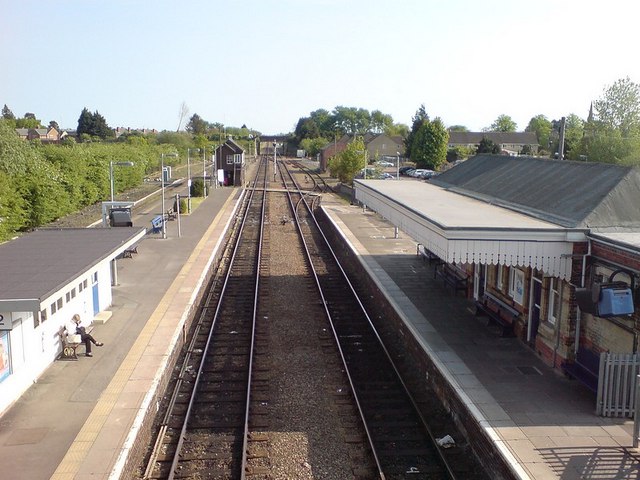
Moreton-in-Marsh is a market town in the Evenlode Valley, within the Cotswolds district and Area of Outstanding Natural Beauty in Gloucestershire, England. The town stands at the crossroads of the Fosse Way Roman road (now the A429) and the A44. It is served by Moreton-in-Marsh railway station on the Cotswold Line. It is relatively flat and low-lying compared with the surrounding Cotswold Hills. The River Evenlode rises near Batsford, runs around the edge of Moreton and meanders towards Oxford, where it flows into the Thames just east of Eynsham. Just over east of Moreton, the Four shire stone marked the boundary of the historic counties of Gloucestershire, Warwickshire, Worcestershire and Oxfordshire, until the re-organisation of the county boundaries in 1931. Since then it marks the meeting place of Gloucestershire, Warwickshire and Oxfordshire. Toponymy Moreton is derived from Old English which means "Farmstead on the Moor" and "in Marsh" is from ''henne'' and ''m ... [...More Info...] [...Related Items...] OR: [Wikipedia] [Google] [Baidu] |
Domesday Book
Domesday Book () – the Middle English spelling of "Doomsday Book" – is a manuscript record of the "Great Survey" of much of England and parts of Wales completed in 1086 by order of King William I, known as William the Conqueror. The manuscript was originally known by the Latin name ''Liber de Wintonia'', meaning "Book of Winchester", where it was originally kept in the royal treasury. The '' Anglo-Saxon Chronicle'' states that in 1085 the king sent his agents to survey every shire in England, to list his holdings and dues owed to him. Written in Medieval Latin, it was highly abbreviated and included some vernacular native terms without Latin equivalents. The survey's main purpose was to record the annual value of every piece of landed property to its lord, and the resources in land, manpower, and livestock from which the value derived. The name "Domesday Book" came into use in the 12th century. Richard FitzNeal wrote in the ''Dialogus de Scaccario'' ( 1179) that the book ... [...More Info...] [...Related Items...] OR: [Wikipedia] [Google] [Baidu] |
Villages In Gloucestershire
A village is a clustered human settlement or community, larger than a hamlet but smaller than a town (although the word is often used to describe both hamlets and smaller towns), with a population typically ranging from a few hundred to a few thousand. Though villages are often located in rural areas, the term urban village is also applied to certain urban neighborhoods. Villages are normally permanent, with fixed dwellings; however, transient villages can occur. Further, the dwellings of a village are fairly close to one another, not scattered broadly over the landscape, as a dispersed settlement. In the past, villages were a usual form of community for societies that practice subsistence agriculture, and also for some non-agricultural societies. In Great Britain, a hamlet earned the right to be called a village when it built a church. [...More Info...] [...Related Items...] OR: [Wikipedia] [Google] [Baidu] |


