|
Don (river)
The Don ( rus, Дон, p=don) is the fifth-longest river in Europe. Flowing from Central Russia to the Sea of Azov in Southern Russia, it is one of Russia's largest rivers and played an important role for traders from the Byzantine Empire. Its basin is between the Dnieper basin to the west, the lower Volga basin immediately to the east, and the Oka basin (tributary of the Volga) to the north. Native to much of the basin were Slavic nomads. The Don rises in the town of Novomoskovsk southeast of Tula (in turn south of Moscow), and flows 1,870 kilometres to the Sea of Azov. The river's upper half ribbles (meanders subtly) south; however, its lower half consists of a great eastern curve, including Voronezh, making its final stretch, an estuary, run west south-west. The main city on the river is Rostov-on-Don. Its main tributary is the Seversky Donets, centred on the mid-eastern end of Ukraine, thus the other country in the overall basin. To the east of a series of three ... [...More Info...] [...Related Items...] OR: [Wikipedia] [Google] [Baidu] |
Voronezh Oblast
Voronezh Oblast (russian: Воронежская область, Voronezhskaya oblast) is a federal subject of Russia (an oblast). Its administrative center is the city of Voronezh. Its population was 2,308,792 as of the 2021 Census. Geography Voronezh Oblast borders internally with Belgorod Oblast, Kursk Oblast, Lipetsk Oblast, Tambov Oblast, Saratov Oblast, Volgograd Oblast and Rostov Oblast and internationally with Ukraine. Voronezh Oblast is located in the central belt of the European part of Russia, in a very advantageous strategic location, transport links to the site going to the industrial regions of Russia. Within the radius (12 hours of driving 80 km/h) 960 kilometers around Voronezh more than 50% of the population Russia, and 40% in Ukraine live. The area of the region - 52.4 thousand km2, which is about one third of the whole area of Central Black Earth Region. The length of the region from north to south - 277.5 km, and from west to east - 352 km. Mu ... [...More Info...] [...Related Items...] OR: [Wikipedia] [Google] [Baidu] |
Volga
The Volga (; russian: Во́лга, a=Ru-Волга.ogg, p=ˈvoɫɡə) is the List of rivers of Europe#Rivers of Europe by length, longest river in Europe. Situated in Russia, it flows through Central Russia to Southern Russia and into the Caspian Sea. The Volga has a length of , and a catchment area of «Река Волга» , Russian State Water Registry which is more than twice the size of Ukraine. It is also Europe's largest river in terms of average discharge (hydrology), discharge at delta – between and – and of drainage basin. It is widely regarded as the Rivers in Russia, national river of Russia. The hypothetical old Russian state, the Rus' Khaganate, arose along the Volga . Historically, the river served as an important meeting place of various Eurasian civilizations. The river flows in Russia through forests, Fo ... [...More Info...] [...Related Items...] OR: [Wikipedia] [Google] [Baidu] |
Shem
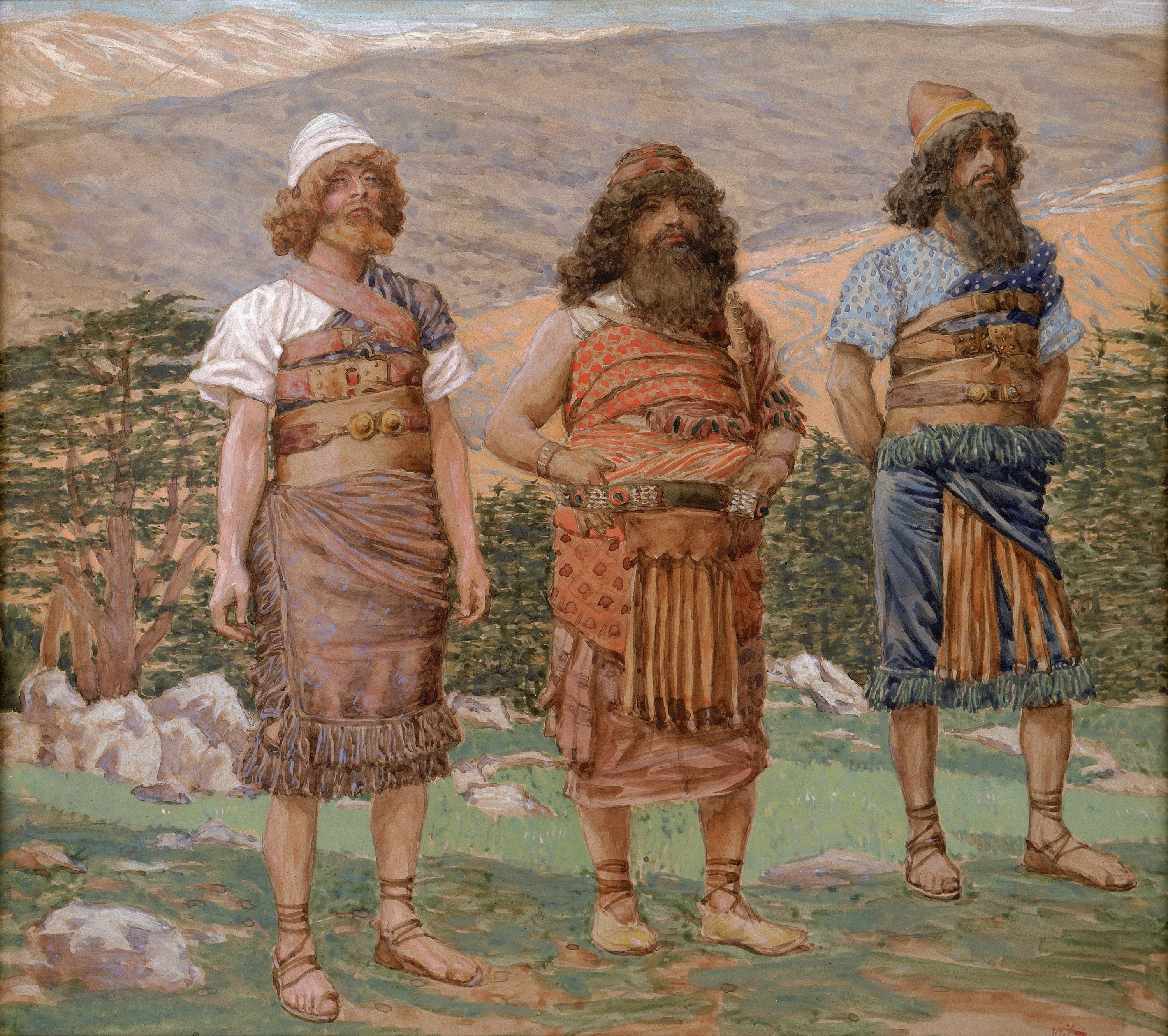
Shem (; he, שֵׁם ''Šēm''; ar, سَام, Sām) ''Sḗm''; Ge'ez: ሴም, ''Sēm'' was one of the sons of Noah in the book of Genesis and in the book of Chronicles, and the Quran. The children of Shem were Elam, Ashur, Arphaxad, Lud and Aram, in addition to unnamed daughters. Abraham, the patriarch of Jews, Christians, and Muslims, was one of the descendants of Arphaxad. Islamic literature describes Shem as one of the believing sons of Noah. Some sources even identify Shem as a prophet in his own right and that he was the next prophet after his father. Shem is mentioned several times in Genesis 5-11 as well as 1 Chronicles 1:4. In the Bible Genesis 10 Genesis 10:21 refers to relative ages of Shem and his brother Japheth, but with sufficient ambiguity to have yielded different English translations. The verse is translated in the King James Version as: "Unto Shem also, the father of all the children of Eber, the brother of Japheth the elder, even to him wer ... [...More Info...] [...Related Items...] OR: [Wikipedia] [Google] [Baidu] |
Japheth
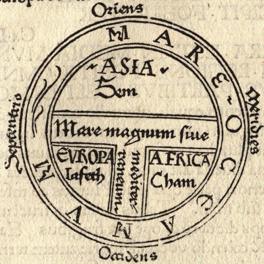
Japheth ( he, יֶפֶת ''Yép̄eṯ'', in pausa ''Yā́p̄eṯ''; el, Ἰάφεθ '; la, Iafeth, Iapheth, Iaphethus, Iapetus) is one of the three sons of Noah in the Book of Genesis, in which he plays a role in the story of Noah's drunkenness and the curse of Ham, and subsequently in the Table of Nations as the ancestor of the peoples of the Aegean Sea, Anatolia, and elsewhere. In medieval and early modern European tradition he was considered to be the progenitor of the European peoples, Javakhishvili, Ivane (1950), ''Historical-Ethnological problems of Georgia, the Caucasus and the Near East''. Tbilisi, pp. 130–135 (in Georgian). while Islamic traditions also include the Chinese people among his descendants. Etymology The meaning of the name ''Japheth'' is disputable. There are two possible sources to the meaning of the name: * From Aramaic root , meaning ''to extend''. In this case, the name would mean ''may He extend'' (Rashi). * From Hebrew root , meaning ''beauty ... [...More Info...] [...Related Items...] OR: [Wikipedia] [Google] [Baidu] |
Sons Of Noah
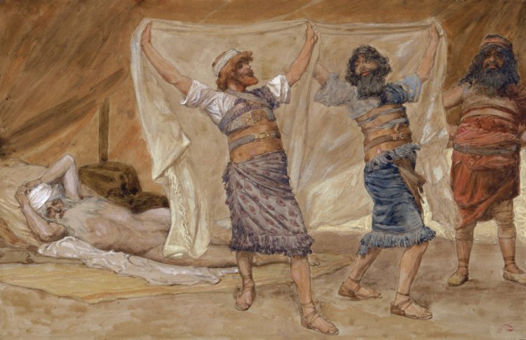
The Generations of Noah, also called the Table of Nations or Origines Gentium, is a genealogy of the sons of Noah, according to the Hebrew Bible (Genesis ), and their dispersion into many lands after the Flood, focusing on the major known societies. The term ''nations'' to describe the descendants is a standard English translation of the Hebrew word "goyim", following the 400 CE Latin Vulgate's "nationes", and does not have the same political connotations that the word entails today. The list of 70 names introduces for the first time several well-known ethnonyms and toponyms important to biblical geography, such as Noah's three sons Shem, Ham and Japheth, from which 18th century German scholars at the Göttingen School of History derived the race terminology Semites, Hamites and Japhetites. Certain of Noah's grandsons were also used for names of peoples: from Elam, Ashur, Aram, Cush, and Canaan were derived respectively the Elamites, Assyrians, Arameans, Cushites, and Cana ... [...More Info...] [...Related Items...] OR: [Wikipedia] [Google] [Baidu] |
Book Of Jubilees
The Book of Jubilees, sometimes called Lesser Genesis (Leptogenesis), is an ancient Jewish religious work of 50 chapters (1,341 verses), considered canonical by the Ethiopian Orthodox Church as well as Beta Israel (Ethiopian Jews), where it is known as the ''Book of Division'' (Ge'ez language, Ge'ez: መጽሐፈ ኩፋሌ ''Mets'hafe Kufale''). ''Jubilees'' is considered one of the pseudepigrapha by Roman Catholic, Eastern Orthodox, and Protestant Churches.Stephen L Harris, Harris, Stephen L., Understanding the Bible. Palo Alto: Mayfield. 1985. It is also not considered canonical within Judaism outside of Beta Israel. It was well known to Early Christians, as evidenced by the writings of Epiphanius of Salamis, Epiphanius, Justin Martyr, Origen, Diodorus of Tarsus, Isidore of Alexandria, Isidore of Seville, Eutychius of Alexandria, John Malalas, George Syncellus, and George Kedrenos. The text was also utilized by the community that originally collected the Dead Sea Scrolls. No c ... [...More Info...] [...Related Items...] OR: [Wikipedia] [Google] [Baidu] |
Antes (people)
The Antes, or Antae ( gr, Ἄνται), were an early East Slavic tribal polity of the 6th century CE. They lived on the lower Danube River, in the northwestern Black Sea region (present-day Moldova and central Ukraine), and in the regions around the Don River (in Middle and Southern Russia). Scholars commonly associate the Antes with the archaeological Penkovka culture. First mentioned in the historical record in 518, the Antes invaded the Diocese of Thrace sometime between the years of 533 and 545. Thereafter, they became Byzantine '' foederati'' and received gold payments and a fort (named "Turris" - the Latin word ''turris'' means 'tower') somewhere north of the Danube at a strategically important location to prevent hostile barbarians from invading Roman lands. Thus from 545 to the 580s, Antean soldiers fought in various Byzantine campaigns. The Pannonian Avars attacked the Antes at the beginning of the 7th century, when the Antes disappeared as a group and became ancest ... [...More Info...] [...Related Items...] OR: [Wikipedia] [Google] [Baidu] |
Proto-Indo-Europeans
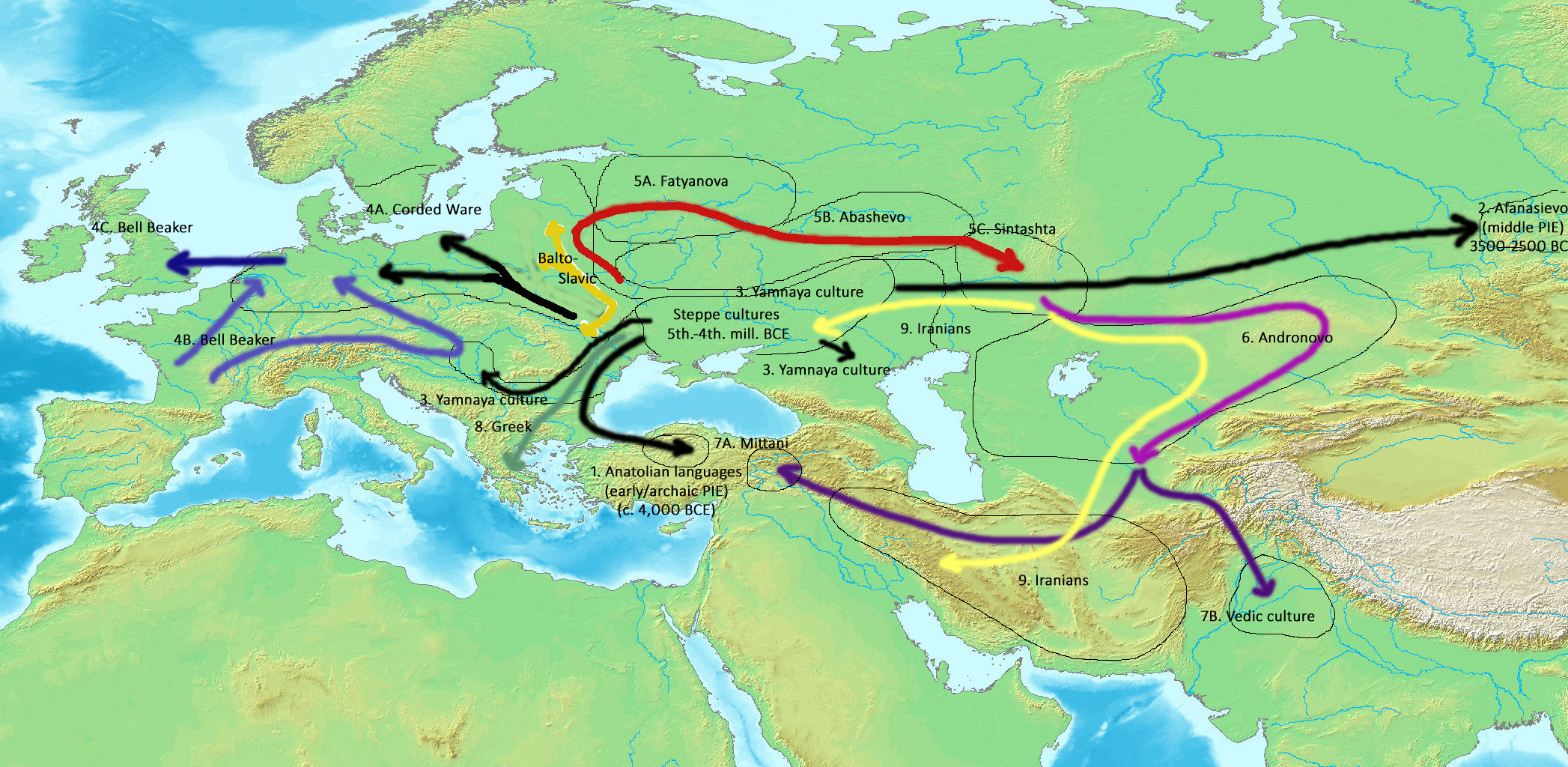
The Proto-Indo-Europeans are a hypothetical prehistoric population of Eurasia who spoke Proto-Indo-European (PIE), the ancestor of the Indo-European languages according to linguistic reconstruction. Knowledge of them comes chiefly from that linguistic reconstruction, along with material evidence from archaeology and archaeogenetics. The Proto-Indo-Europeans likely lived during the late Neolithic, or roughly the 4th millennium BC. Mainstream scholarship places them in the Pontic–Caspian steppe zone in Eurasia (present-day Ukraine and southern Russia). Some archaeologists would extend the time depth of PIE to the middle Neolithic (5500 to 4500 BC) or even the early Neolithic (7500 to 5500 BC) and suggest alternative location hypotheses. By the early second millennium BC, descendants of the Proto-Indo-Europeans had reached far and wide across Eurasia, including Anatolia (Hittites), the Aegean (the linguistic ancestors of Mycenaean Greece), the north of Europe (Corded War ... [...More Info...] [...Related Items...] OR: [Wikipedia] [Google] [Baidu] |
Kurgan Hypothesis
The Kurgan hypothesis (also known as the Kurgan theory, Kurgan model, or steppe theory) is the most widely accepted proposal to identify the Proto-Indo-European homeland from which the Indo-European languages spread out throughout Europe and parts of Asia. It postulates that the people of a Kurgan culture in the Pontic steppe north of the Black Sea were the most likely speakers of the Proto-Indo-European language (PIE). The term is derived from the Russian ''kurgan'' (), meaning tumulus or burial mound. The steppe theory was first formulated by Otto Schrader (1883) and V. Gordon Childe (1926), then systematized in the 1950s by Marija Gimbutas, who used the term to group various prehistoric cultures, including the Yamnaya (or Pit Grave) culture and its predecessors. In the 2000s, David Anthony instead used the core Yamnaya culture and its relationship with other cultures as a point of reference. Gimbutas defined the Kurgan culture as composed of four successive periods, with t ... [...More Info...] [...Related Items...] OR: [Wikipedia] [Google] [Baidu] |
Boxing The Compass
The points of the compass are a set of horizontal, radially arrayed compass directions (or azimuths) used in navigation and cartography. A compass rose is primarily composed of four cardinal directions—north, east, south, and west—each separated by 90 degrees, and secondarily divided by four ordinal (intercardinal) directions—northeast, southeast, southwest, and northwest—each located halfway between two cardinal directions. Some disciplines such as meteorology and navigation further divide the compass with additional azimuths. Within European tradition, a fully defined compass has 32 'points' (and any finer subdivisions are described in fractions of points). Compass points are valuable in that they allow a user to refer to a specific azimuth in a colloquial fashion, without having to compute or remember degrees. Designations The names of the compass point directions follow these rules: 8-wind compass rose * The four cardinal directions are north (N), east (E) ... [...More Info...] [...Related Items...] OR: [Wikipedia] [Google] [Baidu] |
Estuary
An estuary is a partially enclosed coastal body of brackish water with one or more rivers or streams flowing into it, and with a free connection to the open sea. Estuaries form a transition zone between river environments and maritime environments and are an example of an ecotone. Estuaries are subject both to marine influences such as tides, waves, and the influx of saline water, and to fluvial influences such as flows of freshwater and sediment. The mixing of seawater and freshwater provides high levels of nutrients both in the water column and in sediment, making estuaries among the most productive natural habitats in the world. Most existing estuaries formed during the Holocene epoch with the flooding of river-eroded or glacially scoured valleys when the sea level began to rise about 10,000–12,000 years ago. Estuaries are typically classified according to their geomorphological features or to water-circulation patterns. They can have many different names, such as bays, ... [...More Info...] [...Related Items...] OR: [Wikipedia] [Google] [Baidu] |

.jpg)


