|
Dominion Atlantic Railway
The Dominion Atlantic Railway was a historic railway which operated in the western part of Nova Scotia in Canada, primarily through an agricultural district known as the Annapolis Valley. The Dominion Atlantic Railway was unusually diverse for a regional railway, operating its own hotel chain, steamship line and named luxury trains such as the ''Flying Bluenose''. It is credited with playing a major role in developing Nova Scotia's tourism and agriculture industries. The DAR's corporate headquarters were originally located in London, United Kingdom, until 1912, followed by Montreal, Quebec, but was always operationally headquartered in Kentville, Nova Scotia, where the railway retained a unique identity and a high degree of independence until the end of the steam era. A depiction of Evangeline from the poem ''Evangeline, A Tale of Acadie'' published in 1847 by Henry Wadsworth Longfellow was incorporated into the DAR logo along with the text 'Land of Evangeline Route'. The comp ... [...More Info...] [...Related Items...] OR: [Wikipedia] [Google] [Baidu] |
Nova Scotia
Nova Scotia ( ; ; ) is one of the thirteen provinces and territories of Canada. It is one of the three Maritime provinces and one of the four Atlantic provinces. Nova Scotia is Latin for "New Scotland". Most of the population are native English-speakers, and the province's population is 969,383 according to the 2021 Census. It is the most populous of Canada's Atlantic provinces. It is the country's second-most densely populated province and second-smallest province by area, both after Prince Edward Island. Its area of includes Cape Breton Island and 3,800 other coastal islands. The Nova Scotia peninsula is connected to the rest of North America by the Isthmus of Chignecto, on which the province's land border with New Brunswick is located. The province borders the Bay of Fundy and Gulf of Maine to the west and the Atlantic Ocean to the south and east, and is separated from Prince Edward Island and the island of Newfoundland by the Northumberland and Cabot straits, ... [...More Info...] [...Related Items...] OR: [Wikipedia] [Google] [Baidu] |
Nova Scotia Railway
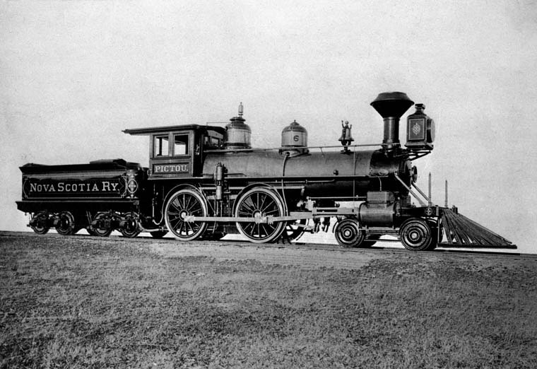
The Nova Scotia Railway is a historic Canadian railway. It was composed of two lines, one connecting Richmond (immediately north of Halifax) with Windsor, the other connecting Richmond with Pictou Landing via Truro. The railway was incorporated March 31, 1853 and received a charter to build railway lines from Halifax to Pictou by way of Truro, as well as from Halifax to Victoria Beach, Nova Scotia on the Annapolis Basin opposite Digby by way of Windsor. The company also received a charter to build from Truro to the border with New Brunswick. The railway was a key project of the visionary Nova Scotian leader Joseph Howe who felt a government built railway led by Nova Scotia was necessary after the failure of the Intercolonial Railway talks and several fruitless private proposals. The railway line to Windsor (known as the Windsor Branch) was opened in June 1858 and the line to Truro (known as the Eastern Line) was opened in December 1858. No further work was undertaken on the ... [...More Info...] [...Related Items...] OR: [Wikipedia] [Google] [Baidu] |
Truro, Nova Scotia
Truro (Mi'kmaq: ''Wagobagitik''; Scottish Gaelic: ''Truru'') is a town in central Nova Scotia, Canada. Truro is the shire town of Colchester County and is located on the south side of the Salmon River floodplain, close to the river's mouth at the eastern end of Cobequid Bay. History The area has been home to the Mi'kmaq people for several centuries. The Mi'kmaq name for the Truro area, "Wagobagitik" means "end of the water's flow". Mi'kmaq people continue to live in the area at the Millbrook and Truro reserves of the Millbrook – We’kopekwitk band. Acadian settlers came to this area in the early 1700s. The Mi'kmaq name for the Truro area was shortened by the settlers to "Cobequid", and the bay to the west of the town is still named Cobequid Bay. By 1727, the settlers had established a small village near the present downtown site of Truro known as "Vil Bois Brule" (Village in the burnt wood). Many Acadians in this region left in the Acadian Exodus which preceded the Expulsi ... [...More Info...] [...Related Items...] OR: [Wikipedia] [Google] [Baidu] |
Weston, Nova Scotia
Weston, Nova Scotia is a small community located in the central part of the Annapolis Valley. It is located about 3 miles (4.82 km) north-west of Berwick, Nova Scotia The community is roughly bordered on the north by Nova Scotia Route 221, Route 221 (North Mountain), on the south by the 101 Highway (Berwick & Cariboo Bog), on the east by the Chute Road (west of the 360 Harbourville Road, Somerset), and on the west by Parker Brook (east of Victoria Road, Aylesford). History Weston was named by its settlers on November 16, 1859 at a public meeting which was called for the purpose of naming the district. At the time it formed part of the Cornwallis Township which was established in 1761. Its name was likely chosen after a place in England however some have suggested that it is based on the fact the nearby settlers in Somerset would say "west on' when giving driving directions to the location. Settlers were given grants of land by the Crown and cleared the forested land with ... [...More Info...] [...Related Items...] OR: [Wikipedia] [Google] [Baidu] |
Centreville, Kings, Nova Scotia
Centreville is a rural farming community in Kings County, Nova Scotia, Canada, located 10 kilometres north of Kentville on Route 359. As of 2021, the population was 1,159. Route 309 and Route 221 cross at the settlement. The village was once a junction on the Cornwallis Valley Railway branchline of the Dominion Atlantic Railway. Demographics In the 2021 Census of Population conducted by Statistics Canada, Centreville had a population of 1,159 living in 500 of its 511 total private dwellings, a change of from its 2016 population of 1,129. With a land area of , it had a population density of in 2021. Notable residents Centreville was home to the 1930s artist, Charles Macdonald, famous for his work in concrete. His innovative concrete home in Centreville is now the Charles Macdonald Concrete House Museum. Another important Centreville resident was Roscoe Fillmore Roscoe Alfred Fillmore (10 July 188720 November 1968) was a Canadian radical political activist, horticultural ... [...More Info...] [...Related Items...] OR: [Wikipedia] [Google] [Baidu] |
Cornwallis Valley Railway
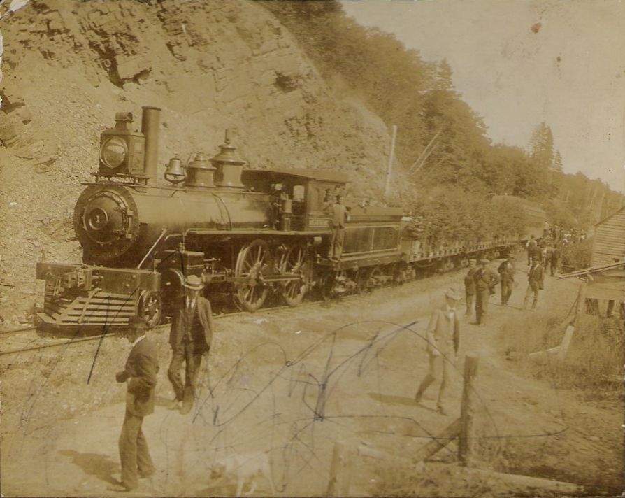
The Cornwallis Valley Railway (CVR) was a historic Canadian railway in Nova Scotia's Annapolis Valley. It was built in 1889 and ran from Kentville to Kingsport serving the Cornwallis Township area of Kings County. For most of its history, it operated as a branch line of the Dominion Atlantic Railway and was sometimes known as the "Kingsport Line". Route The CVR crossed its namesake, the Cornwallis River, at Kentville and ran north to stations at the Camp Aldershot military base, Mill Village (Steam Mill), and Centreville and then ran east to Ford's Crossing (Gibson Woods), Sheffield Mills, Hillaton, Canning, Pereau, and ended on the large government wharf at Kingsport. An additional branch, the North Mountain Line was added in 1914 running from Centreville to Weston. Creation The Cornwallis Valley Railway was formed in 1887 by merchants in Canning, Nova Scotia, and Kentville including the Member of Parliament Frederick William Borden. Canning merchant Stephen She ... [...More Info...] [...Related Items...] OR: [Wikipedia] [Google] [Baidu] |
Kingsport, Nova Scotia
Kingsport is a small seaside village located in Kings County, Nova Scotia, Canada, on the shores of the Minas Basin. It was famous at one time for building some of the largest wooden ships ever built in Canada.In the Wake of the Windships, Frederick William Wallace, (London, 1927), p. 223. Geography Kingsport is located just northeast of the mouth of the Habitant River, on the west side of Minas Basin, a few miles east of Canning at the eastern end of Route 221. It is bordered by a tidal marsh to the west and sandy beaches to the south and east. Red sedimentary cliffs carved by continuous erosion rise from the beaches to the east. The dramatic 12 metre tides produce very large sand and mud flats at low tide. The village is surrounded by large expanses of fertile farmland. An earlier name was Indian Point, later changed to Oak Point due to the number of oak trees that grew along the bank of the south side of the lower road, leading to the wharf. The name was finally changed to ... [...More Info...] [...Related Items...] OR: [Wikipedia] [Google] [Baidu] |
Halifax And Southwestern Railway
The Halifax and South Western Railway was a historic Canadian railway operating in the province of Nova Scotia. The legal name of this railway was the Halifax & South Western Railway, as is defined in various Acts of the Nova Scotia Legislature, such as 1902 c.1, Act respecting the Halifax & South Western Railway Co.. However, Halifax & Southwestern Railway is also sometimes also used. The H&SW was created in spring 1901 when William Mackenzie and Donald Mann approached the provincial government with plans to finish the abortive plans for a railway from Halifax to Yarmouth along the province's South Shore. For many years, the line had significant curvature throughout its length, a result of the rugged local topography, which earned it the moniker, "Hellish Slow & Wobbly". Predecessors The H&SW was not the first railway to build on the South Shore of Nova Scotia, as various charters for railway companies had preceded it. The Nova Scotia Central Railway (NSCR) had opened its ... [...More Info...] [...Related Items...] OR: [Wikipedia] [Google] [Baidu] |
Middleton, Nova Scotia
Middleton is a town in Annapolis County, Nova Scotia, Canada. Situated on the north bank of the Annapolis River, it is located close to the centre of the Annapolis Valley, from which it gets its nickname, "The Heart of the Valley". History Where the Annapolis River and the Nictaux river meet was a popular shad fishing spot for Mi'kmaq families before the arrival of the European settlers. It would be later settled by French Acadians that used these waterways to reach the capital of Port-Royal and farming. In the late 1750s the region was settled by New England Planters, and Loyalists to replace the ousted French Acadians. The first four families to be granted land there would later comprise the town of Middleton. They included families with names like Gates and Marshall and Richardson. Col. Philip Richardson received six lots of two hundred and fifty acres each, which ran from the Annapolis River half way to the Mountain to the north, while his neighbour to the west, Anthony Marsh ... [...More Info...] [...Related Items...] OR: [Wikipedia] [Google] [Baidu] |
Middleton And Victoria Beach Railway
The Middleton and Victoria Beach Railway was a historic Canadian railway which ran from Middleton to Port Wade in Annapolis County, Nova Scotia, Canada. It was purchased and completed by the Halifax and Southwestern Railway in 1906. A portion of the line remained in operation until 1983. Route The line's eastern terminus was in Middleton, where it connected with the Dominion Atlantic Railway running between Halifax and Yarmouth, and also with the Nova Scotia Central Railway running from Middleton south to Bridgewater and Lunenburg. Running westward from Middleton, the Middleton and Victoria Beach line never actually ran as far as Victoria Beach, but made its western terminus in Port Wade where a quarter-mile wharf was built for loading and unloading of freight. This continued to be used even after the railway stopped running. The line of the railway ran along the north side of the Annapolis River closer to the North Mountain and the farms there than was the Dominion Atla ... [...More Info...] [...Related Items...] OR: [Wikipedia] [Google] [Baidu] |
Nova Scotia Central Railway
The Halifax and South Western Railway was a historic Canadian railway operating in the province of Nova Scotia. The legal name of this railway was the Halifax & South Western Railway, as is defined in various Acts of the Nova Scotia Legislature, such as 1902 c.1, Act respecting the Halifax & South Western Railway Co.. However, Halifax & Southwestern Railway is also sometimes also used. The H&SW was created in spring 1901 when William Mackenzie and Donald Mann approached the provincial government with plans to finish the abortive plans for a railway from Halifax to Yarmouth along the province's South Shore. For many years, the line had significant curvature throughout its length, a result of the rugged local topography, which earned it the moniker, "Hellish Slow & Wobbly". Predecessors The H&SW was not the first railway to build on the South Shore of Nova Scotia, as various charters for railway companies had preceded it. The Nova Scotia Central Railway (NSCR) had opened its ... [...More Info...] [...Related Items...] OR: [Wikipedia] [Google] [Baidu] |
Midland Railway (Canada)
Midland Railway was a Nova Scotian railway company formed in 1896 to build a railway through Hants County, Nova Scotia, connecting Truro to Windsor. Completed in 1901, it operated independently until 1905 when it became part of the Dominion Atlantic Railway and later the Canadian Pacific Railway, until the line closed in 1983. Route The railway's route ran 57. 84 miles following a series of gently curving river valleys, beginning with the St. Croix River near Windsor then following the Kennetcook River and Five Mile River to the Shubenacadie River and across to Black Rock, Clifton and following the lower reaches of the Salmon River to Truro. Beginning in Truro, the railway went through the communities of Clifton, Princeport, South Maitland, Kennetcook, Clarksville, Stanley, Mosherville, and Scotch Village, Brooklyn, Mantua and ended in Windsor. A number of private gypsum spurs connected to the Midland near Windsor and Mantua. History Chartered by the province of Nova Scoti ... [...More Info...] [...Related Items...] OR: [Wikipedia] [Google] [Baidu] |


