|
Djidjelli Expedition
The Djidjelli expedition was a 1664 military expedition by Louis XIV to seize the port of Djidjelli and establish a naval base against the Berber corsairs. There was a disagreement among the leaders of the expedition as to what its objectives should be. Ultimately the town of Djidjelli was taken easily, but after three months, heavily besieged and deprived of reinforcements by an outbreak of plague, the French abandoned the city and returned home. Background The young king Louis XIV wanted to safeguard trade by the French merchant navy, which was continually being attacked by Barbary Coast pirates coming from the regencies of Algiers, Tunis and Tripoli, under Ottoman administration and protection. The expedition chose to attack a city halfway between Algiers and Tunis. The plan was to seize and fortify it, using it as an advance post for attacks against the corsairs, as the English were then doing from Tangier. They considered Bougie, Bône and Stora, near a French commerci ... [...More Info...] [...Related Items...] OR: [Wikipedia] [Google] [Baidu] |
Djidjelli
Jijel ( ar, جيجل), the classical Igilgili, is the capital of Jijel Province in north-eastern Algeria. It is flanked by the Mediterranean Sea in the region of Corniche Jijelienne and had a population of 131,513 in 2008. Jijel is the administrative and trade center for a region specialising in cork processing, leather tanning and steelmaking. Local crops include citrus and grain. Fishing is also of great importance. Tourists (mainly Algerians) are attracted to Jijel for its landscapes and fine sand beaches. Being a resort town, there are many hotels and restaurants. There are Phoenician tombs nearby. Geography and ecology Jijel is situated 30 km from Taza National Park; this national park and other vicinity features support a variety of flora and fauna. It is an important habitat for the endangered Barbary macaque, ''Macaca sylvanus''.C. Michael Hogan. 2008 History Igilgili originally Phoenician, the city passed to the Carthaginians, the Roman Republic and Empire, ... [...More Info...] [...Related Items...] OR: [Wikipedia] [Google] [Baidu] |
Plague (disease)
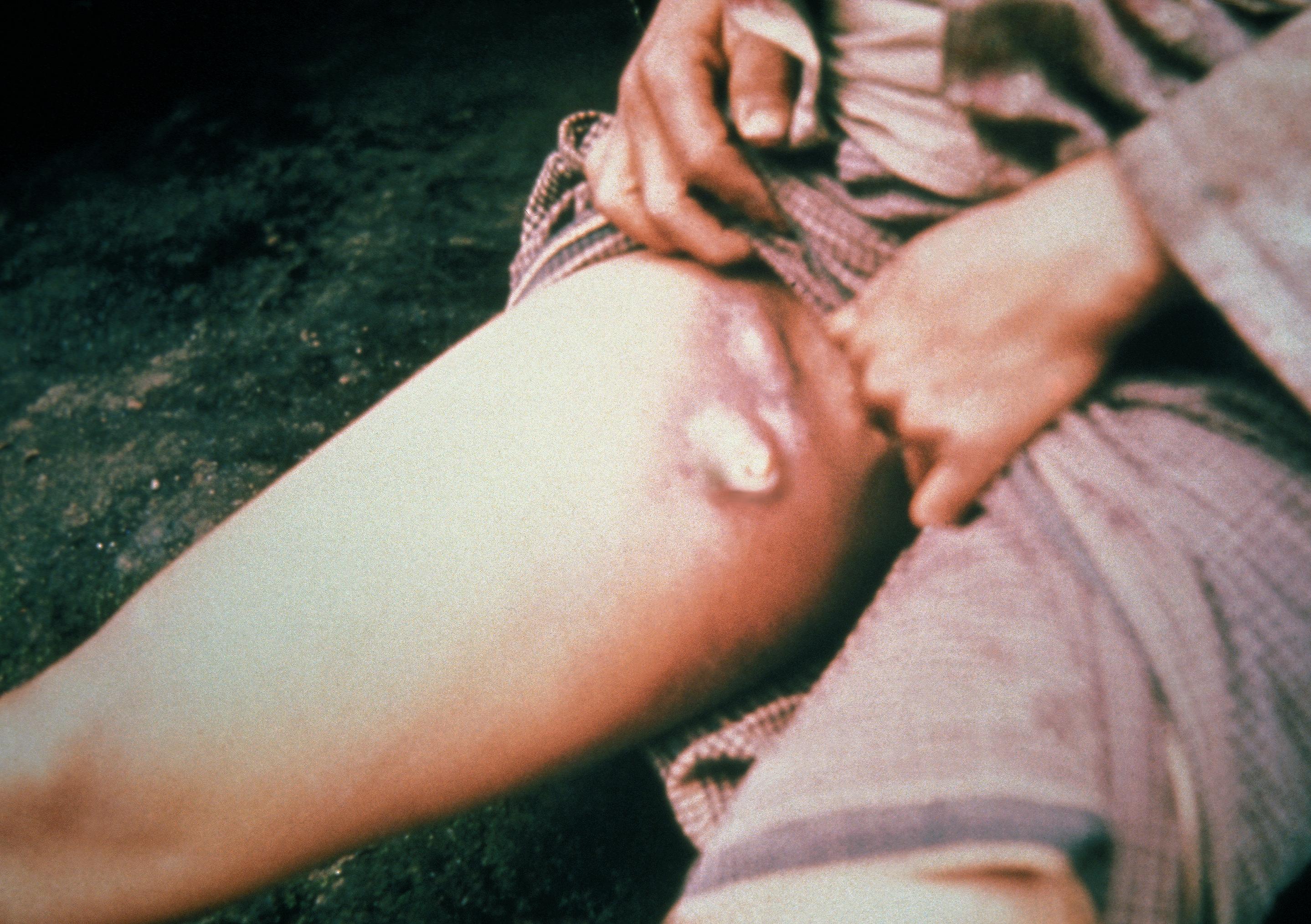
Plague is an infectious disease caused by the bacterium ''Yersinia pestis''. Symptoms include fever, weakness and headache. Usually this begins one to seven days after exposure. There are three forms of plague, each affecting a different part of the body and causing associated symptoms. Pneumonic plague infects the lungs, causing shortness of breath, coughing and chest pain; bubonic plague affects the lymph nodes, making them swell; and septicemic plague infects the blood and can cause tissues to turn black and die. The bubonic and septicemic forms are generally spread by flea bites or handling an infected animal, whereas pneumonic plague is generally spread between people through the air via infectious droplets. Diagnosis is typically by finding the bacterium in fluid from a lymph node, blood or sputum. Those at high risk may be vaccinated. Those exposed to a case of pneumonic plague may be treated with preventive medication. If infected, treatment is with antibiotic ... [...More Info...] [...Related Items...] OR: [Wikipedia] [Google] [Baidu] |
Jijel
Jijel ( ar, جيجل), the classical Igilgili, is the capital of Jijel Province in north-eastern Algeria. It is flanked by the Mediterranean Sea in the region of Corniche Jijelienne and had a population of 131,513 in 2008. Jijel is the administrative and trade center for a region specialising in cork processing, leather tanning and steelmaking. Local crops include citrus and grain. Fishing is also of great importance. Tourists (mainly Algerians) are attracted to Jijel for its landscapes and fine sand beaches. Being a resort town, there are many hotels and restaurants. There are Phoenician tombs nearby. Geography and ecology Jijel is situated 30 km from Taza National Park; this national park and other vicinity features support a variety of flora and fauna. It is an important habitat for the endangered Barbary macaque, ''Macaca sylvanus''.C. Michael Hogan. 2008 History Igilgili originally Phoenician, the city passed to the Carthaginians, the Roman Republic and Empire, ... [...More Info...] [...Related Items...] OR: [Wikipedia] [Google] [Baidu] |
Bastion De France
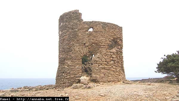
The Bastion de France was a trading post founded in the sixteenth century by French merchants of Corsican origin who had established themselves in North Africa near Annaba. It developed important commercial links with Marseille, especially in the valuable coral trade. It was demolished and rebuilt a number of times. Tomasino Lenche The Bastion de France was built in 1561 by Tomasino Lenche to secure his family's lucrative position in the coral fisheries off the North African coast. The Lenche family (also known as Linche, Lencio or Lenciu) were originally from Morsiglia ( Cap Corse) and Tomasino Lenche had established himself in business in Marseille as early as 1533. In 1550, Sultan Selim II granted him the right to fish for coral at Massacarès, (Mers el-Kharez) near Annaba. The following year Henri II of France granted him a monopoly on this fishery, which was renewed in 1560 by Charles IX. In 1552 Tomasino established the ''Magnifique Compagnie du corail'' (''Magnificent C ... [...More Info...] [...Related Items...] OR: [Wikipedia] [Google] [Baidu] |
Skikda
Skikda ( ar, سكيكدة; formerly Philippeville from 1838 to 1962 and Rusicade in ancient times) is a city in northeastern Algeria and a port on the Mediterranean. It is the capital of Skikda Province and Skikda District. History The Phoenicians and Carthaginians established a trading post and fort named (, " Jug Cape") after Skikda's nearby cape. Falling under Roman hegemony after the Punic Wars, the name was Latinized as Rusicade or Rusiccade. Rusicade contained the largest Roman theatre in Algeria, dating to the reign of Hadrian. In late antiquity, the port was destroyed during the Vandals' invasion of 530. The Byzantines reconquered the region in 533 and 534, but left large areas under Berber control. The town was overrun by the Umayyad Caliphate at the end of the 7th century. Present-day Skikda was founded by Sylvain Charles Valée in 1838 under the name Philippeville, honoring the French king at the time. The French were in the process of annexing Algeria and d ... [...More Info...] [...Related Items...] OR: [Wikipedia] [Google] [Baidu] |
Annaba
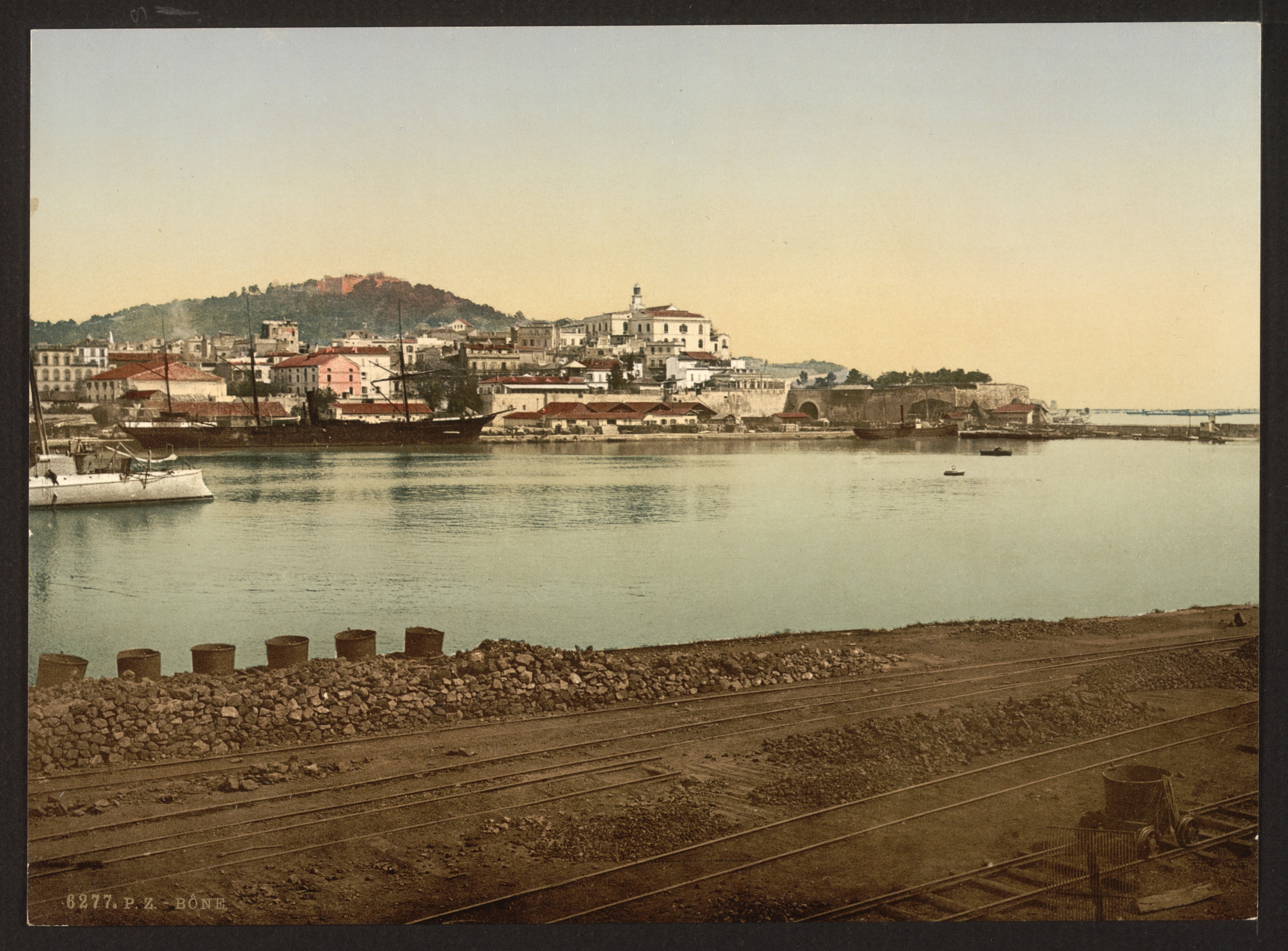
Annaba ( ar, عنّابة, "Place of the Jujubes"; ber, Aânavaen), formerly known as Bon, Bona and Bône, is a seaport city in the northeastern corner of Algeria, close to the border with Tunisia. Annaba is near the small Seybouse River and is in the Annaba Province. With a population of about 464,740 (2019) and 1,000,000 for the metropole, Annaba is the third-largest city and the leading industrial center in Algeria. Annaba is a coastal city that underwent significant growth during the 20th century. Annaba has a metropolitan area with a higher population density than the other metropolitan areas of the Algerian coastline, such as Oran and Algiers. Much of eastern and southern Algeria uses the services, equipment and infrastructure of Annaba. Economically, it is the centre for various economic activities, such as industry, transportation, finance, and tourism. Names Present-day Annaba grew up on the site of Aphrodisium, the seaport of the Roman city . (The modern ci ... [...More Info...] [...Related Items...] OR: [Wikipedia] [Google] [Baidu] |
Béjaïa
Béjaïa (; ; ar, بجاية, Latn, ar, Bijāya, ; kab, Bgayet, Vgayet), formerly Bougie and Bugia, is a Mediterranean port city and commune on the Gulf of Béjaïa in Algeria; it is the capital of Béjaïa Province, Kabylia. Béjaïa is the largest principally Kabyle-speaking city in the region of Kabylia, Algeria. Geography The town is overlooked by the mountain ', whose profile is said to resemble a sleeping woman. Other nearby scenic spots include the ''Aiguades'' beach and the '' Pic des Singes'' (Peak of the Monkeys); the latter site is a habitat for the endangered Barbary macaque, which prehistorically had a much broader distribution than at present. All three of these geographic features are located in the Gouraya National Park. The Soummam river runs past the town. Under French rule, it was known under various European names, such as Budschaja in German, Bugia in Italian, and Bougie in French. The French and Italian versions, due to the town's wax trade, ... [...More Info...] [...Related Items...] OR: [Wikipedia] [Google] [Baidu] |
Tangier
Tangier ( ; ; ar, طنجة, Ṭanja) is a city in northwestern Morocco. It is on the Moroccan coast at the western entrance to the Strait of Gibraltar, where the Mediterranean Sea meets the Atlantic Ocean off Cape Spartel. The town is the capital of the Tanger-Tetouan-Al Hoceima region, as well as the Ṭanja-Aẓila Prefecture of Morocco. Many civilisations and cultures have influenced the history of Tangier, starting from before the 10th centuryBCE. Between the period of being a strategic Berber town and then a Phoenician trading centre to Morocco's independence era around the 1950s, Tangier was a nexus for many cultures. In 1923, it was considered as having international status by foreign colonial powers and became a destination for many European and American diplomats, spies, bohemians, writers and businessmen. The city is undergoing rapid development and modernisation. Projects include tourism projects along the bay, a modern business district called Tangier City Cen ... [...More Info...] [...Related Items...] OR: [Wikipedia] [Google] [Baidu] |
Ottoman Empire
The Ottoman Empire, * ; is an archaic version. The definite article forms and were synonymous * and el, Оθωμανική Αυτοκρατορία, Othōmanikē Avtokratoria, label=none * info page on book at Martin Luther University) // CITED: p. 36 (PDF p. 38/338) also known as the Turkish Empire, was an empire that controlled much of Southeast Europe, Western Asia, and Northern Africa between the 14th and early 20th centuries. It was founded at the end of the 13th century in northwestern Anatolia in the town of Söğüt (modern-day Bilecik Province) by the Turkoman tribal leader Osman I. After 1354, the Ottomans crossed into Europe and, with the conquest of the Balkans, the Ottoman beylik was transformed into a transcontinental empire. The Ottomans ended the Byzantine Empire with the conquest of Constantinople in 1453 by Mehmed the Conqueror. Under the reign of Suleiman the Magnificent, the Ottoman Empire marked the peak of its power and prosperity, as well a ... [...More Info...] [...Related Items...] OR: [Wikipedia] [Google] [Baidu] |
Tripoli, Libya
Tripoli (; ar, طرابلس الغرب, translit= Ṭarābulus al-Gharb , translation=Western Tripoli) is the capital city, capital and largest city of Libya, with a population of about 1.1 million people in 2019. It is located in the northwest of Libya on the edge of the desert, on a point of rocky land projecting into the Mediterranean Sea and forming a bay. It includes the port of Tripoli and the country's largest commercial and manufacturing center. It is also the site of the University of Tripoli. The vast barracks, which includes the former family estate of Muammar Gaddafi, is also located in the city. Colonel Gaddafi largely ruled the country from his residence in this barracks. Tripoli was founded in the 7th century BC by the Phoenicians, who gave it the Libyco-Berber name ( xpu, 𐤅𐤉𐤏𐤕, ) before passing into the hands of the Greek rulers of Cyrenaica as Oea ( grc-gre, Ὀία, ). Due to the city's long history, there are many sites of archeolog ... [...More Info...] [...Related Items...] OR: [Wikipedia] [Google] [Baidu] |
Tunis
''Tounsi'' french: Tunisois , population_note = , population_urban = , population_metro = 2658816 , population_density_km2 = , timezone1 = CET , utc_offset1 = +01:00 , timezone1_DST = , utc_offset1_DST = , postal_code_type = Postal code , postal_code = 1xxx, 2xxx , area_code_type = Calling code , area_code = 71 , iso_code = TN-11, TN-12, TN-13 and TN-14 , blank_name_sec2 = geoTLD , blank_info_sec2 = .tn , website = , footnotes = Tunis ( ar, تونس ') is the capital and largest city of Tunisia. The greater metropolitan area of Tunis, often referred to as "Grand Tunis", has about 2,700,000 inhabitants. , it is the third-largest city in the Maghreb ... [...More Info...] [...Related Items...] OR: [Wikipedia] [Google] [Baidu] |
Algiers
Algiers ( ; ar, الجزائر, al-Jazāʾir; ber, Dzayer, script=Latn; french: Alger, ) is the capital and largest city of Algeria. The city's population at the 2008 Census was 2,988,145Census 14 April 2008: Office National des Statistiques de l'Algérie (web). and in 2020 was estimated to be around 4,500,000. Algiers is located on the Mediterranean Sea and in the north-central portion of Algeria. Algiers is situated on the west side of a bay of the Mediterranean Sea. The modern part of the city is built on the level ground by the seashore; the old part, the ancient city of the deys, climbs the steep hill behind the modern town and is crowned by the Casbah or citadel (a UNESCO World Heritage Site), above the sea. The casbah and the two quays form a triangle. Names The city's name is derived via French and Catalan ''Origins of Algiers'' by Louis Leschi, speech delivered June 16, 1941, published in ''El Djezair Sheets'', July 194History of Algeria . from the Arabic name ... [...More Info...] [...Related Items...] OR: [Wikipedia] [Google] [Baidu] |


