|
Dietikon Railway Station
Dietikon railway station is a railway station in Switzerland, situated in the canton of Zürich and the city of Dietikon. The station is located on the Swiss Federal Railway's Zürich to Olten main line and is also the terminus of the metre gauge Bremgarten–Dietikon railway (BD). The station is served by Zürich S-Bahn lines S11, S12, S19, and S42; by some long distance trains on the main line; and by S-Bahn line S17 on the BD. History The first station on the site was built by the Swiss Northern Railway in 1847, as part of their pioneering line from Zürich to Baden, and hence was one of the first railway stations in Switzerland. The original station building was constructed on the northern side of the railway line and still exists, albeit now used as a rail enthusiasts' club. The original station was replaced in the 1860s by a new building on the southern, city centre, side of the line. This in turn was replaced in the 1970s by the current large station building ... [...More Info...] [...Related Items...] OR: [Wikipedia] [Google] [Baidu] |
Dietikon
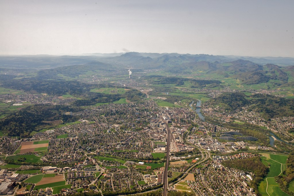
Dietikon is the fifth biggest city of the canton of Zürich in Switzerland, after Zürich, Winterthur, Uster and Dübendorf. It is the capital of the same-named district of Dietikon and part of the Zürich metropolitan area. Geography The industrial city Dietikon is situated at an elevation of at the confluence of the Reppisch and the Limmat, located in the Limmat Valley (German: ''Limmattal''), along the railway line from Zürich to Baden. Here and in the neighboring region, Spreitenbach, is also the large Limmattal rail freight marshalling yard. Dietikon has an area of . Of this area, 17.2% is used for agricultural purposes, while 27% is forested. Of the rest of the land, 49.1% is settled (buildings or roads) and the remainder (6.7%) is non-productive (rivers, glaciers or mountains). housing and buildings made up 33.8% of the total area, while transportation infrastructure made up the rest (15.3%). Of the total unproductive area, water (streams and lakes) made up 4.9% ... [...More Info...] [...Related Items...] OR: [Wikipedia] [Google] [Baidu] |
S17 (ZVV)
S17 may refer to: Aviation * Rans S-17 Stinger, an American ultralight aircraft * Saab 17, a Swedish reconnaissance aircraft * Short S.17 Kent, a British flying boat airliner * SIAI S.17, an Italian racing flying boat * Sikorsky S-17, a Russian biplane * Twin Lakes Airport (South Carolina), in Aiken County, South Carolina, United States Rail and transit * Funabori Station, in Edogawa, Tokyo, Japan * Gorō Station, in Ōzu, Ehime Prefecture, Japan * Nippombashi Station, in Chūō-ku, Osaka, Japan * Nonami Station, in Tempaku-ku, Nagoya, Aichi Prefecture, Japan * Ranshima Station, in Otaru, Hokkaido, Japan * Wohlen–Dietikon railway line, of the Zürich S-Bahn Roads * S17 Baicheng Ring Expressway, China * Expressway S17 (Poland) * County Route S17 (California), United States Vessels * * , a submarine of the Royal Navy * , a torpedo boat of the Imperial German Navy * , a submarine of the United States Navy Other uses * 40S ribosomal protein S17 * British NVC co ... [...More Info...] [...Related Items...] OR: [Wikipedia] [Google] [Baidu] |
Koblenz (Switzerland)
Koblenz (or Coblenz) is a town and municipality in the district of Zurzach in the canton of Aargau in Switzerland. History Middle Ages Koblenz is first mentioned in 10th or 11th Century as ''Confluentia'', for the confluence of the Aare and Rhine rivers. In 1265 it was mentioned as ''Cobilz''. In the Roman era a goods yard and watchtowers existed along the Rhine at this place. The remaining late Roman watchtower is listed as a heritage site of national significance. The town has been settled since the Middle Ages. The Koblenz boatmen had a monopoly over transport of goods from the then important market town of Zurzach downstream along dangerous currents of the Rhine towards Basel. 19th Century With the arrival of the railway in the 19th century Koblenz and Zurzach lost this important source of income. Geography Koblenz has an area, , of . Of this area, or 41.4% is used for agricultural purposes, while or 29.2% is forested. Of the rest of the land, or 19.6% ... [...More Info...] [...Related Items...] OR: [Wikipedia] [Google] [Baidu] |
Effretikon
Illnau-Effretikon is a municipality in the district of Pfäffikon in the canton of Zürich in Switzerland. It includes the villages of Illnau, Effretikon, Ottikon and Bisikon. On 1 January 2016 Kyburg and Illnau-Effretikon merged to form the municipality of Illnau-Effretikon. History Illnau-Effretikon is first mentioned in 745 as ''Illenavvia'' and ''Erpfratinchova''. At first the name of the municipality was Illnau as that town used to be the political and economic center of the municipality. However, when the railway connection was built from Zurich to Winterthur in 1855, only the much smaller Effretikon was in a position to receive a railway station. Subsequently, the economic boom caused by the railway made Effretikon grow disproportionately until it had outgrown Illnau by the beginning of the 20th century. The name of the municipality was finally changed to Illnau-Effretikon in 1973. On 1 January 2016 the former municipality of Kyburg and Illnau-Effretikon merged to form ... [...More Info...] [...Related Items...] OR: [Wikipedia] [Google] [Baidu] |
Bremgarten, Aargau
Bremgarten is a municipality in the Swiss canton of Aargau. It serves as seat of the district of Bremgarten. The medieval old town is listed as a heritage site of national significance. In 2013, Bremgarten was the first municipality in Europe to introduce laws forbidding asylum seekers from visiting certain public places such as libraries, swimming pools, schools and churches. On 1 January 2014 the former municipality of Hermetschwil-Staffeln merged into the municipality of Bremgarten.Nomenklaturen – Amtliches Gemeindeverzeichnis der Schweiz accessed 13 December 2014 History The area was known before 1140 as ''Bremgarten'', though the city wasn't founded until almost a century later. In 1230, a settlement was fo ...[...More Info...] [...Related Items...] OR: [Wikipedia] [Google] [Baidu] |
Wohlen
Wohlen is a municipality in the district of Bremgarten in the canton of Aargau in Switzerland. History The earliest known settlements in Wohlen date from the late Hallstatt era (600-500 BC). This settlement left two clusters of burial mounds in ''Hohbühl'' and ''Häslerhau''. While the graves were discovered and excavated in 1925–1930, the location of the settlement is still unknown. During the Roman era two large estates were built at Oberdorf and the Brünishalde. Both estates date from about 50 AD and supported a number of fields. The harvested grain was probably for the maintenance of the Roman troops at the military camp Vindonissa. Of the estates all that remains is masonry, tile, mosaic pieces and coins, as well as some foundations at ''Häslerhau''. During the migration of the Alemanni in the 5th Century into the area, they built their own settlements to the right of the ''Bünz'' in Chappele, Steingasse, Kirche and along the upper main street as well as alo ... [...More Info...] [...Related Items...] OR: [Wikipedia] [Google] [Baidu] |
Brugg
, neighboring_municipalities = Gebenstorf, Habsburg, Hausen, Holderbank, Lupfig, Riniken, Rüfenach, Schinznach, Untersiggenthal, Villigen, Villnachern, Veltheim, Windisch , twintowns = Rottweil (Germany) , website = www.stadt-brugg.ch Brugg (sometimes written as Brugg AG in order to distinguish it from other ''Brugg''s) is a Swiss municipality and a town in the canton of Aargau and is the seat of the district of the same name. The town is located at the confluence of the Aare, Reuss, and Limmat, with the Aare flowing through its medieval part. It is located approximately from the cantonal capital of Aarau; from Zürich; and about from Basel. Brugg is the Swiss German term for bridge (german: Brücke). This is an allusion to the purpose of the medieval town's establishment under the Habsburgs, as the town is located at the narrowest point on the Aare in the Swiss midlands. The Habsburgs’ oldest known residence is located in the ne ... [...More Info...] [...Related Items...] OR: [Wikipedia] [Google] [Baidu] |
Winterthur
, neighboring_municipalities = Brütten, Dinhard, Elsau, Hettlingen, Illnau-Effretikon, Kyburg, Lindau, Neftenbach, Oberembrach, Pfungen, Rickenbach, Schlatt, Seuzach, Wiesendangen, Zell , twintowns = Hall in Tirol (Austria), La Chaux-de-Fonds (Switzerland), Pilsen (Czech Republic), Yverdon-les-Bains (Switzerland) , website = stadt.winterthur.ch Winterthur (; french: Winterthour, lang) is a city in the canton of Zürich in northern Switzerland. With over 110,000 residents it is the country's sixth-largest city by population, and is the ninth-largest agglomeration with about 140,000 inhabitants. Located about northeast of Zürich, Winterthur is a service and high-tech industrial satellite city within Greater Zürich. The official language of Winterthur is German,The official language in any municipality in German-speaking Switzerland is always German. In this context, the term 'German' is used as an umbrella term for any variety of German. So, a ... [...More Info...] [...Related Items...] OR: [Wikipedia] [Google] [Baidu] |
Aarau
Aarau (, ) is a List of towns in Switzerland, town, a Municipalities of Switzerland, municipality, and the capital of the northern Swiss Cantons of Switzerland, canton of Aargau. The List of towns in Switzerland, town is also the capital of the district of Aarau (district), Aarau. It is German-speaking and predominantly Protestant. Aarau is situated on the Swiss plateau, in the valley of the Aare, on the river's right bank, and at the southern foot of the Jura Mountains, and is west of Zürich, south of Basel and northeast of Bern. The municipality borders directly on the canton of Solothurn to the west. It is the largest town in Aargau. At the beginning of 2010 Rohr, Aargau, Rohr became a district of Aarau. The official language of Aarau is (the Swiss variety of Standard) Swiss Standard German, German, but the main spoken language is the local variant of the Alemannic German, Alemannic Swiss German (linguistics), Swiss German dialect. Geography and geology The old city of Aarau ... [...More Info...] [...Related Items...] OR: [Wikipedia] [Google] [Baidu] |
Lenzburg
Lenzburg is a town in the central region of the Swiss canton Aargau and is the capital of the Lenzburg District. The town, founded in the Middle Ages, lies in the Seetal valley, about 3 kilometres south of the Aare river. Lenzburg and the neighbouring municipalities of Niederlenz and Staufen have grown together in an agglomeration. History A Neolithic grave field of the Cortaillod culture has been discovered on the ''Goffersberg'' (close to the Lenzburg Castle) dating from 4300 - 3500 BCE. A Roman theater was uncovered when a motorway was built in 1964. It was part of a small settlement with 500 inhabitants that existed for approximately 200 years. The settlement was abandoned in the 3rd century. In the 5th and 6th centuries, an Alamanni settlement existed. Lenzburg is first mentioned in 924 as ''de Lencis''. In 1036, Lenzburg Castle was used for the first time as seat for the Count of Lenzburg, then an important lord. The house however died out in 1173, and the castle was t ... [...More Info...] [...Related Items...] OR: [Wikipedia] [Google] [Baidu] |
Wetzikon
Wetzikon is a small town in the Zurich Highlands (Zürcher Oberland) area of Switzerland, in the district of Hinwil in the canton of Zürich. Geography The municipality Wetzikon has an area of . Of this area, 42.4% is used for agricultural purposes, while 17.6% is forested. Of the rest of the land, 27.9% is settled (buildings or roads) and the remainder (12.1%) is non-productive (streams, lakes and non-productive vegetation). housing and buildings made up 20% of the total area, while transportation infrastructure made up the rest (7.9%). Of the total unproductive area, water (streams and lakes) made up 3.3% of the area. 30.5% of the total municipal area was undergoing some type of construction. It is located near Lake Pfäffikon in the Zürcher Oberland, between Uster and Rapperswil-Jona. The ''Robenhauser Ried'' wetland is a nature reserve of national importance and is situated between Seegräben, Kempten and Irgenhausen covering an area of about . Demographics Wetzi ... [...More Info...] [...Related Items...] OR: [Wikipedia] [Google] [Baidu] |


