|
Dhaulpur
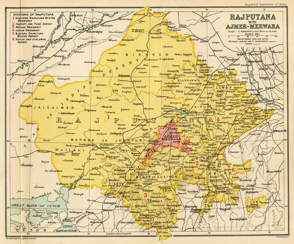
Dholpur is a city in the Dholpur district in Rajasthan state of India. It is situated on the left bank of the famous Chambal river. The city is the administrative headquarters of Dholpur District and was formerly seat of the Dholpur (princely state), Dholpur princely state. Dhaulpur became a separate district in 1982 comprising Dholpur, Rajakhera, Saramathura, Bari and Baseri Tehsils. Dholpur district is a part of Bharatpur division, Bharatpur Division/Commissionerate. It is bordered by Bharatpur district of Rajasthan and Uttar Pradesh to the north, Madhya Pradesh to the south, Karauli district to the west and Uttar Pradesh and Madhya Pradesh to the east. Dhaulpur is famous for his Red Stone and ancient time temple. Here is Machkund temple and kund which is famous as "Tirthon ka Bhanja". Two famous shiv temple situated here 1.)Mahakaal Shiv Temple. 2.)Bhooteshwar Mahadev Temple. Bhooteshwar Mahadev Temple situated at Baseri Block of Dhaulpur. It is situated at bank of parvati ... [...More Info...] [...Related Items...] OR: [Wikipedia] [Google] [Baidu] |
Dholpur Bus Stand
Dholpur is a city in the Dholpur district in Rajasthan state of India. It is situated on the left bank of the famous Chambal river. The city is the administrative headquarters of Dholpur District and was formerly seat of the Dholpur princely state. Dhaulpur became a separate district in 1982 comprising Dholpur, Rajakhera, Saramathura, Bari and Baseri Tehsils. Dholpur district is a part of Bharatpur Division/Commissionerate. It is bordered by Bharatpur district of Rajasthan and Uttar Pradesh to the north, Madhya Pradesh to the south, Karauli district to the west and Uttar Pradesh and Madhya Pradesh to the east. Dhaulpur is famous for his Red Stone and ancient time temple. Here is Machkund temple and kund which is famous as "Tirthon ka Bhanja". Two famous shiv temple situated here 1.)Mahakaal Shiv Temple. 2.)Bhooteshwar Mahadev Temple. Bhooteshwar Mahadev Temple situated at Baseri Block of Dhaulpur. It is situated at bank of parvati river.It is very peaceful and beautiful t ... [...More Info...] [...Related Items...] OR: [Wikipedia] [Google] [Baidu] |
Dholpur District
Dholpur District is a district of Rajasthan state in Northern India. The town of Dholpur is the district headquarters. Dholpur District is a part of Bharatpur Divisional Commissionerate. It was carved out from the erstwhile Bharatpur District on 15 April 1982. Dholpur District has an area of 3084 km². The Chambal River forms the southern boundary of the district, across which lies the state of Madhya Pradesh. The district is bounded by the state of Uttar Pradesh on the east and northeast, by Bharatpur District of Rajasthan on the northwest, and Karauli District of Rajasthan on the west. All along the bank of the Chambal River the district is deeply intersected by ravines; low ranges of hills in the western portion of the district supply quarries of fine-grained and easily worked red sandstone. Administratively the district is divided into four subdivisions, Dholpur, Bari, Rajakhera, and Baseri, and six tehsils, Dholpur, Bari, Rajakhera, Basedi, Sarmathura and Saipau. T ... [...More Info...] [...Related Items...] OR: [Wikipedia] [Google] [Baidu] |
Chambal River
The Chambal River is a tributary of the Yamuna River in Central and Northern India, and thus forms part of the greater Gangetic drainage system. The river flows north-northeast through Madhya Pradesh, running for a time through Rajasthan then forming the boundary between Rajasthan and Madhya Pradesh before turning southeast to join the Yamuna in Uttar Pradesh state. It is a legendary river and finds mention in ancient scriptures. The perennial Chambal originates at Janapav, south of Mhow town, near Manpur, Indore, on the south slope of the Vindhya Range in Madhya Pradesh. The Chambal and its tributaries drain the Malwa region of northwestern Madhya Pradesh, while its tributary, the Banas, which rises in the Aravalli Range, drains southeastern Rajasthan. It ends a confluence of five rivers, including the Chambal, Kwari, Yamuna, Sind, Pahuj, at Pachnada near Bhareh in Uttar Pradesh state, at the border of Bhind and Etawah districts. The Chambal River is considered pollution ... [...More Info...] [...Related Items...] OR: [Wikipedia] [Google] [Baidu] |
Bharatpur District
Bharatpur District is a district in Rajasthan States and territories of India, state in western India. The town of Bharatpur, India, Bharatpur is the District Headquarters, Division Headquarters and Headquarters of Bharatpur, India, Bharatpur Police Range of Rajasthan Police. Bharatpur District is a part of National Capital Region (India), National Capital Region of India Delhi. History The area in later medieval times was ruled by the Sinsinwar clan of the Hindu Jat people, Jats. In 1733 AD, Maharaja Suraj Mal built the city of Bharatpur. It is believed that it was a well-fortified city under his rule. Bharatpur was carved out from Mewat and got its name from Lord Bharat (Lord Rama's brother). Geography Bharatpur, also known as ‘Eastern Gate of Rajasthan’, is located in the Braj region 180 km away from Delhi. Geographically, the district is situated between 26° 22' and 27° 83' N and 76° 53' and 78° 17' E and its average height above sea level is around 183 m. B ... [...More Info...] [...Related Items...] OR: [Wikipedia] [Google] [Baidu] |
Karauli District
Karauli District is a district of Rajasthan in western India. The town of Karauli is the district headquarters. Karauli District comes under Bharatpur division, Bharatpur Divisional Commissionerate. Karauli is famous for popular red-stone. The population of the district is 1,458,248 (2011 census), indicating a population density is 264 persons per km2. Geography and location The district of Karauli encompasses an area of . It is bordered by Dholpur District to the east; by Bharatpur District to the north-east; by Dausa District to the north; and by Sawai Madhopur District to the west. The Chambal River forms the south-eastern boundary of the district, from Mandrayal across which lies the state of Madhya Pradesh. While almost the entire district is covered by hills and ravines, there are no lofty peaks, the highest having an elevation of less than above sea level. Good grade stone and some iron ore comprise the mineral resources of the area. Topography Karauli's natural en ... [...More Info...] [...Related Items...] OR: [Wikipedia] [Google] [Baidu] |
Chambal River
The Chambal River is a tributary of the Yamuna River in Central and Northern India, and thus forms part of the greater Gangetic drainage system. The river flows north-northeast through Madhya Pradesh, running for a time through Rajasthan then forming the boundary between Rajasthan and Madhya Pradesh before turning southeast to join the Yamuna in Uttar Pradesh state. It is a legendary river and finds mention in ancient scriptures. The perennial Chambal originates at Janapav, south of Mhow town, near Manpur, Indore, on the south slope of the Vindhya Range in Madhya Pradesh. The Chambal and its tributaries drain the Malwa region of northwestern Madhya Pradesh, while its tributary, the Banas, which rises in the Aravalli Range, drains southeastern Rajasthan. It ends a confluence of five rivers, including the Chambal, Kwari, Yamuna, Sind, Pahuj, at Pachnada near Bhareh in Uttar Pradesh state, at the border of Bhind and Etawah districts. The Chambal River is considered pollution ... [...More Info...] [...Related Items...] OR: [Wikipedia] [Google] [Baidu] |
Dholpur (princely State)
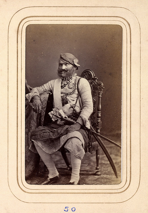
Dhaulpur State or Dholpur State, historically known as the Kingdom of Dholpur, was a kingdom of eastern Rajasthan, India, which was founded in AD 1806 by a Jat ruler Rana Kirat Singh of Gohad. After 1818, the state was placed under the authority of British India's Rajputana Agency. The Ranas ruled the state until the independence of India in 1947, when the kingdom was merged with the Union of India. The princely state of Dholpur was located in the present-day state of Rajasthan. The state had an area of , and an estimated revenue of Rs.9,60,000. The former chief minister of Rajasthan, Vasundhara Raje, was a member of the erstwhile ruling family of Dholpur as she was married to Maharaja Hemant Singh before getting divorced. History Very little is known of the early history of the state. According to tradition a predecessor state was established as Dhavalapura. In 1505 neighboring Gohad State of Rana Jats was founded and between 1740 and 1756 Gohad occupied Gwalior Fo ... [...More Info...] [...Related Items...] OR: [Wikipedia] [Google] [Baidu] |
North Central Railway Zone
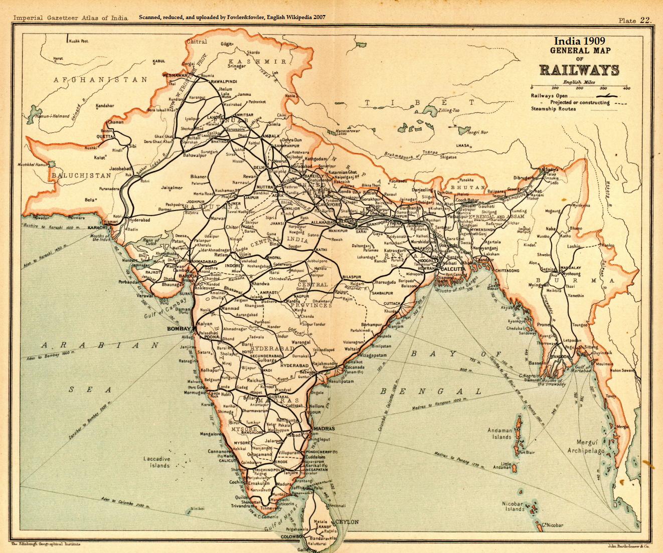
The North Central Railway (abbreviated NCR) is one of the 19 railway zones in India. The largest railway station in NCR is Kanpur Central. It is headquartered at Prayagraj and comprises three divisions: Allahabad division, Jhansi division, Agra division of the erstwhile Northern Railway, Jhansi division of the erstwhile Central Railway, and new Agra division. History The North Central Railway, in its present form, came into existence on 1 April 2003. The North Central Railway present network extends over a large area of North Central India, covering the states of Delhi, Uttar Pradesh, Madhya Pradesh, Rajasthan and Haryana. By December 2017, railways for the first time installed 6,095 GPS-enabled "Fog Pilot Assistance System" railway signalling devices in four most affected zones, Northern Railway zone, North Central Railway zone, North Eastern Railway zone and North Western Railway zone, by doing away with the old practice of putting firecrackers on train tracks to a ... [...More Info...] [...Related Items...] OR: [Wikipedia] [Google] [Baidu] |
Madhya Pradesh
Madhya Pradesh (, ; meaning 'central province') is a state in central India. Its capital is Bhopal, and the largest city is Indore, with Jabalpur, Ujjain, Gwalior, Sagar, and Rewa being the other major cities. Madhya Pradesh is the second largest Indian state by area and the fifth largest state by population with over 72 million residents. It borders the states of Uttar Pradesh to the northeast, Chhattisgarh to the east, Maharashtra to the south, Gujarat to the west, and Rajasthan to the northwest. The area covered by the present-day Madhya Pradesh includes the area of the ancient Avanti Mahajanapada, whose capital Ujjain (also known as Avantika) arose as a major city during the second wave of Indian urbanisation in the sixth century BCE. Subsequently, the region was ruled by the major dynasties of India. The Maratha Empire dominated the majority of the 18th century. After the Anglo-Maratha Wars in the 19th century, the region was divided into several princel ... [...More Info...] [...Related Items...] OR: [Wikipedia] [Google] [Baidu] |
Morena
Morena is the headquarter city of Morena district, in the Indian state of Madhya Pradesh. It is governed by a municipality corporation. It is also the administrative headquarters of the Chambal division. It is from Gwalior, Madhya Pradesh. Geography Morena is located at . It has an average elevation of 177 metres (580 feet). Demographics As of the 2011 Census of India, Morena had a population of . 13.2% of the population is under six years old. Literacy was 80.28%; male literacy was 89.08% and female literacy was 70.22%. Notable people * Ram Prasad Bismil, Indian revolutionary from the village of Barbai. * Narendra Singh Tomar, Minister in Indian government. * Adal Singh Kansana, former minister in Madhya Pradesh government. * Rustam Singh, former minister in Madhya Pradesh government. * Ashok Argal, Mayor of Morena Municipal corporation. * Paan Singh Tomar, Athlete. *Nandini Agarwal, Youngest person to clear Chartered Accountancy course with AIR-1. Scho ... [...More Info...] [...Related Items...] OR: [Wikipedia] [Google] [Baidu] |
Arab
The Arabs (singular: Arab; singular ar, عَرَبِيٌّ, DIN 31635: , , plural ar, عَرَب, DIN 31635: , Arabic pronunciation: ), also known as the Arab people, are an ethnic group mainly inhabiting the Arab world in Western Asia, North Africa, the Horn of Africa, and the western Indian Ocean islands (including the Comoros). An Arab diaspora is also present around the world in significant numbers, most notably in the Americas, Western Europe, Turkey, Indonesia, and Iran. In modern usage, the term "Arab" tends to refer to those who both carry that ethnic identity and speak Arabic as their native language. This contrasts with the narrower traditional definition, which refers to the descendants of the tribes of Arabia. The religion of Islam was developed in Arabia, and Classical Arabic serves as the language of Islamic literature. 93 percent of Arabs are Muslims (the remainder consisted mostly of Arab Christians), while Arab Muslims are only 20 percent of the ... [...More Info...] [...Related Items...] OR: [Wikipedia] [Google] [Baidu] |


_male.jpg)