|
Debelyanov Point
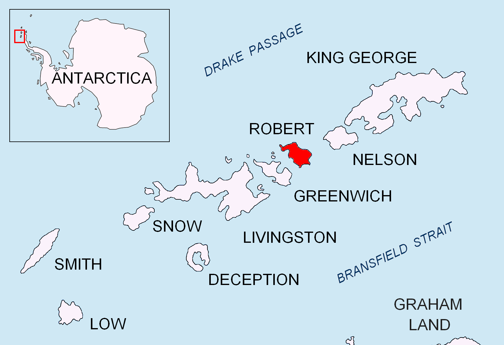
Debelyanov Point ( bg, Дебелянов нос, ‘Debelyanov Nos’ \de-be-'lya-nov 'nos\) is a point forming the northwest side of the entrance to Mitchell Cove in Robert Island, South Shetland Islands. Situated 2.8 km northwest of Negra Point and 3.81 km southeast of Fort William Point. Bulgarian early mapping in 2008. Named after the Bulgarian poet Dimcho Debelyanov (1887–1916). Maps * L.L. IvanovAntarctica: Livingston Island and Greenwich, Robert, Snow and Smith Islands.Scale 1:120000 topographic map. Troyan: Manfred Wörner Foundation, 2009. References Debelyanov Point.SCAR Composite Antarctic Gazetteer Bulgarian Antarctic Gazetteer.Antarctic Place-names Commission The Antarctic Place-names Commission was established by the Bulgarian Antarctic Institute in 1994, and since 2001 has been a body affiliated with the Ministry of Foreign Affairs of Bulgaria. The Commission approves Bulgarian place names in .... (details in Bulgarianbasic datain E ... [...More Info...] [...Related Items...] OR: [Wikipedia] [Google] [Baidu] |
Mitchell Cove
Mitchell Cove is the 2.8 km wide bay indenting for 3 km the southwest coast of Robert Island in the South Shetland Islands, Antarctica southeast of Alfatar Peninsula, and entered between Debelyanov Point and Negra Point. The area was visited by early 19th century sealers. The feature is named after James Mitchell, co-owner of the British cutter ''Beaufoy'' under Captain James Weddell that visited the South Shetlands in 1823–24. Location The cove's midpoint is located at (US mapping in 1821, British mapping in 1822 and 1968, Chilean in 1971, Argentine in 1980, and Bulgarian in 2009). See also * Robert Island * South Shetland Islands The South Shetland Islands are a group of Antarctic islands with a total area of . They lie about north of the Antarctic Peninsula, and between southwest of the nearest point of the South Orkney Islands. By the Antarctic Treaty of 195 ... Map * L.L. IvanovAntarctica: Livingston Island and Greenwich, Robert, Snow and Smi ... [...More Info...] [...Related Items...] OR: [Wikipedia] [Google] [Baidu] |
Robert Island
Robert Island or Mitchells Island or Polotsk Island or Roberts Island is an island long and wide, situated between Nelson Island and Greenwich Island in the South Shetland Islands, Antarctica. Robert Island is located at . Surface area . The name "Robert Island" dates back to around 1821 and is now established in international usage. Much of the Coppermine Peninsula in the west of the island is made up by a perched strandflat surface that was in past at sea level. Captain Richard Fildes may have named Robert Island for his brig . Fildes was sealing in the South Shetlands in 1821–1822 until ice destroyed his vessel in March 1822. Fildes Strait is named for him. See also * List of lighthouses in Antarctica * Clothier Harbor * Composite Antarctic Gazetteer * List of Antarctic and sub-Antarctic islands * List of Antarctic islands south of 60° S * SCAR * Territorial claims in Antarctica Seven sovereign states – Argentina, Australia, Chile, France, New Zealand, ... [...More Info...] [...Related Items...] OR: [Wikipedia] [Google] [Baidu] |
South Shetland Islands
The South Shetland Islands are a group of Antarctic islands with a total area of . They lie about north of the Antarctic Peninsula, and between southwest of the nearest point of the South Orkney Islands. By the Antarctic Treaty of 1959, the islands' sovereignty is neither recognized nor disputed by the signatories and they are free for use by any signatory for non-military purposes. The islands have been claimed by the United Kingdom since 1908 and as part of the British Antarctic Territory since 1962. They are also claimed by the governments of Chile (since 1940, as part of the Antártica Chilena province) and Argentina (since 1943, as part of Argentine Antarctica, Tierra del Fuego Province). Several countries maintain research stations on the islands. Most of them are situated on King George Island, benefitting from the airfield of the Chilean base Eduardo Frei. There are sixteen research stations in different parts of the islands, with Chilean stations being ... [...More Info...] [...Related Items...] OR: [Wikipedia] [Google] [Baidu] |
Negra Point
Negra Point is the ice-free tipped point on the southwest coast of Robert Island in the South Shetland Islands, Antarctica forming the southeast side of the entrance to Mitchell Cove. The area was visited by early 19th century seal hunters. The feature was named descriptively by one of the Chilean Antarctic expeditions. Location The point is located at which is 6.43 km northeast of Spark Point, Greenwich Island, 2.8 km southeast of Debelyanov Point, 4.5 km northwest of Beron Point and 8.84 km northwest of Edwards Point (Chilean mapping in 1975, British mapping in 1968, and Bulgarian in 2005 and 2009). See also * Robert Island * South Shetland Islands The South Shetland Islands are a group of Antarctic islands with a total area of . They lie about north of the Antarctic Peninsula, and between southwest of the nearest point of the South Orkney Islands. By the Antarctic Treaty of 195 ... Maps * L.L. Ivanov et al. Antarctica: Livingston Isla ... [...More Info...] [...Related Items...] OR: [Wikipedia] [Google] [Baidu] |
Fort William (Robert Island)
Fort William Point is the conspicuous flat-topped rocky headland forming the northwest extremity of Coppermine Peninsula and Robert Island in the South Shetland Islands, Antarctica. The point is a northwest entrance point of English Strait and forms the west side of the entrance to Carlota Cove. The feature was named by the early 19th century sealers who used it as a landmark for entering English Strait from the north. Location The point is located at which is southwest of Catharina Point, north of Spark Point, north-northeast of Barrientos Island, east of Okol Rocks and southeast of Table Island (British mapping in 1821, 1962 and 1968, Argentine in 1949, Soviet Union in 1961, Chilean in 1974, and Bulgarian in 2009). See also * List of lighthouses in Antarctica * Composite Antarctic Gazetteer * Robert Island * SCAR * South Shetland Islands * Territorial claims in Antarctica Seven sovereign states – Argentina, Australia, Chile, France, New Zealand, Norway, and the U ... [...More Info...] [...Related Items...] OR: [Wikipedia] [Google] [Baidu] |
Bulgaria
Bulgaria (; bg, България, Bǎlgariya), officially the Republic of Bulgaria,, ) is a country in Southeast Europe. It is situated on the eastern flank of the Balkans, and is bordered by Romania to the north, Serbia and North Macedonia to the west, Greece and Turkey to the south, and the Black Sea to the east. Bulgaria covers a territory of , and is the sixteenth-largest country in Europe. Sofia is the nation's capital and largest city; other major cities are Plovdiv, Varna and Burgas. One of the earliest societies in the lands of modern-day Bulgaria was the Neolithic Karanovo culture, which dates back to 6,500 BC. In the 6th to 3rd century BC the region was a battleground for ancient Thracians, Persians, Celts and Macedonians; stability came when the Roman Empire conquered the region in AD 45. After the Roman state splintered, tribal invasions in the region resumed. Around the 6th century, these territories were settled by the early Slavs. The Bulgars, led by Asp ... [...More Info...] [...Related Items...] OR: [Wikipedia] [Google] [Baidu] |
Dimcho Debelyanov
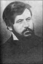
Dimcho Debelyanov () (28 March 1887 – 2 October 1916) was a Bulgarian poet and author. Born to a prosperous tailoring family in Koprivshtitsa, Bulgaria, Debelyanov experienced financial hardship upon the death of his father in 1896, which necessitated his family moving to Plovdiv, and then on to Sofia in 1904. Debelyanov's nostalgia for Koprivshtitsa influenced his work, often speaking of his eight years in Plovdiv with regret and calling it "the sorrowful city". Debelyanov studied Law, history and literature at the Faculties of Law and History and Philosophy at Sofia University and translated works in both French and English. In 1906, Debelyanov began sending poetry to Bulgarian literary magazines at the urging of friend and fellow poet Pencho Slaveikov, which were accepted and well received. His poems at this time were satirical, with symbolist qualities and subjects, such as dreams, idealism and the stylising of medieval legends. Debelyanov worked several odd jobs d ... [...More Info...] [...Related Items...] OR: [Wikipedia] [Google] [Baidu] |
Composite Antarctic Gazetteer
The Composite Gazetteer of Antarctica (CGA) of the Scientific Committee on Antarctic Research (SCAR) is the authoritative international gazetteer containing all Antarctic toponyms published in national gazetteers, plus basic information about those names and the relevant geographical features. The Gazetteer includes also parts of the International Hydrographic Organization (IHO) General Bathymetric Chart of the Oceans (GEBCO) gazetteer for under-sea features situated south of 60° south latitude. , the overall content of the CGA amounts to 37,893 geographic names for 19,803 features including some 500 features with two or more entirely different names, contributed by the following sources: {, class="wikitable sortable" ! Country ! Names , - , United States , 13,192 , - , United Kingdom , 5,040 , - , Russia , 4,808 , - , New Zealand , 2,597 , - , Australia , 2,551 , - , Argentina , 2,545 , - , Chile , 1,866 , - , Norway , 1,706 , - , Bulgaria , 1,450 , - , G ... [...More Info...] [...Related Items...] OR: [Wikipedia] [Google] [Baidu] |
Antarctic Place-names Commission
The Antarctic Place-names Commission was established by the Bulgarian Antarctic Institute in 1994, and since 2001 has been a body affiliated with the Ministry of Foreign Affairs of Bulgaria. The Commission approves Bulgarian place names in Antarctica, which are formally given by the President of the Republic according to the Bulgarian Constitution (Art. 98) and the established international practice. Bulgarian names in Antarctica Geographical names in Antarctica reflect the history and practice of Antarctic exploration. The nations involved in Antarctic research give new names to nameless geographical features for the purposes of orientation, logistics, and international scientific cooperation. As of 2021, there are some 20,091 named Antarctic geographical features, including 1,601 features with names given by Bulgaria.Bulgarian Antarctic Gazett ... [...More Info...] [...Related Items...] OR: [Wikipedia] [Google] [Baidu] |
Headlands Of Robert Island
A headland, also known as a head, is a coastal landform, a point of land usually high and often with a sheer drop, that extends into a body of water. It is a type of promontory. A headland of considerable size often is called a cape.Whittow, John (1984). ''Dictionary of Physical Geography''. London: Penguin, 1984, pp. 80, 246. . Headlands are characterised by high, breaking waves, rocky shores, intense erosion, and steep sea cliff. Headlands and bays are often found on the same coastline. A bay is flanked by land on three sides, whereas a headland is flanked by water on three sides. Headlands and bays form on discordant coastlines, where bands of rock of alternating resistance run perpendicular to the coast. Bays form when weak (less resistant) rocks (such as sands and clays) are eroded, leaving bands of stronger (more resistant) rocks (such as chalk, limestone, and granite) forming a headland, or peninsula. Through the deposition of sediment within the bay and the erosion of the ... [...More Info...] [...Related Items...] OR: [Wikipedia] [Google] [Baidu] |


