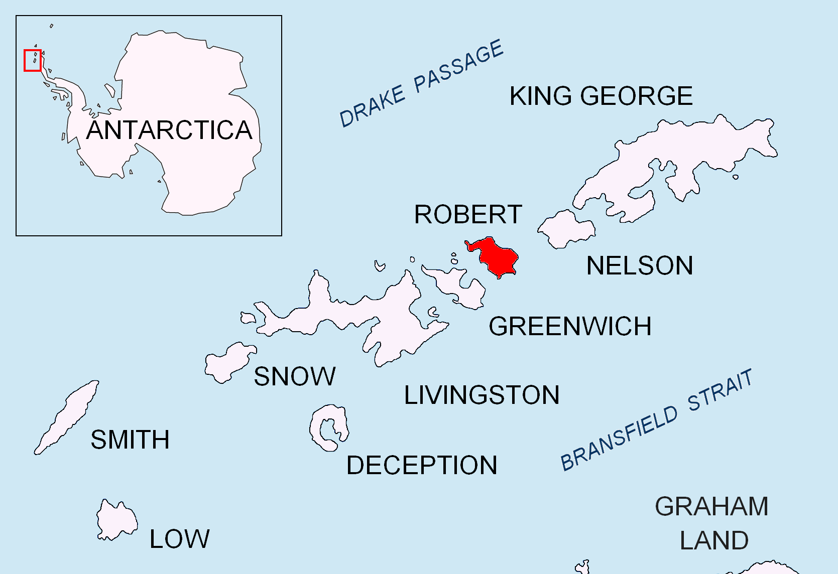
Mitchell Cove on:
[Wikipedia]
[Google]
[Amazon]

 Mitchell Cove is the 2.8 km wide bay indenting for 3 km the southwest coast of Robert Island in the
Antarctica: Livingston Island and Greenwich, Robert, Snow and Smith Islands
Scale 1:120000 topographic map. Troyan: Manfred Wörner Foundation, 2009.
SCAR Composite Antarctic Gazetteer
Coves of Robert Island {{RobertIsland-geo-stub

 Mitchell Cove is the 2.8 km wide bay indenting for 3 km the southwest coast of Robert Island in the
 South Shetland Islands
The South Shetland Islands are a group of Antarctic islands with a total area of . They lie about north of the Antarctic Peninsula, and between southwest of the nearest point of the South Orkney Islands. By the Antarctic Treaty of 195 ...
, Antarctica
Antarctica () is Earth's southernmost and least-populated continent. Situated almost entirely south of the Antarctic Circle and surrounded by the Southern Ocean, it contains the geographic South Pole. Antarctica is the fifth-largest contine ...
southeast of Alfatar Peninsula
Alfatar Peninsula ( bg, полуостров Алфатар, poluostrov Alfatar, ) is a peninsula extending 4 km in northeast-southwest direction and 2.8 km wide, forming the northwest extremity of Robert Island, South Shetland Islands. ...
, and entered between Debelyanov Point
Debelyanov Point ( bg, Дебелянов нос, ‘Debelyanov Nos’ \de-be-'lya-nov 'nos\) is a point forming the northwest side of the entrance to Mitchell Cove in Robert Island, South Shetland Islands. Situated 2.8 km northwest of Neg ...
and Negra Point
Negra Point is the ice-free tipped point on the southwest coast of Robert Island in the South Shetland Islands, Antarctica forming the southeast side of the entrance to Mitchell Cove. The area was visited by early 19th century seal hunters.
Th ...
. The area was visited by early 19th century sealers Sealer may refer either to a person or ship engaged in seal hunting, or to a sealant; associated terms include:
Seal hunting
* Sealer Hill, South Shetland Islands, Antarctica
* Sealers' Oven, bread oven of mud and stone built by sealers around 180 ...
.
The feature is named after James Mitchell, co-owner of the British cutter ''Beaufoy'' under Captain James Weddell
James Weddell (24 August 1787 – 9 September 1834) was a British sailor, navigator and seal hunter who in February 1823 sailed to latitude of 74° 15′ S—a record 7.69 degrees or 532 statute miles south of the Antarct ...
that visited the South Shetlands in 1823–24.
Location
The cove's midpoint is located at (US mapping in 1821, British mapping in 1822 and 1968, Chilean in 1971, Argentine in 1980, and Bulgarian in 2009).See also
* Robert Island *South Shetland Islands
The South Shetland Islands are a group of Antarctic islands with a total area of . They lie about north of the Antarctic Peninsula, and between southwest of the nearest point of the South Orkney Islands. By the Antarctic Treaty of 195 ...
Map
* L.L. IvanovAntarctica: Livingston Island and Greenwich, Robert, Snow and Smith Islands
Scale 1:120000 topographic map. Troyan: Manfred Wörner Foundation, 2009.
References
SCAR Composite Antarctic Gazetteer
Coves of Robert Island {{RobertIsland-geo-stub